


Why visit Vize
Townapedia lists 28 museums and landmarks, 4 parks and trails, 43 places to eat, 2 places to stay and 2 attractions in and around town.
Highlights include Tarihi Yazı Mahalle Örtülü Çeşmesi and Asma Kayalar Manastır Mağaraları.
Weather in Vize
Forecast from MET Norway (CC BY 4.0). Full forecast
About Vize
Vize (Turkish: [ˈvize]) is a town in Kırklareli Province in the Marmara region of Turkey. It is the seat of Vize District. Its population is 15,116 (2022). The mayor is Ercan Özalp (CHP).
From the Wikipedia article Vize (this version), under CC BY-SA 4.0.
Travel tips from other travellers: Vize on Wikivoyage (CC BY-SA 4.0).
Things to do2

Museums and landmarks28

Tarihi Yazı Mahalle Örtülü Çeşmesi
Monument and historic site
Hasan Basri Gündüz, Hatice Gündüz Hayratıdır.



16 more on the map.
Parks, trails and playgrounds4


Restaurants and cafes43
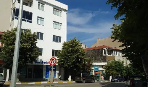


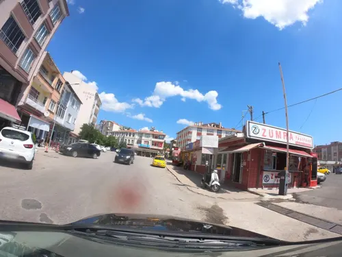



31 more on the map.
Where to stay2
Churches and places of worship6
Shopping10
Gas and EV charging2
Schools, colleges and libraries11
Healthcare8
Map of Vize
116 places. The map loads OpenStreetMap tiles when you open it.
Getting there and nearby towns
Tekirdağ Çorlu Atatürk Airport (TEQ) is the nearest airport with scheduled flights listed in OpenStreetMap, 50 km away.
- Pınarhisar 22 km west, about 22 min by car
- Üsküp 35 km northwest, about 35 min by car
- Çerkezköy 38 km southeast, about 38 min by car
- Velimeşe 37 km south, about 37 min by car
- Lüleburgaz 39 km southwest, about 39 min by car
- Hamitabat 41 km west, about 41 min by car
- Marmaracık 41 km south, about 41 min by car
- Çorlu 46 km south, about 46 min by car
- Kırklareli 48 km west, about 48 min by car
- Tekirdağ 70 km south, about 1 h 15 min by car
Drive times are estimates from straight-line distance, not routes.
Local news
Headlines from INDB.
Reviews, tips and questions
Loading what members have shared...
Sources and licences
- GeoNames (CC BY 4.0): population, coordinates, regions and time zone
- Mapillary (see each image): photos
- OpenStreetMap contributors (ODbL 1.0): places, airports, map data
- Wikidata (CC0 1.0): elevation, founding date, time zone, website
- Wikimedia Commons (see each image): photos
- Wikipedia (CC BY-SA 4.0): overview and history text
Photo credits
- Vize view - P1020883, User:Vmenkov, CC BY-SA 3.0
- Kale Fountain (Vize) - 20250602105359, Sadrettin, CC BY-SA 4.0
- Vize Gazi Süleymanpaşa Camii Galeri Katın Sütun Başlığı Detayı, Alicembasli, CC BY 4.0
- Vize Gazi Süleymanpaşa Camii Galeri Katı, Alicembasli, CC BY 4.0
- Vize Gazi Süleymanpaşa Camii İç Mekanı, Alicembasli, CC BY 4.0
- Vize Gazi Süleymanpaşa Camii Sütun Başlığı Detayı, Alicembasli, CC BY 4.0
- Vize Gazi Süleymanpaşa Camii 2, Alicembasli, CC BY 4.0
- Vize Gazi Süleymanpaşa Camii Dış Duvar Detayı, Alicembasli, CC BY 4.0
- Vize Gazi Süleymanpaşa Camii, Alicembasli, CC BY 4.0
- Kaleden Vize... - panoramio, Sinan Şahin, CC BY 3.0
- Kale Fountain (Vize) - 20250602105331, Sadrettin, CC BY-SA 4.0
- Vize Kalesi Burç Detayı, Alicembasli, CC BY 4.0
- Vize Kalesi Burcu 3, Alicembasli, CC BY 4.0
- Kale Fountain (Vize) - 20250602105317, Sadrettin, CC BY-SA 4.0
- Vize Kalesi Kapısı ve Burcu 2, Alicembasli, CC BY 4.0
- Kale Fountain (Vize) - 20250602105410, Sadrettin, CC BY-SA 4.0
- Vize Hasan Bey Camii minaresi, Alicembasli, CC BY 4.0
- Kale Fountain (Vize) - 20250602105235, Sadrettin, CC BY-SA 4.0
- Vize - Şerbetdar Hasan Bey Mosque - 20250602100008, Sadrettin, CC BY-SA 4.0
- Vize... - panoramio, Sinan Şahin, CC BY 3.0
- Vize Kalesi Burcu, Alicembasli, CC BY 4.0
- Vize Hasan Bey Camii Minber ve Mihrap, Alicembasli, CC BY 4.0
- Vize Hasan Bey Camii, Alicembasli, CC BY 4.0
- Vize Kalesi Bilgilendirme Panosu, Alicembasli, CC BY 4.0
- Vize Hasan Bey Camii 2, Alicembasli, CC BY 4.0
- Hasan-Bey-Camii-Vize-1970ler-02, Machiel Kiel, CC BY 4.0
- Hasan-Bey-Camii-Vize-1970ler-01, Machiel Kiel, CC BY 4.0
- Kale Fountain (Vize) - 20250602105216, Sadrettin, CC BY-SA 4.0
- Vize - Şerbetdar Hasan Bey Mosque - 20250602095447, Sadrettin, CC BY-SA 4.0
- Vize Kalesi Kapısı 3, Alicembasli, CC BY 4.0
- Vize - Şerbetdar Hasan Bey Mosque - 20250602095535, Sadrettin, CC BY-SA 4.0
- Vize - Şerbetdar Hasan Bey Mosque - 20250602095602, Sadrettin, CC BY-SA 4.0
- Vize - Şerbetdar Hasan Bey Mosque - 20250602095430, Sadrettin, CC BY-SA 4.0
- Vize Kalesi Kapısı, Alicembasli, CC BY 4.0
- Vize Kalesi Burcu 2, Alicembasli, CC BY 4.0
- Vize - Şerbetdar Hasan Bey Mosque - 20250602095412, Sadrettin, CC BY-SA 4.0
- Vize - Şerbetdar Hasan Bey Mosque - 20250602095948, Sadrettin, CC BY-SA 4.0
- Vize - Kale, Vize - 20250602105530, Sadrettin, CC BY-SA 4.0
- Vize - Şerbetdar Hasan Bey Mosque - 20250602095332, Sadrettin, CC BY-SA 4.0
- Vize banner Castle ruins, Sinan Şahin, CC BY 3.0
- Vize Hagia Sophia - P1020915, User:Vmenkov, CC BY-SA 3.0
- Vize - Ferhat Bey Hammam - 20250602094219, Sadrettin, CC BY-SA 4.0
- Vize - Covered Fountain - 20250602110243, Sadrettin, CC BY-SA 4.0
- Vize - Kale Hammam - 20250602100254, Sadrettin, CC BY-SA 4.0
- Vize - Vize Çömlek Tepe Höyüğü - 20250602113928, Sadrettin, CC BY-SA 4.0
- Vize - Fatma Hatun Mosque - 20250602091322, Sadrettin, CC BY-SA 4.0
- Yeni Cami, Vize - 20250602120734, Sadrettin, CC BY-SA 4.0
- Street-level photo, sis651, CC BY-SA 4.0
- Street-level photo, sis651, CC BY-SA 4.0
- Street-level photo, sis651, CC BY-SA 4.0
- Street-level photo, sis651, CC BY-SA 4.0
- Street-level photo, sis651, CC BY-SA 4.0
- Street-level photo, sis651, CC BY-SA 4.0
- Street-level photo, asturksever, CC BY-SA 4.0
- Street-level photo, sis651, CC BY-SA 4.0
- Street-level photo, asturksever, CC BY-SA 4.0
- Street-level photo, sis651, CC BY-SA 4.0


Page built November 8, 2026. Spotted a mistake? Tell us or suggest a place.