


Why visit Zile
Townapedia lists 1 museum or landmark and 1 park or trail in and around town.
Highlights include Zile Kalesi and Danışmentli Parkı.
Weather in Zile
Forecast from MET Norway (CC BY 4.0). Full forecast
About Zile
Zile, known in ancient times as Zela (Greek: Ζῆλα) (still as Latin Catholic titular see), is a city in Tokat Province, Turkey. It is the seat of Zile District. Its population is 33,557 (2022). Zile lies to the south of Amasya and the west of Tokat in north-central Turkey.
From the Wikipedia article Zile (this version), under CC BY-SA 4.0.
Museums and landmarks1

Parks, trails and playgrounds1

Churches and places of worship4




Schools, colleges and libraries4

History
Historically, Zile has been known as Zela (Greek: Ζῆλα), Zelitis (Greek: Ζηλίτις), Zelid, Anzila, Gırgırıye (Karkariye), Zīleh, Zilleli, Zeyli, and Silas (Greek: Σίλας). Zile castle, the only solid castle in Anatolia, was built by Roman commander Lucius Cornelius Sulla. The castle contains the Amanos temple, and is called silla, meaning "respected". In Semra Meral's Her Yönüyle Zile, she claims that the name "Zile" came from "Zela", stemming from "Silla".
From the History section of Zile on Wikipedia, under CC BY-SA 4.0.
Healthcare18
Map of Zile
28 places. The map loads OpenStreetMap tiles when you open it.
Getting there and nearby towns
Tokat Airport (TJK) is the nearest airport with scheduled flights listed in OpenStreetMap, 43 km away.
- Turhal 19 km northeast, about 19 min by car
- Kızılca 26 km northwest, about 26 min by car
- İlyas 29 km north, about 29 min by car
- Karaköprü 28 km north, about 28 min by car
- Amasya 39 km north, about 39 min by car
- Tokat 57 km east, about 57 min by car
- Merzifon 73 km northwest, about 1 h 15 min by car
- Havza 77 km north, about 1 h 15 min by car
- Çorum 84 km west, about 1 h 30 min by car
- Gümüşhacıköy 85 km northwest, about 1 h 30 min by car
Drive times are estimates from straight-line distance, not routes.
Local news
Headlines from INDB.
Reviews, tips and questions
Loading what members have shared...
Sources and licences
- GeoNames (CC BY 4.0): population, coordinates, regions and time zone
- Mapillary (see each image): photos
- OpenStreetMap contributors (ODbL 1.0): places, airports, map data
- Wikidata (CC0 1.0): elevation, founding date, time zone, website
- Wikimedia Commons (see each image): photos
- Wikipedia (CC BY-SA 4.0): overview and history text
Photo credits
- Zile gece, Posuur at English Wikipedia, CC BY-SA 3.0
- Kaleden zile - panoramio, ahmet bzt, CC BY 3.0
- Kaleden Zile-2 - panoramio, ahmet bzt, CC BY 3.0
- Zile kalesi - panoramio, ahmet bzt, CC BY 3.0
- Zile-2005 - panoramio, ahmet bzt, CC BY 3.0
- Zile 2004 - panoramio, ahmet bzt, CC BY 3.0
- Boyacı Hasan Ağa Camii, Sabriizsy, CC BY-SA 4.0
- Zile kalesi, Zeynepnurkabadayı, CC BY-SA 4.0
- Gül konağı, Zeynepnurkabadayı, CC BY-SA 4.0
- Kale - panoramio - ahmet bzt, ahmet bzt, CC BY 3.0
- Kücük ev-2 - panoramio, ahmet bzt, CC BY 3.0
- Kücük ev - panoramio, ahmet bzt, CC BY 3.0
- Lise önü - panoramio, ahmet bzt, CC BY 3.0
- ISS030-E-117185 - View of Earth, Earth Science and Remote Sensing Unit , Lyndon B. Johnson Space Center, Public domain
- ISS030-E-133828 - View of Earth, Earth Science and Remote Sensing Unit , Lyndon B. Johnson Space Center, Public domain
- ISS023-E-9624 - View of Earth, Earth Science and Remote Sensing Unit , Lyndon B. Johnson Space Center, Public domain
- Gece - panoramio, ahmet bzt, CC BY 3.0
- Atiye bekir - panoramio, ahmet bzt, CC BY 3.0
- Kar altında - panoramio, ahmet bzt, CC BY 3.0
- Okul bahçesi - panoramio, ahmet bzt, CC BY 3.0
- Subat-2008 - panoramio, ahmet bzt, CC BY 3.0
- Aktif kentten - panoramio, ahmet bzt, CC BY 3.0
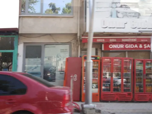
- Street-level photo, aliaktrk52, CC BY-SA 4.0


Page built November 8, 2026. Spotted a mistake? Tell us or suggest a place.