


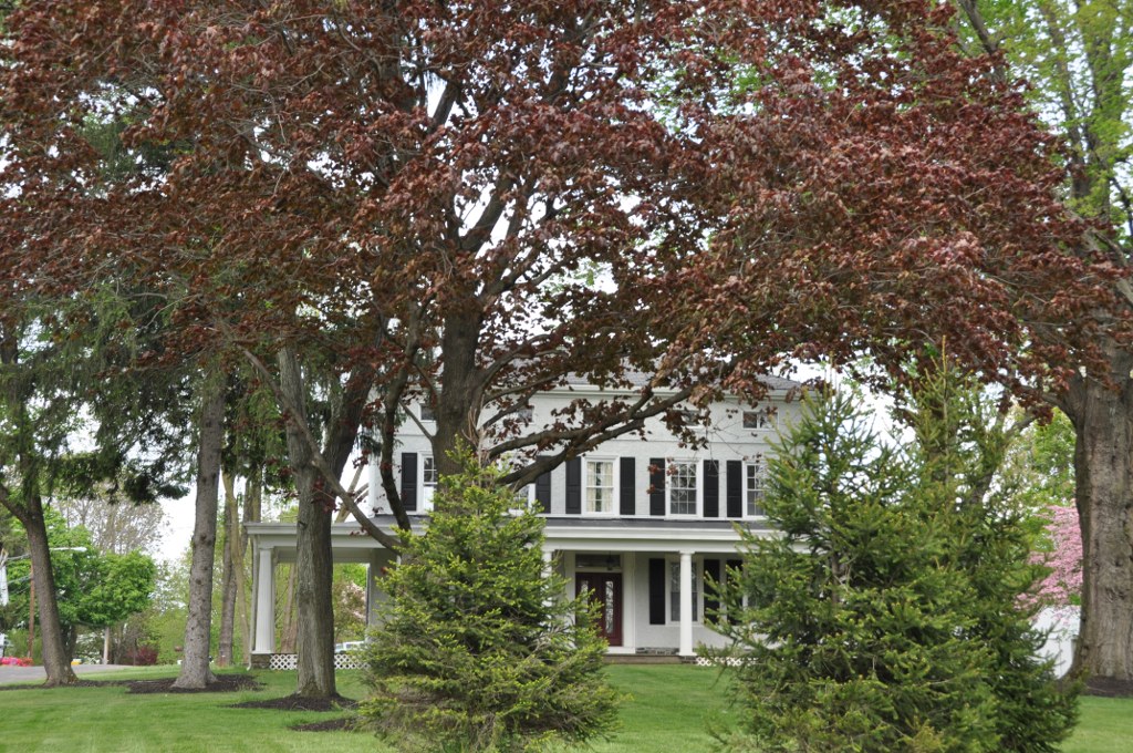

Trevose, Pennsylvania
Trevose is a community of 3,635 people in Bucks County, Pennsylvania.
Why visit Trevose
Townapedia lists 7 museums and landmarks, 5 parks and trails and 41 places to eat in and around town.
Highlights include Belmont, Churchville Historic District and Churchville Nature Center.
July is the warmest month, with average highs of 86°F; January lows average 22°F.
Weather in Trevose
Forecast from the National Weather Service. Full forecast
About Trevose
Trevose is a census-designated place within Lower Southampton Township in Bucks County, Pennsylvania, United States.
From the Wikipedia article Trevose, Pennsylvania (this version), under CC BY-SA 4.0.
Museums and landmarks7
Belmont
Monument and historic site · National Register of Historic Places · 1.8 mi
Historic home in Bensalem, Pennsylvania

Churchville Historic District
Monument and historic site · National Register of Historic Places · 2.7 mi
Historic district in Northampton Township and Upper Southampton Township, Pennsylvania
Growden Mansion
Monument and historic site · National Register of Historic Places · 2.0 mi
Building in Pennsylvania, United States

Mechanicsville School
Monument and historic site · National Register of Historic Places · 3.1 mi
School in Philadelphia, Pennsylvania

Langhorne Manor School
Monument and historic site · National Register of Historic Places · 3.3 mi

Watson Comly School
Monument and historic site · National Register of Historic Places · 2.5 mi

Parks, trails and playgrounds5


Churchville Nature Center
Park · 2.5 mi
Park in Pennsylvania, United States of America

Restaurants and cafes41

Peppe's Mexican Grill
Restaurant · Mexican · 0.4 mi
Mexican Restaurant in Feasterville-Trevose, PA
3501 Brownsville Rd, Feasterville-Trevose
Mo-Th,Su 11:00-20:00; Fr-Sa 11:00-21:00

Buck Hotel
Diner · American · 1.1 mi
1200 Buck Road, Feasterville
Mo off; Tu-Th 12:00-22:00; Fr 12:00-23:00; Sa 11:00-24:00; Su 11:00-20:00
Nina's II
Restaurant · Pizza · 0.8 mi
1748 Bridgetown Pike, Feasterville-Trevose
Mo-Th 10:30-22:00; Fr-Sa 10:30-23:00; Su 11:30-22:00
Osaki Cuisine
Restaurant · Japanese
3949 Brownsville Road
Mo-Th 11:00-22:00; Fr-Sa 11:00-23:00; Su 12:00-22:00
Samarkand Steakhouse
Restaurant · Steak House · 1.0 mi
1135 Bustleton Pike, Feasterville-Trevose
Mo-Su 11:00-23:00
Toscana 52
Restaurant · Italian · 1.1 mi
4603 Street Road, Feasterville-Trevose
Mo-Th 11:00-21:00; Fr 11:00-22:00; Sa 12:00-22:00; Su 12:00-21:00
Uno Pizzeria & Grill
Restaurant · Pizza · 1.5 mi
801 Neshaminy Mall, Bensalem
Su-Th 11:00-23:00; Fr,Sa 11:00-24:00

MyThai
Restaurant · Thai
1808 Brownsville Road, Trevose
We-Su 11:30-20:30
29 more on the map.
Churches and places of worship8

Slavic Pentecostal New Life
Church · Pentecostal · 0.5 mi
4908 Oak Avenue, Bensalem Township

History
The community is named after the Growden Mansion, the homestead of settler Joseph Growden. The homestead was named after Growden's homestead in England (Growden was Cornish; Trevose is from the Cornish word Trenfos for farm.).
From the History section of Trevose, Pennsylvania on Wikipedia, under CC BY-SA 4.0.
Shopping12
Gas and EV charging7
Schools, colleges and libraries45
Healthcare3
Map of Trevose
128 places. The map loads OpenStreetMap tiles when you open it.
Climate by month
Monthly table
| Month | High | Low | Rain | Snow |
|---|---|---|---|---|
| Jan | 39°F | 22°F | 3.7 in | 7.0 in |
| Feb | 42°F | 23°F | 3.1 in | 5.7 in |
| Mar | 50°F | 29°F | 4.6 in | 3.5 in |
| Apr | 62°F | 40°F | 4.0 in | 0.0 in |
| May | 72°F | 50°F | 4.0 in | 0.0 in |
| Jun | 81°F | 60°F | 4.6 in | 0.0 in |
| Jul | 86°F | 65°F | 4.9 in | 0.0 in |
| Aug | 84°F | 64°F | 4.7 in | 0.0 in |
| Sep | 77°F | 56°F | 4.7 in | 0.0 in |
| Oct | 66°F | 44°F | 4.2 in | 0.1 in |
| Nov | 55°F | 33°F | 3.6 in | 0.2 in |
| Dec | 44°F | 26°F | 4.7 in | 3.4 in |
U.S. Climate Normals 1991-2020 for Neshaminy Falls (2 mi away), NOAA NCEI.
People and cost of living
American Community Survey 5-year estimates, 2020-2024, U.S. Census Bureau. Estimates have margins of error, larger for small towns.
Disaster history
Bucks County has had 17 federal disaster declarations since 2000, most often for hurricanes.
- 2021-09-10: Remnants Of Hurricane Ida (Hurricane)
- 2020-03-30: Covid-19 Pandemic (Biological)
- 2020-03-13: Covid-19 (Biological)
- 2016-03-23: Severe Winter Storm And Snowstorm (Snowstorm)
- 2014-02-06: Severe Winter Storm (Severe Ice Storm)
- 2013-01-10: Hurricane Sandy (Hurricane)
OpenFEMA disaster declarations summaries.
Getting there and nearby towns
Northeast Philadelphia Airport (PNE) is the nearest airport with scheduled flights listed in OpenStreetMap, 5 miles away.
- Feasterville 1 mi northwest, about 1 min by car
- Parkland 3 mi east, about 4 min by car
- Churchville 3 mi north, about 5 min by car
- Penndel 4 mi east, about 6 min by car
- Langhorne Manor 4 mi east, about 6 min by car
- Langhorne 4 mi northeast, about 6 min by car
- Bryn Athyn 5 mi west, about 7 min by car
- Richboro 5 mi north, about 8 min by car
- Eddington 5 mi southeast, about 8 min by car
- Cornwells Heights 5 mi south, about 9 min by car
Drive times are estimates from straight-line distance, not routes.
Local news
Headlines from INDB, the NEMICO news database.
Reviews, tips and questions
Loading what members have shared...
Sources and licences
- NCES EDGE (Public domain): public schools
- NOAA NCEI U.S. Climate Normals 1991-2020 (Public domain): climate by month
- OpenFEMA (Public domain): disaster declarations
- OpenStreetMap contributors (ODbL 1.0): places, airports, map data
- U.S. Census Bureau (Public domain): population, income, housing, education, commute
- Wikidata (CC0 1.0): elevation, founding date, time zone, website, landmarks and historic places
- Wikimedia Commons (see each image): photos
- Wikipedia (CC BY-SA 4.0): overview and history text
Photo credits
- Trevose, PA, Mr. Matté (if there is an issue with this image, contact me using this image's Commons talk page , my Commons user talk page , or my English Wikipedia user talk page ; I'll know about it a lot faster), CC BY 4.0
- EF3 damage in Trevose, Pennsylvania, NWS Philadelphia/Mt. Holly, Public domain
- BensalemPA GrowdenMansion, User:Magicpiano, CC BY-SA 4.0
- Mechanicsville School, Smallbones, Public domain
- BensalemPA Belmont, User:Magicpiano, CC BY-SA 4.0
- Churchville Station, Coemgenus at en.wikipedia, Public domain
- Langhorne Manor School 01, Shuvaev, CC BY-SA 3.0
- Watson Comly 1892, Smallbones, Public domain
- Churchville Reservoir in mid-November, Entobill92, CC BY-SA 4.0
- Lower Southampton Township Hall, BucksCo PA 03, Shuvaev, CC BY-SA 4.0
- Lower Southampton Township District Court, BucksCo PA, Shuvaev, CC BY-SA 4.0
- Lower Southampton Township Hall, BucksCo PA 01, Shuvaev, CC BY-SA 4.0
- Lower Southampton Township Hall, BucksCo PA 02, Shuvaev, CC BY-SA 4.0
- Lower Southampton Elementary School, BucksCo PA, Shuvaev, CC BY-SA 4.0
- 2022-11-02 13 42 29 View south along Pennsylvania State Route 213 (Bridgetown Pike) just south of Bristol Road in Lower Southampton Township, Bucks County, Pennsylvania, Famartin, CC BY-SA 4.0
- PA 213 sb end signage approaching PA 532, Jan. 2024, Mr. Matté (if there is an issue with this image, contact me using this image's Commons talk page , my Commons user talk page , or my English Wikipedia user talk page ; I'll know about it a lot faster), CC BY-SA 4.0
- 2022-11-02 13 52 16 View north along Pennsylvania State Route 213 (Bridgetown Pike) just north of Old Bristol Road along the border of Northampton Township and Lower Southampton Township in Bucks..., Famartin, CC BY-SA 4.0
- PA 213 NB past PA 532, Dough4872, CC BY-SA 3.0
- 2022-11-02 13 46 15 View north along Pennsylvania State Route 213 (Bridgetown Pike) just north of Pennsylvania State Route 532 (Buck Road) in Lower Southampton Township, Bucks County, Pennsylvania, Famartin, CC BY-SA 4.0
- 2022-11-01 16 46 00 View east along Pennsylvania State Route 132 (Street Road) just east of Pennsylvania State Route 532 (Bustleton Pike) in Lower Southampton Township, Bucks County, Pennsylvania, Famartin, CC BY-SA 4.0
- 2022-09-20 16 08 26 View north along Pennsylvania State Route 532 (Buck Road) just north of Pennsylvania State Route 213 (Bridgetown Pike) in Lower Southampton Township, Bucks County, Pennsylvania, Famartin, CC BY-SA 4.0
- Sweetie Dunloafs, CountryFan10, CC BY-SA 4.0
- 2022-09-20 15 19 21 View south along Pennsylvania State Route 532 (Buck Road) just north of Pennsylvania State Route 213 (Bridgetown Pike) in Lower Southampton Township, Bucks County, Pennsylvania, Famartin, CC BY-SA 4.0
- The Buck Hotel, Feasterville, BucksCo PA 01, Shuvaev, CC BY-SA 4.0
- PA 532 NB at Bustleton Pike split, Dough4872, CC BY-SA 3.0
- Feasterville Banner, Dough4872, CC BY-SA 3.0
- 2022-09-20 15 22 06 View south along Pennsylvania State Route 532 (Bustleton Pike) just south of Bridgetown Pike in Lower Southampton Township, Bucks County, Pennsylvania, Famartin, CC BY-SA 4.0
- PA 532 NB past PA 132, Dough4872, CC BY-SA 3.0
- Neshaminy Falls SEPTA station inbound train December 2017, Dough4872, CC BY-SA 3.0
- 2022-08-06 08 20 45 View west along Interstate 276 (Pennsylvania Turnpike Delaware River Extension) between Exit 351 and Exit 343 in Lower Southampton Township, Bucks County, Pennsylvania, Famartin, CC BY-SA 4.0
- Neshaminy Falls SEPTA station September 2018, Dough4872, CC BY-SA 4.0
- 2022-08-11 18 22 56 View east along Interstate 276 (Pennsylvania Turnpike Delaware River Extension) just west of Exit 351 in Lower Southampton Township, Bucks County, Pennsylvania, Famartin, CC BY-SA 4.0
- 2022-08-11 18 22 09 View east along Interstate 276 (Pennsylvania Turnpike Delaware River Extension) between Exit 343 and Exit 351 in Lower Southampton Township, Bucks County, Pennsylvania, Famartin, CC BY-SA 4.0
- PA TPK WB from Harding Avenue overpass, Dough4872, CC BY-SA 4.0
- 2022-09-17 13 23 55 View east along Interstate 276 (Pennsylvania Turnpike Delaware River Extension) from the overpass for Harding Avenue in Lower Southampton Township, Bucks County, Pennsylvania, Famartin, CC BY-SA 4.0
- 2022-09-17 13 23 39 View west along Interstate 276 (Pennsylvania Turnpike Delaware River Extension) from the overpass for Harding Avenue in Lower Southampton Township, Bucks County, Pennsylvania, Famartin, CC BY-SA 4.0
- 2022-09-20 15 13 58 View south along Pennsylvania State Route 532 (Buck Road) from the overpass for the rail line just south of Old Bristol Road in Northampton Township, Bucks County, Pennsylvania, Famartin, CC BY-SA 4.0
- 2022-09-20 15 13 41 View north along Pennsylvania State Route 532 (Buck Road) from the overpass for the rail line just south of Old Bristol Road in Northampton Township, Bucks County, Pennsylvania, Famartin, CC BY-SA 4.0
- 2022-10-06 11 31 06 View west along Pennsylvania State Route 132 (Street Road) from the overpass for Interstate 276 (Pennsylvania Turnpike Delaware River Extension) in Bensalem Township, Bucks..., Famartin, CC BY-SA 4.0
- 2022-08-11 18 25 56 View east along Interstate 276 (Pennsylvania Turnpike Delaware River Extension) at Exit 351 (U.S. Route 1, TO Interstate 95 SOUTH, Philadelphia, Trenton) in Bensalem Township..., Famartin, CC BY-SA 4.0


Page built October 30, 2026. Spotted a mistake? Tell us or suggest a place.