


Penndel, Pennsylvania
Penndel is a borough of 2,513 people in Bucks County, Pennsylvania, founded in 1899.
Why visit Penndel
Townapedia lists 10 museums and landmarks, 10 parks and trails, 9 places to eat and 2 attractions in and around town.
Highlights include Cairn University, Sesame Place Philadelphia, Belmont and Edgemont.
July is the warmest month, with average highs of 86°F; January lows average 22°F.
Weather in Penndel
Forecast from the National Weather Service. Full forecast
About Penndel
Penndel is a borough in Bucks County, Pennsylvania, United States. The population was 2,507 at the 2020 census.
From the Wikipedia article Penndel, Pennsylvania (this version), under CC BY-SA 4.0.
Things to do2

Cairn University
School · 0.8 mi
Christian university near Philadelphia, PA

Sesame Place Philadelphia
Monument and historic site · 3.1 mi
Children's theme park in Middletown Township, Bucks County, Pennsylvania, United States, themed after children's TV series Sesame Street
Museums and landmarks10
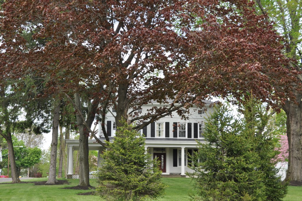
Belmont
Monument and historic site · National Register of Historic Places · 2.2 mi
Historic home in Bensalem, Pennsylvania

Edgemont
Monument and historic site · National Register of Historic Places · 2.6 mi
Historic home located in Middletown Township, Bucks County, Pennsylvania

Harewood and Beechwood
Monument and historic site · National Register of Historic Places · 1.6 mi
Historic house in Pennsylvania, United States

Hulmeville Historic District
Monument and historic site · National Register of Historic Places · 0.9 mi
Historic district in Pennsylvania, United States

Joseph Richardson House
Monument and historic site · National Register of Historic Places · 1.5 mi
Listed on the NRHP in Bucks County, Pennsylvania

Langhorne Historic District
Monument and historic site · National Register of Historic Places · 1.5 mi
Historic district in Pennsylvania, United States

Langhorne Library
Museum · National Register of Historic Places · 1.5 mi
Museum in Pennsylvania, United States of America

Sotcher Farmhouse
Monument and historic site · National Register of Historic Places · 3.4 mi
Historic house in Pennsylvania, United States

Tomlinson-Huddleston House
Monument and historic site · National Register of Historic Places · 1.5 mi
Historic house in Pennsylvania, United States


Langhorne Manor School
Monument and historic site · National Register of Historic Places · 0.7 mi
Parks, trails and playgrounds10

Restaurants and cafes9

The Valley Pizza
Restaurant · Pizza · 1.2 mi
5421 Neshaminy Boulevard
Mo-Fr 10:00 - 22:00


History
Penndel Borough, although small, is rich in history. The area, originally inhabited by the Lenape people, was settled by Thomas Langhorne, an English Quaker preacher, and by Henry Paulin, a Quaker Yeoman, on land grants from William Penn. Penndel remained a farming region until 1876 when the Philadelphia Reading Railroad began service, and the Langhorne train station was established. In 1878 Thomas Eastburn & Co. advertised 130 Building Lots in the area calling it "The Eden of Bucks County." Slowly individual homes and small businesses were built in close proximity to the railroad, and the town expanded from there. It began as the Eden Post Office, was incorporated as the borough of Attleboro on June 22, 1899; the name changed to South Langhorne in February 1911, and finally to Penndel on November 17, 1947. Today Penndel has both a thriving industrial district and residential areas with both new and historically significant homes.
From the History section of Penndel, Pennsylvania on Wikipedia, under CC BY-SA 4.0.
Churches and places of worship6
Shopping2
Gas and EV charging8
Schools, colleges and libraries46
Center For Student Learning Cs At Pennsbury
School · 5.3 mi
345 Lakeside Drive, Levittown
Healthcare1
Map of Penndel
94 places. The map loads OpenStreetMap tiles when you open it.
Climate by month
Monthly table
| Month | High | Low | Rain | Snow |
|---|---|---|---|---|
| Jan | 39°F | 22°F | 3.7 in | 7.0 in |
| Feb | 42°F | 23°F | 3.1 in | 5.7 in |
| Mar | 50°F | 29°F | 4.6 in | 3.5 in |
| Apr | 62°F | 40°F | 4.0 in | 0.0 in |
| May | 72°F | 50°F | 4.0 in | 0.0 in |
| Jun | 81°F | 60°F | 4.6 in | 0.0 in |
| Jul | 86°F | 65°F | 4.9 in | 0.0 in |
| Aug | 84°F | 64°F | 4.7 in | 0.0 in |
| Sep | 77°F | 56°F | 4.7 in | 0.0 in |
| Oct | 66°F | 44°F | 4.2 in | 0.1 in |
| Nov | 55°F | 33°F | 3.6 in | 0.2 in |
| Dec | 44°F | 26°F | 4.7 in | 3.4 in |
U.S. Climate Normals 1991-2020 for Neshaminy Falls (2 mi away), NOAA NCEI.
People and cost of living
American Community Survey 5-year estimates, 2020-2024, U.S. Census Bureau. Estimates have margins of error, larger for small towns.
Disaster history
Bucks County has had 17 federal disaster declarations since 2000, most often for hurricanes.
- 2021-09-10: Remnants Of Hurricane Ida (Hurricane)
- 2020-03-30: Covid-19 Pandemic (Biological)
- 2020-03-13: Covid-19 (Biological)
- 2016-03-23: Severe Winter Storm And Snowstorm (Snowstorm)
- 2014-02-06: Severe Winter Storm (Severe Ice Storm)
- 2013-01-10: Hurricane Sandy (Hurricane)
OpenFEMA disaster declarations summaries.
Getting there and nearby towns
Northeast Philadelphia Airport (PNE) is the nearest airport with scheduled flights listed in OpenStreetMap, 7 miles away.
- Langhorne Manor 1 mi north, about 1 min by car
- Parkland 1 mi west, about 2 min by car
- Langhorne 2 mi north, about 3 min by car
- Levittown 3 mi east, about 5 min by car
- Fairless Hills 4 mi northeast, about 6 min by car
- Feasterville 4 mi west, about 7 min by car
- Churchville 5 mi northwest, about 9 min by car
- Eddington 5 mi south, about 8 min by car
- Newtown 5 mi north, about 8 min by car
- Burlington 6 mi southeast, about 10 min by car
Drive times are estimates from straight-line distance, not routes.
Local news
Headlines from INDB, the NEMICO news database.
Reviews, tips and questions
Loading what members have shared...
Sources and licences
- NCES EDGE (Public domain): public schools
- NOAA NCEI U.S. Climate Normals 1991-2020 (Public domain): climate by month
- OpenFEMA (Public domain): disaster declarations
- OpenStreetMap contributors (ODbL 1.0): places, airports, map data
- U.S. Census Bureau (Public domain): population, income, housing, education, commute
- Wikidata (CC0 1.0): elevation, founding date, time zone, website, landmarks and historic places
- Wikimedia Commons (see each image): photos
- Wikipedia (CC BY-SA 4.0): overview and history text
Photo credits
- Penndel Pennsylvania, Marduk, Public domain
- PA 513 nb approaching US 1 Bus., Penndel (1), Aug. 2026, Mr. Matté (if there is an issue with this image, contact me using this image's Commons talk page , my Commons user talk page , or my English Wikipedia user talk page ; I'll know about it a lot faster), CC BY-SA 4.0
- Penndel, PA borough hall, March 2024, Mr. Matté (if there is an issue with this image, contact me using this image's Commons talk page , my Commons user talk page , or my English Wikipedia user talk page ; I'll know about it a lot faster), CC BY-SA 4.0
- 2022-11-02 15 35 57 View north along Pennsylvania State Route 513 (Bellevue Avenue) just north of Woodland Avenue in Penndel, Bucks County, Pennsylvania, Famartin, CC BY-SA 4.0
- PA 513 nb approaching US 1 Bus., Penndel (2), Aug. 2026, Mr. Matté (if there is an issue with this image, contact me using this image's Commons talk page , my Commons user talk page , or my English Wikipedia user talk page ; I'll know about it a lot faster), CC BY-SA 4.0
- 2022-11-02 14 38 15 View south along Pennsylvania State Route 513 (Bellevue Avenue) just south of U.S. Route 1 Business (Lincoln Highway) in Penndel, Bucks County, Pennsylvania, Famartin, CC BY-SA 4.0
- 2022-11-03 12 11 13 View south along U.S. Route 1 Business (Lincoln Highway) just south of Pennsylvania State Route 513 (Bellevue Avenue) in Penndel, Bucks County, Pennsylvania, Famartin, CC BY-SA 4.0
- PA 513 nb at Hulmeville Avenue, Penndel, Aug. 2026, Mr. Matté (if there is an issue with this image, contact me using this image's Commons talk page , my Commons user talk page , or my English Wikipedia user talk page ; I'll know about it a lot faster), CC BY-SA 4.0
- PA 513 nb entering Penndel, Aug. 2026, Mr. Matté (if there is an issue with this image, contact me using this image's Commons talk page , my Commons user talk page , or my English Wikipedia user talk page ; I'll know about it a lot faster), CC BY-SA 4.0
- 2022-11-02 10 15 41 View southwest along Legrande Avenue at Pennsylvania State Route 413 (Durham Road-Bellevue Avenue) in Penndel, Bucks County, Pennsylvania, Famartin, CC BY-SA 4.0
- 2022-11-02 14 36 43 View south along Pennsylvania State Route 413 (Bellevue Avenue) just north of Park Avenue in Penndel, Bucks County, Pennsylvania, Famartin, CC BY-SA 4.0
- 2022-11-03 12 57 35 View north along U.S. Route 1 Business (Lincoln Highway) just north of Neshaminy Street in Penndel, Bucks County, Pennsylvania, Famartin, CC BY-SA 4.0
- 2022-11-02 15 38 30 View north along U.S. Route 1 Business and south along Pennsylvania State Route 413 (Lincoln Highway) at Robbins Avenue in Penndel, Bucks County, Pennsylvania, Famartin, CC BY-SA 4.0
- Langhorne HD 14, Hshuvaeva, CC BY-SA 3.0
- Edgemont HABS Photo, Jack E. Boucher, photographer, Public domain
- Tomlinson-Huddleston House 01, Hshuvaeva, CC BY-SA 3.0
- FairlessHillsPA SotcherFarmhouse, User:Magicpiano, CC BY-SA 4.0
- Langhorne Library 02, Hshuvaeva, CC BY-SA 3.0
- MiddletownTwpPA Beechwood, User:Magicpiano, CC BY-SA 4.0
- Hulmeville Borough Hall, Marduk, CC0
- Joseph Richardson House Langhorne PA Nov 09, Doug Kerr from Albany, NY, United States, CC BY-SA 2.0
- BensalemPA Belmont, User:Magicpiano, CC BY-SA 4.0
- Langhorne Manor School 01, Shuvaev, CC BY-SA 3.0
- Philadelphia Biblical University, Marduk, CC0
- 2009-08-31B - Count's Splash Castle, Transity ( talk • contribs ), CC BY-SA 3.0
- PA 513 SB past US 1 BUS, Dough4872, CC BY-SA 3.0
- CSX ES44AH 3122 NB Langhorne PA, Dough4872, CC BY-SA 4.0
- CSX ET44AH 3390 NB Langhorne PA, Dough4872, CC BY-SA 4.0
- SEPTA Silverliner V 719 at Langhorne station, Dough4872, CC BY-SA 4.0
- CSX AC4400CWM 7230 NB Langhorne PA, Dough4872, CC BY-SA 4.0
- PA 413 nb at West Trenton Line, Aug. 2026, Mr. Matté (if there is an issue with this image, contact me using this image's Commons talk page , my Commons user talk page , or my English Wikipedia user talk page ; I'll know about it a lot faster), CC BY-SA 4.0
- Langhorne SEPTA station inbound train April 2019, Dough4872, CC BY-SA 4.0
- Langhorne SEPTA station inbound train December 2017, Dough4872, CC BY-SA 3.0
- Langhorne SEPTA station inbound train February 2019, Dough4872, CC BY-SA 4.0
- CSX ES44AH 968 NB Langhorne PA, Dough4872, CC BY-SA 4.0
- 2022-11-02 14 35 31 View south along Pennsylvania State Route 413 (Bellevue Avenue) just south of Comly Avenue in Middletown Township, Bucks County, Pennsylvania, Famartin, CC BY-SA 4.0
- 2022-11-02 10 19 22 View north along Pennsylvania State Route 413 (Bellevue Avenue) just south of Comly Avenue along the border of Langhorne Manor and Middletown Township in Bucks County, Pennsylvania, Famartin, CC BY-SA 4.0
- Langhorne, PA station from Comly Avenue, Aug. 2026, Mr. Matté (if there is an issue with this image, contact me using this image's Commons talk page , my Commons user talk page , or my English Wikipedia user talk page ; I'll know about it a lot faster), CC BY-SA 4.0
- Comly Avenue wb, Langhorne Manor, PA, Aug. 2026, Mr. Matté (if there is an issue with this image, contact me using this image's Commons talk page , my Commons user talk page , or my English Wikipedia user talk page ; I'll know about it a lot faster), CC BY-SA 4.0
- 2022-11-02 14 41 19 View south along Pennsylvania State Route 513 (Bellevue Avenue) just south of Birch Avenue in Middletown Township, Bucks County, Pennsylvania, Famartin, CC BY-SA 4.0


Page built October 30, 2026. Spotted a mistake? Tell us or suggest a place.