


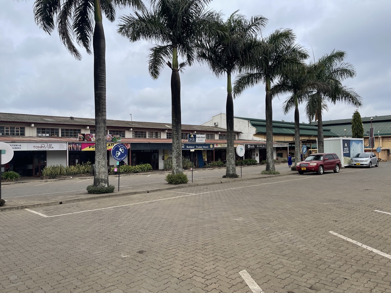

Arusha, Tanzania
Arusha is a regional capital of 617,631 people in Arusha, Tanzania, founded in 1948.
Why visit Arusha
Townapedia lists 18 museums and landmarks, 15 parks and trails, 181 places to eat, 148 places to stay and 25 attractions in and around town.
Highlights include Glen Farm Shop, Arusha Declaration Monument, Cultural Heritage Museum and Sheikh Amri Abeid Memorial Stadium.
Weather in Arusha
Forecast from MET Norway (CC BY 4.0). Full forecast
About Arusha
Arusha is a city in Tanzania. The city is the capital of the Arusha Region. It has a population of 617,631 people.
From the Wikipedia article Arusha (this version), under CC BY-SA 4.0.
Travel tips from other travellers: Arusha on Wikivoyage (CC BY-SA 4.0).
Photos of Arusha


Things to do25




13 more on the map.
Museums and landmarks18

Arusha Declaration Monument
Monument and historic site · 0.6 km
Monument in Arusha, Tanzania


HKFARMS
Monument and historic site · 8.0 km
2018 Hkaaya Moivaro Road
Mo-Sa 00:00-24:00
Arusha Tours (Hidden Arusha Waterfall, Coffee & Village Tour - All-Inclusive)
Monument and historic site · 7.6 km
6 more on the map.
Parks, trails and playgrounds15





3 more on the map.
Restaurants and cafes181
CAFE LA ZAYNAB
Restaurant · Coffee Shop, Fish, Pizza, Regional, Fish And Chips, Barbecue
Kilombero Avenue, Arusha City
24/7
Cape2Cairo Cafe Arusha
Restaurant · African, Breakfast, Burger, Chicken, Chinese, Coffee Shop, Curry, Fish, Fish And Chips, Ice Cream, Indian, International, Italian Pizza, Noodles, Pancake, Pizza, Sandwich, Sausage, Seafood, Steak House, Tea · 1.3 km
50E Indian Street
Mo-Sa 08:00-18:00
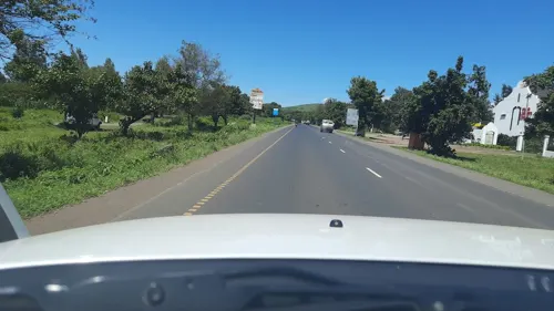



The Dutch food and drinks
Restaurant · Multi Cuisine, Pizza, Burger, Sandwich, Chicken, Ice Cream, Pancake, Cake · 2.1 km
Kanisani Road, Arusha
Mo-Su 09:00-23:00
Burka Coffee Lounge
Restaurant · Regional, Coffee Shop · 5.6 km
Mo-Su 08:00-23:00
169 more on the map.
History
The current site of Arusha was first settled in the 1830s by the agro-pastoral Arusha Maasai from the Arusha Chini community, south of Mount Kilimanjaro. They traded grains, honey, beer, and tobacco with the pastoral Kisongo Maasai in exchange for livestock, milk, meat, and skins. Demand for Arusha's foodstuffs increased substantially during the 1860s when the Pangani Valley trade route was extended through Old Moshi, Arusha, and ultimately to western Kenya. Although not yet a town, it was a regional centre with a number of urban features.
Arusha was conquered by the Germans in 1896 after the murder of the first two missionaries who attempted to settle on nearby Mount Meru. The Germans established a permanent presence in 1900 when a military fort (a boma) was built and soldiers were garrisoned there. "The boma was a solid statement, meant to impress German moral and political order on the surrounding countryside. Set on a rise overlooking the plains, the fortress-like building dominated the surrounding landscape" complete with a machine gun.
Read more of the history
Many Africans were forcibly displaced from their ancestral lands by the Germans and forced to dig lime or carry stones to construct the fort. The British took Arusha from the Germans in 1916 during World War I. German officials left the area, the British deported German missionaries and settlers, and only a skeletal military administration of the town remained.
During the 1920s, civilian administration was implemented, missionaries from the United States arrived, British and Greek settlers reoccupied the former German farms, and the town grew, especially after the British moved the regional administration from New Moshi to Arusha. The extension of the railroad from Moshi to Arusha in 1928-29 greatly increased commerce. The Great Depression soon squelched commerce and Arusha in 1940 had fewer than 2,000 residents. Growth resumed during World War II and by 1948, the population had increased to more than 5,000.
In 1952, a partial census was conducted in Tanganyika, covering cities and towns. Arusha's population at the time was 7,797, of whom 1,084 were Europeans, 3,153 were Asians, and 3,560 native Africans.
By the 1950s, Arusha was "a polyglot, westernized little town; it has a Greek community, several Germans predating World War I, and some German Jewish refugees post-dating World War II." A state of emergency was declared in the Arusha region in 1953 in response to the Mau Mau Uprising. Journalist John Gunther noted at the time that "a loyal tribe, the Waarusha, threatened to take violent countermeasures against the Kikuyus themselves, if the British did not. The authorities arrested the leading Mau Mau conspirators, screened thousands more, and deported other thousands back to Kenya."
In the 1960s, parts of the movie Hatari! with John Wayne were filmed at Momela Lakes and at Mount Meru.
Arusha has been a crucial city in the history of modern Tanzania. Official documents ceding independence to Tanganyika were signed by the United Kingdom at Arusha in 1961. The Arusha Declaration was signed in 1967 in Arusha. The Arusha Accords were signed at the city of Arusha on 4 August 1993, by representatives of competing factions in the Rwandan civil war.
The Arusha Peace and Reconciliation Agreement for Burundi was signed on 28 August 2000 as part of a process forging peace in that country through power sharing and establishing a transitional government.
The January 2015 Arusha Agreement for South Sudan created a framework for the reunification of South Sudan's ruling SPLM party, which had splintered into three creating a humanitarian crisis as fighting between factions intensified. It provided that all SPLM members who were dismissed be reinstated to their previous positions and a secret ballot system be adopted.
In 1994, the UN Security Council decided by its Resolution 955 of 8 November 1994 that Arusha should host the ad hoc International Criminal Tribunal for Rwanda. The establishment of the tribunal with its foreign employees has influenced the local economy of the city increasing the cost of living for residents. The tribunal has downsized due to its closure in 2014, but its legal successor, the United Nations International Residual Mechanism for Criminal Tribunals established by United Nations Security Council Resolution 1966, will continue entertaining a branch in Arusha, opening on 1 July 2012. The tribunal indicted 93 individuals and sentenced 62.
The Tanzanian government intended to declare Arusha a city on 1 July 2006, but this was delayed due to pending municipality boundary adjustments. Arusha was granted city status on 15 August 2012, with it becoming official on 2 November 2012.
In 2013, a quarry located in Arusha collapsed and killed 14 miners after heavy rain.
From the History section of Arusha on Wikipedia, under CC BY-SA 4.0.
More about Arusha
Geography
Despite its proximity to the equator, Arusha's elevation of 1,400 metres (4,600 ft) on the southern slopes of Mount Meru keeps temperatures relatively low and alleviates humidity. Cool dry air is prevalent for much of the year. The temperature typically ranges between 10 and 30 °C (50 and 86 °F) with an average annual high temperature around 25 °C or 77 °F. It has distinct wet and dry seasons, and experiences an eastern prevailing wind from the Indian Ocean, a few hundred kilometres east. Under the Köppen climate classification system, it has a subtropical highland climate (Cwb). Areas away from Arusha to the south and west are classified as tropical savanna climate (Aw).
The record high since records began in 2000 is 39 °C or 102.2 °F. The record low is 7 °C or 44.6 °F. Arusha averages 29.8 days per year above 32 °C or 89.6 °F – all between November and March. Arusha's annual rainfall average is 1,180 millimetres (46.46 in), mostly coming during the long rainy season from March to May. Areas immediately to the north and northeast of Arusha can see more rain and cooler temperatures due to the influence of Mt. Meru, whose rain shadow extends toward the southeast side of the mountain.
Arts and culture
The city hosts the National Natural History Museum, which contains three exhibits on early man, plants and animals of the region, and the history of the city. The Natural National History Museum used to be an administration outpost for the Germans in the 1900s. It was opened in 1987 as a public museum and displays important assets to the scientific community such as models of Australopithecus people, human ancestors that lived over 2 million years ago. It is also home to a giant tortoise, over 100 years old, which freely roams the grounds.
A small museum adjacent to the Uhuru monument displays information about the proceedings of the 1967 Arusha Declaration.
The Arusha Cultural Heritage Centre is a large privately run art gallery in a striking building, resembling the Guggenheim museum whilst drawing on African symbols (drum, spear, and shield). It holds a wide range of African art, including from the Tanzanian TingaTinga school. Exhibits are for sale and there is not a permanent collection.
Education
Most Arushan children attend public schools located in almost every ward of the city. There are five international schools in and around Arusha: International School Moshi (Arusha Campus), Arusha Meru International School, Braeburn School, St Constantine's International School, and Kennedy House International School.
The city of Arusha is home to the National College of Tourism - Arusha Campus, Arusha Technical College, Tengeru Institute of community Development, The Nelson Mandela African Institute of Science and Technology, Eastern and Southern African Management Institute, MS Training Centre for Development Cooperation (MS-TCDC), The Institute of Accountancy Arusha, Forestry Training Institute, Olmotonyi, Tanzania Wildlife Research Institute, Tumaini University Makumira, and The Mount Meru University.
Arcadia University hosts a film course that has led to the creation of the Arusha African Film Festival, which allows people to come and watch films created by local people. The guidelines allows a multitude of filmmakers to be taken into account for awards, and each year a new theme is chosen for the festival. The AAFF is connected to the East African Film Festival, which also gives ample opportunity for awards and credit to young filmmakers.
From the Wikipedia article Arusha, under CC BY-SA 4.0.
Notable people from Arusha
 Hilde Frafjord JohnsonNorwegian diplomat and politicianPhoto: Mona Høvset, CC BY-SA 4.0
 Vanessa MdeeTanzanian singer and media personalityPhoto: Panik kun, CC BY 3.0
 Phaustin Baha SulleTanzanian long distance runnerPhoto: Grzegorz Jereczek from Gdańsk, Poland, CC BY-SA 2.0
 Eddie OdhiamboTanzanian association football playerPhoto: Skippo10, CC BY-SA 4.0
 Hussein TanzaniyaSomali political scientistPhoto: Hussein M Adam, CC BY-SA 4.0
 Harold O'NealAmerican musicianPhoto: Acnscans, CC BY 4.0
- Edward LowassaTanzanian politician (1953–2024)
- Novatus DismasTanzanian footballer
- Frederick Sumayeformer Prime Minister of Tanzania
- Miriam OdembaTanzanian model
- Nurdin BakariTanzanian footballer
- Danny MrwandaTanzanian footballer


Born in Arusha, according to Wikidata (CC0). Each name links to its Wikipedia article.
Where to stay148
Churches and places of worship51
Sombetini Parish church
Church · Roman Catholic · 4.1 km
14910 Sombetini Avenue, Arusha
Shopping53
Gas and EV charging37
Schools, colleges and libraries203
Nelson Mandela African Institution of Science and Technology
School · 13.1 km
The Nelson Mandela African Institution of Science and Technology (NM-AIST)
School · 13.3 km
Engarenarok Tetra Primary School
School · Lutheran · 0.7 km
Mwana St, Arusha City
Engarenarok Tetra Secondary School
School · Lutheran · 0.6 km
Mwana St, Arusha City
Healthcare104
Map of Arusha
250 places. The map loads OpenStreetMap tiles when you open it.
Getting there and nearby towns
Arusha airport (ARK) is the nearest airport with scheduled flights listed in OpenStreetMap, 6 km away.
- Poli 15 km east, about 15 min by car
- Usa River 19 km east, about 19 min by car
- Nkoaranga 19 km east, about 19 min by car
- Monduli 27 km west, about 27 min by car
- Kingori 35 km east, about 35 min by car
- Mbuguni 37 km southeast, about 37 min by car
- Merelani 39 km southeast, about 39 min by car
- Boma la Ngombe 52 km east, about 52 min by car
- Makuyuni 68 km west, about 1 h 15 min by car
- Moshi 72 km east, about 1 h 15 min by car
Drive times are estimates from straight-line distance, not routes.
Keep exploring
Local news
Headlines from INDB.
Reviews, tips and questions
Loading what members have shared...
Sources and licences
- GeoNames (CC BY 4.0): population, coordinates, regions and time zone
- Mapillary (see each image): photos
- OpenStreetMap contributors (ODbL 1.0): places, airports, map data
- Wikidata (CC0 1.0): elevation, founding date, time zone, website, landmarks and historic places
- Wikimedia Commons (see each image): photos
- Wikipedia (CC BY-SA 4.0): overview and history text
Photo credits
- Arusha, Tanzania (Explored) - Flickr - romanboed, Roman Boed from The Netherlands, CC BY 2.0
- ALMC Hospital in Arusha, IICD from The Hague, The Netherlands, CC BY 2.0
- Daladala minibus with the route 'Mapambazuko' at Arusha bus stand, Brayan Tesha, CC0
- Mount meru with snow, Arusha Region, Tanzania, Khalidsalewa, CC BY-SA 4.0
- TFA Complex Mall, Levolosi Ward, Arusha City, Khalidsalewa, CC BY-SA 4.0
- View of Meru from Levolosi Ward, Arusha City, Khalidsalewa, CC BY-SA 4.0
- Stopover in Arusha CIty Bus Terminal, Harald Ulver, CC BY-SA 4.0
- Queue of daladala minibuses at a stage in Arusha and passengers boarding, Brayan Tesha, CC0
- Arusha city centre traffic congestion, Brayan Tesha, CC0
- Arusha Declaration Monument, Jonathan Stonehouse, CC BY 2.0
- Sheikh Amri Abeid Memorial Stadium, Richard Allen, CC BY-SA 2.0
- Manyatta builders, Swahilito, CC BY-SA 4.0
- Market vendor with fresh vegetables, Shamim mdoe, CC0
- Mt. Meru View, Timz art (T.Mbilinyi), CC BY-SA 4.0
- Bodaboda with Cargo, Elton Kann, CC0
- Bodaboda carrying water containers, Elton Kann, CC0
- Bodaboda carrying oversized sack, Elton Kann, CC0
- Samia Suluhu Hassan in May 2017, Gospel Kitaa, CC BY-SA 2.0
- Samia Suluhu Hassan (34538118495), Gospel Kitaa, CC BY-SA 2.0
- Sheikh Amri Abeid Memorial Stadium (southwards), Harald Ulver, CC BY-SA 4.0
- View of southern Kiranyi Ward, Halidtz, CC BY-SA 4.0
- Masjid Quba St, levolosi Ward, Khalidsalewa, CC BY-SA 4.0
- Levolosi Apartments, Levolosi Ward, Khalidsalewa, CC BY-SA 4.0
- Sheikh Amri Abeid Memorial Stadium (northwards), Harald Ulver, CC BY-SA 4.0
- Rubega ( a maasai cloth), Rosemary S Haule, CC0
- Orkoto ( a piece of cloth worn by maasai women), Rosemary S Haule, CC0
- Enkarewa(a beaded neckless worn by maasai women), Rosemary S Haule, CC0
- Bodaboda Stand, Elton Kann, CC0
- Daladala minibuses with "Dr. Dre" decorations at a waiting point, Brayan Tesha, CC0
- Street-level photo, ralebipim, CC BY-SA 4.0
- Street-level photo, stonor, CC BY-SA 4.0
- Street-level photo, ralebipim, CC BY-SA 4.0
- Street-level photo, ralebipim, CC BY-SA 4.0
- Street-level photo, stonor, CC BY-SA 4.0
- Street-level photo, ralebipim, CC BY-SA 4.0
- Street-level photo, ralebipim, CC BY-SA 4.0
- Street-level photo, calista2019, CC BY-SA 4.0
- Street-level photo, ralebipim, CC BY-SA 4.0
- Street-level photo, ralebipim, CC BY-SA 4.0
- Street-level photo, calista2019, CC BY-SA 4.0
- Street-level photo, themartinix, CC BY-SA 4.0
- Street-level photo, calista2019, CC BY-SA 4.0
- Street-level photo, stonor, CC BY-SA 4.0


Page built November 10, 2026. Spotted a mistake? Tell us or suggest a place.