


Dar es Salaam, Tanzania
Dar es Salaam is a regional capital of 5,383,728 people in Dar es Salaam Region, Tanzania, founded in 1862.
Why visit Dar es Salaam
Townapedia lists 53 museums and landmarks, 152 parks and trails, 392 places to eat, 98 places to stay and 55 attractions in and around town.
Highlights include Makatumbe Range Rear Lighthouse, Selander Bridge, National Museum of Tanzania and Askari Monument.
Weather in Dar es Salaam
Forecast from MET Norway (CC BY 4.0). Full forecast
About Dar es Salaam
Dar es Salaam (English: , Swahili: [ɗɑr‿ɛs‿sɑˈlɑːm] ; from Arabic: دَار السَّلَام, romanised: Dār as-Salām, lit. 'Abode of Peace') is the largest city and financial hub of Tanzania and capital of the Dar es Salaam Region. It is located on the Swahili coast. With a population of over 7 million people, Dar es Salaam is the largest city in East Africa by population and the fifth-largest in Africa. Dar es Salaam remains an important economic centre and one of the fastest-growing cities in the world.
From the Wikipedia article Dar es Salaam (this version), under CC BY-SA 4.0.
Travel tips from other travellers: Dar es Salaam on Wikivoyage (CC BY-SA 4.0).
Photos of Dar es Salaam


Things to do55

Makatumbe Range Rear Lighthouse
Lighthouse · 8.3 km
Lighthouse in Tanzania




Makatumbe Front Range Lighthouse
Lighthouse · 7.5 km
Lighthouse in Tanzania
Oyster Bay Range Front Lighthouse
Lighthouse · 4.9 km
Lighthouse in Tanzania
Oyster Bay Rear Range Lighthouse
Lighthouse · 4.7 km
Lighthouse in Tanzania


Ex Standard Charter building [26]
Scenic view · 1.7 km
Indira Ghandhi, Dar es Salaam
43 more on the map.
Museums and landmarks53

National Museum of Tanzania
Museum · 2.9 km
Consortium of Tanzanian museums
Shaaban Robert St., Dar es Salaam

Askari Monument
Monument and historic site · 2.3 km
Monument in Dar es Salaam

Mwalimu Nyerere Memorial House
Museum · 2.1 km
Museum for Julius Nyerere

Rangi Gallery
Museum · 6.1 km
Rangi Gallery brings together East African artists and art enthusiasts and collectors from around the world.
Makangira Street, Dar es Salaaam
Tu-Sa 10:00-18:00

Uhuru Monument
Monument and historic site · 1.3 km
Memorial in Dar es Salaam, Tanzania
41 more on the map.
Parks, trails and playgrounds152

tpc parking
Park · 2.9 km
TPC parking ground
Chang'ombe Road, Dar es salaam
Mo-Fr 08:00-17:00


140 more on the map.
Restaurants and cafes392
Atti
Restaurant · Korean · 7.1 km
Plot no 250 Kimwri Road, Dar es salaaam
Mo-Sa 12:00-14:30; Mo-Fr 17:30-22:00; Sa 18:00-22:00
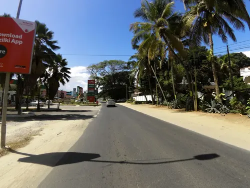
Café Aroma
Cafe · Coffee Shop, Cake, Breakfast, Crepe, Ice Cream, Sandwich, Tea · 3.1 km
Obama Road, Dar es salaam
Mo-Fr 08:00-23:00; Sa 10:00-23:00; Su 08:00-17:00
Munchies Masaki
Cafe · Ice Cream, Coffee Shop · 6.5 km
42 Haile Selassie Road, Dar es Salaam
Mo-Su 11:00-20:00



The Slow Leopard
Restaurant · Burger, International · 7.8 km
Bar and Restaurant, Sports Bar
1829/11 Chole Road
Su-Fr 09:00-23:00; Sa 09:00-24:00
Bali's & Co - International Cuisine
Restaurant · Pizza, Burger, Chinese, Chicken, Kebab, Indian, American, Seafood, Soup, Steak House, Noodle, Fish And Chips, Barbecue, Curry, Fries, Shawarma, Salad · 2.1 km
Allykhan Road, Dar es salaam
Mo-Su 18:00-00:00
Dar Fish Market
Restaurant · International, Regional, Seafood · 7.3 km
180 Msasani Bay, Dar es salaaam
Mo-Th 11:00-00:00; Fr-Su 11:00-01:00
The Cask in Dar
Restaurant · Burger, Pizza, Coffee Shop, Chicken, Seafood, International, Steak House · 10.6 km
768Q+GQJ, Dar es Salaam
24/7
Cask in Dar
Restaurant · Burger, Pizza, Chicken, Sandwich, Steak House, Fish And Chips, Barbecue, Seafood, Dessert · 10.6 km
24/7
380 more on the map.
History
In the 19th century, 'Mzizima (Swahili for "healthy town") was a coastal fishing village on the periphery of Indian Ocean trade routes. In 1865 or 1866, Sultan Majid bin Said of Zanzibar began building a new city very close to Mzizima and named it Dar es Salaam. The name is commonly translated from Arabic as "abode (home) of peace", from dar ("house"), and es salaam ("of peace"). Dar es Salaam fell into decline after Majid's death in 1870, but was revived in 1887 when the German East Africa Company established a station there. The town's growth was facilitated by its role as the administrative and commercial centre of German East Africa and industrial expansion following the construction of the Central Railway Line in the early 1900s.
In the East African campaign of World War I, British and Empire forces captured German East Africa. The Royal Navy bombarded the city with the monitor Mersey on 21 July 1916 and battleship HMS Vengeance on 21 August. The German colonial authorities surrendered the city on 3 September. German East Africa became the British Tanganyika Territory.
Read more of the history
Dar es Salaam remained the administrative and commercial centre. Under British indirect rule, European areas such as Oyster Bay and African areas (e.g., Kariakoo and Ilala) developed separately from the city centre. The city's population also included a large number of workers from British India, many of whom came to take advantage of trade and commercial opportunities. After World War II, Dar es Salaam experienced a period of rapid growth.
Political developments, including the formation and growth of the Tanganyika African National Union, led to Tanganyika's independence from colonial rule in December 1961. Dar es Salaam continued to serve as its capital, even when Tanganyika and the People's Republic of Zanzibar merged to form Tanzania in 1964. In 1973, provisions were made to relocate the capital to Dodoma, a more centrally located city in the interior. The relocation process to Dodoma was completed, although Dar es Salaam continued to be the location of most government offices.
In 1967, the Tanzanian government declared the ujamaa policy, which made Tanzania lean towards socialism. The move hampered the potential growth of the city as the government encouraged people not to move into cities and instead remain in Ujamaa socialist villages. By the 1980s, the policy failed to combat the increasing poverty and hunger that Tanzania faced, and had delayed necessary development. This situation led to the liberalisation policy of the 1980s that essentially ended socialism and silenced its proponents within Tanzania's government through political repression.
Until the late 1990s, Dar es Salaam was not regarded in the same echelon as Africa's leading cities like Cairo, Nairobi, Johannesburg, Lagos, or Addis Ababa. During the 2000s, businesses opened and prospered; growth expanded in the construction sector, with new multi-storey buildings, bridges and roads; Tanzanian banks headquartered in the city became better regulated; and the Dar es Salaam Stock Exchange expanded. The port is prominent for entrepot trade with landlocked countries like Rwanda, Burundi, Zambia, and the eastern portion of the Democratic Republic of the Congo. The city's skyline features tall buildings, among them the 35-storey PSPF Tower (finished in 2015) and the Tanzania Ports Authority (TPA) Tower, the tallest in the country (completed in 2016).
A number of historical buildings and elements of urban planning, such as parts of the harbour and streets going back to colonial times, still exist. The Old Boma, one of the city's oldest buildings, was built in 1866–67 by Majid bin Said, sultan of Zanzibar, and enlarged under German rule. The Botanical Gardens now are close to the National Museum of Tanzania. The present-day State House goes back to Majid bin Said, and were the seat of the German and later the British colonial governments. Along with the Azania Front Lutheran Church, built between 1899 and 1902, and the Roman Catholic St. Joseph's Cathedral, constructed around the same period, Ocean Road Hospital are early historical buildings in Dar es Salaam.
From the History section of Dar es Salaam on Wikipedia, under CC BY-SA 4.0.
More about Dar es Salaam
Geography
Dar es Salaam is located at 6°48' S, 39°17' E (−6.8000, 39.2833), on a natural harbour on the coast of East Africa, with sandy beaches in some areas.
Dar es Salaam Region is divided into five administrative districts, four of which are governed by municipal councils that are affiliated with the city's suburbs or wards.
Kinondoni is the most populated of the districts. It houses half of the city's population and several high-income suburbs.
Masaki, Oyster Bay and Ada Estate are the high-income suburbs located along the central beach. During the Colonial Era, they were the major European suburbs of the city. Diplomats and expatriates currently reside in these areas. Oyster Bay Beach (also known as Coco Beach) is the only white sandy beach east of Kinondoni.
Mikocheni and Regent Estate are also suburbs within the district. These are high and middle-income areas with Mikocheni B enjoying a higher population density than Mikocheni A and Regent Estate. According to the 2012 census, the Mikocheni ward had a population of 32,947.
Msasani is a peninsula to the northeast of the city centre and home to expatriates from the United Kingdom and other western countries. It contains a mixture of traditional shops and western-oriented resorts and stores including the redevelopment of the former Msani Slipway shipyard by architect Antoni Folkers.
Economy
Dar es Salaam is Tanzania's most important city for both business and government. The city contains high concentrations of trade and other services and manufacturing compared to other parts of the country, which has about 65 percent of its population in rural areas. Downtown includes small businesses, many of which are run by traders and proprietors whose families originated in the Middle East and the Indian subcontinent—areas of the world with which the settlements of the Tanzanian coast have had long-standing trading relations.
The Dar es Salaam Central Business District is the largest in Tanzania and comprises the Kisutu, Kivukoni, Upanga and Kariakoo areas. The downtown area is located in the Ilala district. Kivukoni is home to the Tanzania Central Bank, The Bank of Tanzania, the Dar es Salaam Stock Exchange and the city's important Magogoni fish market. With businesses and offices, Kisutu is the location of Dar es Salaam central railway station, the PSPF Towers, and the TPA Tower.
Dar es Salaam is undergoing major construction and development. The 35-storey PSPF Twin Towers are the second tallest building in the city and the country. The city has major infrastructural challenges, including an outdated transport system and occasional power rationing.
Arts and culture
The Tingatinga painting style originates from Dar es Salaam. The Nyumba ya sanaa ("House of Art") is a cultural centre, workshop and retail outlet dedicated to Tanzanian art, showcasing and promoting Tanzanian craftsmanship. Prominent Tanzanian sculptor George Lilanga has donated some of his works to the centre, including decorations of the building's main entrance.
The music scene in Dar es Salaam is divided among several styles. The longest-standing style is live dance music (muziki wa dansi) played by bands such as DDC Mlimani Park Orchestra and Malaika Musical Band. Taarab, which was traditionally popular in Zanzibar has also found a niche. However, it remains small compared both to dance music and "Bongo Flava", a broad category representing the Tanzanian take on hip hop and rhythm and blues that has quickly become the most popular locally produced music. The rap music scene is also present. Traditional music, which locally refers to tribal music, is still performed, but typically only on family-oriented occasions such as weddings.
Education
Dar es Salaam has the highest literacy rate in the country, with 93.9% of the residents being literate, compared to the national average of 77.9%. The city's GER lacks in comparison to the rest of the country with 96.1%, which is however still sufficient. On the other hand, its secondary GER is one of the highest in the country (61.8%).
The University of Dar es Salaam is the oldest and second largest public university in Tanzania after the University of Dodoma. It is located in the western part of the city in north-east Ubungo, and occupies 1,625 acres (6.58 km2) on Observation Hill, 13 km (8 mi) from the city centre. The university has 16,400 undergraduate and 2,700 postgraduate students.
From the Wikipedia article Dar es Salaam, under CC BY-SA 4.0.
Notable people from Dar es Salaam
 Mbwana SamattaTanzanian association football playerPhoto: Werner100359, CC BY-SA 4.0
 Hasheem ThabeetTanzanian basketball player (born 1987)Photo: Paulou, CC BY-SA 4.0
 Rachel LuttrellCanadian actressPhoto: Gage Skidmore, CC BY-SA 3.0
 David Adjayearchitect (born 1966)Photo: GSAPPstudent, CC BY-SA 4.0
 Vicky NtetemaBBC radio journalistPhoto: U.S. Department of State from United States, Public domain
- Marin HinkleAmerican actress
- Bibi Titi MohamedTanzanian politician (1926-2000)
- Muhoozi KainerugabaUgandan army commander
- Diamond PlatnumzTanzanian artist, dancer, philanthropist and businessman
- Simon MsuvaTanzanian association football player
- Mrisho NgasaTanzanian footballer
- Judith Kirton-DarlingBritish politician and trade unionist (born 1977)


Born in Dar es Salaam, according to Wikidata (CC0). Each name links to its Wikipedia article.
Where to stay98
DoubleTree by Hilton Hotel Dar es Salaam - Oyster Bay
Motel and hotel · 7.7 km
Slipway Road, Msasani Peninsular, Dar es Salaam
Churches and places of worship101
Hail Mary, Mother of Mercy
Church · Roman Catholic · 12.3 km
Kanisani Street, Dar es Salaam
Kanisa la Pentekoste Tanzania Mchikichini Parish Center
Church · Protestant
Utengule, Dar es Salaam
Shopping195
Gas and EV charging90
Schools, colleges and libraries100
Healthcare99
Map of Dar es Salaam
250 places. The map loads OpenStreetMap tiles when you open it.
Getting there and nearby towns
Julius Nyerere International Airport (DAR) is the nearest airport with scheduled flights listed in OpenStreetMap, 9 km away.
- Mwandege 17 km south, about 17 min by car
- Vikindu 21 km south, about 21 min by car
- Kisarawe 24 km west, about 24 min by car
- Mapinga 33 km northwest, about 33 min by car
- Mkuranga 33 km south, about 33 min by car
- Kibaha 39 km west, about 39 min by car
- Mahonda 47 km northeast, about 47 min by car
- Sokoni 53 km northeast, about 53 min by car
- Bagamoyo 59 km northwest, about 59 min by car
- Mlandizi 61 km west, about 1 h by car
Drive times are estimates from straight-line distance, not routes.
Keep exploring
Local news
Headlines from INDB.
Reviews, tips and questions
Loading what members have shared...
Sources and licences
- GeoNames (CC BY 4.0): population, coordinates, regions and time zone
- Mapillary (see each image): photos
- OpenStreetMap contributors (ODbL 1.0): places, airports, map data
- Wikidata (CC0 1.0): elevation, founding date, time zone, website, landmarks and historic places
- Wikimedia Commons (see each image): photos
- Wikipedia (CC BY-SA 4.0): overview and history text
Photo credits
- Dar es Salaam before dusk, Muhammad Mahdi Karim, GFDL 1.2
- Laika ac Dar es Salaam (9787816971), Laika ac from USA, CC BY-SA 2.0
- Water Carrier, Dar es Salaam (8147471496), Rod Waddington from Kergunyah, Australia, CC BY-SA 2.0
- Cleaness for all in the city of Dar es salaam, Rwebogora, CC BY-SA 4.0
- Girl, Dar es Salaam (8147397229), Rod Waddington from Kergunyah, Australia, CC BY-SA 2.0
- Pizza Hut at Mkuki Mall, Gerezani ward, Ilala MC, Dar es Salaam, Mangapwani, CC BY-SA 4.0
- A lighthouse in Zanzibar, Egbert, CC BY-SA 2.0
- TZ DarEsSalaam National museum, User:Digr, CC BY-SA 3.0
- Askari monument dar es salaam, Moongateclimber, Public domain
- Girls' Hostel (Low Cost) Ardhi University, Chiboko, CC BY-SA 3.0
- Nkrumah, Xlandfair at English Wikipedia, Public domain
- Aga Khan Hospital, Dar es Salaam, Ali A. Fazal, CC BY-SA 4.0
- IST Secondary Campus, Ali A. Fazal, CC BY-SA 4.0
- St. Joseph in Dar es Salaam ShiftN, aj82 , shifted by Rabanus Flavus, CC BY-SA 2.0
- The Open University of Tanzania, LittleT889, CC BY-SA 4.0
- Selander Bridge, LittleT889, CC BY-SA 4.0
- Tanzanite Bridge, From Msasani Ward in Kinondoni District to Kivukoni ward in Ilala District, Mangapwani, CC BY-SA 4.0
- Front of the house, at Mwalimu Nyerere Memorial House, Mzimuni, Kinondoni MC, Dar es Salaam, Mangapwani, CC BY-SA 4.0
- Wallet Sale (7941194678), Rod Waddington from Kergunyah, Australia, CC BY-SA 2.0
- Fishing Fleet (7970094594), Rod Waddington from Kergunyah, Australia, CC BY-SA 2.0
- Laika ac National Museum of Tanzania (9788007675), Laika ac from USA, CC BY-SA 2.0
- KASSIM, Kassim ally likutu, CC BY-SA 4.0
- Bin in street, Rwebogora, CC BY-SA 4.0
- SGR seen from Gerezani ward, Ilala MC, Mangapwani, CC BY-SA 4.0
- SGR in Gerezani ward, Ilala MC, Mangapwani, CC BY-SA 4.0
- Kariakoo Waking Up, Ismizotz, CC BY-SA 4.0
- Traditional medicines in Tanzania, Rwebogora, CC BY-SA 4.0
- A traditional therapist exhibiting his medications, Rwebogora, CC BY-SA 4.0
- Alternative medicines, Rwebogora, CC BY-SA 4.0
- Gerezani Scene at Nyerere Road, Gerezani, Ilala MC, Mangapwani, CC BY-SA 4.0
- The Archbishop of York, Dr. Michael Ramsey, The National Archives UK, No restrictions
- The Archbishop of York, Dr. Michael Ramsey (cropped), The National Archives UK, No restrictions
- Street-level photo, ramanihuria, CC BY-SA 4.0
- Street-level photo, ralebipim, CC BY-SA 4.0
- Street-level photo, ralebipim, CC BY-SA 4.0
- Street-level photo, ralebipim, CC BY-SA 4.0
- Street-level photo, roadsafetytz, CC BY-SA 4.0
- Street-level photo, jfrek, CC BY-SA 4.0
- Street-level photo, ng_here01, CC BY-SA 4.0
- Street-level photo, ralebipim, CC BY-SA 4.0
- Street-level photo, ralebipim, CC BY-SA 4.0
- Street-level photo, ralebipim, CC BY-SA 4.0
- Street-level photo, ralebipim, CC BY-SA 4.0
- Street-level photo, chrisbeddow, CC BY-SA 4.0
- Street-level photo, ralebipim, CC BY-SA 4.0
- Street-level photo, enoinyangete, CC BY-SA 4.0
- Street-level photo, chrisbeddow, CC BY-SA 4.0
- Street-level photo, ralebipim, CC BY-SA 4.0
- Street-level photo, ralebipim, CC BY-SA 4.0
- Street-level photo, ralebipim, CC BY-SA 4.0


Page built November 10, 2026. Spotted a mistake? Tell us or suggest a place.