


Makumbako, Tanzania
Makambako
Makumbako is a city of 116,232 people in Njombe, Tanzania.
Why visit Makumbako
Townapedia lists 1 place to eat and 1 place to stay in and around town.
Weather in Makumbako
Forecast from MET Norway (CC BY 4.0). Full forecast
About Makumbako
Makambako is a medium-sized town and district in the Njombe Region of the Tanzanian Southern Highlands, located roughly 40 miles north of Njombe city by road. It is located at junction of the A104 and B4 roads between Njombe, Iringa, and Mbeya. Its population according to the 2002 Tanzanian census was 51,049.
From the Wikipedia article Makambako (this version), under CC BY-SA 4.0.
Travel tips from other travellers: Makumbako on Wikivoyage (CC BY-SA 4.0).
Restaurants and cafes1
Where to stay1
Churches and places of worship2

Gas and EV charging1


History
Makambako was visited by Paul Theroux who in his book Dark Star Safari: Overland from Cairo to Cape Town described it not as a town but "a collection of hovels on stretch of paved road where idle people sat or stood."
The town of Makambako has seen fast development. As a result, the northwest Wabena are advocating for Makambako to become its own district.
Makambako's rapid development owes to being the location where Songea Road branches off Tanzania Zambia Road (TANZAM), Presence of Tanzania Zambia Railway Authority (TAZARA)'s railway station. Presence of TAZARA railway station lead to establishment of police station, TAZARA workers quarters, development of TAZARA water intake at Bwawani which is now being developed by the government. Presence of Tanzania People Defence Force (TPDF) Legion. All these led to the influx of workers from different parts of Tanzania as a well as people from nearby villages to trade in the area. These development led to development of market, modern and local bars etc making it the business centre.
From the History section of Makambako on Wikipedia, under CC BY-SA 4.0.
More about Makumbako
Geography
Makambako is now a town, located in the Southern Highlands of Tanzania, approximately 60 kilometers north of the district capital of Njombe. The town of Makambako contains the settlements of Ikwete, Maguvani, Ubena, Kipagamo, Idofi, Mlowa, Mkolango, Lyamkena, Kiumba, Mwembetogwa, Mjimwema, Kitisi, Kivavi and Kilimahewa.
The Makambako Plateau is one of three agroecological zones in the Njombe District, the other two being the Eastern Highlands and the Njombe Plateau.
Maize is commonly grown in the plateau while Makambako is notable for tomato cultivation and trade.
Arts and culture
The largest ethnic group in Makambako town are the Bena. Their living arrangements include large, polygamous, extended families and on average, there are more than five children in a household. Farming responsibility is left to women with almost all of them following an occupation. Female headed households are more dependent on subsistence food, operating as "street vendors" or with mobile fast-food kitchens.
Other group of people includes Kinga from Makete district who famous in trading activities. Pangwa from Ludewa District and Hehe are from nearby Iringa Region.
There is also a significant number of people from other regions who came to work as Soldiers, Police officers and Railway workers who have established permanent settlement in the town.
Kiswahili is widely spoken just as other urban areas of Tanzania.
The native tribe of this area are Bena who are at adjacent to the Iringa Region where Hehe is spoken hence many residents speak Kisovi a variation of Kibena which some vocabulary and pronunciation resemble that of Hehe counterparts
Education
There are several educational institutions in Makambako including primary schools, secondary schools and one university. Some of these include primary schools like Azimio Primary School, Makambako primary School, Maendeleo primary school, Uhuru primary school, Umoja primary school, also secondary schools like Makambako secondary school, Lyamkena secondary school, Maguvani secondary school, Kipagamo secondary school, Naboti secondary school, genesis secondary school, Mcf-Makambako Girls Secondary School, Ngogo secondary school, Mukilima secondary school. Also there is one university named St. Joseph University of Tanzania.
From the Wikipedia article Makambako, under CC BY-SA 4.0.
Schools, colleges and libraries12
Healthcare1
Map of Makumbako
18 places. The map loads OpenStreetMap tiles when you open it.
Getting there and nearby towns
Njombe Airport (JOM) is the nearest airport with scheduled flights listed in OpenStreetMap, 57 km away.
- Mtwango 19 km south, about 19 min by car
- Ilembula 28 km west, about 28 min by car
- Malangali 32 km north, about 32 min by car
- Rujewa 52 km west, about 52 min by car
- Makungu 51 km east, about 51 min by car
- Njombe 56 km south, about 56 min by car
- Urunda 63 km west, about 1 h by car
- Mafinga 79 km northeast, about 1 h 15 min by car
- Chimala 89 km west, about 1 h 30 min by car
Drive times are estimates from straight-line distance, not routes.
Keep exploring
Local news
Headlines from INDB.
Reviews, tips and questions
Loading what members have shared...
Sources and licences
- GeoNames (CC BY 4.0): population, coordinates, regions and time zone
- Mapillary (see each image): photos
- OpenStreetMap contributors (ODbL 1.0): places, airports, map data
- Wikidata (CC0 1.0): elevation, founding date, time zone, website
- Wikimedia Commons (see each image): photos
- Wikipedia (CC BY-SA 4.0): overview and history text
Photo credits
- Makambako Station, David Brossard, CC BY-SA 2.0
- Rovos train at the Makumbako Railway Station, David Brossard, CC BY-SA 2.0
- Canteen at the Makubako Station along the Tazara Railway, David Brossard, CC BY-SA 2.0
- Derailed tank cars on the TAZARA, David Brossard, CC BY-SA 2.0
- Locomotives and signals (8483865093) (2), David Brossard, CC BY-SA 2.0
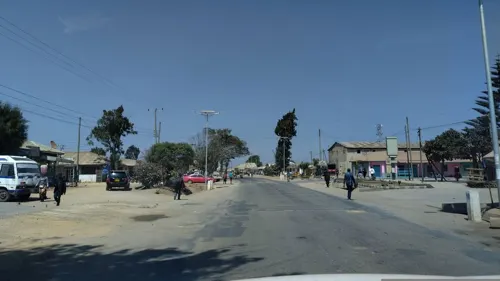
- Street-level photo, 100sassa, CC BY-SA 4.0
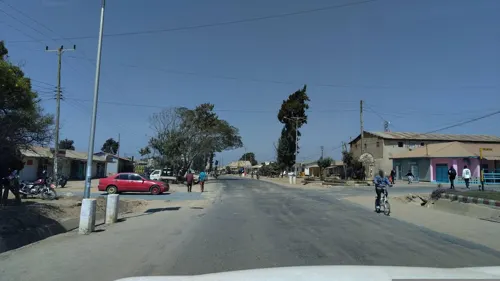
- Street-level photo, 100sassa, CC BY-SA 4.0
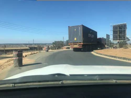
- Street-level photo, allennatai, CC BY-SA 4.0
Page built November 10, 2026. Spotted a mistake? Tell us or suggest a place.