


Morogoro, Tanzania
Morogoro is a regional capital of 471,409 people in Morogoro, Tanzania.
Why visit Morogoro
Townapedia lists 7 museums and landmarks, 16 parks and trails, 108 places to eat, 190 places to stay and 8 attractions in and around town.
Highlights include Lupanga, Jamhuri Stadium and vimbweta.
Weather in Morogoro
Forecast from MET Norway (CC BY 4.0). Full forecast
About Morogoro
Morogoro is a city located in the eastern part of Tanzania, approximately 196 kilometers (122 miles) west of Dar es Salaam. It serves as the capital of the Morogoro Region. Informally, it is referred to as Mji kasoro bahari, which translates to city short of an ocean/port.
From the Wikipedia article Morogoro (this version), under CC BY-SA 4.0.
Travel tips from other travellers: Morogoro on Wikivoyage (CC BY-SA 4.0).
Photos of Morogoro


Things to do8


Multipurpose Hall (M. H)
Cinema and theater · 4.6 km
The multipurpose Hall is used for different in campus activities like conferences, public lecturings and ceremonies celebrations.
Museums and landmarks7

Parks, trails and playgrounds16

Jamhuri Stadium
Sports field and stadium · 1.3 km
Sports and public festivals ceremonial areas.
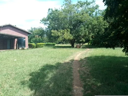

JUKWAA LA MASHABIKI
Sports field and stadium · 4.3 km
A place where fans use to stay while watching games



4 more on the map.
Restaurants and cafes108
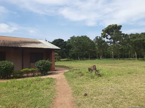




Scoops'n'smiles
Ice cream · 1.0 km
Station Road
Sa-Su 10:00-23:00; Tu-Fr 13:00-22:00

Suzzy Catering Services
Restaurant · Pizza, Regional, Burger, Sandwich, Ice Cream · 1.1 km
Mo-Su 08:00-23:00
Dragonair's
Restaurant · Pizza, Burger · 3.2 km
Mo-Th 12:00-23:00; Fr-Su 12:00-23:00
Tex Palace Restaurant
Restaurant · Coffee Shop, Pizza, Chicken, Fish And Chips, Kebab
Ngoto Street, Morogoro

96 more on the map.
More about Morogoro
Geography
The city is situated at the foothills of the Uluguru Mountains and serves as a significant agricultural center in the region. Morogoro is the site of many Sisal plantations. The climate in Morogoro is warm and tropical with average highs ranging from 32 °C (90.7 °F) to 27.8 °C (82.6 °F), and lows ranging from 16.7 °C (62.1 °F) to 12.4 °C (54.3 °F).
Education
Morogoro is home to several notable universities and colleges, including Sokoine University of Agriculture (SUA), Muslim University of Morogoro, St. Joseph University College, and Jordan University College. Mzumbe University is located approximately 26 kilometers south of the town along the Iringa Highway. The municipality also houses renowned institutions such as Ardhi Institute Morogoro, Morogoro Teachers College, and LITI (Livestock Training Institute).
Morogoro boasts several notable secondary schools, including Kilakala Girls High School, one of the oldest in the country and previously known as Marian College. The region is also home to Morogoro Secondary School, formerly Aga Khan Secondary School, Forest Hill Secondary, Jabal Hira Muslim Secondary, Kigurunyembe Secondary, Lutheran Junior Seminary, St. Francis de Sales Seminary, Kimamba Secondary, Sua Secondary, Ifakara Secondary, St. Peter's Seminary, Lupanga Practising Secondary School (a recently established institution near Kigurunyembe Teacher's College), and Kola Hill Secondary School. Additionally, Morogoro is host to the Morogoro International School, an English-language institution established in 1975.
From the Wikipedia article Morogoro, under CC BY-SA 4.0.
Notable people from Morogoro
- Kelvin JohnTanzanian footballer
- Julie ManningTanzanian lawyer, judge and politician
- Shomari KapombeTanzanian footballer
- Faridi MussaTanzanian association football player
- Aishi ManulaTanzanian football player
- Mzamiru YassinTanzanian footballer
- Dickson JobTanzanian footballer
- Yahya ZaydTanzanian footballer
- Hassan KessyTanzanian association football player
- Vincent Lawrence MpwajiTanzanian Roman-Catholic priest
- Ashok Jivraj RabheruBritish businessman (born 1952)
- GodzillaTanzanian musician (1988-2019)
Born in Morogoro, according to Wikidata (CC0). Each name links to its Wikipedia article.
Where to stay190
Churches and places of worship129
Shopping21
Gas and EV charging36
Schools, colleges and libraries220
Healthcare122
Afya Medicare Specialized Clinic
Clinic and pharmacy · 1.0 km
Old Dar es Salaam Road
Map of Morogoro
250 places. The map loads OpenStreetMap tiles when you open it.
Getting there and nearby towns
- Ngerengere 51 km east, about 51 min by car
- Magole 59 km northwest, about 59 min by car
- Kimamba 58 km west, about 58 min by car
- Dumila 60 km northwest, about 1 h by car
- Msowero 60 km northwest, about 1 h by car
- Kisanga 69 km south, about 1 h 15 min by car
- Kilosa 75 km west, about 1 h 15 min by car
- Madizini 76 km north, about 1 h 15 min by car
- Chalinze 79 km east, about 1 h 15 min by car
- Lubata 84 km north, about 1 h 30 min by car
Drive times are estimates from straight-line distance, not routes.
Keep exploring
Local news
Headlines from INDB.
Reviews, tips and questions
Loading what members have shared...
Sources and licences
- GeoNames (CC BY 4.0): population, coordinates, regions and time zone
- Mapillary (see each image): photos
- OpenStreetMap contributors (ODbL 1.0): places, airports, map data
- Wikidata (CC0 1.0): elevation, founding date, time zone, website, landmarks and historic places
- Wikimedia Commons (see each image): photos
- Wikipedia (CC BY-SA 4.0): overview and history text
Photo credits
- Morogoro panorama, Muhammad Mahdi Karim, GFDL 1.2
- Luc Toulotte at the wheel of his Mini Moke in Morogoro (3084034151), mwanasimba from La Réunion, CC BY-SA 2.0
- Peugeot 304 at Mzumbe, Morogoro (3084032343), mwanasimba from La Réunion, CC BY-SA 2.0
- Morogoro from Uluguru Mountains, tik_tok, CC BY-SA 2.0
- Morogoro and Uluguru Mountains, tik_tok, CC BY-SA 2.0
- Morogoro, Wet season, MillaVillaKulla, CC BY-SA 2.0
- Morogoro and Uluguru Mountains-2, aleksip, CC BY-SA 2.0
- Daladala stand, Morogoro, aleksip, CC BY-SA 2.0
- Morogoro-1, MillaVillaKulla, CC BY-SA 2.0
- Morogoro street, aleksip, CC BY-SA 2.0
- Bus station, Morogoro, MillaVillaKulla, CC BY-SA 2.0
- Morogoro Bus Station and Uluguru Mountains, tik_tok, CC BY-SA 2.0
- Morogoro from Uluguru Mountains-2, MillaVillaKulla, CC BY-SA 2.0
- Hotel Morogoro 20251213 173450, Josefito123, CC BY 4.0
- Hotel Morogoro 20251213 173044, Josefito123, CC BY 4.0
- Hotel Morogoro 20251 213 172249, Josefito123, CC BY 4.0
- Hotel Morogoro 20251213 172251, Josefito123, CC BY 4.0
- Chipsi mayai en Morogoro 20251201 203826, Josefito123, CC0
- Waterfall Bahati Camp Uluguru Morogoro, Muhammad Mahdi Karim, GFDL
- Morogoro, Abdul255, CC BY-SA 4.0
- Jamhuri Stadium, Morogoro, Egbert, CC BY-SA 2.0
- Transformador electrico 20251130 081645, Josefito123, CC0
- Hotel Lite 20251130 072605, Josefito123, CC0
- A fork in the road, Dar es Salaam-Dodom-Iringa - panoramio, Xiaotong Gao, CC BY-SA 3.0
- Artocarpus altilis 340712414, Liliana Ramírez-Freire, CC BY 4.0
- Artocarpus altilis 340712397, Liliana Ramírez-Freire, CC BY 4.0
- Artocarpus altilis 340712404, Liliana Ramírez-Freire, CC BY 4.0
- Artocarpus altilis 340712400, Liliana Ramírez-Freire, CC BY 4.0
- Hotel Rombian Lodge 20251213 192255, Josefito123, CC BY 4.0
- Partidos de Futbol 20251213 181702, Josefito123, CC BY 4.0
- Hotel Rombian Lodge 20251213 133708, Josefito123, CC BY 4.0
- Hotel Rombian Lodge 20251213 133716, Josefito123, CC BY 4.0
- Image-Uluguru Mountain Ranges Panorama alt, Muhammad Mahdi Karim, GFDL
- Uluguru Mountain Ranges Panorama, Muhammad Mahdi Karim, GFDL
- Sunrise mt uluguru, Muhammad Mahdi Karim, GFDL
- Jardín Botánico de la Universidad de Agricultura de Sokaine 20251213 164326, Josefito123, CC BY 4.0
- Jardín Botánico de la Universidad de Agricultura de Sokaine 20251213 164324, Josefito123, CC BY 4.0
- Street-level photo, calista2019, CC BY-SA 4.0
- Street-level photo, calista2019, CC BY-SA 4.0
- Street-level photo, philipovictor, CC BY-SA 4.0
- Street-level photo, roadroid, CC BY-SA 4.0
- Street-level photo, SUA, CC BY-SA 4.0
- Street-level photo, Abdisele, CC BY-SA 4.0
- Street-level photo, roadroid, CC BY-SA 4.0
- Street-level photo, AlemayehuYemane, CC BY-SA 4.0


Page built November 10, 2026. Spotted a mistake? Tell us or suggest a place.