


Why visit Pangani
Townapedia lists 2 museums and landmarks, 1 park or trail, 6 places to eat and 10 places to stay in and around town.
Weather in Pangani
Forecast from MET Norway (CC BY 4.0). Full forecast
About Pangani
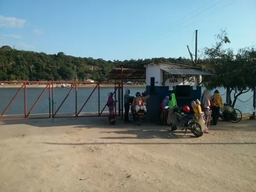
Pangani (Mji wa Pangani, in Swahili) is a historic town and capital of Pangani District in the Tanga Region of Tanzania. The town lies 45 km (28 mi) south of the city of Tanga, at the mouth of the Pangani River in which the town is named after. Administrately the town Pangani is situated within two wards, Pangani Mashariki and Pangani Magharibi. The town is currently the largest settlement in Pangani District and is a major tourist attraction in Tanga region and is a home to Muhembo, a Tanzanian National Historic Site.
From the Wikipedia article Pangani (this version), under CC BY-SA 4.0.
Photos of Pangani


Museums and landmarks2

Parks, trails and playgrounds1

Restaurants and cafes6



Where to stay10

History
The first people to live in Pangani Bay were hunter-gatherers during the Palaeolithic era. They fashioned tools out of quartz river pebbles by hammering them with simple, forceful blows. Southwest of Bweni, the escarpment is covered in debris from the production and usage of stone tools. Lithic artefacts from more recent sites show that populations that used iron for agriculture continued to use (or even went back to) stone technologies after making the shift to an agricultural lifestyle, occasionally employing rare raw materials from upriver. By 600–1000 C.E., if not earlier, farming villages using iron began to appear in the region.
They created TIW and dwelt near the Pangani River or atop escarpments with a view of the waterway. The farming peoples of Pangani Bay were the Bondei and Zigua.
Early TIW found close to Kumbamtoni resembled coastal pottery from the southern and central parts of the Swahili coast. Such pottery are accompanied with more than 20 disc beads made of sea shells in Kumbamtoni. Along the river bank, there are also a few Maore Ware sherds that come from the interior of the continent. At sites in Pangani Bay, there is no indication of foreign ceramics from before 1000 C.E., such as Sasanian Islamic variations. However, the discovery of a purported Roman ceramic (or Indic copy) points to communication with the larger Indian Ocean in the first millennium C.E.
Read more of the history
During the Swahili era (1250–1550 CE), interactions between indigenous tribes of the Pangani coast and communities in the Indian Ocean took place, but at a minor level. Thus, the "Golden Age" of the Swahili (1250/1350-1550 C.E., but especially the earlier centuries within this range) influenced littoral settlers in northeastern Tanzania, although not nearly to the extent felt at Kilwa on the southern Swahili coast (where the gold trade flourished 1200-1350 C.E.) or at Mombasa and Malindi in Kenya. Late in this era, Tongoni as well as Swahili towns on Tanga Island (in the bay near Tanga Town) with monumental Swahili architecture began to grow in importance.
Archaeologists have also found the remains of small 15th century Swahili settlements on the bluffs just north of Pangani at Muhembo, According to the research, Pangani Bay's first inhabitant's Zanjian traditions served as the cradle of later Swahili culture. From the Zanjian to the Swahili periods, local people continued to practise the majority of their pottery, trading, and culinary practises. Minor alterations are also discernible, most likely due to ongoing interactions with bordering groups along the shore. From the Zanjian to the Swahili periods, pottery with comparable form and ornamentation was employed.
Shellfish evidence reveals patterns of food collecting by the first inhabitants and the kinds of foods that were consumed, suggesting both change and continuity. The discovery of Sasanian Islamic wares from the Persian Gulf during the Zanjian period and black-and-yellow ceramics from the Red Sea during the Swahili eras is evidence of the old maritime trade history in Pangani Bay. The pottery in Zanjian and Swahili villages in Pangani Bay shared characteristics with that of sites on the East African coast (Shanga, Kilwa, and Kaole), as well as its hinterland (Mombo), in addition to the recognised internal cultural continuity. Such evidence suggests that the people of Pangani Bay are still connected to other communities in East Africa on a regional level.
The southern Swahili coast (south of Tanga Town) is thought to have developed a different tradition from the northern coast (from Mombasa to the Lamu Archipelago in Kenya) before 1250 C.E. Due to a shift in Islamic influence (from the Persian Gulf to the Red Sea) that brought people together and encouraged settlement growth and expansion, the northern shore dominated the economy during this time. on this model, resurrected leadership anchored on Islamic doctrine, iconography, and emulation increased trade monopolies and sparked close ties with other groups in the Indian Ocean through trade. During this time, it is likely that a rigid, emic idea of the African hinterland developed as wealthy coastal Swahili town dwellers (waungwana) saw the need to set themselves apart from people who lived in the interior in order to consolidate their authority and safeguard expanding trade monopolies.
Surface investigations revealed 18 Swahili sites, including Mnyongeni, Mtakani, and Kumbamtoni (1250–1550 C.E.). Villagers in Muhembo and Tongoni were constructing coral structures and going to mosques for prayer by 1400 C.E. These were the two biggest towns in their respective regions at the time. Other community members (from Muhembo and Tongoni) resided in distant wattle-and-daub homes. Foreign contacts, which may be seen in the archaeological record in the form of Asian ceramics and glass beads, had a significant impact on the formation of identity borders. For example, 62 of 81 (75.3%) of the beads found during excavations at these sites—92 of 108 (85.2%) at Muhembo (Site 37 in Survey Unit 4); and Tongoni—are of foreign (glass) provenance. Among other things, locals created iron tools, textiles, nonglass beads, and ceramics.
The situation along the coast was different after 1550 C.E. In contrast to Mombasa, the majority of coastal cities shrank in population, lost their once-dominant status, or even fell into ruin. By 1600 C.E. and 1850 C.E., respectively, pottery from Post-Swahili and Post-Post-Swahili settlements were widespread. The initial phase of these at Pangani was characterised by diffuse settlement. Compared to sites from earlier, Swahili times, those that included only Post-Swahili materials were found during the survey to be relatively smaller. On the other hand, findings from sites containing mostly Swahili artefacts are scarcely any Post-Swahili remains.
From the History section of Pangani on Wikipedia, under CC BY-SA 4.0.
More about Pangani
Economy
The Mauya plantations no longer grow sugar, but produce much coconut and betel-nut. Pangani was once a secondary center of the sisal industry, servicing sisal plantations to the north and south of town. Pangani also has a fishing industry. In recent years beach resorts north and south of the town have brought tourists. The town is a district headquarters. Its hospital draws patients from many parts of the region. Funguni Secondary School is in Pangani Town and Boza Secondary School is a short distance north.
From the Wikipedia article Pangani, under CC BY-SA 4.0.
Notable people from Pangani
 Abushiri ibn Salim al-HarthiMerchant and plantation ownerPhoto: Perbandt, Conradin von (Verfasser)..., Public domain
- Kleist SykesTanganyikan activist
Born in Pangani, according to Wikidata (CC0). Each name links to its Wikipedia article.
Churches and places of worship1
Schools, colleges and libraries5
Healthcare2
Map of Pangani
27 places. The map loads OpenStreetMap tiles when you open it.
Getting there and nearby towns
Tanga Airport (TGT) is the nearest airport with scheduled flights listed in OpenStreetMap, 38 km away.
- Majengo 31 km north, about 31 min by car
- Muheza 36 km northwest, about 36 min by car
- Tanga 42 km north, about 42 min by car
- Nungwi 49 km southeast, about 49 min by car
- Mlalo 55 km north, about 55 min by car
- Maramba 58 km northwest, about 58 min by car
- Mkokotoni 59 km southeast, about 59 min by car
- Kijini 61 km southeast, about 1 h by car
- Korogwe 62 km northwest, about 1 h by car
- Zanzibar 86 km south, about 1 h 30 min by car
Drive times are estimates from straight-line distance, not routes.
Towns near Pangani


Keep exploring
Local news
Headlines from INDB.
Reviews, tips and questions
Loading what members have shared...
Sources and licences
- GeoNames (CC BY 4.0): population, coordinates, regions and time zone
- Mapillary (see each image): photos
- OpenStreetMap contributors (ODbL 1.0): places, airports, map data
- Wikidata (CC0 1.0): elevation, founding date, time zone, website
- Wikimedia Commons (see each image): photos
- Wikipedia (CC BY-SA 4.0): overview and history text
Photo credits
- Swahili house in Pangani, Pangani District, Tanga Region, Mnazini, CC BY-SA 4.0
- Side post of Swahili door in Pangani, Tanga Region, Mnazini, CC BY-SA 4.0
- Arabic Inscription on Swahili door in Pangani, Tanga Region, Mnazini, CC BY-SA 4.0
- Front view of Swahili door in Pangani, Tanga Region, Mnazini, CC BY-SA 4.0
- Center post of Swahili door in Pangani, Pangani District, Tanga Region, Mnazini, CC BY-SA 4.0
- Swahili door details, Pangani District, Tanga Region, Mnazini, CC BY-SA 4.0
- Swahili door in Pangani District, Tanga Region, Mnazini, CC BY-SA 4.0
- Old Swahili House, Pangani Mashariki Ward, Halidtz, CC BY-SA 4.0
- Pangani town coconut street, Halidtz, CC BY-SA 4.0
- Swahili window in Pangani, Pangani District, Tanga Region, Mnazini, CC BY-SA 4.0
- Swahili House detail, Pangani mashariki ward, Pangani, Halidtz, CC BY-SA 4.0
- Street Scene in Pangani Mashariki 01, Halidtz, CC BY-SA 4.0
- Historic Street Pangani, Pangani District, Tanga Region, Mnazini, CC BY-SA 4.0
- Street Scene in Pangani Mashariki 02, Halidtz, CC BY-SA 4.0
- Street in Pangani, Pangani District, Tanga Region, Mnazini, CC BY-SA 4.0
- Pangani Street, Pangani District, Tanga Region, Mnazini, CC BY-SA 4.0
- Pangani, Aslak Raanes from Trondheim, Norway, CC BY 2.0
- Swahili river cargo Boats in Pangani Town, Halidtz, CC BY-SA 4.0
- Istiquamaa School, Pangani Mashariki, Pangani District, Mnazini, CC BY-SA 4.0
- Bweni, Pangani District, Mnazini, CC BY-SA 4.0
- Mangrove on Pangani River, Pangani District, Mnazini, CC BY-SA 4.0
- Historic Muhembo ruins, Pangani DC, Tanga Region5, Mnazini, CC BY 4.0
- Historic Muhembo ruins, Pangani DC, Tanga Region6, Mnazini, CC BY 4.0
- Porokanya Saadani Beach Coast, Research Impacts, CC BY-SA 4.0
- Street-level photo, janvanbekkum, CC BY-SA 4.0


Page built November 10, 2026. Spotted a mistake? Tell us or suggest a place.