

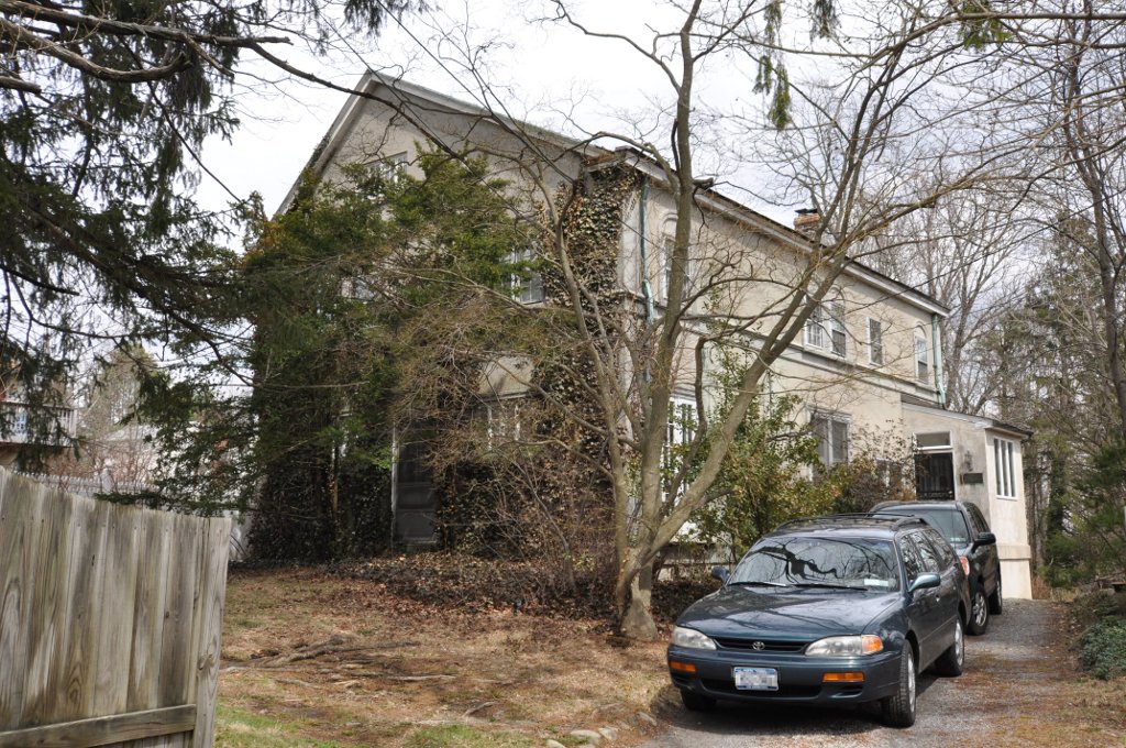


Valhalla, New York
Valhalla is a community of 2,937 people in Westchester County, New York.
Why visit Valhalla
Townapedia lists 15 museums and landmarks, 6 parks and trails, 7 places to eat and 1 attraction in and around town.
Highlights include Bar Building, Elijah Miller House, Davis Brook Park and Kensico Dam Plaza.
July is the warmest month, with average highs of 83°F; January lows average 22°F.
Weather in Valhalla
Forecast from the National Weather Service. Full forecast
About Valhalla
Valhalla is a hamlet and census-designated place (CDP) within the town of Mount Pleasant, in Westchester County, New York, United States, in the New York City metropolitan area. As of the 2020 census, Valhalla had a population of 3,213. The hamlet is known for being the home of the primary hospital campus of Westchester Medical Center and New York Medical College as well as the burial place of numerous notable people. The hamlet's name was inspired by Valhalla, a hall for the slain in Norse mythology.
From the Wikipedia article Valhalla, New York (this version), under CC BY-SA 4.0.
Things to do1

Museums and landmarks15

Bar Building
Monument and historic site · National Register of Historic Places · 3.2 mi
Historic commercial building in New York, United States

Elijah Miller House
Museum · National Register of Historic Places · 1.3 mi
Historic house in New York, United States

Elmsford Reformed Church and Cemetery
Monument and historic site · National Register of Historic Places · 2.8 mi
Historic church in New York, United States

Good Counsel Complex
Monument and historic site · National Register of Historic Places · 2.7 mi
In White Plains, New York, United States

Hammond House
Monument and historic site · National Register of Historic Places · 1.8 mi
Historic house in New York, United States

Jacob Purdy House
Monument and historic site · National Register of Historic Places · 2.8 mi
Historic house in New York, United States

John Hartford House
Monument and historic site · National Register of Historic Places · 0.9 mi
Historic house in New York, United States
Leo Friedlander Studio
Monument and historic site · National Register of Historic Places · 2.9 mi
White Plains, New York, NRHP-listed

Mapleton
Monument and historic site · National Register of Historic Places · 2.8 mi
House in White Plains, New York, United States

Peoples National Bank and Trust Company Building
Monument and historic site · National Register of Historic Places · 3.2 mi
Building in New York, United States

Stony Hill Cemetery
Monument and historic site · National Register of Historic Places · 2.1 mi
Historic cemetery in Westchester County, New York, US
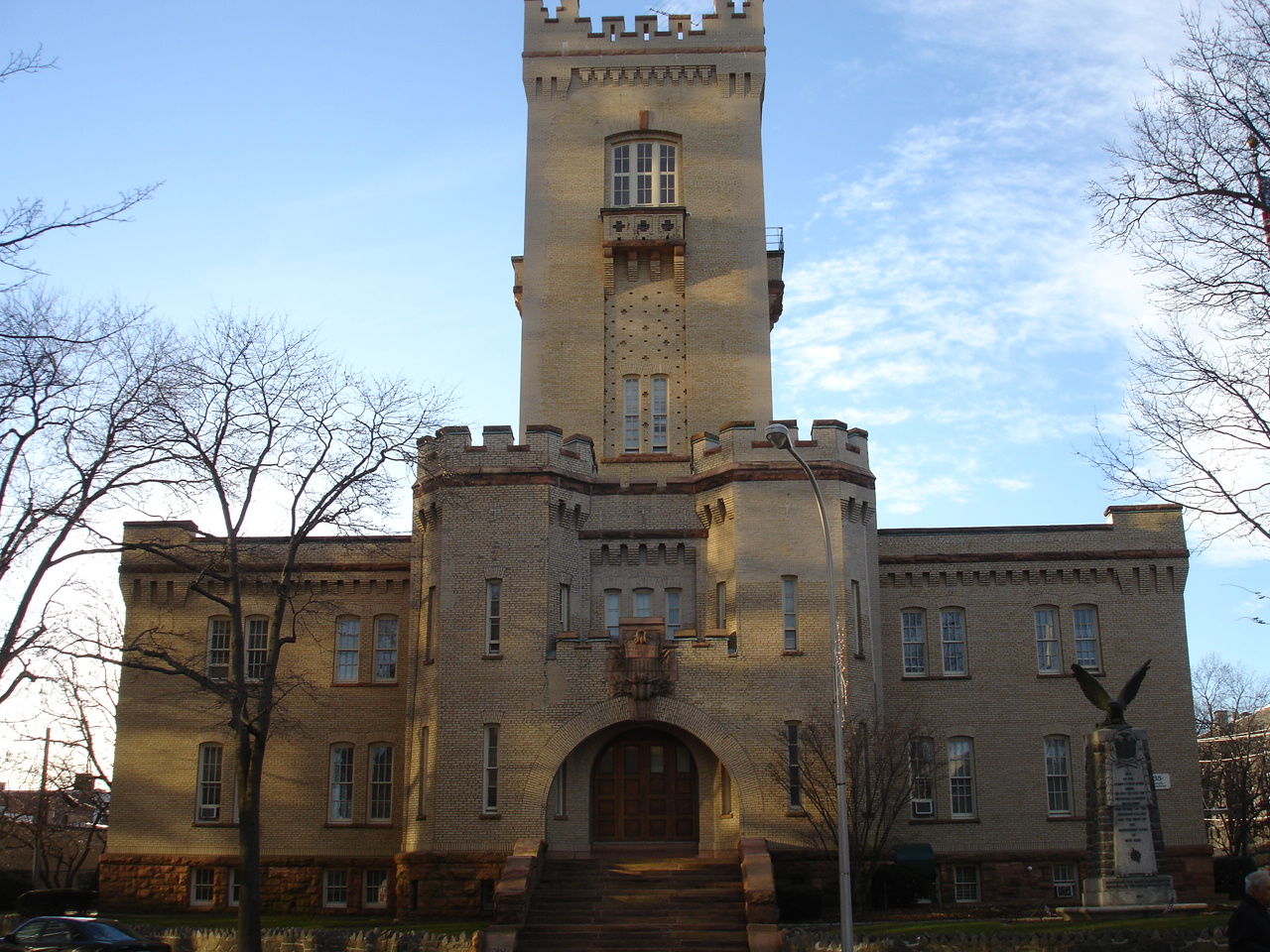


White Plains Armory
Monument and historic site · National Register of Historic Places · 3.3 mi
Armory in New York, United States of America
3 more on the map.
Parks, trails and playgrounds6


Fountains Park
Park · 0.9 mi
"a wooded area located adjacent to and south of Clove Road...
Hillandale Avenue
Restaurants and cafes7



Churches and places of worship4
Union Church of Pocantico Hills
Church · National Register of Historic Places · 3.1 mi
Gas and EV charging4
Schools, colleges and libraries50
Healthcare2
Map of Valhalla
89 places. The map loads OpenStreetMap tiles when you open it.
Climate by month
Monthly table
| Month | High | Low | Rain |
|---|---|---|---|
| Jan | 37°F | 22°F | 3.2 in |
| Feb | 40°F | 24°F | 2.5 in |
| Mar | 48°F | 30°F | 4.1 in |
| Apr | 59°F | 40°F | 4.2 in |
| May | 69°F | 50°F | 3.9 in |
| Jun | 78°F | 59°F | 4.2 in |
| Jul | 83°F | 65°F | 4.1 in |
| Aug | 81°F | 64°F | 4.4 in |
| Sep | 74°F | 57°F | 4.9 in |
| Oct | 63°F | 46°F | 4.3 in |
| Nov | 52°F | 36°F | 3.6 in |
| Dec | 42°F | 28°F | 4.2 in |
U.S. Climate Normals 1991-2020 for Westchester Co Ap (4 mi away), NOAA NCEI.
People and cost of living
American Community Survey 5-year estimates, 2020-2024, U.S. Census Bureau. Estimates have margins of error, larger for small towns.
Disaster history
Westchester County has had 21 federal disaster declarations since 2000, most often for hurricanes.
- 2024-01-30: Severe Storm And Flooding (Flood)
- 2021-09-05: Remnants Of Hurricane Ida (Hurricane)
- 2021-09-02: Remnants Of Hurricane Ida (Hurricane)
- 2021-08-22: Hurricane Henri (Hurricane)
- 2020-10-02: Tropical Storm Isaias (Hurricane)
- 2020-03-20: Covid-19 Pandemic (Biological)
OpenFEMA disaster declarations summaries.
Getting there and nearby towns
Westchester County Airport (HPN) is the nearest airport with scheduled flights listed in OpenStreetMap, 4 miles away.
- Hawthorne 2 mi northwest, about 3 min by car
- Elmsford 2 mi southwest, about 4 min by car
- Fairview 3 mi south, about 4 min by car
- Thornwood 3 mi north, about 5 min by car
- White Plains 4 mi south, about 6 min by car
- Pleasantville 4 mi north, about 6 min by car
- Hartsdale 4 mi south, about 7 min by car
- Harrison 5 mi southeast, about 8 min by car
- Tarrytown 5 mi west, about 8 min by car
- Sleepy Hollow 5 mi west, about 8 min by car
Drive times are estimates from straight-line distance, not routes.
Local news
Headlines from INDB, the NEMICO news database.
Reviews, tips and questions
Loading what members have shared...
Sources and licences
- NCES EDGE (Public domain): public schools
- NOAA NCEI U.S. Climate Normals 1991-2020 (Public domain): climate by month
- OpenFEMA (Public domain): disaster declarations
- OpenStreetMap contributors (ODbL 1.0): places, airports, map data
- U.S. Census Bureau (Public domain): population, income, housing, education, commute
- Wikidata (CC0 1.0): elevation, founding date, time zone, website, landmarks and historic places
- Wikimedia Commons (see each image): photos
- Wikipedia (CC BY-SA 4.0): overview and history text
Photo credits
- Kensico dam, Vincent de Lagabbe, CC BY-SA 3.0
- HartsdaleNY LeoFriedlanderStudio, User:Magicpiano, CC BY-SA 4.0
- Mapleton, Joshua Koerner, CC BY-SA 3.0
- White Plains Rural Cemetery 2012-09-23 12-26 jeh, jim.henderson, CC BY-SA 3.0
- Hartford-hall, Dmadeo, CC BY-SA 4.0
- Elijahmillerhouse, NortyNort ( talk ), CC BY-SA 3.0
- WhitePlainsNY GoodCounselChapel, User:Magicpiano, CC BY-SA 4.0
- HarrisonNY StonyHillCemetery2, Magicpiano, CC BY-SA 4.0
- Jacob Purdy House, GaoKyle, CC BY-SA 4.0
- Bar Building 2012-09-23 jeh, jim.henderson, CC BY-SA 3.0
- Hammond House, Hawthorne, NY, Daniel Case, CC BY-SA 3.0
- Peoples National Bank and Trust Company Building 31 Mamaroneck Av jeh, jim.henderson, CC BY-SA 3.0
- ArmoryWhitePlains, KForce, CC BY-SA 3.0
- WhitePlainsNY YWCA Housing, User:Magicpiano, CC BY-SA 4.0

Page built October 30, 2026. Spotted a mistake? Tell us or suggest a place.