


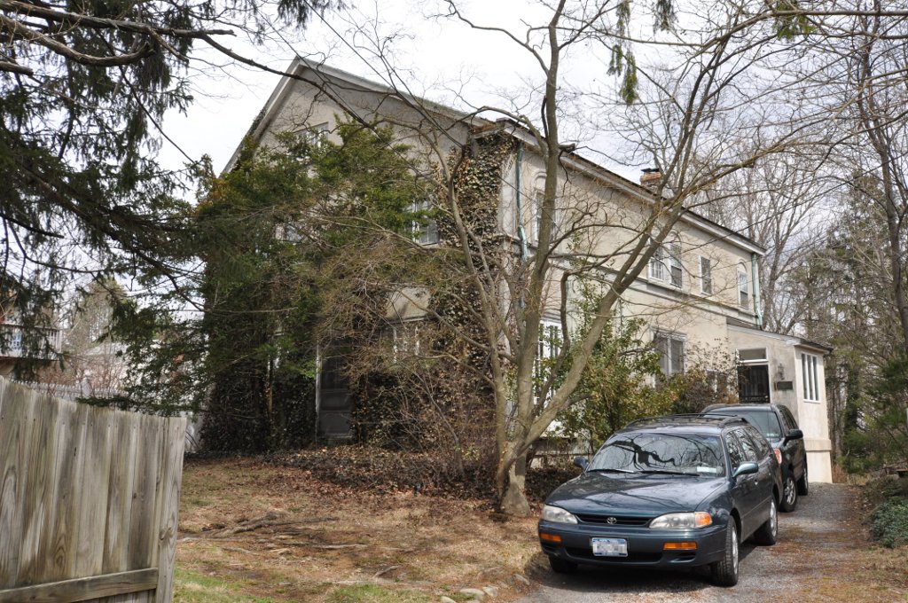

Hartsdale, New York
Hartsdale is a community of 2,903 people in Westchester County, New York.
Why visit Hartsdale
Townapedia lists 29 museums and landmarks, 18 parks and trails, 25 places to eat and 1 attraction in and around town.
Highlights include Saint Vladimir's Orthodox Theological Seminary, Bar Building, Caleb Hyatt House and Anthony F. Veteran Park.
July is the warmest month, with average highs of 86°F; January lows average 23°F, and about 33 inches of snow fall in a normal year.
Weather in Hartsdale
Forecast from the National Weather Service. Full forecast
About Hartsdale
Hartsdale is a hamlet located in the town of Greenburgh, Westchester County, New York, United States. The population was 5,293 at the 2010 census. It is a suburb of New York City.
From the Wikipedia article Hartsdale, New York (this version), under CC BY-SA 4.0.
Things to do1

Saint Vladimir's Orthodox Theological Seminary
School · 3.3 mi
Eastern Orthodox seminary in Yonkers, New York, United States
Museums and landmarks29

Bar Building
Monument and historic site · National Register of Historic Places · 2.2 mi
Historic commercial building in New York, United States

Caleb Hyatt House
Monument and historic site · National Register of Historic Places · 2.3 mi
Scarsdale, New York, listed on the NRHP in Westchester County

East Irvington School
Monument and historic site · National Register of Historic Places · 3.2 mi
School building in New York, United States of America

Elmsford Reformed Church and Cemetery
Monument and historic site · National Register of Historic Places · 2.8 mi
Historic church in New York, United States

Evangeline Booth House
Monument and historic site · National Register of Historic Places · 0.5 mi
Historic house in Hartsdale, New York, USA

Good Counsel Complex
Monument and historic site · National Register of Historic Places · 2.6 mi
In White Plains, New York, United States

Hartsdale Pet Cemetery
Monument and historic site · National Register of Historic Places · 0.5 mi
Pet cemetery in Greenburgh, New York

Hartsdale station
Monument and historic site · National Register of Historic Places · 0.5 mi
Railway station in New York, US

Jacob Purdy House
Monument and historic site · National Register of Historic Places · 2.1 mi
Historic house in New York, United States
Leo Friedlander Studio
Monument and historic site · National Register of Historic Places · 1.9 mi
White Plains, New York, NRHP-listed

Mapleton
Monument and historic site · National Register of Historic Places · 2.6 mi
House in White Plains, New York, United States


Odell House
Monument and historic site · National Register of Historic Places · 0.8 mi
Historic house in New York, United States
17 more on the map.
Parks, trails and playgrounds18



Hart's Brook Park and Preserve
Hiking and trails
156 Ridge Road, Hartsdale
sunrise-sunset
Harwood Park
Park · 1.4 mi
Acquired in 1928. 10.9 Acres. Passive park with a pond, walking paths, and park seating.
56 Olmsted Road, Scarsdale
6 more on the map.
Restaurants and cafes25

Royal Palace
Restaurant · Indian · 1.5 mi
Indian Restaurant
77 Knollwood Road, White Plains
Mo-Th 11:30-21:30; Fr-Sa 11:30-22:00; Su 11:30-21:00

IHOP
Restaurant · Breakfast, Pancake
28 South Central Avenue, Hartsdale
Mo-We,Su 07:00-20:00; Th 07:00-21:00; Fr,Sa 07:00-22:00
Redefine Meals
Restaurant · American, Asian, Italian, Mexican · 1.4 mi
417 North Central Avenue, Hartsdale
Mo-Su 08:00-22:00

Toreore
Restaurant · Chicken, Hot Dog, Korean · 1.2 mi
371 Central Avenue
Mo-Th 11:00-20:30; Fr-Su 11:00-21:00

13 more on the map.
History
Hartsdale, a CDP/hamlet/post-office in the town of Greenburgh, New York, lies on the Bronx River 20 miles (32 km) north of New York City. It is served by the Metro-North Harlem River commuter rail line into Grand Central Terminal. Hartsdale is the home of America's first canine pet cemetery (started by veterinarian Samuel Johnson in 1896), and the world's first Carvel Ice Cream store (1934), which closed in 2008.
From the History section of Hartsdale, New York on Wikipedia, under CC BY-SA 4.0.
Churches and places of worship12
Our Lady of Shkodra - Albanian Catholic Church
Church · Roman Catholic · 0.9 mi
361 West Hartsdale Avenue, Hartsdale
St. Paul's United Methodist Church
Church · United Methodist · 0.7 mi
130 North Central Avenue, Hartsdale
Scarsdale Synagogue Temples Tremont and Emanu-El
Place of worship · 1.3 mi
2 Ogden Road, Scarsdale
Shopping3
Gas and EV charging3
Schools, colleges and libraries49
Healthcare1
Map of Hartsdale
141 places. The map loads OpenStreetMap tiles when you open it.
Climate by month
Monthly table
| Month | High | Low | Rain | Snow |
|---|---|---|---|---|
| Jan | 40°F | 23°F | 3.9 in | 9.4 in |
| Feb | 43°F | 24°F | 3.3 in | 10.9 in |
| Mar | 51°F | 31°F | 4.4 in | 5.8 in |
| Apr | 63°F | 40°F | 4.3 in | 0.7 in |
| May | 73°F | 50°F | 4.3 in | 0.0 in |
| Jun | 81°F | 59°F | 4.6 in | 0.0 in |
| Jul | 86°F | 64°F | 4.5 in | 0.0 in |
| Aug | 84°F | 63°F | 4.4 in | 0.0 in |
| Sep | 77°F | 56°F | 4.6 in | 0.0 in |
| Oct | 65°F | 45°F | 4.4 in | 0.0 in |
| Nov | 54°F | 36°F | 3.9 in | 0.3 in |
| Dec | 44°F | 29°F | 4.7 in | 5.6 in |
U.S. Climate Normals 1991-2020 for Dobbs Ferry-Ardsley Hcn (2 mi away), NOAA NCEI.
People and cost of living
American Community Survey 5-year estimates, 2020-2024, U.S. Census Bureau. Estimates have margins of error, larger for small towns.
Disaster history
Westchester County has had 21 federal disaster declarations since 2000, most often for hurricanes.
- 2024-01-30: Severe Storm And Flooding (Flood)
- 2021-09-05: Remnants Of Hurricane Ida (Hurricane)
- 2021-09-02: Remnants Of Hurricane Ida (Hurricane)
- 2021-08-22: Hurricane Henri (Hurricane)
- 2020-10-02: Tropical Storm Isaias (Hurricane)
- 2020-03-20: Covid-19 Pandemic (Biological)
OpenFEMA disaster declarations summaries.
Getting there and nearby towns
Westchester County Airport (HPN) is the nearest airport with scheduled flights listed in OpenStreetMap, 6 miles away.
- Greenville 1 mi southwest, about 2 min by car
- Ardsley 2 mi west, about 3 min by car
- Scarsdale 2 mi southeast, about 3 min by car
- Fairview 2 mi north, about 3 min by car
- White Plains 3 mi east, about 5 min by car
- Elmsford 3 mi north, about 4 min by car
- Dobbs Ferry 3 mi west, about 5 min by car
- Eastchester 4 mi south, about 6 min by car
- Harrison 4 mi east, about 7 min by car
- Tarrytown 5 mi northwest, about 8 min by car
Drive times are estimates from straight-line distance, not routes.
Local news
Headlines from INDB, the NEMICO news database.
Reviews, tips and questions
Loading what members have shared...
Sources and licences
- NCES EDGE (Public domain): public schools
- NOAA NCEI U.S. Climate Normals 1991-2020 (Public domain): climate by month
- OpenFEMA (Public domain): disaster declarations
- OpenStreetMap contributors (ODbL 1.0): places, airports, map data
- U.S. Census Bureau (Public domain): population, income, housing, education, commute
- Wikidata (CC0 1.0): elevation, founding date, time zone, website, landmarks and historic places
- Wikimedia Commons (see each image): photos
- Wikipedia (CC BY-SA 4.0): overview and history text
Photo credits
- Hartsdale, Chris Vahlkamp, Public domain
- East Irvington School, Beyond My Ken, CC BY 3.0
- Evangeline Booth House, PointsofNoReturn, CC BY-SA 4.0
- ScarsdalePostOffice, Self made photo, CC BY-SA 3.0
- HartsdaleNY LeoFriedlanderStudio, User:Magicpiano, CC BY-SA 4.0
- Mapleton, Joshua Koerner, CC BY-SA 3.0
- White Plains Rural Cemetery 2012-09-23 12-26 jeh, jim.henderson, CC BY-SA 3.0
- Spanish American War Monument to the 71st Infantry Regiment, Oct 2012, DK Big Fish, Public domain
- WhitePlainsNY GoodCounselChapel, User:Magicpiano, CC BY-SA 4.0
- Hartsdale Pet Cemetery October 2012, Anthony22, CC BY-SA 3.0
- HStation, Cmvahlkamp, Public domain
- WhitePlainsNY WomensClub, User:Magicpiano, CC BY-SA 4.0
- Jacob Purdy House, GaoKyle, CC BY-SA 4.0
- Percy Grainger Home and Studio, Jesús Jiménez Flores, CC BY-SA 3.0
- Soundview Manor 2012-10-25 jeh, jim.henderson, CC BY-SA 3.0
- Bar Building 2012-09-23 jeh, jim.henderson, CC BY-SA 3.0
- GreenburghNY RomerVanTasselHouse, Magicpiano, CC BY-SA 4.0
- Odell House 1, PointsofNoReturn, CC BY-SA 4.0
- Scarsdale Woman's Club 37 Drake Rd, cloudy jeh, Jim.henderson, CC0
- Hyatt shoemakers shop now historical society jeh, Jim.henderson, CC0
- Peoples National Bank and Trust Company Building 31 Mamaroneck Av jeh, jim.henderson, CC BY-SA 3.0
- ArmoryWhitePlains, KForce, CC BY-SA 3.0
- WhitePlainsNY YWCA Housing, User:Magicpiano, CC BY-SA 4.0
- Ferncliff best 800, Anthony22 at English Wikipedia, CC BY-SA 3.0
- St. Vladimir's Seminary, Three Hierarchs Chapel, Hayk Asori, CC0
- Imac Heart Mary RCC 8 Carman Rd Scarsdale jeh, Jim.henderson, CC0


Page built October 30, 2026. Spotted a mistake? Tell us or suggest a place.