


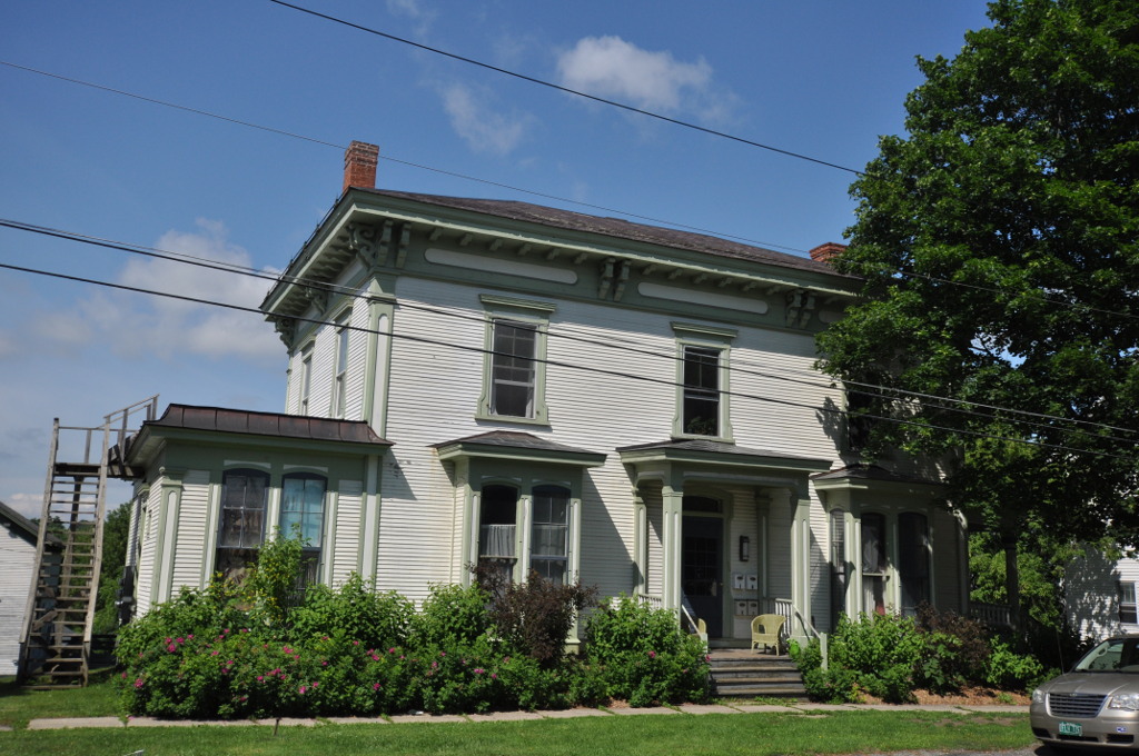


Vergennes, Vermont
Vergennes is a city of 2,565 people in Addison County, Vermont, founded in October 23, 1783.
Why visit Vergennes
Townapedia lists 10 museums and landmarks, 3 parks and trails, 13 places to eat, 3 places to stay and 2 attractions in and around town.
Highlights include The Vergennes Opera House, Marsh Hill, Capts. Louis and Philomene Daniels House and Gen. Samuel Strong House.
July is the warmest month, with average highs of 83°F; January lows average 10°F, and about 59 inches of snow fall in a normal year.
Weather in Vergennes
Forecast from the National Weather Service. Full forecast
About Vergennes
Vergennes is a city located in the northwest quadrant of Addison County, Vermont, United States. The municipality is bordered by the towns of Ferrisburgh, Panton, and Waltham. As of the 2020 census, its population was 2,553. It is the smallest of Vermont's 10 cities in terms of population, though the city of Winooski has the smallest area.
From the Wikipedia article Vergennes, Vermont (this version), under CC BY-SA 4.0.
Things to do2


Museums and landmarks10

Capts. Louis and Philomene Daniels House
Monument and historic site · National Register of Historic Places
Building in Vermont, United States
Gen. Samuel Strong House
Monument and historic site · National Register of Historic Places
Historic house on West Main Street in Vergennes, Vermont

Samuel Paddock Strong House
Monument and historic site · National Register of Historic Places · 0.5 mi
Building in Vermont, United States

Union Meetinghouse
Monument and historic site · National Register of Historic Places · 2.7 mi
Historic church in Vermont, United States


Vergennes Historic District
Monument and historic site · National Register of Historic Places
Historic district in Vermont, United States
Vergennes Residential Historic District
Monument and historic site · National Register of Historic Places
Historic district in Vermont, United States

Northern Daughters
Museum
Northern Daughters is a contemporary art gallery located at Vermont. We strive to be a space that merges the aesthetic of blue chip...
221 Main Street, Vergennes
Parks, trails and playgrounds3

Vergennes Union Elementary School Ice Rink
Sports field and stadium · 0.4 mi
Formerly an outdoor basketball court (some practice hoops are still up year-round). This Ice Rink is typically maintained by the...


Restaurants and cafes13



lu lu
Ice cream
185 Main Street, Vergennes
Mo off; Tu 11:00-19:00; We 11:00-19:00; Th 11:00-19:00; Fr...

Hired Hand Brewing Co.
Bar and pub
Bar Antidote opened in 2009 and is located in a comfortable speakeasy setting in downtown Vergennes. Since then, award-winning Chef and...
35 Green Street, Vergennes
Tu-Sa 16:00-19:30

Black Sheep Bistro
Restaurant
Chef Mahe's staff welcome you to the Black Sheep Bistro in Vergennes. Our menu has been prepared with fresh, local ingredients and...
253 Main Street, Vergennes
Park Squeeze
Bar and pub
On Main Street in Vergennes - a great family venue, serving burgers, flatbreads, with full bar.
161 Main Street, Vergennes

1 more on the map.
History
Vergennes was settled in 1766 by Donald MacIntosh. It was established as a city in 1788, the only one in Vermont not to have been first chartered as a town or independent village. Instead, intersecting portions of the pre-existing towns of New Haven, Panton, and Ferrisburg at the Otter Creek Falls were combined to form Vergennes. It is the smallest city by population in Vermont.
The city is named for Frenchman Charles Gravier, comte de Vergennes, who greatly aided the rebel colonial effort in the American Revolutionary War.
Here, Thomas Macdonough built and armed the fleet that defeated the British on Lake Champlain during the War of 1812. The Monkton Iron Company (which was at the time the largest iron works in the nation) manufactured the fittings for Macdonough's fleet, as well as most of the cannon shot used by the United States Army in the north. The ore used was mined in nearby Monkton. USS Saratoga, USS Eagle, USS Ticonderoga, and USS Preble were built or refitted in Vergennes as a part of that fleet.
From the History section of Vergennes, Vermont on Wikipedia, under CC BY-SA 4.0.
Where to stay3
Churches and places of worship8
Vergennes United Methodist Church
Church · United Methodist
129 Main Street, Vergennes
Champlain Valley Christian Reformed Church
Church · Reformed · 0.9 mi
73 Church Street, Vergennes
Shopping5
Gas and EV charging4
Schools, colleges and libraries7
Healthcare1
Map of Vergennes
56 places. The map loads OpenStreetMap tiles when you open it.
Climate by month
Monthly table
| Month | High | Low | Rain | Snow |
|---|---|---|---|---|
| Jan | 29°F | 10°F | 2.5 in | 13.3 in |
| Feb | 32°F | 10°F | 2.1 in | 13.3 in |
| Mar | 40°F | 20°F | 2.4 in | 11.9 in |
| Apr | 55°F | 34°F | 3.4 in | 2.6 in |
| May | 68°F | 45°F | 3.4 in | 0.0 in |
| Jun | 77°F | 56°F | 4.2 in | 0.0 in |
| Jul | 83°F | 61°F | 4.1 in | 0.0 in |
| Aug | 81°F | 59°F | 3.5 in | 0.0 in |
| Sep | 73°F | 51°F | 3.2 in | 0.0 in |
| Oct | 59°F | 40°F | 4.0 in | 0.3 in |
| Nov | 47°F | 29°F | 2.9 in | 3.8 in |
| Dec | 36°F | 18°F | 3.0 in | 13.4 in |
U.S. Climate Normals 1991-2020 for Vergennes (0 mi away), rain and snow from Cornwall Hcn, NOAA NCEI.
People and cost of living
American Community Survey 5-year estimates, 2020-2024, U.S. Census Bureau. Estimates have margins of error, larger for small towns.
Disaster history
Addison County has had 22 federal disaster declarations since 2000, most often for severe storms.
- 2024-08-20: Severe Storm, Flooding, Landslides, And Mudslides (Severe Storm)
- 2024-08-08: Tropical Depression Debby (Tropical Storm)
- 2023-10-06: Severe Storms And Flooding (Flood)
- 2023-07-14: Severe Storms, Flooding, Landslides, And Mudslides (Flood)
- 2023-07-10: Flooding (Flood)
- 2021-08-22: Tropical Storm Henri (Hurricane)
OpenFEMA disaster declarations summaries.
Getting there and nearby towns
Patrick Leahy Burlington International Airport (BTV) is the nearest airport with scheduled flights listed in OpenStreetMap, 22 miles away.
- Bristol 8 mi east, about 14 min by car
- Middlebury 12 mi southeast, about 19 min by car
- Port Henry 13 mi southwest, about 21 min by car
- Mineville 14 mi west, about 23 min by car
- Shelburne 16 mi north, about 25 min by car
- South Burlington 19 mi north, about 30 min by car
- Burlington 22 mi north, about 36 min by car
- Essex Junction 23 mi north, about 38 min by car
- Ticonderoga 24 mi south, about 39 min by car
- Keeseville 26 mi northwest, about 41 min by car
Drive times are estimates from straight-line distance, not routes.
Local news
Headlines from INDB, the NEMICO news database.
Reviews, tips and questions
Loading what members have shared...
Sources and licences
- NCES EDGE (Public domain): public schools
- NOAA NCEI U.S. Climate Normals 1991-2020 (Public domain): climate by month
- OpenFEMA (Public domain): disaster declarations
- OpenStreetMap contributors (ODbL 1.0): places, airports, map data
- U.S. Census Bureau (Public domain): population, income, housing, education, commute
- Wikidata (CC0 1.0): elevation, founding date, time zone, website, landmarks and historic places
- Wikimedia Commons (see each image): photos
- Wikipedia (CC BY-SA 4.0): overview and history text
Photo credits
- August 2005 view of falls on Otter Creek from Vergennes town dock, Ahale at English Wikipedia, Public domain
- Vergennes, VT 05491, USA - panoramio, Dizzyman, CC BY-SA 3.0
- VergennesVT ResidentialHD2, Magicpiano, CC BY-SA 4.0
- VergennesVT ResidentialHD3, Magicpiano, CC BY-SA 4.0
- VergennesVT ResidentialHD1, Magicpiano, CC BY-SA 4.0
- VergennesVT ResidentialHD4, Magicpiano, CC BY-SA 4.0
- VergennesVT DanielsHouse1, Magicpiano, CC BY-SA 4.0
- VergennesVT DanielsHouse2, Magicpiano, CC BY-SA 4.0
- Ferrisburgh–Vergennes station 5, Quincy Morgan, CC0
- Ferrisburgh–Vergennes dormer, Mackensen, CC BY-SA 4.0
- Ferrisburgh–Vergennes station 2, Quincy Morgan, CC0
- Ferrisburgh–Vergennes station 3, Quincy Morgan, CC0
- Ferrisburgh–Vergennes station 4, Quincy Morgan, CC0
- Ferrisburgh–Vergennes station 1 (cropped), Quincy Morgan, CC0
- Ferrisburgh–Vergennes station 1, Quincy Morgan, CC0
- Ferrisburgh–Vergennes station 7, Quincy Morgan, CC0
- Ferrisburgh–Vergennes, looking south, Mackensen, CC BY-SA 4.0
- Ferrisburgh–Vergennes, looking north, Mackensen, CC BY-SA 4.0
- Drive at Ferrisburgh–Vergennes, Mackensen, CC BY-SA 4.0
- Ferrisburgh–Vergennes station building, Mackensen, CC BY-SA 4.0
- Ferrisburgh–Vergennes station 8, Quincy Morgan, CC0
- Town Hall, Vergennes, Vermont, Jared and Corin, CC BY-SA 2.0
- Union Meeting House, Ferrisburgh, Vermont, Doug Kerr from Albany, NY, United States, CC BY-SA 2.0
- STRONG HOUSE, JERRYE & ROY KLOTZ MD, CC BY-SA 3.0
- BixbyLibrary, Travellers & Tinkers, CC BY-SA 4.0
- Miss Vermont 2025 Sophia Parker, Dismas, CC BY 4.0


Page built October 30, 2026. Spotted a mistake? Tell us or suggest a place.