


Why visit Bà Nà
Townapedia lists 3 museums and landmarks, 3 parks and trails, 17 places to eat, 4 places to stay and 2 attractions in and around town.
Highlights include Golden Bridge.
Weather in Bà Nà
Forecast from MET Norway (CC BY 4.0). Full forecast
Things to do2


Museums and landmarks3

Parks, trails and playgrounds3

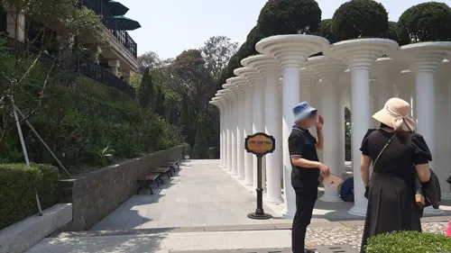
Restaurants and cafes17

Tru Vu Tea Corner
Cafe · Tea · 1.6 km
Trú Vũ Trà Quán, традиционный чайный домик в северном вьетнамском стиле. Здесь можно насладиться чайной церемонией, любуясь облаками,...

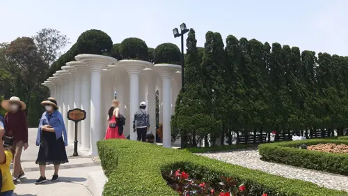


5 more on the map.
Where to stay4
Churches and places of worship5
Map of Bà Nà
34 places. The map loads OpenStreetMap tiles when you open it.
Getting there and nearby towns
Da Nang International Airport (DAD) is the nearest airport with scheduled flights listed in OpenStreetMap, 24 km away.
- Ba 9 km west, about 9 min by car
- Tư 9 km northwest, about 9 min by car
- Đại Đồng 13 km south, about 13 min by car
- Đại Quang 15 km southeast, about 15 min by car
- Thanh Khê 24 km northeast, about 24 min by car
- Da Nang 27 km east, about 27 min by car
- Điện Bàn 31 km east, about 31 min by car
- Hoi An 39 km east, about 39 min by car
- Huế 67 km northwest, about 1 h by car
- Hương Trà 81 km northwest, about 1 h 15 min by car
Drive times are estimates from straight-line distance, not routes.
Local news
Headlines from INDB.
Reviews, tips and questions
Loading what members have shared...
Sources and licences
- GeoNames (CC BY 4.0): population, coordinates, regions and time zone
- Mapillary (see each image): photos
- OpenStreetMap contributors (ODbL 1.0): places, airports, map data
- Wikidata (CC0 1.0): elevation, founding date, time zone, website, landmarks and historic places
- Wikimedia Commons (see each image): photos
Photo credits
- Bà Nà Hills Western Part (43718445270), Raita Futo from Tokyo, Japan, CC BY 2.0
- Bà Nà Hills Western Part (30594993367), Raita Futo from Tokyo, Japan, CC BY 2.0
- Bà Nà Hills Western Part (45535932291), Raita Futo from Tokyo, Japan, CC BY 2.0
- Bà Nà Hills Western Part (44621782625), Raita Futo from Tokyo, Japan, CC BY 2.0
- Bà Nà Hills Western Part (44621783275), Raita Futo from Tokyo, Japan, CC BY 2.0
- Bà Nà Hills Asian Part (44621786485), Raita Futo from Tokyo, Japan, CC BY 2.0
- Bà Nà Hills Asian Part (30594991907), Raita Futo from Tokyo, Japan, CC BY 2.0
- Bà Nà Hills Asian Part (43718444680), Raita Futo from Tokyo, Japan, CC BY 2.0
- Bà Nà Hills lizard (45535932651), Raita Futo from Tokyo, Japan, CC BY 2.0
- Bà Nà Hills Western Part (43718445780), Raita Futo from Tokyo, Japan, CC BY 2.0
- Bà Nà Hills in the clouds (43718448170), Raita Futo from Tokyo, Japan, CC BY 2.0
- Bà Nà Hills Western Part (44621788795), Raita Futo from Tokyo, Japan, CC BY 2.0
- Bà Nà Hills Asian Part (44810268994), Raita Futo from Tokyo, Japan, CC BY 2.0
- Bà Nà Hills Western Part (44621789585), Raita Futo from Tokyo, Japan, CC BY 2.0
- The Golden Bridge, Ba Na Hills, Vietnam, . Ray in Manila, CC BY 2.0
- 84186-Da-Nang (48572443736), xiquinhosilva, CC BY 2.0
- 84160-Da-Nang (48572592457), xiquinhosilva, CC BY 2.0
- 84182-Da-Nang (48572593937), xiquinhosilva, CC BY 2.0
- 84175-Da-Nang (48572593452), xiquinhosilva, CC BY 2.0
- 84166-Da-Nang (48572440981), xiquinhosilva, CC BY 2.0
- 84154-Da-Nang (48572591852), xiquinhosilva, CC BY 2.0
- 84152-Da-Nang (48572442536), xiquinhosilva, CC BY 2.0
- Ba na hills top - panoramio, 嶋耕作, CC BY 3.0
- Lunar Castle Moon Kingdom aerial view dusk Ba Na Hills Da Nang Vietnam, Vivu Vietnam, CC BY-SA 4.0
- Linh Ung Pagoda morning mist Ba Na Hills Da Nang Vietnam, Vivu Vietnam, CC BY-SA 4.0
- Linh Ung Pagoda aerial view Ba Na Hills Da Nang Vietnam, Vivu Vietnam, CC BY-SA 4.0
- 84466-Da-Nang (48720272261), xiquinhosilva, CC BY 2.0
- 84332-Da-Nang (48951698906), xiquinhosilva, CC BY 2.0
- 바나힐 썬월드 광장, 양념파닭, CC BY-SA 4.0
- 84417-Da-Nang (48951898612), xiquinhosilva, CC BY 2.0
- Vietnam, Ba Na Hill, Golden Bridge - Laslovarga (1), Laslovarga, CC BY-SA 4.0
- Vietnam, Ba Na Hill, Golden Bridge - Laslovarga (3), Laslovarga, CC BY-SA 4.0
- Vietnam, Ba Na Hill, Golden Bridge - Laslovarga, Laslovarga, CC BY-SA 4.0
- Vietnam, Ba Na Hill, Golden Bridge - Laslovarga (2), Laslovarga, CC BY-SA 4.0
- Ba Na Hills in the mist, Vivu Vietnam, CC BY-SA 4.0
- Ba Na Hills (I), This Photo was taken by Supanut Arunoprayote . Feel free to use any of my images, but please mention me as the author and may send me a message. (สามารถใช้ภาพได้อิสระ..., CC BY 4.0
- Da Nang Golden Bridge, Sun World Ba Na Hills, Vivu Vietnam, CC BY-SA 4.0
- 84293-Da-Nang (48951698776), xiquinhosilva, CC BY 2.0
- 84380-Da-Nang (48951898482), xiquinhosilva, CC BY 2.0
- Linh Ung Pagoda Buddha statue aerial view at sunset in Ba Na Hills Da Nang Vietnam, Vivu Vietnam, CC BY-SA 4.0
- Street-level photo, BernadetteCompetente, CC BY-SA 4.0
- Street-level photo, BernadetteCompetente, CC BY-SA 4.0


Page built November 8, 2026. Spotted a mistake? Tell us or suggest a place.