


Cẩm Lệ, Vietnam
Cẩm Lệ is a town of 78,837 people in Da Nang City, Vietnam, founded in August 20, 2005.
Why visit Cẩm Lệ
Townapedia lists 15 museums and landmarks, 12 parks and trails, 356 places to eat, 34 places to stay and 8 attractions in and around town.
Highlights include Tran Thi Ly Bridge, Dragon River Bridge, Museum of Cham Sculpture and Zone 5 Military Museum.
Weather in Cẩm Lệ
Forecast from MET Norway (CC BY 4.0). Full forecast
About Cẩm Lệ
Cẩm Lệ was a former urban district of Da Nang in the South Central Coast region of Vietnam.
From the Wikipedia article Cẩm Lệ district (this version), under CC BY-SA 4.0.
Things to do8


Nguyen Van Troi Bridge
Bridge · 4.6 km
Pedestrian bridge in Da Nang, Vietnam



Museums and landmarks15


Zone 5 Military Museum
Museum · 3.8 km
Military museum in Da Nang, Vietnam


3 more on the map.
Parks, trails and playgrounds12



Restaurants and cafes356
The Amazing Taco | In Da Nang
Restaurant · Mexican, Taco · 4.9 km
Mexican restaurant run by Magnus and Chi, a Swedish/Vietnamese couple.
29 Mỹ An 5, Da Nang
17:00-23:00

Becoming Specialty Coffee
Cafe · Coffee Shop, Cake, Regional, Asian, Vietnamese, Juice · 4.0 km
74 Đường Thi Sách
Mo-Su 08:00-21:00
Bếp Của Mạ - Cơm niêu và món Huế
Restaurant · Vietnamese · 3.2 km
346 Hai Tháng Chín, Đà Nẵng
Mo-Su 10:00-21:00
Mì Cay SEOUL Hải Châu
Restaurant · Korean · 4.5 km
Lô B6-B7, Đường 2/9, Bình Thuận, Hải Châu Đường 2 Tháng 9, Đà Nẵng
Mo-Su 08:00-22:00
Bánh Mì BÀ RY I Madam Ry
Cafe · Bubble Tea, Coffee Shop, Sandwich, Vietnamese · 4.8 km
36 Đường Đào Tấn
Mo-Su 06:30-23:45

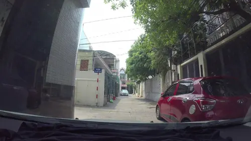
420 Coffee and Pub
Bar and pub · Mexican, Vietnamese, Western · 4.4 km
One of the biggest venue for craft beer with 11 kinds on tap over 20 kinds on can and bottle
12 Kiệt 03 Phan Thành Tài, Đà Nẵng
Mo-Su 16:20-23:00
ANs - Vegeterian Cuisine
Restaurant · 4.5 km
Delicious vegeterian restaurant
169F Đường Trưng Nữ Vương
Ba Duong
Restaurant · Vietnamese, Pancake · 4.8 km
23 Kiệt 280 Hoàng Diệu
Mo-Su 09:30-21:30
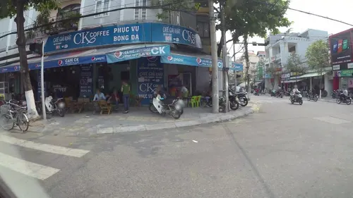


Bun Bo Ba Dieu
Restaurant · Vietnamese, Beef Noodle · 4.6 km
17 Trần Tống
Mo-Su 13:00+
344 more on the map.
Where to stay34
Churches and places of worship18
Hòa Cường Catholic Church
Church · Catholic · 3.0 km
150 Đường Nguyễn Hữu Thọ, Đà Nẵng
Shopping23
Showroom Thiết Bị Phụ Kiện Bếp TaKing - Kho Số 3
Grocery · 4.8 km
23 Đường Nguyễn Nhược Pháp, Hòa Khánh
Thiết Bị Phụ Kiện Bếp TaKing - Công Ty
Grocery · 4.7 km
209 Đường Bùi Tấn Diên, Phường Hòa Khánh
Thiết Bị Phụ Kiện Bếp TaKing - Kho Số 1
Grocery · 4.7 km
190 Bùi Tấn Diên, Hòa Khánh
Thiết Bị Phụ Kiện Bếp TaKing - Kho Số 2
Grocery · 4.9 km
130 Đường Nguyễn Nhược Pháp, Hòa Khánh
Gas and EV charging26
Schools, colleges and libraries60
Trường Trung học cơ sở & Trung học phổ thông Hiển Nhân
School · 1.9 km
254 Lương Nhữ Hocj
Trung tâm Giáo dục thường xuyên số 2 thành phố Đà Nẵng (cơ sở 2)
School · 2.2 km
105 Đường Lê Sát
Healthcare19
Bệnh viện Răng - Hàm - Mặt thành phố Đà Nẵng
Hospital · 4.2 km
118 Đường Lê Đình Lý
Map of Cẩm Lệ
250 places. The map loads OpenStreetMap tiles when you open it.
Getting there and nearby towns
Da Nang International Airport (DAD) is the nearest airport with scheduled flights listed in OpenStreetMap, 3 km away.
- Hòa Cường 4 km northwest, about 4 min by car
- Da Nang 6 km north, about 6 min by car
- Sơn Trà 6 km northeast, about 6 min by car
- Thanh Khê 6 km north, about 6 min by car
- An Hải 6 km northeast, about 6 min by car
- Hải Châu 14 km southwest, about 14 min by car
- Điện Bàn 15 km south, about 15 min by car
- Đại Lộc 17 km southwest, about 17 min by car
- Hoi An 21 km southeast, about 21 min by car
- Huế 82 km northwest, about 1 h 15 min by car
Drive times are estimates from straight-line distance, not routes.
Local news
Headlines from INDB.
Reviews, tips and questions
Loading what members have shared...
Sources and licences
- GeoNames (CC BY 4.0): population, coordinates, regions and time zone
- Mapillary (see each image): photos
- OpenStreetMap contributors (ODbL 1.0): places, airports, map data
- Wikidata (CC0 1.0): elevation, founding date, time zone, website, landmarks and historic places
- Wikimedia Commons (see each image): photos
- Wikipedia (CC BY-SA 4.0): overview and history text
Photo credits
- Trần Thị Lý Bridge at daytime, [Tycho] talk , http://shansov.net, CC BY-SA 3.0
- Cầu Rồng, Bùi Thụy Đào Nguyên, CC BY-SA 3.0
- Han River, Da Nang, Vietnam (15428173695), Gary Todd from Xinzheng, China, CC0
- Cầu Trần Thị Lý và cầu Nguyễn Văn Trỗi, Linhcandng ( thảo luận ), CC BY-SA 3.0
- Sông Hàn 1, Peter in s, CC0
- Le musée Cham (Da Nang) (4395751687), Jean-Pierre Dalbéra from Paris, France, CC BY 2.0
- Bảo Tàng Khu 5, Zone 5 Military Museum, Da Nang, 2016, Photographer: Mosbatho, CC BY 4.0
- Tòa A - Trường Đại học Kinh tế - Đại học Đà Nẵng, Buitrunghiep, CC0
- Duy Tan University, Truyenthong.wkp, CC BY-SA 4.0
- Sông Cầu Đỏ, MuDavid, CC0
- Bệnh viện Đa khoa Tâm Trí Đà Nẵng, Linhcandng ( thảo luận ), CC BY-SA 3.0
- Level crossing with barriers, upgraded fence DN, Dragfyre, CC BY-SA 3.0
- UBND phường Hòa Thọ Đông, Linhcandng ( thảo luận ), CC BY-SA 3.0
- USAID Deputy Administrator Donald Steinberg and delegation visit Danang Airport (7162265478), USAID Vietnam, Public domain
- Railroad workers DN, Dragfyre, CC BY-SA 3.0
- Nguyen Khuyen middle school, ꧁༒𝓷𝓱𝓪𝓬𝓷𝔂༒꧂, CC BY-SA 4.0
- Nguyen Khuyen middle school - Campus, ꧁༒𝓷𝓱𝓪𝓬𝓷𝔂༒꧂, CC BY-SA 4.0
- USAID Deputy Administrator Donald Steinberg and delegation visit Danang Airport (7162267974), USAID Vietnam, Public domain
- USAID Deputy Administrator Donald Steinberg and delegation visit Danang Airport (7162272704), USAID Vietnam, Public domain
- Sandy field construction Da Nang, Dragfyre, CC BY-SA 3.0
- Tòa án nhân dân Tp Đà Nẵng, Linhcandng ( thảo luận ), CC BY-SA 4.0
- Nhà máy nước Cầu Đỏ (TP Đà Nẵng) - panoramio, Nghiem DangVi, CC BY 3.0
- Environmental Remediation of Dioxin Contamination at Danang Airport Project Launch (7744834664), USAID Vietnam, Public domain
- Burning offerings Tat Nien Tet 2011, Dragfyre, CC BY-SA 3.0
- Pygathrix nemaeus 20211140, James Hardcastle, CC BY 4.0
- Pygathrix nemaeus 20208141, James Hardcastle, CC BY 4.0
- Pygathrix nemaeus 20208138, James Hardcastle, CC BY 4.0
- Messy airplane seat, 0hAerqplane, CC BY-SA 4.0
- USAID Deputy Administrator Donald Steinberg visits Danang Airport where dioxin remediation project will be conducted (7162055012), USAID Vietnam, Public domain
- Helio Center, Da Nang (49373166151), Martin Lewison from Forest Hills, NY, U.S.A., CC BY 2.0
- Helio Center, Da Nang (49374154082), Martin Lewison from Forest Hills, NY, U.S.A., CC BY 2.0
- Helio Center, Da Nang (49373528603), Martin Lewison from Forest Hills, NY, U.S.A., CC BY 2.0
- Helio Center, Da Nang (49374881916), Martin Lewison from Forest Hills, NY, U.S.A., CC BY 2.0
- Food court at Helio Center, Da Nang (49358101972), Martin Lewison from Forest Hills, NY, U.S.A., CC BY 2.0
- Food court at Helio Center, Da Nang (49358206972), Martin Lewison from Forest Hills, NY, U.S.A., CC BY 2.0
- Eating in Vietnam (49356768161), Martin Lewison from Forest Hills, NY, U.S.A., CC BY 2.0
- Cung Thiếu nhi Đà Nẵng (49370578561), Martin Lewison from Forest Hills, NY, U.S.A., CC BY 2.0
- Sông Cái Đà Nẵng, MuDavid, CC0
- Tòa án Nhân dân Thành phố Đà Nẵng, Linhcandng ( thảo luận ), CC BY-SA 3.0
- Cung Thiếu nhi Đà Nẵng (49357889906), Martin Lewison from Forest Hills, NY, U.S.A., CC BY 2.0
- Street-level photo, kaartcam, CC BY-SA 4.0
- Street-level photo, kaartcam, CC BY-SA 4.0
- Street-level photo, kaartcam, CC BY-SA 4.0
- Street-level photo, kaartcam, CC BY-SA 4.0
- Street-level photo, ruslan_fat, CC BY-SA 4.0
- Street-level photo, kaartcam, CC BY-SA 4.0
- Street-level photo, kaartcam, CC BY-SA 4.0
- Street-level photo, kaartcam, CC BY-SA 4.0
- Street-level photo, kaartcam, CC BY-SA 4.0
- Street-level photo, kaartcam, CC BY-SA 4.0
- Street-level photo, kaartcam, CC BY-SA 4.0
- Street-level photo, kaartcam, CC BY-SA 4.0
- Street-level photo, kaartcam, CC BY-SA 4.0
- Street-level photo, kaartcam, CC BY-SA 4.0
- Street-level photo, kaartcam, CC BY-SA 4.0
- Street-level photo, kaartcam, CC BY-SA 4.0


Page built November 8, 2026. Spotted a mistake? Tell us or suggest a place.