


Why visit Cần Đước
Townapedia lists 5 museums and landmarks, 6 parks and trails and 2 places to eat in and around town.
Weather in Cần Đước
Forecast from MET Norway (CC BY 4.0). Full forecast
About Cần Đước
Cần Đước is a former rural district (huyện) of Long An province in the Mekong River Delta region of Vietnam. Cần Đước is located in the south of Long An. As of 2019 the district had a population of 187,359. The district covers an area of 218.20 km2.
From the Wikipedia article Cần Đước district (this version), under CC BY-SA 4.0.
Museums and landmarks5

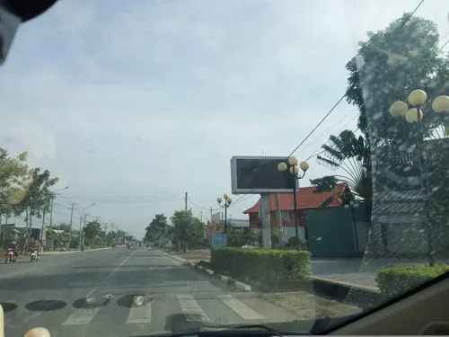


Parks, trails and playgrounds6

Restaurants and cafes2

Quán ăn Khôi Nguyên
Restaurant · Seafood
64A Quốc lộ 50, Huyện Cần Đước
Mo-Su 09:00-21:00

Churches and places of worship40

28 more on the map.
History
At the beginning, Cần Đước was a small village located in a peninsula created by the Mương Ông Quỳnh and Rach Ben Ba distributaries. In 1698, the present-day Cần Đước belonged to Phiên Trấn fort. In 1808, it belonged to the town of Phiên An. In the 13th year of Minh Mạng's rule (1832), Cần Đước became part of Phước Lộc county, phủ (old subdivision of a province but larger than a county) Tân An, Gia Định Province. In 1867, Cần Đước became a county itself when Phước Lộc became a phủ. In 1871, Phước Lộc was merged into Chợ Lớn Province.
From the History section of Cần Đước district on Wikipedia, under CC BY-SA 4.0.
Gas and EV charging8
Cửa hàng Xăng dầu Petrolimex Số 51
Gas station · 1.5 km
Đường tránh Thị trấn Cần Đước
Schools, colleges and libraries28
Healthcare7
Map of Cần Đước
96 places. The map loads OpenStreetMap tiles when you open it.
Getting there and nearby towns
Tan Son Nhat International Airport (SGN) is the nearest airport with scheduled flights listed in OpenStreetMap, 35 km away.
- Nhà Bè 26 km northeast, about 26 min by car
- Quận Sáu 27 km north, about 27 min by car
- Quận Mười Một 29 km north, about 29 min by car
- Quận Năm 28 km north, about 28 min by car
- Quận Mười 30 km north, about 30 min by car
- Quận Ba 31 km north, about 31 min by car
- Quận Bốn 31 km north, about 31 min by car
- Mỹ Tho 31 km southwest, about 31 min by car
- Ho Chi Minh City 35 km north, about 35 min by car
- Gò Vấp 35 km north, about 35 min by car
Drive times are estimates from straight-line distance, not routes.
Local news
Headlines from INDB.
Reviews, tips and questions
Loading what members have shared...
Sources and licences
- GeoNames (CC BY 4.0): population, coordinates, regions and time zone
- Mapillary (see each image): photos
- OpenStreetMap contributors (ODbL 1.0): places, airports, map data
- Wikidata (CC0 1.0): elevation, founding date, time zone, website
- Wikimedia Commons (see each image): photos
- Wikipedia (CC BY-SA 4.0): overview and history text
Photo credits
- Hình0064, TuanUt, CC BY-SA 3.0
- Tân Trạch, Cần Đước, Long An, Vietnam - panoramio (1), ONG TAM, CC BY-SA 3.0
- Mỹ Lệ, Cần Đước, Long An, Vietnam - panoramio, ONG TAM, CC BY-SA 3.0
- Tân Trạch, Cần Đước, Long An, Vietnam - panoramio (2), ONG TAM, CC BY-SA 3.0
- Tân Trạch, Cần Đước, Long An, Vietnam - panoramio, ONG TAM, CC BY-SA 3.0
- Long Sơn, Cần Đước, Long An, Vietnam - panoramio (4), ONG TAM, CC BY-SA 3.0
- Buýt 150 tại BXB Chợ Lớn (Khu A), CrystalizedMetal, CC0
- Nga tu Cho tram, huyen tan tap ,can giuoc Long an vn - panoramio, trungydang, CC BY 3.0
- Lang que Can giuoc Longan - panoramio, trungydang, CC BY 3.0
- Longan Cangiuoc, duong lang que - panoramio, trungydang, CC BY 3.0
- Long Phụng, Cần Giuộc, Long An, Vietnam - panoramio, trungydang, CC BY 3.0
- Truong pho thong trung hoc Dong Thanh,Can giuoc, longan,vn - panoramio, trungydang, CC BY 3.0
- 20180526-153042pineapple, Boom Jayson, CC BY-SA 4.0
- 20180526-160249bamboo, Boom Jayson, CC BY-SA 4.0
- 20180527-161758Piper sarmentosum, Boom Jayson, CC BY-SA 4.0
- 20180526-161007flower, Boom Jayson, CC BY-SA 4.0
- 20190521 161230Scadoxus multiflorus, Boom Jayson, CC BY-SA 4.0
- Trường Bình, Cần Giuộc, Long An, Vietnam - panoramio (9), ONG TAM, CC BY-SA 3.0
- Street-level photo, sg_right_1, CC BY-SA 4.0


Page built November 8, 2026. Spotted a mistake? Tell us or suggest a place.