


Why visit Châu Phong
Townapedia lists 3 museums and landmarks, 2 parks and trails, 29 places to eat and 20 places to stay in and around town.
Weather in Châu Phong
Forecast from MET Norway (CC BY 4.0). Full forecast
About Châu Phong
Châu Phong is a rural commune (xã) of An Giang Province, Vietnam.
From the Wikipedia article Châu Phong (this version), under CC BY-SA 4.0.
Museums and landmarks3

Ngôi Nhà Cổ
Monument and historic site · 0.9 km
Ngôi nhà trong ảnh là nhà sàn truyền thống của người Chăm, thường thấy ở An Giang và khu vực Nam Bộ. Nhà được dựng trên hệ cột cao, giúp...
Parks, trails and playgrounds2


Restaurants and cafes29


Hanuri korean food
Restaurant · Korean · 2.1 km
172 Nguyễn Văn Thoại
Mo-Su 11:00-22:00
Mạnh Tường
Restaurant · Regional · 1.7 km
15 Nguyễn Hữu Cảnh, Châu Đốc
Mo-Su 09:00-21:00

Kim Quang Bakery
Bakery · 0.9 km
ĐT. 953, Tân Châu
Mo-Su 06:00-19:00
Ẩm Thửc Chay
Restaurant · Vietnamese · 1.6 km
68 Đường Trưng Nữ Vương
17 more on the map.
Where to stay20



8 more on the map.
Churches and places of worship19
Chùa Châu Viên
Place of worship · 2.1 km
Hẻm 119 Nguyễn Văn Thoại, Thành phố Châu Đốc
Shopping3
Schools, colleges and libraries8
Healthcare1
Map of Châu Phong
85 places. The map loads OpenStreetMap tiles when you open it.
Getting there and nearby towns
Rach Gia Airport (VKG) is the nearest airport with scheduled flights listed in OpenStreetMap, 84 km away.
- Châu Đốc 3 km southwest, about 3 min by car
- Khánh Hòa 5 km southeast, about 5 min by car
- Tân Châu 15 km northeast, about 15 min by car
- Ấp Long Thạnh 16 km east, about 16 min by car
- Nhà Bàng 18 km southwest, about 18 min by car
- Ấp Phú Hòa 20 km north, about 20 min by car
- Tịnh Biên 25 km southwest, about 25 min by car
- Cao Lãnh 62 km southeast, about 1 h by car
- Thốt Nốt 66 km southeast, about 1 h by car
- Rạch Giá 79 km south, about 1 h 15 min by car
Drive times are estimates from straight-line distance, not routes.
Local news
Headlines from INDB.
Reviews, tips and questions
Loading what members have shared...
Sources and licences
- GeoNames (CC BY 4.0): population, coordinates, regions and time zone
- Mapillary (see each image): photos
- OpenStreetMap contributors (ODbL 1.0): places, airports, map data
- Wikidata (CC0 1.0): elevation, founding date, time zone, website
- Wikimedia Commons (see each image): photos
- Wikipedia (CC BY-SA 4.0): overview and history text
Photo credits
- Cau Pha Châu Phong,xa Chau giang, tx. Tân Châu, An Giang, Việt Nam - panoramio, trungydang, CC BY 3.0
- ĐT951, Châu Phong, tx. Tân Châu, An Giang, Vietnam - panoramio, trungydang, CC BY 3.0
- ĐT953, Châu Phong, tx. Tân Châu, An Giang, Vietnam - panoramio, trungydang, CC BY 3.0
- ĐT951, Châu Phong, tx. Tân Châu, An Giang, Vietnam - panoramio (2), trungydang, CC BY 3.0
- ĐT951, Châu Phong, tx. Tân Châu, An Giang, Vietnam - panoramio (1), trungydang, CC BY 3.0
- Nha xua, xa chau giang, tinh lo 953 ,tanchau - panoramio, trungydang, CC BY 3.0
- Cổng tam quan, thị xã Tân châu,huyện Châu giang, tỉnh an giang, việt nam - panoramio, trungydang, CC BY 3.0
- Cau xa Chau Phong,Tan chau -an giang - panoramio, trungydang, CC BY 3.0
- Chua Cham, Tan chau-chau giang vietnam - panoramio, trungydang, CC BY 3.0
- Thanh duong hoi giao, xa Chau giang,tinh lo 953, Tanchau - panoramio, trungydang, CC BY 3.0
- Chua nguoi cham,Chau giang-Tan chau,An giang, photo by Dyt - panoramio, trungydang, CC BY 3.0
- 04-Bassac River-nX-04955, PsamatheM, CC BY-SA 4.0
- 04-Bassac River-nX-04954, PsamatheM, CC BY-SA 4.0
- Sông Hậu giang,Châu đốc, angiang, vietnam - panoramio, trungydang, CC BY 3.0
- Ride on the Mekong (15941487540), Jean-Marc Astesana from Voisins le Bretonneux, France, CC BY-SA 2.0
- Le village flottant (Chau Doc, Vietnam) (6620583143), Jean-Pierre Dalbéra from Paris, France, CC BY 2.0
- Le village flottant (Chau Doc, Vietnam) (6620578201), Jean-Pierre Dalbéra from Paris, France, CC BY 2.0
- Le village flottant des pisciculteurs (Chau Doc, Vietnam) (6620595609), Jean-Pierre Dalbéra from Paris, France, CC BY 2.0
- Le village flottant des pisciculteurs (Chau Doc, Vietnam) (6620590765), Jean-Pierre Dalbéra from Paris, France, CC BY 2.0
- Le village flottant des pisciculteurs (Chau Doc, Vietnam) (6620584989), Jean-Pierre Dalbéra from Paris, France, CC BY 2.0
- Le village flottant des pisciculteurs (Chau Doc, Vietnam) (6620592099), Jean-Pierre Dalbéra from Paris, France, CC BY 2.0
- Ride on the Mekong (15915387925), Jean-Marc Astesana from Voisins le Bretonneux, France, CC BY-SA 2.0
- Home sweet home (15729425179), Jean-Marc Astesana from Voisins le Bretonneux, France, CC BY-SA 2.0
- Thi xa chau doc -angiang - panoramio, trungydang, CC BY 3.0
- Bo song Chau doc, tp. Châu Đốc, An Giang, Việt Nam - panoramio, trungydang, CC BY 3.0
- Ben pha chau doc- angiang, viet nam - panoramio, trungydang, CC BY 3.0
- Chau doc angiang- vietnam - panoramio, trungydang, CC BY 3.0
- Ben pha Chau doc,tp. Châu Đốc, An Giang, Việt Nam - panoramio, trungydang, CC BY 3.0
- Song Hau giang- Pha Chau Giang - angiang- Vietnam - panoramio, trungydang, CC BY 3.0
- 79 Lê Lợi, Châu Phú B, tp. Châu Đốc, An Giang, Vietnam - panoramio, trungydang, CC BY 3.0
- - Phà Châu giang,Chau doc angiang- Vietnam - panoramio, trungydang, CC BY 3.0
- Pha Chau doc, an giang 2012 - panoramio, trungydang, CC BY 3.0
- Ben pha Chau doc - panoramio, trungydang, CC BY 3.0
- Nhà sàn Châu Đốc- angiang- vietnam - panoramio, trungydang, CC BY 3.0
- Cheo xuong, song hau, Chau doc,photo by Dyt - panoramio, trungydang, CC BY 3.0
- Ben Pha Chau giang,Châu Phú B, tp. Châu Đốc, An Giang, Việt Nam - panoramio, trungydang, CC BY 3.0
- Chau doc- song hau. angiang - panoramio, trungydang, CC BY 3.0
- Châu đốc- angiang- vietnam - panoramio, trungydang, CC BY 3.0
- Pha chau giang, Chau doc, angiang vietnam - panoramio, trungydang, CC BY 3.0
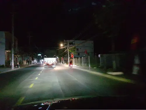
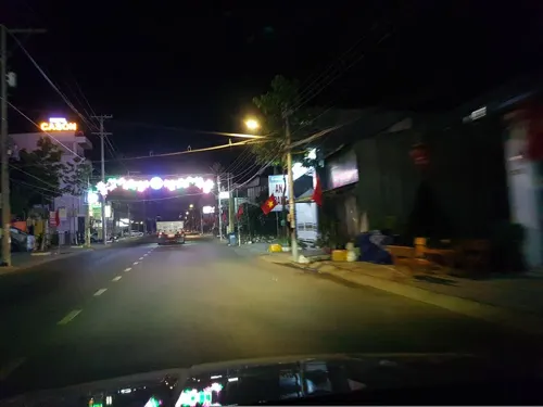
- Street-level photo, VPTD, CC BY-SA 4.0
- Street-level photo, VPTD, CC BY-SA 4.0
- Street-level photo, VPTD, CC BY-SA 4.0


Page built November 8, 2026. Spotted a mistake? Tell us or suggest a place.