


Why visit Cô Tô
Townapedia lists 1 museum or landmark, 1 place to eat, 3 places to stay and 1 attraction in and around town.
Weather in Cô Tô
Forecast from MET Norway (CC BY 4.0). Full forecast
About Cô Tô
Cô Tô () is an archipelago and a special administrative zone of Quảng Ninh in the northeastern region of Vietnam. As of 2019, the Cô Tô district had a population of 6,285, which is the lowest-population subdivision in Quảng Ninh. Cô Tô covers an area of 47.3 km2. The district capital lies at Cô Tô.
From the Wikipedia article Cô Tô (this version), under CC BY-SA 4.0.
Travel tips from other travellers: Cô Tô on Wikivoyage (CC BY-SA 4.0).
Things to do1

Museums and landmarks1
Restaurants and cafes1

Where to stay3



History
Cô Tô which has the ancient name Chang Son (Chang Mountain), has long been the residence of fishermen's boats in the Northeast but has not yet become a settlement because it was always harassed by Chinese pirates.
Under the Nguyễn dynasty, the population here became more crowded; most emigrated from China. Later, the island was occupied by French colonialists. In the middle of the 20th century, France withdrew. After that, the Chinese also returned home, the population on the island was only 10%, causing all production activities to decline.
On March 23, 1994, the government changed the name of Cam Pha district to Vân Đồn district and split the Cô Tô archipelago into two communes Thanh Lan and Cô Tô to establish the Cô Tô district.
In 2006, the population of the Cô Tô district was 5,240 people with 1,178 households. Since 1994 until now, the state has had many supportive policies on electricity prices, petrol prices, construction and upgrading of infrastructure, and the daily passenger train Vân Đồn - Cô Tô, improving people's life in this area. This is constantly improving.
On October 16, 2013, Cô Tô officially got electricity from the national grid when the project of bringing electricity to the island was completed, worth 1,106 billion VND.
From the History section of Cô Tô on Wikipedia, under CC BY-SA 4.0.
Churches and places of worship2
Schools, colleges and libraries8
Healthcare1
Map of Cô Tô
17 places. The map loads OpenStreetMap tiles when you open it.
Getting there and nearby towns
Van Don International Airport (VDO) is the nearest airport with scheduled flights listed in OpenStreetMap, 40 km away.
- Thị Trấn Cái Rồng 37 km west, about 37 min by car
- Thị Trấn Đầm Hà 46 km north, about 46 min by car
- Cẩm Phả Mines 49 km west, about 49 min by car
- Cẩm Phả 51 km west, about 51 min by car
- Thị Trấn Tiên Yên 55 km northwest, about 55 min by car
- Thị Trấn Ba Chẽ 60 km northwest, about 1 h by car
- Móng Cái 65 km north, about 1 h by car
- Dongxing 67 km north, about 1 h by car
- Hạ Long 72 km west, about 1 h 15 min by car
- Thị Trấn Bình Liêu 72 km northwest, about 1 h 15 min by car
Drive times are estimates from straight-line distance, not routes.
Local news
Headlines from INDB.
Reviews, tips and questions
Loading what members have shared...
Sources and licences
- GeoNames (CC BY 4.0): population, coordinates, regions and time zone
- Mapillary (see each image): photos
- OpenStreetMap contributors (ODbL 1.0): places, airports, map data
- Wikidata (CC0 1.0): elevation, founding date, time zone, website
- Wikimedia Commons (see each image): photos
- Wikipedia (CC BY-SA 4.0): overview and history text
Photo credits
- Âu cảng, Phuotcafe, CC BY-SA 4.0
- Rừng chõi nguyên sinh, Phuotcafe, CC BY-SA 4.0
- Alone, Tuấn Nguyễn, CC BY-SA 3.0
- Co To Island Quang Ninh Viet Nam, Tuấn Nguyễn, CC BY-SA 3.0
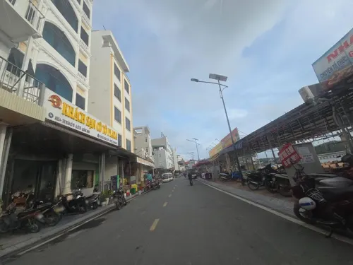
- Street-level photo, hoangvietanh, CC BY-SA 4.0
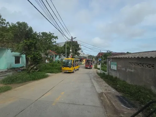
- Street-level photo, hoangvietanh, CC BY-SA 4.0
Page built November 8, 2026. Spotted a mistake? Tell us or suggest a place.