


Why visit Đông Ngạc
Townapedia lists 5 museums and landmarks, 6 parks and trails, 178 places to eat, 12 places to stay and 4 attractions in and around town.
Highlights include Nhật Tân Bridge, Thăng Long Bridge, Vietnam Museum of Ethnology and Peace Park.
Weather in Đông Ngạc
Forecast from MET Norway (CC BY 4.0). Full forecast
Things to do4



Museums and landmarks5


Parks, trails and playgrounds6




Restaurants and cafes178
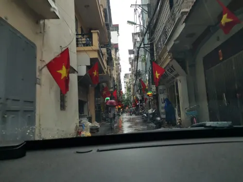
Bún Riêu cá Trường Sa
Restaurant · Asian
11 Ngõ 87 Lê Văn Hiến, Đông Ngạc, Bắc Từ Liêm, Hà Nội 100000, Việt Nam
24/7

Quán cỏ restaurant
Restaurant · Hotpot · 1.0 km
68 Đường Đức Thắng, Hà Nội
7:00 - 22:00
cơm ngon Hà Nội
Restaurant · Regional
Phố Văn Hội, Phường Đức Thắng
Mo-Sa 09:00-20:00
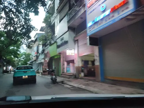
Ốc anh em
Restaurant · Regional · 0.8 km
85 P. Lê Văn Hiến, Đông Ngạc, Từ Liêm, Hà Nội, Việt Nam
24/7
Chill-Tiệm Trà Chanh
Cafe · Bubble Tea · 0.7 km
Số 27 Ng. 59 P. Lê Văn Hiến, Đông Ngạc, Bắc Từ Liêm, Hà Nội, Việt Nam
24/7
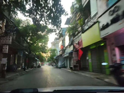
Coffe Number 1
Cafe · Coffee Shop · 0.7 km
Số 11 Ngõ 3 Nông Lâm, Hà Nội
Mo-Su 07:00-22:00

Cà Phê Tom
Cafe · Coffee Shop · 0.6 km
Sông Nhuệ, Hà Nội
Mo-Su 09:00-21:00
Cơm Ngon
Restaurant · Vietnamese
Sông Nhuệ, Phường Đức Thắng
Mo-Sa 09:00-18:00
Fin BBQ
Restaurant · 0.7 km
Cạnh Ky Học Viện Tài CHính, 9 Ngõ 87 Lê Văn Hiến, Đông Ngạc, Hà Nội, Việt Nam
Mo-Su 08:00-23:00


Fin BBQ - Buffet Thịt Nướng
Restaurant · Hotpot · 0.7 km
9 Ng.87 Đường Lê Văn Hiến, Hà Nội
24/7
166 more on the map.
Where to stay12
Churches and places of worship16
St Joseph Seminary Hanoi - Co Nhue campus
Church · Roman Catholic · 1.9 km
Cổ Nhuế
Shopping13
Shop 10k Nga Ngố
Grocery · 0.7 km
51 P. Lê Văn Hiến, phường Đức Thắng Quận, Bắc Từ Liêm, Hà Nội 10858, Việt Nam
Gas and EV charging4
Schools, colleges and libraries41
Hanoi University of Natural Resources and Environment
School · 4.0 km
Healthcare28
Nhà thuốc Đức Huy 152
Clinic and pharmacy · 0.9 km
152-Phố Văn Hội-Đức Thắng-Bắc Từ Liêm-HN
Lá nam Acnes
Clinic and pharmacy
3QCC+XXQ, Ng. 32 P. Viên, Đông Ngạc, Bắc Từ Liêm, Hà Nội, Việt Nam
Nhà thuốc 24/7
Clinic and pharmacy · 0.7 km
9 P. Lê Văn Hiến, Đông Ngạc, Bắc Từ Liêm, Hà Nội 10000, Việt Nam
thuốc sâu răng
Clinic and pharmacy · 1.0 km
3QGF+9MW, Đông Ngạc, Bắc Từ Liêm, Hà Nội, Việt Nam
Map of Đông Ngạc
250 places. The map loads OpenStreetMap tiles when you open it.
Getting there and nearby towns
Noi Bai International Airport (HAN) is the nearest airport with scheduled flights listed in OpenStreetMap, 16 km away.
- Bắc Từ Liêm 3 km southwest, about 3 min by car
- Tây Hồ 4 km east, about 4 min by car
- Cầu Giấy 6 km southeast, about 6 min by car
- Yên Hòa 7 km south, about 7 min by car
- Ô Chợ Dừa 8 km southeast, about 8 min by car
- Hanoi 9 km southeast, about 9 min by car
- Đống Đa 9 km southeast, about 9 min by car
- Thanh Xuân 10 km south, about 10 min by car
- Vinhomes Smart City 9 km south, about 9 min by car
- Hoàn Kiếm 10 km southeast, about 10 min by car
Drive times are estimates from straight-line distance, not routes.
Local news
Headlines from INDB.
Reviews, tips and questions
Loading what members have shared...
Sources and licences
- GeoNames (CC BY 4.0): population, coordinates, regions and time zone
- Mapillary (see each image): photos
- OpenStreetMap contributors (ODbL 1.0): places, airports, map data
- Wikidata (CC0 1.0): elevation, founding date, time zone, website, landmarks and historic places
- Wikimedia Commons (see each image): photos
Photo credits
- Inverted V Arches (18373617190), Michael Coghlan from Adelaide, Australia, CC BY-SA 2.0
- Cau Thang Long Hanoi,Bac Noi bai, photo Dyt2011 - panoramio, trungydang, CC BY 3.0
- 070920091603 CauThanhTri, Newone at Vietnamese Wikipedia, CC BY-SA 3.0
- Trống Đồng building, Vietnam Museum of Ethnology, Nam Hy Hoàng Phong, CC BY 3.0
- Tòa nhà A10, Winall9x, CC BY-SA 4.0
- Ulis.khoaphap2, ULIS - VNU, CC BY-SA 3.0
- Thanh102, Thanh102, CC BY-SA 4.0
- Khu đô thị bắc cổ nhuế chèm, Motbit, CC BY-SA 4.0
- Motorciklistoj veturantaj dum pluvo en Hanojo, RG72, CC BY-SA 4.0
- Bến xe Bus Nam Thăng Long (năm 2007) - panoramio, ngocchat1014, CC BY 3.0
- Toàn cảnh công viên Hòa Bình nhìn từ trên cao, Motbit, CC BY-SA 4.0
- Sân bóng cạnh khu đô thị cổ nhuế xuân đỉnh - panoramio, ngocchat1014, CC BY 3.0
- Sân khu đô thị mới Cổ Nhuế - Xuân Đỉnh - panoramio, ngocchat1014, CC BY 3.0
- Khu đô thị Cổ Nhuế - Xuân Đỉnh (02-01-2007) - panoramio, ngocchat1014, CC BY 3.0
- Học sinh tan trường - panoramio - ngocchat1014, ngocchat1014, CC BY 3.0
- Sân khu đô thị cổ nhuế xuân đỉnh (năm 2008) - panoramio, ngocchat1014, CC BY 3.0
- Buổi tối mùa đông khu đô thị Cổ Nhuế Xuân Đỉnh (năm 2008) - panoramio, ngocchat1014, CC BY 3.0
- Sương mù tại khu đô thị (năm 2008) - panoramio, ngocchat1014, CC BY 3.0
- Đường tàu - panoramio, ngocchat1014, CC BY 3.0
- Xe đỗ ngổn ngang khu đô thị mới phố Trần Quang Phú 2009, ngocchat1014, CC BY 3.0
- Ringway 3 under construction, Roadeditingonline, CC BY-SA 4.0
- Ciputra Hanoi International City 26, Amenoc, CC0
- Ciputra Hanoi International City 28, Amenoc, CC0
- Ciputra Hanoi International City 29, Amenoc, CC0
- Ciputra Hanoi International City 30, Amenoc, CC0
- Around Xuan La 27, Amenoc, CC0
- Around Xuan La 28, Amenoc, CC0
- Khu biệt thự liền kề khu đô thị cổ Nhuế Xuân Đỉnh (6.8.2009)) - panoramio, ngocchat1014, CC BY 3.0
- Ciputra Hanoi International City 27, Amenoc, CC0
- Around Xuan La 29, Amenoc, CC0
- Around Xuan La 30, Amenoc, CC0
- Around Xuan La 34, Amenoc, CC0
- Khu biệt thự liền kề khu đô thị cổ Nhuế Xuân Đỉnh (6.8.2009)) - panoramio - ngocchat1014, ngocchat1014, CC BY 3.0
- Ciputra Hanoi International City 24, Amenoc, CC0
- Around Xuan La 36, Amenoc, CC0
- Around Xuan La 35, Amenoc, CC0
- Ciputra Hanoi International City 23, Amenoc, CC0
- Ciputra Hanoi International City 22, Amenoc, CC0
- Around Xuan La 31, Amenoc, CC0
- Ciputra Hanoi International City 21, Amenoc, CC0
- Crossroad near Peace Park, Amenoc, CC0
- Street-level photo, hn_left_2, CC BY-SA 4.0
- Street-level photo, hn_left_2, CC BY-SA 4.0
- Street-level photo, hn_right_1, CC BY-SA 4.0
- Street-level photo, hn_left_2, CC BY-SA 4.0
- Street-level photo, hn_left_2, CC BY-SA 4.0
- Street-level photo, hn_left_2, CC BY-SA 4.0
- Street-level photo, hn_left_2, CC BY-SA 4.0
- Street-level photo, hn_right_1, CC BY-SA 4.0
- Street-level photo, hn_left_2, CC BY-SA 4.0
- Street-level photo, hn_front_1, CC BY-SA 4.0
- Street-level photo, hn_front_1, CC BY-SA 4.0
- Street-level photo, hn_right_1, CC BY-SA 4.0
- Street-level photo, hn_right_1, CC BY-SA 4.0
- Street-level photo, hn_right_2, CC BY-SA 4.0
- Street-level photo, hn_front_1, CC BY-SA 4.0


_-_panoramio.jpg)


_-_panoramio_-_ngocchat1014.jpg)


Page built November 8, 2026. Spotted a mistake? Tell us or suggest a place.