


Why visit Tây Hồ
Townapedia lists 39 museums and landmarks, 18 parks and trails, 274 places to eat, 37 places to stay and 13 attractions in and around town.
Highlights include Chương Dương Bridge, Hanoi Opera House, Vietnam Museum of Ethnology and B-52 Victory Museum.
Weather in Tây Hồ
Forecast from MET Norway (CC BY 4.0). Full forecast
About Tây Hồ
Tây Hồ (West Lake) is an urban district (quận) located on the north side of central Hanoi, the capital city of Vietnam. The district wraps around the West Lake (hồ Tây), one of the largest natural lakes of Vietnam. The district currently has 8 wards, covering a total area of 24.39 square kilometres (9.42 sq mi). As of 2019, there were 160,495 people residing in the district, the population density is 6,600 inhabitants per square kilometer.
From the Wikipedia article Tây Hồ district (this version), under CC BY-SA 4.0.
Things to do13


Hanoi Opera House
Cinema and theater · 7.0 km
Theatre in Hanoi, Vietnam





1 more on the map.
Museums and landmarks39

Vietnam Museum of Ethnology
Museum · 3.4 km
Museum in Hanoi, Vietnam
Đường Nguyễn Văn Huyên, Hà Nội
Tu-Su 08:30-17:30

B-52 Victory Museum
Museum · 4.1 km
Military museum in Ba Đình district, Hanoi

Đại La
Monument and historic site · 6.4 km
Fortress around which present Hanoi grew up

Đống Đa Mound
Monument and historic site · 6.5 km
Historic burial mound in Hanoi, Vietnam


Ho Chi Minh Mausoleum
Monument and historic site · 4.4 km
National mausoleum in Hanoi, Vietnam


Hỏa Lò Prison
Museum · 6.1 km
Prison in Hanoi used for political prisoners in colonial times and for prisoners of war during the Vietnam war

Huu Tiep Lake
Monument and historic site · 3.9 km
Lake in Hanoi, Vietnam

Kính Thiên Palace
Monument and historic site · 4.7 km
Hall in Hanoi, Vietnam

National Museum of Vietnamese History
Museum · 7.1 km
National museum in Hanoi, Vietnam

Presidential Palace Historical Site
Museum · 4.2 km
Ho Chi Minh's home in Hanoi
27 more on the map.
Parks, trails and playgrounds18

Công viên Hồ Tây
Sports field and stadium · 0.8 km
614 Đường Lạc Long Quân
Mo-Fr 08:30-20:00; Sa,Su 09:00-20:00





6 more on the map.
Restaurants and cafes274


NYC Pizza
Restaurant · Pizza · 1.5 km
5A Ngách 12/2 Phố Đặng Thai Mai
Fr-Su 11:00-00:00; Mo-Th 14:30-23:00
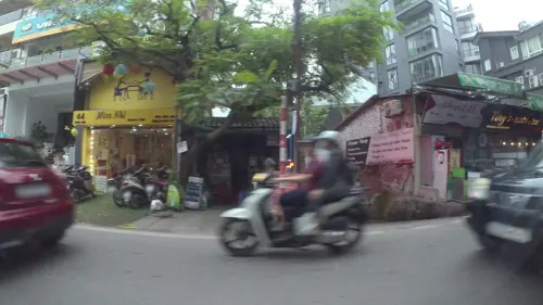
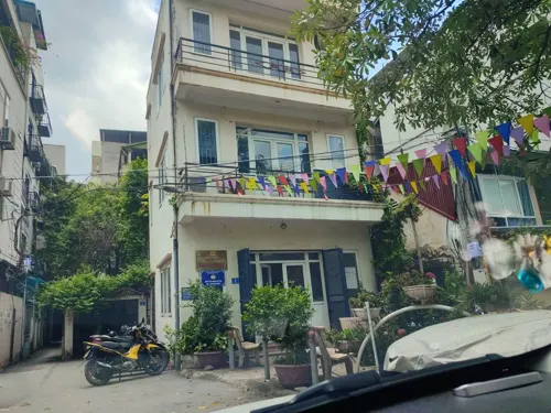
Vegetarian Cực Lạc Restaurant
Restaurant · Regional · 2.7 km
Số 9 Ngõ 295 Thụy Khuê, Hà Nội
Mo-Su 07:00-21:00
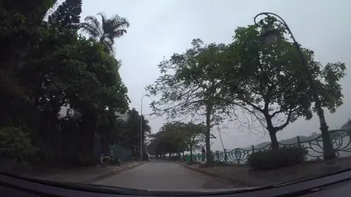


Dê Ngon Quán By Chef Thái Râu - 439 Âu Cơ (cơ sở 2)
Restaurant · 1.4 km
437 Đường Âu Cơ, Hà Nội
10:00-23:30
262 more on the map.
History
Following decree 69/CE set fourth by the Socialist Republic of Vietnam government, Tây Hồ was officially recognized as a district on October 28, 1995. The district was, and is, still considered to be a center of entertainment, tourism, and natural conservation of Hanoi.
Since 1996, Tây Hồ has been home to the Quảng Bá flower market (chợ Hoa đêm Quảng Bá), one of the largest night flower markets in Vietnam and a popular tourist destination.
From the History section of Tây Hồ district on Wikipedia, under CC BY-SA 4.0.
Where to stay37
Churches and places of worship56
Shopping34
Gas and EV charging20
Cửa hàng Xăng dầu Nghĩa Tân
Gas station · 3.3 km
148 Đường Hoàng Quốc Việt, Hà Nội
Schools, colleges and libraries87
Hanoi University of Natural Resources and Environment
School · 5.6 km
Healthcare27
Map of Tây Hồ
250 places. The map loads OpenStreetMap tiles when you open it.
Getting there and nearby towns
Noi Bai International Airport (HAN) is the nearest airport with scheduled flights listed in OpenStreetMap, 17 km away.
- Phú Thương 2 km north, about 2 min by car
- Hanoi 6 km southeast, about 6 min by car
- Long Bien 10 km southeast, about 10 min by car
- Phúc Yên 22 km northwest, about 22 min by car
- Thuận Thanh 28 km east, about 28 min by car
- Sơn Tây 32 km west, about 32 min by car
- Việt Trì 51 km northwest, about 51 min by car
- Thái Nguyên 59 km north, about 59 min by car
- Phủ Lý 59 km south, about 59 min by car
- Nam Định 80 km southeast, about 1 h 15 min by car
Drive times are estimates from straight-line distance, not routes.
Local news
Headlines from INDB.
Reviews, tips and questions
Loading what members have shared...
Sources and licences
- GeoNames (CC BY 4.0): population, coordinates, regions and time zone
- Mapillary (see each image): photos
- OpenStreetMap contributors (ODbL 1.0): places, airports, map data
- Wikidata (CC0 1.0): elevation, founding date, time zone, website, landmarks and historic places
- Wikimedia Commons (see each image): photos
- Wikipedia (CC BY-SA 4.0): overview and history text
Photo credits
- West Lake (Hanoi), Rungbachduong, CC BY-SA 3.0
- Chuong Duong Bridge, Rungbachduong, CC BY-SA 2.5
- Hanoi Opera House, 24 December 2016, xiquinhosilva, CC BY 2.0
- Long bien bridge, Pierre De Hanscutter, CC BY-SA 3.0
- Inverted V Arches (18373617190), Michael Coghlan from Adelaide, Australia, CC BY-SA 2.0
- Cau Thang Long Hanoi,Bac Noi bai, photo Dyt2011 - panoramio, trungydang, CC BY 3.0
- 070920091603 CauThanhTri, Newone at Vietnamese Wikipedia, CC BY-SA 3.0
- Cầu thê húc Hà nội vietnam - panoramio, trungydang, CC BY 3.0
- Trống Đồng building, Vietnam Museum of Ethnology, Nam Hy Hoàng Phong, CC BY 3.0
- B-52 tail section and museum building, Mztourist, CC BY-SA 4.0
- Go Dong Da 3, The original uploader was Bình Giang at Vietnamese Wikipedia ., Public domain
- Hanoi Museum, Grenouille vert, CC BY-SA 3.0
- Lăng Bác - NKS, NKSTTSSHNVN, CC BY-SA 4.0
- Ho Chi Minh museum, Hanoi 2, Aaron from san francisco, United States, CC BY-SA 2.0
- HanoiHilton, Unknown author, Public domain
- Ngọc Hà, Ba Đình, Hà Nội, Vietnam - panoramio (1), redsea99, CC BY 3.0
- Vietnam National Museum of History, Hanoi, Vietnam, Alistair Morrenger, Public domain
- Ho Chi Minh House 1463237026 5317a7aaed, joxeankoret, CC BY-SA 2.0
- 4G4A7753 HDR, Khoitran1957, CC BY-SA 4.0
- Ham Long Church, Newone (thảo luận), CC BY-SA 3.0
- St. Joseph's Cathedral - 50129345872, John Ragai, CC BY 2.0
- FTU 2011, 19 & Trường Đại học Ngoại thương, CC BY-SA 4.0
- Ulis.khoaphap2, ULIS - VNU, CC BY-SA 3.0
- Lichsuhanoimoi, Lachy70, Public domain
- HanoiUniversityOfPharmacy, Đại học Dược Hà Nội, CC BY-SA 4.0
- Kính Thiên, NguyenThanhBac123, CC BY-SA 4.0
- Phủ Tây Hồ, Bùi Thụy Đào Nguyên, CC BY-SA 3.0
- Vietnam-Korea 25, Amenoc, CC0
- Official building near Ho Tay 05, Amenoc, CC0
- Near Ho Tay 03, Amenoc, CC0
- Near Ho Tay 04, Amenoc, CC0
- Tay Ho Communist propaganda posters in 2015 05, Vuong Tri Binh, CC BY-SA 4.0
- Ciputra from public street, Amenoc, CC0
- Tay Ho Communist propaganda posters in 2015 07, Vuong Tri Binh, CC BY-SA 4.0
- Tay Ho Communist propaganda posters in 2015 08, Vuong Tri Binh, CC BY-SA 4.0
- Vietnamese Dragon statues in Tay Ho with Communist propaganda texts in 2015, Vuong Tri Binh, CC BY-SA 4.0
- Tay Ho Communist propaganda posters in 2015 06, Vuong Tri Binh, CC BY-SA 4.0
- Tay Ho temple gate in 2015, Vuong Tri Binh, CC BY-SA 4.0
- Viettel Group office building at Tay Ho in 2015, Vuong Tri Binh, CC BY-SA 4.0
- Quan Am statue at Tay Ho in 2015, Vuong Tri Binh, CC BY-SA 4.0
- Gate in the Lenin park in Ba Dinh in 2014, Vuong Tri Binh, CC BY-SA 4.0
- Crossroad near Peace Park, Amenoc, CC0
- Công Viên Ngoại Giao Đoàn, Amenoc, CC0
- Street-level photo, hn_right_2, CC BY-SA 4.0
- Street-level photo, kaart_1, CC BY-SA 4.0
- Street-level photo, hn_right_1, CC BY-SA 4.0
- Street-level photo, hn_right_2, CC BY-SA 4.0
- Street-level photo, hn_front_1, CC BY-SA 4.0
- Street-level photo, kaart_1, CC BY-SA 4.0
- Street-level photo, hn_right_1, CC BY-SA 4.0
- Street-level photo, hn_front_1, CC BY-SA 4.0
- Street-level photo, kaart_1, CC BY-SA 4.0
- Street-level photo, hn_front_1, CC BY-SA 4.0
- Street-level photo, kaart_1, CC BY-SA 4.0
- Street-level photo, hn_right_1, CC BY-SA 4.0


Page built November 8, 2026. Spotted a mistake? Tell us or suggest a place.