


Long Diền, Vietnam
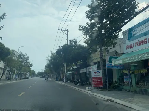
Long Diền is a town of 18,093 people in Ho Chi Minh City (HCMC), Vietnam.
Loading the weather...
Population18,093
GeoNames
RegionHo Chi Minh City (HCMC)
Elevation17 m
56 ft
Time zoneAsia/Ho Chi Minh
Nearest airportVung Tau Airport (VTG)
18 km
Why visit Long Diền
Townapedia lists 3 parks and trails, 7 places to eat, 1 place to stay and 3 attractions in and around town.
Weather in Long Diền
Forecast from MET Norway (CC BY 4.0). Full forecast
Things to do3



Parks, trails and playgrounds3


Restaurants and cafes7



Advertisement
Where to stay1

Churches and places of worship49
Shopping24
Advertisement
Gas and EV charging8
Schools, colleges and libraries12
Healthcare3
Advertisement
Map of Long Diền
110 places. The map loads OpenStreetMap tiles when you open it.
Getting there and nearby towns
Vung Tau Airport (VTG) is the nearest airport with scheduled flights listed in OpenStreetMap, 18 km away.
- Xã Long Hải 11 km south, about 11 min by car
- Phú Mỹ 23 km northwest, about 23 min by car
- Long Khánh 49 km north, about 49 min by car
- Thủ Đức 63 km northwest, about 1 h by car
- Quận Bốn 64 km northwest, about 1 h by car
- Quận Ba 66 km northwest, about 1 h by car
- Biên Hòa 67 km northwest, about 1 h by car
- Dĩ An 68 km northwest, about 1 h 15 min by car
- Quận Mười 68 km northwest, about 1 h 15 min by car
- Ho Chi Minh City 74 km northwest, about 1 h 15 min by car
Drive times are estimates from straight-line distance, not routes.
Local news
Headlines from INDB.
Reviews, tips and questions
Loading what members have shared...
Sources and licences
- GeoNames (CC BY 4.0): population, coordinates, regions and time zone
- Mapillary (see each image): photos
- OpenStreetMap contributors (ODbL 1.0): places, airports, map data
- Wikidata (CC0 1.0): elevation, founding date, time zone, website
- Wikimedia Commons (see each image): photos
Photo credits
- Duong Bui Cong Minh, huyen Long Dien, Baria Vungtau - panoramio, trungydang, CC BY 3.0
- Duong Vo thi sau, tt Long Dien, Baria Vungtau,vn - panoramio, trungydang, CC BY 3.0
- Nga tu, Bui cong,nh va Vothisau, tt Longdien, Baria Vungtau,vn - panoramio, trungydang, CC BY 3.0
- Bui cong minh, tt Longdien, baria vungtau - panoramio, trungydang, CC BY 3.0
- Duong Truongchinh, tt Longdien, baria vungtau, vn - panoramio, trungydang, CC BY 3.0
- 142 Bui Cong Minh, kp LongBinh, huyen Longdien,tinh Baria Vungtau, Vn - panoramio, trungydang, CC BY 3.0
- Long Điền, Bà Rịa - Vũng Tàu, Vietnam - panoramio (5), trungydang, CC BY 3.0
- Long Điền, Bà Rịa - Vũng Tàu, Vietnam - panoramio (4), trungydang, CC BY 3.0
- Tinh Xa Ngoc Dien, Long Dien, Baria, Vungtau - panoramio, trungydang, CC BY 3.0
- Tinh xa Ngoc Dien, huyen Long Dien, Ba ria vungtau, Vn - panoramio, trungydang, CC BY 3.0
- Long Điền, Bà Rịa - Vũng Tàu, Vietnam - panoramio (6), trungydang, CC BY 3.0
- San trong Tinh xa Ngoc Dien, huyen Long dien, Baria Vungtau, Vn - panoramio, trungydang, CC BY 3.0
- Tinh xa Ngoc Dien, longdien , Baria, Vungtau, vietnam - panoramio, trungydang, CC BY 3.0
- Long Điền, Bà Rịa - Vũng Tàu, Vietnam - panoramio (3), trungydang, CC BY 3.0
- Long Điền, Bà Rịa - Vũng Tàu, Vietnam - panoramio (1), trungydang, CC BY 3.0
- Thảnh thơi - panoramio, VCTBR, CC BY 3.0
- Long Điền, Bà Rịa - Vũng Tàu, Vietnam - panoramio, VCTBR, CC BY 3.0
- Bờ sông Long Hương - panoramio, VCTBR, CC BY 3.0
- Vào vụ mùa - panoramio, VCTBR, CC BY 3.0
- Đàn dê - panoramio, VCTBR, CC BY 3.0
- Bửa củi - panoramio, VCTBR, CC BY 3.0
- Duong Truongchinh, tp Vungtau, Bariavungtau,vn - panoramio, trungydang, CC BY 3.0
- Street-level photo, DriveWithHoang, CC BY-SA 4.0
- Street-level photo, DriveWithHoang, CC BY-SA 4.0
- Street-level photo, DriveWithHoang, CC BY-SA 4.0
- Street-level photo, DriveWithHoang, CC BY-SA 4.0
- Street-level photo, DriveWithHoang, CC BY-SA 4.0
- Street-level photo, DriveWithHoang, CC BY-SA 4.0
- Street-level photo, DriveWithHoang, CC BY-SA 4.0


Page built November 8, 2026. Spotted a mistake? Tell us or suggest a place.