


Why visit Long Thành
Townapedia lists 6 parks and trails, 8 places to eat and 1 place to stay in and around town.
Weather in Long Thành
Forecast from MET Norway (CC BY 4.0). Full forecast
About Long Thành
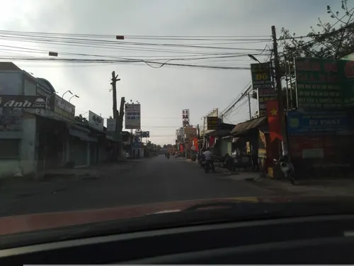
Long Thành is a ward in Đồng Nai, southern Vietnam, 70 km northwest of Vũng Tàu, 20 km southwest of Biên Hòa. The ward is located on the Route 51 that connects industrial Biên Hòa city with the petroleum installation and seaside resort at Vũng Tàu city.
From the Wikipedia article Long Thành, Đồng Nai (this version), under CC BY-SA 4.0.
Parks, trails and playgrounds6


Restaurants and cafes8


AZhu BBQ 中式烧烤串
Restaurant · Chinese · 1.3 km
Khu Chợ Mới, Cầu Xéo, Long Thành, Đồng Nai, Việt Nam, Long Thành


Where to stay1

Churches and places of worship23

Dominican Sisters of Saint Rosa of Lima Congregation - The Mother of Immaculate Conception Convent
Place of worship · 0.7 km
Nguyễn Văn Trị

11 more on the map.
Shopping2
Cửa hàng Điện Nước Hoàng Long Vũ Nhơn Trạch
Grocery · 5.3 km
279 Trần Phú - Bến Cam
Gas and EV charging5
Schools, colleges and libraries17
Trường Đại học Tài nguyên và Môi trường Thành phố Hồ Chí Minh (cơ sở 2)
School · 7.7 km
205 Phùng Hưng
Healthcare4
Map of Long Thành
66 places. The map loads OpenStreetMap tiles when you open it.
Getting there and nearby towns
Long Thanh International Airport (LTH) is the nearest airport with scheduled flights listed in OpenStreetMap, 11 km away.
- Thủ Đức 21 km west, about 21 min by car
- Phú Mỹ 21 km southeast, about 21 min by car
- Biên Hòa 22 km northwest, about 22 min by car
- Dĩ An 24 km northwest, about 24 min by car
- Quận Bốn 27 km west, about 27 min by car
- Quận Ba 29 km west, about 29 min by car
- Gò Vấp 29 km west, about 29 min by car
- Thuận An 30 km northwest, about 30 min by car
- Quận Mười 31 km west, about 31 min by car
- Ho Chi Minh City 35 km west, about 35 min by car
Drive times are estimates from straight-line distance, not routes.
Local news
Headlines from INDB.
Reviews, tips and questions
Loading what members have shared...
Sources and licences
- GeoNames (CC BY 4.0): population, coordinates, regions and time zone
- Mapillary (see each image): photos
- OpenStreetMap contributors (ODbL 1.0): places, airports, map data
- Wikidata (CC0 1.0): elevation, founding date, time zone, website
- Wikimedia Commons (see each image): photos
- Wikipedia (CC BY-SA 4.0): overview and history text
Photo credits
- Tt. Long Thành, tp. Biên Hòa, Đồng Nai, Vietnam - panoramio (34), Lam Tr Th, CC BY-SA 3.0
- Tt. Long Thành, tp. Biên Hòa, Đồng Nai, Vietnam - panoramio (35), Lam Tr Th, CC BY-SA 3.0
- Tt. Long Thành, tp. Biên Hòa, Đồng Nai, Vietnam - panoramio (30), Lam Tr Th, CC BY-SA 3.0
- Tt. Long Thành, tp. Biên Hòa, Đồng Nai, Vietnam - panoramio (31), Lam Tr Th, CC BY-SA 3.0
- Tt. Long Thành, tp. Biên Hòa, Đồng Nai, Vietnam - panoramio (32), Lam Tr Th, CC BY-SA 3.0
- Tt. Long Thành, Long Thành, Đồng Nai, Vietnam - panoramio (2), Lam Tr Th, CC BY-SA 3.0
- Tt. Long Thành, tp. Biên Hòa, Đồng Nai, Vietnam - panoramio (39), Lam Tr Th, CC BY-SA 3.0
- Tt. Long Thành, tp. Biên Hòa, Đồng Nai, Vietnam - panoramio (29), Lam Tr Th, CC BY-SA 3.0
- Tt. Long Thành, tp. Biên Hòa, Đồng Nai, Vietnam - panoramio (40), trungydang, CC BY 3.0
- Tt. Long Thành, tp. Biên Hòa, Đồng Nai, Vietnam - panoramio (43), Lam Tr Th, CC BY-SA 3.0
- Sân vận động long thành đồng nai - panoramio, Lam Tr Th, CC BY-SA 3.0
- Sân vận động long thành - panoramio, Lam Tr Th, CC BY-SA 3.0
- Tt. Long Thành, tp. Biên Hòa, Đồng Nai, Vietnam - panoramio (36), Lam Tr Th, CC BY-SA 3.0
- Tt. Long Thành, tp. Biên Hòa, Đồng Nai, Vietnam - panoramio (33), Lam Tr Th, CC BY-SA 3.0
- Duong truong Chinh,Ql 51-Long Thành, Đồng Nai, Việt Nam - panoramio, trungydang, CC BY 3.0
- Vườn Dầu bệnh viện long thành - panoramio, Lam Tr Th, CC BY-SA 3.0
- Tt. Long Thành, tp. Biên Hòa, Đồng Nai, Vietnam - panoramio (21), Lam Tr Th, CC BY-SA 3.0
- Tt. Long Thành, tp. Biên Hòa, Đồng Nai, Vietnam - panoramio (20), Lam Tr Th, CC BY-SA 3.0
- Trường trung hoc phổ thông long thành - panoramio, Lam Tr Th, CC BY-SA 3.0
- Tt. Long Thành, tp. Biên Hòa, Đồng Nai, Vietnam - panoramio (41), Lam Tr Th, CC BY-SA 3.0
- Duong Truong chinh, ql 51, Long Thành, Đồng Nai, Việt Nam - panoramio, trungydang, CC BY 3.0
- Tt. Long Thành, Long Thành, Đồng Nai, Vietnam - panoramio (3), Lam Tr Th, CC BY-SA 3.0
- Chợ Long Thành cũ - panoramio, Lam Tr Th, CC BY-SA 3.0
- Tt. Long Thành, Long Thành, Đồng Nai, Vietnam - panoramio (5), Lam Tr Th, CC BY-SA 3.0
- Tt. Long Thành, tp. Biên Hòa, Đồng Nai, Vietnam - panoramio (42), Lam Tr Th, CC BY-SA 3.0
- Tt. Long Thành, Long Thành, Đồng Nai, Vietnam - panoramio (9), Lam Tr Th, CC BY-SA 3.0
- Tt. Long Thành, tp. Biên Hòa, Đồng Nai, Vietnam - panoramio (37), Lam Tr Th, CC BY-SA 3.0
- An Phước, Long Thành, Đồng Nai, Vietnam - panoramio (24), Lam Tr Th, CC BY-SA 3.0
- An Phước, Long Thành, Đồng Nai, Vietnam - panoramio (25), Lam Tr Th, CC BY-SA 3.0
- Khu hành chánh - panoramio, Lam Tr Th, CC BY-SA 3.0
- Quán cơm trưa nhà lá - panoramio, Lam Tr Th, CC BY-SA 3.0
- Trung tâm hành chánh - panoramio, Lam Tr Th, CC BY-SA 3.0
- Trung tâm lao động thưong binh và xã hội - panoramio, Lam Tr Th, CC BY-SA 3.0
- Trường nguyễn đức ứng - panoramio, Lam Tr Th, CC BY-SA 3.0
- Vòng xoay thiếu nhi - panoramio, Lam Tr Th, CC BY-SA 3.0
- Ngã tư - panoramio, Lam Tr Th, CC BY-SA 3.0
- Nhà hát thiếu nhi - panoramio, Lam Tr Th, CC BY-SA 3.0
- An Phước, tp. Biên Hòa, Đồng Nai, Vietnam - panoramio (15), Lam Tr Th, CC BY-SA 3.0
- An Phước, tp. Biên Hòa, Đồng Nai, Vietnam - panoramio (16), Lam Tr Th, CC BY-SA 3.0
- Long Thanh AAA Park - panoramio (1), Lam Tr Th, CC BY-SA 3.0
- Street-level photo, VPTD, CC BY-SA 4.0
- Street-level photo, sg_front_1, CC BY-SA 4.0


Page built November 8, 2026. Spotted a mistake? Tell us or suggest a place.