


Thuận Thanh, Vietnam
Thuận Thành
Thuận Thanh is a city of 199,577 people in Bac Ninh, Vietnam.
Why visit Thuận Thanh
Townapedia lists 13 museums and landmarks, 2 parks and trails, 52 places to eat, 2 places to stay and 5 attractions in and around town.
Highlights include Tới Thuần Chuyên Cung Cấp Cá Giống and Tàn tích xưởng bị cháy.
Weather in Thuận Thanh
Forecast from MET Norway (CC BY 4.0). Full forecast
About Thuận Thanh
Thuận Thành [tʰwə̰ʔn˨˩:tʰa̤jŋ˨˩] is a former town of Bắc Ninh province in the Red River Delta of Vietnam.
From the Wikipedia article Thuận Thành (town) (this version), under CC BY-SA 4.0.
Things to do5

Tới Thuần Chuyên Cung Cấp Cá Giống
Farm and orchard · 4.9 km
Xóm Táo, Bắc Ninh
24/7

Museums and landmarks13

1 more on the map.
Parks, trails and playgrounds2

Restaurants and cafes52
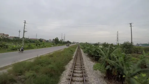
An Coffee
Cafe · Bubble Tea · 7.8 km
Đường tỉnh 385
Mon-Sun (7am-10pm)

Nhà hàng Tín Hiệu
Restaurant · Vietnamese · 8.1 km
Chợ Đậu
24/7
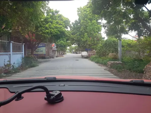
Bún Cá Cay Cậu Đoành
Restaurant · Vietnamese · 7.1 km
ĐT.281
Bún Riêu Cua Tóp Mỡ
Restaurant · Vietnamese · 6.3 km
ĐH.15
Open in Google Maps · 033 699 1102 - 0333 843102 - 0333 843 796
Bún chả Cần Nga
Restaurant · Vietnamese · 7.9 km
Đường tỉnh 385
Cháo Dinh Dưỡng - Bánh Cuốn Chả
Restaurant · Vietnamese · 6.0 km
ĐT.281



40 more on the map.
Where to stay2
Churches and places of worship30
Shopping13
Gas and EV charging16
Schools, colleges and libraries98
Academy of Security Engineering and Technology
School · 2.0 km
Đường Lạc Long Quân, Thành phố Bắc Ninh
Thuan Thanh No 1 High School
School · 1.1 km
Đường Lạc Long Quân, Bắc Ninh
Trường Tiểu học & Trung học cơ sở Song Hồ
School · 1.9 km
Phố Nguyễn Chí Tố, Thành phố Bắc Ninh
Trung tâm Giáo dục thường xuyên Thị xã Thuận Thành
School · 1.0 km
468 Đường Âu Cơ, Bắc Ninh
Trường THCS Nguyễn Thị Định
School · 1.1 km
Đường Lạc Long Quân, Thành phố Bắc Ninh
Healthcare46
Map of Thuận Thanh
250 places. The map loads OpenStreetMap tiles when you open it.
Getting there and nearby towns
Noi Bai International Airport (HAN) is the nearest airport with scheduled flights listed in OpenStreetMap, 35 km away.
- Từ Sơn 13 km northwest, about 13 min by car
- Lim 12 km northwest, about 12 min by car
- Gia Lâm 15 km west, about 15 min by car
- Mỹ Hào 14 km south, about 14 min by car
- Vinhomes Ocean Park 15 km west, about 15 min by car
- Bắc Ninh 16 km north, about 16 min by car
- Phúc Lợi 16 km west, about 16 min by car
- Hanoi 25 km west, about 25 min by car
- Haiphong 66 km east, about 1 h by car
- Việt Trì 77 km northwest, about 1 h 15 min by car
Drive times are estimates from straight-line distance, not routes.
Local news
Headlines from INDB.
Reviews, tips and questions
Loading what members have shared...
Sources and licences
- GeoNames (CC BY 4.0): population, coordinates, regions and time zone
- Mapillary (see each image): photos
- OpenStreetMap contributors (ODbL 1.0): places, airports, map data
- Wikidata (CC0 1.0): elevation, founding date, time zone, website
- Wikimedia Commons (see each image): photos
- Wikipedia (CC BY-SA 4.0): overview and history text
Photo credits
- Hvcnkt&an, Tt234897561, CC0
- Chùa Bút Tháp, Jean-Pierre Dalbéra, CC BY 2.0
- Dinh lang dong dong, Unknown author Unknown author, CC0
- ISS055-E-62824 - View of Earth, Earth Science and Remote Sensing Unit, NASA Johnson Space Center, Public domain
- ISS055-E-62823 - View of Earth, Earth Science and Remote Sensing Unit, NASA Johnson Space Center, Public domain
- Le pont de pierre de la pagode But Thap (4372020751), Jean-Pierre Dalbéra from Paris, France, CC BY 2.0
- La pagode But Thap (4372011689), Jean-Pierre Dalbéra from Paris, France, CC BY 2.0
- La pagode But Thap (4372772166), Jean-Pierre Dalbéra from Paris, France, CC BY 2.0
- Détail dun vase (pagode But Thap) (4372767722), Jean-Pierre Dalbéra from Paris, France, CC BY 2.0
- Plant de bétel (pagode But Thap) (4372771628), dalbera from Paris, France, CC BY 2.0
- Đèn tre Xuân Lai - panoramio, banchay.com, CC BY 3.0
- Street-level photo, cut, CC BY-SA 4.0
- Street-level photo, sg_front_3, CC BY-SA 4.0
- Street-level photo, cut, CC BY-SA 4.0
- Street-level photo, cut, CC BY-SA 4.0
- Street-level photo, hn_front_1, CC BY-SA 4.0
- Street-level photo, hn_front_1, CC BY-SA 4.0
- Street-level photo, hn_front_1, CC BY-SA 4.0
- Street-level photo, hn_front_1, CC BY-SA 4.0
- Street-level photo, hn_front_1, CC BY-SA 4.0
- Street-level photo, hn_front_1, CC BY-SA 4.0
- Street-level photo, hn_front_1, CC BY-SA 4.0
- Street-level photo, hn_front_1, CC BY-SA 4.0
- Street-level photo, hn_front_1, CC BY-SA 4.0
- Street-level photo, hn_front_1, CC BY-SA 4.0
- Street-level photo, hn_front_1, CC BY-SA 4.0
- Street-level photo, hn_front_1, CC BY-SA 4.0
- Street-level photo, hn_front_1, CC BY-SA 4.0
- Street-level photo, hn_front_1, CC BY-SA 4.0
- Street-level photo, hn_front_1, CC BY-SA 4.0
- Street-level photo, hn_front_1, CC BY-SA 4.0
- Street-level photo, hn_front_1, CC BY-SA 4.0
- Street-level photo, sg_front_3, CC BY-SA 4.0


Page built November 8, 2026. Spotted a mistake? Tell us or suggest a place.