


Việt Trì, Vietnam
Việt Trì is a regional capital of 415,280 people in Phu Tho, Vietnam, founded in 1962.
Why visit Việt Trì
Townapedia lists 6 museums and landmarks, 6 parks and trails, 8 places to eat, 6 places to stay and 1 attraction in and around town.
Highlights include Hùng Temple and Phong Châu.
Weather in Việt Trì
Forecast from MET Norway (CC BY 4.0). Full forecast
About Việt Trì
Việt Trì is a former city located in the Northeast region of Vietnam. It was the capital city of Phú Thọ Province. In 2010, the city had a population of 260,288. The city covers an area of 110 square kilometres (42 mi2).
From the Wikipedia article Việt Trì (city) (this version), under CC BY-SA 4.0.
Things to do1

Museums and landmarks6

Hùng Temple
Monument and historic site · 9.3 km
Temple complex in Vietnam

Phong Châu
Monument and historic site · 6.2 km
Capital city of Văn Lang, in present-day Phú Thọ province, Vietnam

Parks, trails and playgrounds6


Restaurants and cafes8

Quán Quê
Restaurant · 2.1 km
Số 9, Ngõ 2215 Đường Hùng Vương
Mo-Su 09:00-22:30




Where to stay6
Churches and places of worship3
Shopping3
Gas and EV charging10
Schools, colleges and libraries46
Healthcare8
Map of Việt Trì
97 places. The map loads OpenStreetMap tiles when you open it.
Getting there and nearby towns
Noi Bai International Airport (HAN) is the nearest airport with scheduled flights listed in OpenStreetMap, 43 km away.
- Cổ Đô 6 km southwest, about 6 min by car
- Phong Châu 10 km south, about 10 min by car
- Thổ Tăng 12 km southeast, about 12 min by car
- Tây Đằng 14 km south, about 14 min by car
- Bích Chu 15 km southeast, about 15 min by car
- Vĩnh Tường 16 km southeast, about 16 min by car
- Phú Thọ 20 km northwest, about 20 min by car
- Vĩnh Yên 21 km east, about 21 min by car
- Hanoi 56 km southeast, about 56 min by car
- Yên Bái 67 km northwest, about 1 h by car
Drive times are estimates from straight-line distance, not routes.
Local news
Headlines from INDB.
Reviews, tips and questions
Loading what members have shared...
Sources and licences
- GeoNames (CC BY 4.0): population, coordinates, regions and time zone
- Mapillary (see each image): photos
- OpenStreetMap contributors (ODbL 1.0): places, airports, map data
- Wikidata (CC0 1.0): elevation, founding date, time zone, website, landmarks and historic places
- Wikimedia Commons (see each image): photos
- Wikipedia (CC BY-SA 4.0): overview and history text
Photo credits
- Viet tri cua toi, Gunnyboyvt, CC BY-SA 3.0
- Tân Dân, tp. Việt Trì, Phú Thọ, Vietnam - panoramio, Tiên Ông, CC BY-SA 3.0
- Shop MỸ PHẨM PHÚ THỌ tại thành phố Việt Trì, Myphamphutho.vn, CC BY-SA 4.0
- Quân khu 2, Vân Phú, tp. Việt Trì, Phú Thọ, Vietnam - panoramio, Tiên Ông, CC BY-SA 3.0
- Mausoleum of Hung King, Viethavvh at vi.wikipedia, Public domain
- SvdVietTri, Khoirp1, CC BY-SA 4.0
- Bdhcxcx, Nguyenthiminh2415, CC BY-SA 4.0
- Lsdbxcx, Nguyenthiminh2415, CC BY-SA 4.0
- ISS034-E-44796 - View of Earth, Earth Science and Remote Sensing Unit , Lyndon B. Johnson Space Center, Public domain
- ISS035-E-23479 - View of Earth, Earth Science and Remote Sensing Unit , Lyndon B. Johnson Space Center, Public domain
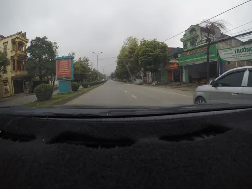
- Street-level photo, phamngocanh501, CC BY-SA 4.0
- Street-level photo, 24dakenlo, CC BY-SA 4.0
- Street-level photo, 24dakenlo, CC BY-SA 4.0
- Street-level photo, 24dakenlo, CC BY-SA 4.0
- Street-level photo, 24dakenlo, CC BY-SA 4.0
- Street-level photo, 24dakenlo, CC BY-SA 4.0


Page built November 8, 2026. Spotted a mistake? Tell us or suggest a place.