


Why visit Vĩnh Yên
Townapedia lists 4 museums and landmarks, 13 parks and trails, 7 places to eat, 6 places to stay and 3 attractions in and around town.
Highlights include Công viên đồi cao.
Weather in Vĩnh Yên
Forecast from MET Norway (CC BY 4.0). Full forecast
About Vĩnh Yên
Vĩnh Yên (Vietnamese: [vǐɲˀ ʔīən] ) is a former city capital of Vĩnh Phúc Province, in the Red River Delta region of northern Vietnam. As of census 2019, the population is 119,128 people, and it covers an area of 50.78 km2.
From the Wikipedia article Vĩnh Yên (city) (this version), under CC BY-SA 4.0.
Things to do3


Museums and landmarks4


Đài tưởng niệm anh hùng liệt sĩ tỉnh Vĩnh Phúc
Monument and historic site · 1.0 km
Parks, trails and playgrounds13

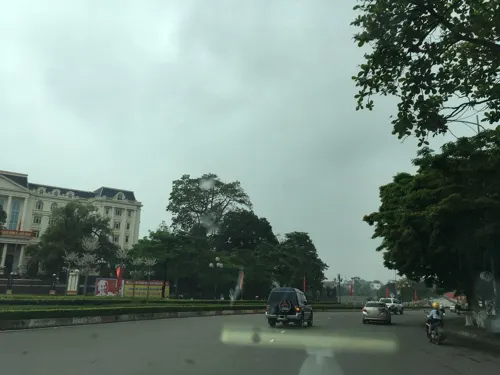

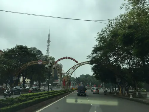


1 more on the map.
Restaurants and cafes7


Cafe Hoàng Qui - Rạp ngoài trời Vĩnh Yên
Cafe · 1.3 km
Hà Huy Tập, Vĩnh Yên
Mo-Su 07:00-21:30

Where to stay6
Churches and places of worship4
Shopping3
Gas and EV charging2
Schools, colleges and libraries37
Healthcare6
Map of Vĩnh Yên
85 places. The map loads OpenStreetMap tiles when you open it.
Getting there and nearby towns
Noi Bai International Airport (HAN) is the nearest airport with scheduled flights listed in OpenStreetMap, 23 km away.
- Tam Đảo 9 km north, about 9 min by car
- Phúc Yên 13 km southeast, about 13 min by car
- Thổ Tăng 13 km southwest, about 13 min by car
- Vĩnh Tường 14 km southwest, about 14 min by car
- Tú Trưng 14 km southwest, about 14 min by car
- Bích Chu 18 km southwest, about 18 min by car
- Việt Trì 21 km west, about 21 min by car
- Sơn Tây 21 km southwest, about 21 min by car
- Hanoi 40 km southeast, about 40 min by car
- Yên Bái 85 km northwest, about 1 h 30 min by car
Drive times are estimates from straight-line distance, not routes.
Local news
Headlines from INDB.
Reviews, tips and questions
Loading what members have shared...
Sources and licences
- GeoNames (CC BY 4.0): population, coordinates, regions and time zone
- Mapillary (see each image): photos
- OpenStreetMap contributors (ODbL 1.0): places, airports, map data
- Wikidata (CC0 1.0): elevation, founding date, time zone, website
- Wikimedia Commons (see each image): photos
- Wikipedia (CC BY-SA 4.0): overview and history text
Photo credits
- Bưu điện tỉnh Vĩnh Phúc, Bùi Thụy Đào Nguyên, CC BY-SA 3.0
- Protocollyris grossepunctata (W.Horn, 1935) (9801091293), Udo Schmidt from Deutschland, CC BY-SA 2.0
- Therates fruhstorferi fruhstorferi W.Horn, 1902 (10102553264), Udo Schmidt from Deutschland, CC BY-SA 2.0
- Tomentaromia spec. 2 (11980197685), Udo Schmidt from Deutschland, CC BY-SA 2.0
- Probstia triumphalis (W.Horn, 1902) (10167713893), Udo Schmidt from Deutschland, CC BY-SA 2.0
- Therates probsti Wiesner, 1988 (10154122303), Udo Schmidt from Deutschland, CC BY-SA 2.0
- Neocollyris (Leptocollyris) discretegrossesculpta (W.Horn, 1942) (10205709644), Udo Schmidt from Deutschland, CC BY-SA 2.0
- Neocollyris (Pachycollyris) strangulata Naviaux, 1991 (10290864715), Udo Schmidt from Deutschland, CC BY-SA 2.0
- Street-level photo, sarahantos, CC BY-SA 4.0
- Street-level photo, sarahantos, CC BY-SA 4.0
- Street-level photo, sarahantos, CC BY-SA 4.0
- Street-level photo, sarahantos, CC BY-SA 4.0


Page built November 8, 2026. Spotted a mistake? Tell us or suggest a place.