


Warrenton, Oregon
Warrenton is a city of 6,327 people in Clatsop County, Oregon, founded in 1899.
Why visit Warrenton
Townapedia lists 53 museums and landmarks, 11 parks and trails, 14 places to eat, 9 places to stay and 6 attractions in and around town.
Highlights include Liberty Theatre, Astoria–Megler Bridge, Daniel Knight Warren House and Albert W. Ferguson House.
August is the warmest month, with average highs of 69°F; February lows average 37°F.
Weather in Warrenton
Forecast from the National Weather Service. Full forecast
About Warrenton
Warrenton is a small, coastal city in Clatsop County, Oregon, United States. Named for D.K. (Daniel Knight) Warren, an early settler, the town is primarily a fishing and logging community. The population was 6,277 according to the 2020 US Census.
From the Wikipedia article Warrenton, Oregon (this version), under CC BY-SA 4.0.
Things to do6

Liberty Theatre
Cinema and theater · National Register of Historic Places · 4.9 mi
Theater in Astoria, Oregon, USA

Astoria–Megler Bridge
Bridge · 4.0 mi
Bridge connecting Washington state and Oregon, USA

Desdemona Sands Light
Lighthouse · 3.8 mi
Lighthouse in Oregon, United States

New Youngs Bay Bridge
Bridge · 3.0 mi
Vertical-lift roadbridge in Oregon, United States

Point Adams Light
Lighthouse · 2.5 mi
Lighthouse in Oregon, United States

Museums and landmarks53

Daniel Knight Warren House
Monument and historic site · National Register of Historic Places · 0.5 mi
Warrenton, Oregon, NRHP-listed
107 Skipanon Road

Albert W. Ferguson House
Monument and historic site · National Register of Historic Places · 5.1 mi
Building in Oregon, United States

Astoria Elks Building
Monument and historic site · National Register of Historic Places · 4.8 mi
Historic building in Oregon, USA

Astoria Victory Monument
Monument and historic site · National Register of Historic Places · 4.1 mi
Monument located in Astoria, Oregon, in the United States

Astoria Wharf and Warehouse Company
Monument and historic site · National Register of Historic Places · 4.6 mi
Historic building in Astoria, Oregon, USA

Captain George Conrad Flavel House
Monument and historic site · National Register of Historic Places · 5.0 mi
Historic house in Oregon, United States

Captain George Flavel House Museum
Monument and historic site · National Register of Historic Places · 4.6 mi
Historic house in Oregon, United States

Charles Stevens House
Monument and historic site · National Register of Historic Places · 4.9 mi
Building in Oregon, United States

Clatsop County Courthouse
Monument and historic site · National Register of Historic Places · 4.7 mi
Courthouse in Astoria, Oregon, USA

Ferdinand Fisher House
Monument and historic site · National Register of Historic Places · 4.8 mi
Building in Oregon, United States
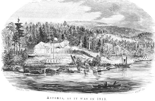
Fort Astoria
Monument and historic site · National Register of Historic Places · 5.0 mi
Former fortified trading post in Oregon, USA

Fort Clatsop
Monument and historic site · National Register of Historic Places · 3.6 mi
Historic military encampment in Oregon, USA
41 more on the map.
Parks, trails and playgrounds11






Restaurants and cafes14



Domino's
Fast food · Pizza · 1.9 mi
1546 Southeast Discovery Lane, Warrenton
Mo-Th 10:30-23:00; Fr-Sa 10:30-24:00; Su 10:30-23:00
DQ Grill & Chill
Fast food · Ice Cream, Burger, Chicken · 1.5 mi
733 South East Marlin Drive, Warrenton
2 more on the map.
History
Prior to the arrival of the first settlers, this land was inhabited by the Clatsop tribe of Native Americans, whose tribe spanned from the south shore of the Columbia River to Tillamook Head. The county in which Warrenton is located was named after these people, as well as the last encampment that the Lewis and Clark Expedition established. Today, a replica of Fort Clatsop still stands just outside of Warrenton city limits.
The first pioneers who settled on the land that would become Warrenton (between 1845 and the early 1850s) were Jeremiah Gerome Tuller, J. W. Wallace, D. E. Pease, Ninian A. Eberman and George Washington Coffenbury. Coffenbury remains a household name in the town, as a local lake in Fort Stevens was named after him.
The first settlement within Warrenton city limits was Lexington, which was laid out in 1848, and served as the first county seat for Clatsop County. The name fell out of use for a time, and the area became known as Skipanon – a name that is now preserved by the Skipanon River, which flows through the town. A Lexington post office operated intermittently between 1850 and 1857; a Skipanon post office operated continuously from 1871 to 1903.
From the History section of Warrenton, Oregon on Wikipedia, under CC BY-SA 4.0.
Where to stay9
Churches and places of worship4
Shopping10
Gas and EV charging5
Schools, colleges and libraries8
Lewis & Clark Elementary School
School · 4.5 mi
92179 Lewis And Clark Rd, Astoria
Healthcare4
Map of Warrenton
124 places. The map loads OpenStreetMap tiles when you open it.
Climate by month
Monthly table
| Month | High | Low | Rain |
|---|---|---|---|
| Jan | 49°F | 38°F | 10.6 in |
| Feb | 51°F | 37°F | 7.2 in |
| Mar | 53°F | 39°F | 7.9 in |
| Apr | 56°F | 42°F | 5.8 in |
| May | 60°F | 46°F | 3.4 in |
| Jun | 64°F | 51°F | 2.3 in |
| Jul | 67°F | 54°F | 0.8 in |
| Aug | 69°F | 54°F | 1.1 in |
| Sep | 68°F | 50°F | 2.7 in |
| Oct | 61°F | 45°F | 6.7 in |
| Nov | 54°F | 40°F | 11.1 in |
| Dec | 49°F | 38°F | 10.7 in |
U.S. Climate Normals 1991-2020 for Astoria Rgnl Ap Hcn 72791 (3 mi away), NOAA NCEI.
People and cost of living
American Community Survey 5-year estimates, 2020-2024, U.S. Census Bureau. Estimates have margins of error, larger for small towns.
Disaster history
Clatsop County has had 12 federal disaster declarations since 2000, most often for severe storms.
- 2026-04-07: Severe Storms, Straight-Line Winds, Flooding, Landslides, And Mudslides (Severe Storm)
- 2020-03-28: Covid-19 Pandemic (Biological)
- 2020-03-13: Covid-19 (Biological)
- 2016-02-17: Severe Winter Storms, Straight-Line Winds, Flooding, Landslides, And Mudslides (Severe Storm)
- 2011-02-17: Severe Winter Storm, Flooding, Mudslides, Landslides, And Debris Flows (Severe Storm)
- 2009-03-02: Severe Winter Storm, Record And Near Record Snow (Severe Storm)
OpenFEMA disaster declarations summaries.
Getting there and nearby towns
Astoria Regional Airport (AST) is the nearest airport with scheduled flights listed in OpenStreetMap, 2 miles away.
- Astoria 6 mi east, about 9 min by car
- Gearhart 10 mi south, about 16 min by car
- Seaside 13 mi south, about 20 min by car
- Cannon Beach 20 mi south, about 32 min by car
- Bayside Gardens 32 mi south, about 51 min by car
- Clatskanie 35 mi east, about 56 min by car
- Rockaway Beach 38 mi south, about 1 h by car
- Vernonia 42 mi southeast, about 1 h by car
- Longview 46 mi east, about 1 h 15 min by car
- Kelso 50 mi east, about 1 h 15 min by car
Drive times are estimates from straight-line distance, not routes.
Local news
Headlines from INDB, the NEMICO news database.
Reviews, tips and questions
Loading what members have shared...
Sources and licences
- NCES EDGE (Public domain): public schools
- NOAA NCEI U.S. Climate Normals 1991-2020 (Public domain): climate by month
- OpenFEMA (Public domain): disaster declarations
- OpenStreetMap contributors (ODbL 1.0): places, airports, map data
- U.S. Census Bureau (Public domain): population, income, housing, education, commute
- Wikidata (CC0 1.0): elevation, founding date, time zone, website, landmarks and historic places
- Wikimedia Commons (see each image): photos
- Wikipedia (CC BY-SA 4.0): overview and history text
Photo credits
- Warren House - Warrenton Oregon, Ian Poellet, CC BY-SA 3.0
- NorthWest POINT - Warrenton Fred Meyer (49493487108), Oregon Department of Transportation, CC BY 2.0
- NorthWest POINT - Warrenton Fred Meyer (49493487688), Oregon Department of Transportation, CC BY 2.0
- Ferdinand Fisher House - Astoria, Oregon, Steve Morgan, CC BY-SA 3.0
- Doughboy Monument - Astoria, Oregon, Steve Morgan, CC BY-SA 3.0
- Liberty Theatre 1 (Astoria, Oregon), Visitor7, CC BY-SA 3.0
- John N. Griffin House - Astoria, Oregon, Steve Morgan, CC BY-SA 3.0
- Grace Episcopal Church and Rectory - Astoria, Oregon, Steve Morgan, CC BY-SA 3.0
- George C. and Winona Flavel House - Astoria, Oregon, Steve Morgan, CC BY-SA 3.0
- Albert W. Ferguson House - front (Astoria, OR), Steve Morgan, CC BY-SA 3.0
- Post office - Astoria Oregon, Ian Poellet, CC BY-SA 3.0
- Clatsop County Courthouse - Astoria Oregon, Ian Poellet ( User:Werewombat ), CC BY-SA 3.0
- John Jacob Astor Hotel in Astoria, Another Believer, CC BY-SA 3.0
- Elks Building, BPOE Lodge 180 Building, Astoria, Another Believer, CC BY-SA 3.0
- Old Grace Episcopal Rectory - Astoria, Oregon, Steve Morgan, CC BY-SA 3.0
- Robert Rensselaer Bartlett House - Astoria, Oregon, Steve Morgan, CC BY-SA 3.0
- Fort Clatsop replica 2007, Glenn Scofield Williams from USA, CC BY 2.0
- Flavel House (Astoria, Oregon), Visitor7, CC BY-SA 3.0
- John Hobson House at dusk - Astoria, Oregon, Steve Morgan, CC BY-SA 3.0
- Franchere fort astoria 1813, Gabriel Franchère, Public domain
- Astoria Wharf & Warehouse Co. building in 2012, Steve Morgan, CC BY-SA 3.0
- Peter L. Cherry House - Astoria, Oregon, Steve Morgan, CC BY-SA 3.0
- Former Columbia Hospital on 16th St - Astoria, Oregon (2012) 2, Steve Morgan, CC BY-SA 3.0
- Captain George Flavel House, Drown Soda, CC BY-SA 3.0
- Norris Staples House - Astoria, Oregon, Steve Morgan, CC BY-SA 3.0
- Charles Stevens House - Astoria, Oregon, Steve Morgan, CC BY-SA 3.0
- OR - Desdemona Sands, Department of Commerce. Bureau of Lighthouses. 1913-7/1/1939, Public domain
- Old Clatsop County jail - Astoria Oregon, Ian Poellet, CC BY-SA 3.0
- New Youngs Bay Bridge vertical-lift section, Steve Morgan, CC BY-SA 3.0
- Astoria-Megler Bridge, Nils Huenerfuerst, CC BY 4.0
- Hypomesus pretiosus 6142007, Lee Cain, CC BY 4.0
- Fort Stevens State Park (49191254447), runarut, CC BY 2.0
- Fort Stevens State Park (49191058341), runarut, CC BY 2.0
- Morning at Coffenbury Lake in Fort Stevens State Park, Rick Obst, CC BY 4.0
- Pay station in the Coffenbury Lake day use area, Rick Obst, CC BY 4.0
- Fishing and floating at Coffenbury Lake in Fort Stevens State Park, Rick Obst, CC BY 4.0
- Picnic tables and restrooms at Coffenbury Lake, Rick Obst, CC BY 4.0
- Coffenbury Lake in Fort Stevens State Park, Rick Obst, CC BY 4.0
- Restrooms and picnic tables in the Coffenbury Lake day use area, Rick Obst, CC BY 4.0
- View from the boat dock at Coffenbury Lake, Rick Obst, CC BY 4.0


Page built October 30, 2026. Spotted a mistake? Tell us or suggest a place.