


Why visit Washburn
Townapedia lists 8 museums and landmarks, 19 parks and trails, 15 places to eat, 9 places to stay and 3 attractions in and around town.
Highlights include Ashland Harbor Breakwater Light, Homestead Gardens, Bayfield County Courthouse and Washburn Cultural Center.
July is the warmest month, with average highs of 77°F; January lows average 4°F.
Weather in Washburn
Forecast from the National Weather Service. Full forecast
About Washburn
Washburn is a city and the county seat of Bayfield County, Wisconsin, United States. The population was 2,051 at the 2020 census. The city is just east of and adjacent to the Town of Washburn. It is in northern Wisconsin, on the shore of Lake Superior's Chequamegon Bay.
From the Wikipedia article Washburn, Wisconsin (this version), under CC BY-SA 4.0.
Things to do3

Ashland Harbor Breakwater Light
Lighthouse · National Register of Historic Places · 3.7 mi
Lighthouse in Wisconsin, United States

Homestead Gardens
Farm and orchard · 1.5 mi
77065 State Highway 13, Washburn
We,Fr,Sa 10:00-17:00

Museums and landmarks8

Bayfield County Courthouse
Monument and historic site · National Register of Historic Places · 0.4 mi
County courthouse in Washburn, United States of America
117 East 5th Street, Washburn
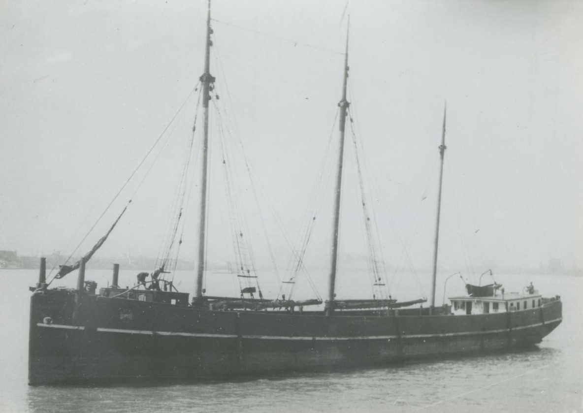
Antelope
Monument and historic site · National Register of Historic Places · 3.7 mi
Shipwreck
Bank of Washburn
Monument and historic site · National Register of Historic Places · 0.5 mi
Bank building in Washburn, Wisconsin, United States


East Third Street Residential Historic District
Monument and historic site · National Register of Historic Places · 0.6 mi
Historic building in Washburn, Wisconsin

Parks, trails and playgrounds19



Washburn Athletic Field Complex
Park · 0.8 mi
247 South 3rd Avenue East, Washburn

7 more on the map.
Restaurants and cafes15


North Coast Coffee
Cafe · Coffee Shop, Sandwich, Ice Cream · 0.4 mi
509 West Bayfield Street, Washburn

Time Out Restaurant
Restaurant · American, Breakfast · 0.5 mi
4 West Bayfield Street, Washburn
A Nickels' Worth Bar & Grill
Bar and pub · 0.5 mi
800 West Bayfield Street, Washburn
Good Thyme Restaurant & Catering
Restaurant · 1.8 mi
77180 State Highway 13, Washburn

South Shore Brewery
Brewery and winery · 0.4 mi
532 West Bayfield Street, Washburn
3 more on the map.
History
In 1659, the French explorers Radisson and Groseilliers touched here on their trip along the south shore of Lake Superior. In 1665 the Jesuit Claude-Jean Allouez established on the shore of the bay, a short distance south of the present city, the first French mission in Wisconsin. He named it "La Pointe du Saint Esprit," and in 1669 it was placed in charge of Father Jacques Marquette. The place was visited by Daniel Greysolon (Du Luth) in 1681–1682, and here in 1693 Pierre-Charles Le Sueur built a stockaded post. In 1718 a fort was erected and a French garrison placed in it. About 1820–1821 a trading post of the American Fur Company was established in the area.
The city itself was founded in 1883, named for Cadwallader C. Washburn, Republican governor of Wisconsin from 1872 until 1874. It was chartered in 1904.
From the History section of Washburn, Wisconsin on Wikipedia, under CC BY-SA 4.0.
Where to stay9
Churches and places of worship3
Messiah Lutheran Church
Church · Evangelical Lutheran
231 West 5th Street, Washburn
St. Louis Catholic Church
Church · Roman Catholic
707 North Washington Avenue, Washburn
Shopping6
Washburn Hardware & Sport
Hardware store · 0.5 mi
110 West Bayfield Street, Washburn
Gas and EV charging3
Schools, colleges and libraries7
Washburn Public Library
Library · National Register of Historic Places · 0.4 mi
307 Washington Avenue, Washburn
Healthcare4
Map of Washburn
77 places. The map loads OpenStreetMap tiles when you open it.
Climate by month
Monthly table
| Month | High | Low | Rain |
|---|---|---|---|
| Jan | 22°F | 4°F | 1.5 in |
| Feb | 26°F | 6°F | 1.3 in |
| Mar | 37°F | 17°F | 1.6 in |
| Apr | 49°F | 29°F | 2.7 in |
| May | 60°F | 40°F | 3.5 in |
| Jun | 71°F | 50°F | 3.9 in |
| Jul | 77°F | 56°F | 3.9 in |
| Aug | 76°F | 55°F | 3.6 in |
| Sep | 68°F | 48°F | 3.4 in |
| Oct | 55°F | 36°F | 3.2 in |
| Nov | 40°F | 25°F | 2.1 in |
| Dec | 28°F | 12°F | 2.0 in |
U.S. Climate Normals 1991-2020 for Bayfield Fish Hatchery (8 mi away), NOAA NCEI.
People and cost of living
American Community Survey 5-year estimates, 2020-2024, U.S. Census Bureau. Estimates have margins of error, larger for small towns.
Disaster history
Bayfield County has had 9 federal disaster declarations since 2000, most often for floods.
- 2026-06-30: Severe Storms, Tornadoes, And Flooding (Flood)
- 2020-04-04: Covid-19 Pandemic (Biological)
- 2020-03-13: Covid-19 (Biological)
- 2018-08-10: Severe Storms, Straight-Line Winds, And Flooding (Flood)
- 2016-08-09: Severe Storms And Flooding (Severe Storm)
- 2013-08-08: Severe Storms, Flooding, And Mudslides (Severe Storm)
OpenFEMA disaster declarations summaries.
Getting there and nearby towns
John F. Kennedy Memorial Airport (ASX) is the nearest airport with scheduled flights listed in OpenStreetMap, 9 miles away.
- Ashland 7 mi south, about 11 min by car
- Hurley 37 mi southeast, about 59 min by car
- Ironwood 39 mi southeast, about 1 h by car
- Bessemer 43 mi east, about 1 h 15 min by car
- Two Harbors 44 mi northwest, about 1 h 15 min by car
- Silver Bay 46 mi north, about 1 h 15 min by car
- Wakefield 48 mi east, about 1 h 15 min by car
- Hayward 54 mi southwest, about 1 h 30 min by car
- Little Round Lake 54 mi southwest, about 1 h 30 min by car
- Park Falls 56 mi southeast, about 1 h 30 min by car
Drive times are estimates from straight-line distance, not routes.
Local news
Headlines from INDB, the NEMICO news database.
Reviews, tips and questions
Loading what members have shared...
Sources and licences
- NCES EDGE (Public domain): public schools
- NOAA NCEI U.S. Climate Normals 1991-2020 (Public domain): climate by month
- OpenFEMA (Public domain): disaster declarations
- OpenStreetMap contributors (ODbL 1.0): places, airports, map data
- U.S. Census Bureau (Public domain): population, income, housing, education, commute
- Wikidata (CC0 1.0): elevation, founding date, time zone, website, landmarks and historic places
- Wikimedia Commons (see each image): photos
- Wikipedia (CC BY-SA 4.0): overview and history text
Photo credits
- WashburnWI-054-050507, Bobak Ha'Eri, CC BY 3.0
- St Louis Catholic Church Washburn, WI - panoramio, Corey Coyle, CC BY 3.0
- Washburn Public Library, Billertl, CC BY-SA 3.0
- Washburn Public Library - panoramio, Corey Coyle, CC BY 3.0
- Washburn City Hall - panoramio, Corey Coyle, CC BY 3.0
- Bayfield county IMG 1630 washburn, Bjoertvedt, CC BY-SA 3.0
- Washburn IGA - Mobil - panoramio, Corey Coyle, CC BY 3.0
- Bank of Washburn, Billertl, CC BY-SA 3.0
- Bayfield county IMG 1629 washburn, Bjoertvedt, CC BY-SA 3.0
- Bayfield county IMG 1628 washburn, Bjoertvedt, CC BY-SA 3.0
- Antelope Ship, Unknown author Unknown author, Public domain
- 205 E. Third Street, Washburn, WI, TheCatalyst31, CC0
- Bayfield County Courthouse - panoramio, Corey Coyle, CC BY 3.0
- Bayfield County Courthouse Dome, Billertl, CC BY-SA 3.0
- Bayfield County WI Courthouse, Billertl, CC BY-SA 3.0
- ChequamegonBooks, Travellers & Tinkers, CC BY-SA 4.0
- Viburnum opulus var. americanum iNat-49259981, Sarah Johnson, CC BY 4.0
- Viburnum opulus var. americanum iNat-49259817, Sarah Johnson, CC BY 4.0
- Prunus americana iNat-8230158, Sarah Johnson (iNaturalist), CC BY 4.0
- Prunus americana iNat-8230088, Sarah Johnson (iNaturalist), CC BY 4.0
- Prunus americana iNat-8230117, Sarah Johnson (iNaturalist), CC BY 4.0
- Okanagana rimosa 398828205, Sarah Johnson, CC BY 4.0
- Cerastium nutans iNat-8345331, Sarah Johnson, CC BY 4.0
- Cerastium nutans iNat-8345302, Sarah Johnson, CC BY 4.0
- Cerastium nutans iNat-8345318, Sarah Johnson, CC BY 4.0
- Two Silos South of Bayfield - panoramio, Corey Coyle, CC BY 3.0
- ISS023-E-12038 - View of Earth, Earth Science and Remote Sensing Unit , Lyndon B. Johnson Space Center, Public domain
- STS129-E-7809 - View of Earth, NASA, Public domain


Page built October 30, 2026. Spotted a mistake? Tell us or suggest a place.