
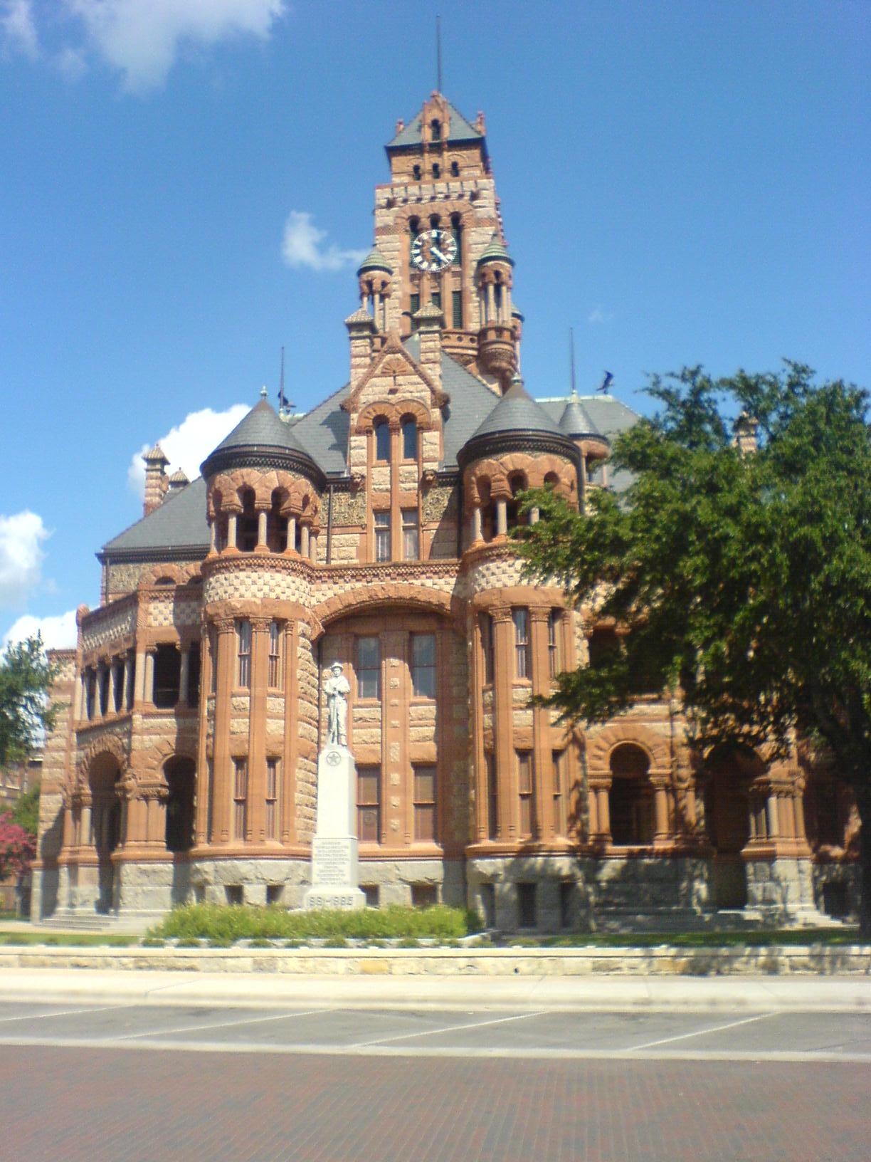


Waxahachie, Texas
Waxahachie is a city of 45,347 people in Ellis County, Texas, founded in 1850.
Why visit Waxahachie
Townapedia lists 42 museums and landmarks, 27 parks and trails, 135 places to eat, 14 places to stay and 18 attractions in and around town.
Highlights include ShowBiz Cinemas, Chautauqua Auditorium, West End Historic District and Scarborough Renaissance Festival.
August is the warmest month, with average highs of 95°F; January lows average 34°F.
Weather in Waxahachie
Forecast from the National Weather Service. Full forecast
About Waxahachie
Waxahachie an exurb south of Dallas, is a city in and the county seat of Ellis County, Texas, United States. Its population was 41,140 in 2020. The city was founded in 1850, and incorporated in 1871. Much of the employment is provided by a number of industries and by educational institutions, including primary and secondary schools, a community college and a private university.
From the Wikipedia article Waxahachie, Texas (this version), under CC BY-SA 4.0.
Things to do18

Waxahachie Amphitheatre
Cinema and theater · 1.5 mi
455 South College Street, Waxahachie
6 more on the map.
Museums and landmarks42


Chautauqua Auditorium
Monument and historic site · National Register of Historic Places · 1.4 mi
Historic place in Waxahachie, Ellis County, Texas
West End Historic District
Monument and historic site · National Register of Historic Places · 1.0 mi
Historic district in Waxahachie, Ellis County, Texas
William Lewis House
Monument and historic site · National Register of Historic Places · 1.3 mi
Building in Waxahachie, Ellis County, Texas


Waxahachie Chautauqua Building
Monument and historic site · 1.4 mi
400 South Grand Avenue, Waxahachie
30 more on the map.
Parks, trails and playgrounds27

Scarborough Renaissance Festival
Sports field and stadium · 4.0 mi
2511 Farm-to-Market 66, Waxahachie
Apr-May Sa-Su 10:00-19:00

Lumpkins Stadium
Sports field and stadium · 1.0 mi
1000 Dallas Highway, Waxahachie
15 more on the map.
Restaurants and cafes135


Asian King Buffet
Restaurant · Asian · 0.6 mi
507 North US Highway 77, Waxahachie
Su-Th 11:00-21:00; Fr,Sa 11:00-21:30
Cajun Bros
Restaurant · Seafood · 0.5 mi
507 North US Highway 77, Waxahachie
Su-Th 11:00-21:00; Fr-Sa 11:30-22:00
Chelys Taqueria Y Mas
Restaurant · Mexican · 0.5 mi
507 North US Highway 77, Waxahachie
Su-Th 11:00-20:00; Fr-Sa 11:00-21:00
Dos Juanitos Mexican Food
Restaurant · Mexican
1200 Ferris Avenue, Waxahachie
Mo-Sa 07:00-22:00, Su 08:00-22:00
Fun Noodle Bar
Restaurant · Ramen · 0.6 mi
791 North US Highway 77, Waxahachie
Su-Th 11:00-21:00; Fr,Sa 11:00-21:30
Mariscos Muelle 77
Restaurant · Mexican, Seafood
1102 Ferris Avenue, Waxahachie
Mo-Th 09:00-22:00, Fr-Su 09:00-24:00
Mr Jims.Pizza
Restaurant · Pizza
401 North US Highway 77, Waxahachie
Su-Th 10:00-22:00; Fr,Sa 10:00-23:00
Pho Noodle & Asian Cuisine
Restaurant · Vietnamese · 0.9 mi
1035 North US Highway 77, Waxahachie
Mo-Sa 11:00-20:00
Rhythm & Brew
Cafe · Coffee Shop · 1.2 mi
100 North College Street, Waxahachie
Mo-Th 07:00-21:00; Fr 07:00-22:00; Sa 08:00-22:00
Stop-N-Go Gyros
Restaurant · Greek, Gyros, Mediterranean · 0.9 mi
1035 North US Highway 77, Waxahachie
Mo-Sa 10:30-21:00; Su 10:30-19:00
123 more on the map.
History
Waxahachie was founded in August 1850 as the seat of the newly established Ellis County on a tract of land donated by early settler Emory W. Rogers, a native of Lawrence County, Alabama, who migrated to Texas in 1839. It was incorporated on April 28, 1871, and in 1875, the state legislature granted investors the right to operate a rail line from Waxahachie Tap Railroad to Garrett, Texas, which greatly increased the population of Waxahachie.
From 1902 to 1942, Waxahachie was the second home of Trinity University, which was a Presbyterian-affiliated institution founded in 1869. Then-Trinity's main administration and classroom building is today the Farmer Administration Building of Nelson University. Trinity's present-day location is in San Antonio.
The town is the namesake of the former United States Naval Ship Waxahachie (YTB-814).
In 1988, the area around Waxahachie was chosen as the site for the Superconducting Super Collider, which was to be the world's largest and most energetic particle accelerator, with a planned ring circumference of 54.1 miles (87.1 km). Seventeen shafts were sunk and 14.6 miles (23.5 km) of tunnel were bored before the project was cancelled by Congress in 1993.
From the History section of Waxahachie, Texas on Wikipedia, under CC BY-SA 4.0.
Where to stay14
Churches and places of worship50
Central Presbyterian Church
Church · Presbyterian · National Register of Historic Places · 0.9 mi
Saint Paul's Episcopal Church
Church · National Register of Historic Places · 1.1 mi
Joshua Chapel A.M.E. Church
Church · National Register of Historic Places · 1.4 mi
Brown Street Church of Christ
Church · Church Of Christ · 1.8 mi
2471 Brown Street, Waxahachie
Christ the King Lutheran Church
Church · Lutheran · 1.2 mi
301 West US Highway 287 (Bypass), Waxahachie
Connect4LIFE Church
Church · Protestant · 1.4 mi
1971 John Arden Drive, Waxahachie
Shopping24
Gas and EV charging18
Schools, colleges and libraries46
Healthcare8
Baylor Scott & White Medical Center – Waxahachie
Hospital · 1.9 mi
2400 North Interstate 35E, Waxahachie
Altus Emergency Center
Clinic and pharmacy · 2.1 mi
1791 North US Highway 77, Waxahachie
Map of Waxahachie
250 places. The map loads OpenStreetMap tiles when you open it.
Climate by month
Monthly table
| Month | High | Low | Rain | Snow |
|---|---|---|---|---|
| Jan | 56°F | 34°F | 2.6 in | 0.0 in |
| Feb | 60°F | 38°F | 2.7 in | 0.0 in |
| Mar | 67°F | 45°F | 4.0 in | 0.0 in |
| Apr | 75°F | 53°F | 3.5 in | 0.0 in |
| May | 82°F | 63°F | 4.3 in | 0.0 in |
| Jun | 90°F | 71°F | 4.2 in | 0.0 in |
| Jul | 95°F | 74°F | 2.5 in | 0.0 in |
| Aug | 95°F | 74°F | 2.9 in | 0.0 in |
| Sep | 88°F | 67°F | 3.3 in | 0.0 in |
| Oct | 78°F | 55°F | 4.7 in | 0.0 in |
| Nov | 66°F | 44°F | 2.9 in | 0.0 in |
| Dec | 58°F | 36°F | 3.1 in | 0.0 in |
U.S. Climate Normals 1991-2020 for Waxahachie (2 mi away), NOAA NCEI.
People and cost of living
American Community Survey 5-year estimates, 2020-2024, U.S. Census Bureau. Estimates have margins of error, larger for small towns.
Disaster history
Ellis County has had 18 federal disaster declarations since 2000, most often for hurricanes.
- 2024-05-17: Severe Storms, Straight-Line Winds, Tornadoes, And Flooding (Flood)
- 2021-02-19: Severe Winter Storms (Severe Ice Storm)
- 2021-02-14: Severe Winter Storm (Severe Ice Storm)
- 2020-08-24: Tropical Storms Marco And Laura (Hurricane)
- 2020-03-25: Covid-19 Pandemic (Biological)
- 2020-03-13: Covid-19 (Biological)
OpenFEMA disaster declarations summaries.
Getting there and nearby towns
Dallas Executive Airport (RBD) is the nearest airport with scheduled flights listed in OpenStreetMap, 19 miles away.
- Red Oak 8 mi northeast, about 13 min by car
- Midlothian 10 mi northwest, about 16 min by car
- Glenn Heights 10 mi north, about 17 min by car
- Ennis 13 mi southeast, about 22 min by car
- DeSoto 14 mi north, about 22 min by car
- Lancaster 14 mi north, about 23 min by car
- Cedar Hill 14 mi northwest, about 23 min by car
- Duncanville 17 mi north, about 28 min by car
- Mansfield 20 mi northwest, about 32 min by car
- Grand Prairie 21 mi northwest, about 35 min by car
Drive times are estimates from straight-line distance, not routes.
Local news
Headlines from INDB, the NEMICO news database.
Reviews, tips and questions
Loading what members have shared...
Sources and licences
- NCES EDGE (Public domain): public schools
- NOAA NCEI U.S. Climate Normals 1991-2020 (Public domain): climate by month
- OpenFEMA (Public domain): disaster declarations
- OpenStreetMap contributors (ODbL 1.0): places, airports, map data
- U.S. Census Bureau (Public domain): population, income, housing, education, commute
- Wikidata (CC0 1.0): elevation, founding date, time zone, website, landmarks and historic places
- Wikimedia Commons (see each image): photos
- Wikipedia (CC BY-SA 4.0): overview and history text
Photo credits
- Ellis county courthouse, Lothar1976 at English Wikipedia, Public domain
- Central presbyterian waxahacie 2008, Larry D. Moore, CC BY 4.0
- Saint Paul's Episcopal Church (1 of 1), Renelibrary, CC BY-SA 4.0
- West End Historic District, Renelibrary, CC BY-SA 3.0
- Waxahachie Chautauqua Building 2016, Larry D. Moore, CC BY 4.0
- William Lewis House2, Renelibrary, CC BY-SA 3.0
Page built October 30, 2026. Spotted a mistake? Tell us or suggest a place.