


West Buechel, Kentucky
West Buechel is a city of 1,599 people in Jefferson County, Kentucky.
Why visit West Buechel
Townapedia lists 16 museums and landmarks, 4 parks and trails, 31 places to eat, 5 places to stay and 1 attraction in and around town.
Highlights include Bellarmine University, Farmington, Audubon Park and Joe Creason Park.
July is the warmest month, with average highs of 88°F; January lows average 27°F.
Weather in West Buechel
Forecast from the National Weather Service. Full forecast
About West Buechel
West Buechel is a home rule-class city in Jefferson County, Kentucky, United States. As of the 2020 census, West Buechel had a population of 1,370.
From the Wikipedia article West Buechel, Kentucky (this version), under CC BY-SA 4.0.
Things to do1

Bellarmine University
School · 2.6 mi
Private, liberal arts, Division I university affiliated with the Catholic church
Museums and landmarks16

Farmington
Monument and historic site · National Register of Historic Places · 1.4 mi
Historic site in Louisville, Kentucky
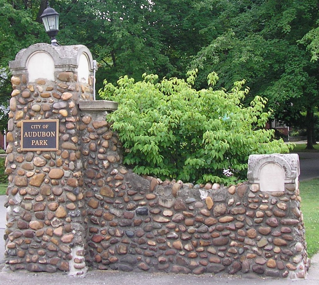
Audubon Park
Monument and historic site · National Register of Historic Places · 3.3 mi
City in Kentucky

Bowman Field
Monument and historic site · National Register of Historic Places · 2.3 mi
Public airport in Louisville, Kentucky, United States

Bray Place
Monument and historic site · National Register of Historic Places · 0.8 mi
Louisville, KY, listed on the NRHP in Kentucky

Bullock-Clifton House
Monument and historic site · National Register of Historic Places · 2.8 mi
Historic house in Kentucky, United States

Commodore Apartment Building
Monument and historic site · National Register of Historic Places · 3.2 mi
Building in Bonnycastle, Kentucky, United States
Hikes-Hunsinger House
Monument and historic site · National Register of Historic Places · 1.5 mi
House in Louisville, United States of America

Humphrey-McMeekin House
Monument and historic site · National Register of Historic Places · 2.5 mi
Historic house in Kentucky, United States

Louisville Male High School
Monument and historic site · National Register of Historic Places · 3.0 mi
High school in Louisville, Jefferson County, Kentucky
Original Highlands
Monument and historic site · National Register of Historic Places · 3.1 mi
Human settlement in Louisville, Kentucky, United States of America
Rose Hill
Monument and historic site · National Register of Historic Places · 2.9 mi
Antebellum house in Louisville, Kentucky

Steam Engine Company No. 20
Monument and historic site · National Register of Historic Places · 3.0 mi
Historic building at 1735 Bardstown Road in Louisville, Kentucky, United States
4 more on the map.
Parks, trails and playgrounds4

Joe Creason Park
Park · 2.4 mi
Park in Louisville, United States of America


Seneca Park
Park · 2.8 mi
Park in Kentucky, United States of America, United States of America
Restaurants and cafes31

Heine Brothers' Coffee
Cafe · Coffee Shop · 1.3 mi
3060 Bardstown Road, Louisville
Mo-Th 05:30-22:00; Fr 05:30-22:00; Sa 06:30-22:00; Su 07:00-22:00

Pizza Hut
Restaurant · Pizza · 0.5 mi
3601 Buechel Bypass, Louisville
Mo-Th 10:30-24:00; Fr-Sa 10:30-01:00; Su 12:00-24:00

TryMe Treats
Bakery · 0.7 mi
A small, home bakery. Specializing in individual desserts,pastries, lemonades & candies
2014 Peabody Lane, Louisville
Mo-Th 10:00-20:00; Fr 10:30-20:00; Sa 10:30-17:00
Tumbleweed
Restaurant · Mexican, Steak House, American · 0.5 mi
3602 Buechel Bypass, West Buechel
Su-Th 11:00-22:00; Fr-Sa 11:00-23:00
El Nopal Mexican Cuisine Gardine ln
Restaurant · Mexican · 1.4 mi
3010 Bardstown Road, Louisville
19 more on the map.
Where to stay5
Holiday Inn Express Louisville Airport Expo Center
Motel and hotel · 1.1 mi
1921 Bishop Lane, Louisville
Bashford Manor Bed & Breakfast
Motel and hotel · 0.8 mi
2227 Bashford Manor Lane, Louisville
Red Roof Inn - Louisville SE - Fairgrounds
Motel and hotel · 1.1 mi
3322 Red Roof Inn Place, Watterson Park
Churches and places of worship28
Saint Francis of Assisi Complex
Church · National Register of Historic Places · 2.7 mi
Saint Bartholomew Catholic Church
Church · Roman Catholic · 1.3 mi
2040 Buechel Bank Road, Louisville
Bashford Manor Baptist Church
Church · Baptist · 0.4 mi
1908 Bashford Manor Lane, West Buechel
Buechel Presbyterian Church
Church · Presbyterian · 1.1 mi
4032 Bardstown Road, Louisville
Community Missionary Baptist Church
Church · Baptist · 0.8 mi
4909 East Indian Trail, Louisville
First Korean Baptist Church
Church · Baptist · 1.1 mi
5937 Six Mile Lane, Louisville
Shopping5
Gas and EV charging4
Schools, colleges and libraries56
Goldsmith Elementary School
School · 1.2 mi
3520 Goldsmith Lane, Louisville
Healthcare2
Map of West Buechel
152 places. The map loads OpenStreetMap tiles when you open it.
Climate by month
Monthly table
| Month | High | Low | Rain |
|---|---|---|---|
| Jan | 43°F | 27°F | 3.3 in |
| Feb | 48°F | 30°F | 3.3 in |
| Mar | 57°F | 38°F | 4.4 in |
| Apr | 69°F | 48°F | 4.7 in |
| May | 77°F | 57°F | 5.2 in |
| Jun | 85°F | 66°F | 4.7 in |
| Jul | 88°F | 69°F | 4.6 in |
| Aug | 87°F | 68°F | 3.5 in |
| Sep | 81°F | 60°F | 3.6 in |
| Oct | 69°F | 48°F | 3.6 in |
| Nov | 57°F | 38°F | 3.4 in |
| Dec | 46°F | 31°F | 3.9 in |
U.S. Climate Normals 1991-2020 for Louisville Bowman Fld (2 mi away), NOAA NCEI.
People and cost of living
American Community Survey 5-year estimates, 2020-2024, U.S. Census Bureau. Estimates have margins of error, larger for small towns.
Disaster history
Jefferson County has had 19 federal disaster declarations since 2000, most often for severe storms.
- 2026-01-24: Severe Winter Storm (Winter Storm)
- 2025-04-24: Severe Storms, Straight-Line Winds, Tornadoes, Flooding, Landslides, And Mudslides (Severe Storm)
- 2025-04-03: Severe Storms, Straight-Line Winds, Tornadoes, And Flooding (Severe Storm)
- 2025-02-24: Severe Storms, Straight-Line Winds, Flooding, Landslides, And Mudslides (Severe Storm)
- 2025-02-16: Severe Storms, Straight-Line Winds, Flooding, And Landslides (Severe Storm)
- 2024-05-22: Severe Storms, Straight-Line Winds, Tornadoes, Landslides, And Mudslides (Severe Storm)
OpenFEMA disaster declarations summaries.
Getting there and nearby towns
Bowman Field (LOU) is the nearest airport with scheduled flights listed in OpenStreetMap, 2 miles away.
- Louisville/Jefferson County 2 mi southeast, about 4 min by car
- Audubon Park 3 mi west, about 5 min by car
- St. Matthews 4 mi northeast, about 7 min by car
- St. Regis Park 4 mi northeast, about 6 min by car
- Jeffersontown 5 mi east, about 9 min by car
- Hurstbourne Acres 5 mi northeast, about 7 min by car
- Hurstbourne 5 mi northeast, about 8 min by car
- Beechwood Village 5 mi northeast, about 8 min by car
- Lyndon 6 mi northeast, about 10 min by car
- Graymoor-Devondale 6 mi northeast, about 10 min by car
Drive times are estimates from straight-line distance, not routes.
Local news
Headlines from INDB, the NEMICO news database.
Reviews, tips and questions
Loading what members have shared...
Sources and licences
- NCES EDGE (Public domain): public schools
- NOAA NCEI U.S. Climate Normals 1991-2020 (Public domain): climate by month
- OpenFEMA (Public domain): disaster declarations
- OpenStreetMap contributors (ODbL 1.0): places, airports, map data
- U.S. Census Bureau (Public domain): population, income, housing, education, commute
- Wikidata (CC0 1.0): elevation, founding date, time zone, website, landmarks and historic places
- Wikimedia Commons (see each image): photos
- Wikipedia (CC BY-SA 4.0): overview and history text
Photo credits
- Farmington, Jack Boucher, Public domain
- Steam Engine 20, 1735 Bardstown, Nyttend, Public domain
- Willam R. Belknap School, Nyttend, Public domain
- St Francis on Bardstown in Louisville, Nyttend, Public domain
- Originalhighlands, Retired username at en.wikipedia, CC BY-SA 3.0
- Audubon park ky, Retired username at en.wikipedia, CC BY-SA 3.0
- Bullock clifton, Unknown author, Public domain
- Humphrey-McMeekin House, W.marsh, CC BY 2.0
- Louisville Male High School, old building, Nyttend, Public domain
- FrontExt3, TeresaLarkHeintzman ( talk ), CC BY-SA 3.0
- Woodbourne House, Louisville, Nyttend, Public domain
- Bowman field airport, David Harpe, CC BY-SA 2.5
- Schuster building 2007, W.marsh, CC BY-SA 3.0
- Louisville Zoo - March 2021, BlueShirtz, CC BY-SA 4.0


Page built October 30, 2026. Spotted a mistake? Tell us or suggest a place.