
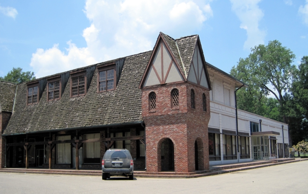


Wilson, Arkansas
Wilson is a city of 1,023 people in Mississippi County, Arkansas, founded in March 19, 1959.
Why visit Wilson
Townapedia lists 5 museums and landmarks, 4 parks and trails and 1 place to eat in and around town.
Highlights include Wilson Commercial Historic District and Wilson Community House.
July is the warmest month, with average highs of 91°F; January lows average 31°F.
Weather in Wilson
Forecast from the National Weather Service. Full forecast
About Wilson
Wilson is a city in Mississippi County, Arkansas, United States. The community is located in the Arkansas Delta and is surrounded by fertile cropland historically used to produce cotton. Wilson started as a company town in 1886 by Robert E. Lee Wilson, who would build a cotton empire and run it from the city.
From the Wikipedia article Wilson, Arkansas (this version), under CC BY-SA 4.0.
Museums and landmarks5
Wilson Commercial Historic District
Monument and historic site · National Register of Historic Places
Historic district in Arkansas, United States

Wilson Community House
Monument and historic site · National Register of Historic Places
Building in Arkansas, United States of America
Wilson High School Gymnasium
Monument and historic site · National Register of Historic Places · 0.5 mi
Wilson Residential Historic District
Monument and historic site · National Register of Historic Places · 1.3 mi
Historic district in Arkansas, United States

Hampson Archeological Museum State Park
Museum
State park in Arkansas, United States
Parks, trails and playgrounds4

Restaurants and cafes1

Churches and places of worship3

History
The area was first known as Crowell's Landing, but mostly washed away in the 1880s. Steamboat agent Dr. J.W. Rhodes purchased 37 acres in 1883 and founded a new landing on the Mississippi River he named Golden Lake. Soon after he was named postmaster.
The city of Wilson was started about a mile and half north as a company town for Robert E. Lee Wilson's nearby logging and sawmill operation founded in 1886. The village prospered when Wilson decided to use the cleared land for agriculture instead of selling it after logging. In 1900, a major archaeological find occurred near Wilson when James K. Hampson discovered the Island 35 Mastodon. All residents of Wilson except the postmaster and railroad employees had access to company doctors for $1.25 annually ($24.09 in 2025 dollars), a rarity in the poverty-stricken Arkansas delta. The company also employed people to work in Wilson's basic service industries, such as drycleaning and automobile repair, keeping the standard of living high.
In the early 1900's, R.L. Wilson began construction on a railroad to connect the town with Golden Landing and his sawmill operations in the area. This line was bought out by the Jonesboro, Lake City and Eastern Railroad in 1912.
From the History section of Wilson, Arkansas on Wikipedia, under CC BY-SA 4.0.
Schools, colleges and libraries3
Map of Wilson
16 places. The map loads OpenStreetMap tiles when you open it.
Climate by month
Monthly table
| Month | High | Low | Rain | Snow |
|---|---|---|---|---|
| Jan | 47°F | 31°F | 4.1 in | 0.6 in |
| Feb | 52°F | 34°F | 4.5 in | 0.9 in |
| Mar | 61°F | 42°F | 5.0 in | 0.3 in |
| Apr | 72°F | 52°F | 5.5 in | 0.0 in |
| May | 81°F | 62°F | 5.5 in | 0.0 in |
| Jun | 89°F | 70°F | 4.0 in | 0.0 in |
| Jul | 91°F | 73°F | 3.9 in | 0.0 in |
| Aug | 90°F | 71°F | 3.0 in | 0.0 in |
| Sep | 85°F | 63°F | 3.3 in | 0.0 in |
| Oct | 74°F | 51°F | 4.0 in | 0.0 in |
| Nov | 61°F | 41°F | 4.3 in | 0.0 in |
| Dec | 51°F | 34°F | 4.9 in | 0.0 in |
U.S. Climate Normals 1991-2020 for Keiser (9 mi away), NOAA NCEI.
People and cost of living
American Community Survey 5-year estimates, 2020-2024, U.S. Census Bureau. Estimates have margins of error, larger for small towns.
Disaster history
Mississippi County has had 17 federal disaster declarations since 2000, most often for severe storms.
- 2026-01-24: Severe Winter Storm (Winter Storm)
- 2025-05-21: Severe Storms, Tornadoes, And Flooding (Flood)
- 2025-04-05: Severe Storms, Tornadoes, And Flooding (Severe Storm)
- 2021-12-23: Severe Storms And Tornadoes (Tornado)
- 2020-08-27: Hurricane Laura (Hurricane)
- 2020-04-03: Covid-19 Pandemic (Biological)
OpenFEMA disaster declarations summaries.
Getting there and nearby towns
Millington Regional Jetport (NQA) is the nearest airport with scheduled flights listed in OpenStreetMap, 17 miles away.
- Atoka 17 mi southeast, about 28 min by car
- Lepanto 17 mi west, about 27 min by car
- Millington 18 mi southeast, about 29 min by car
- Marked Tree 22 mi west, about 35 min by car
- Manila 23 mi north, about 37 min by car
- Bartlett 26 mi southeast, about 42 min by car
- Marion 27 mi south, about 43 min by car
- Blytheville 27 mi north, about 43 min by car
- Lakeland 28 mi southeast, about 44 min by car
- Memphis 32 mi south, about 51 min by car
Drive times are estimates from straight-line distance, not routes.
Local news
Headlines from INDB, the NEMICO news database.
Reviews, tips and questions
Loading what members have shared...
Sources and licences
- NCES EDGE (Public domain): public schools
- NOAA NCEI U.S. Climate Normals 1991-2020 (Public domain): climate by month
- OpenFEMA (Public domain): disaster declarations
- OpenStreetMap contributors (ODbL 1.0): places, airports, map data
- U.S. Census Bureau (Public domain): population, income, housing, education, commute
- Wikidata (CC0 1.0): elevation, founding date, time zone, website, landmarks and historic places
- Wikimedia Commons (see each image): photos
- Wikipedia (CC BY-SA 4.0): overview and history text
Photo credits
- Wilson AR 06 downtown, Thomas R Machnitzki, CC BY 3.0
- The Wilson Community House, Jim Roberts, CC BY-SA 4.0
- The Wilson High School Gymnasium, Jim Roberts, CC BY-SA 4.0
- WilsonResidential Historic House 4877 U.S. Hwy. 61, Jim Roberts, CC BY-SA 4.0
- Wilson AR 07 USPS post office, Thomas R Machnitzki, CC BY 3.0
Page built October 30, 2026. Spotted a mistake? Tell us or suggest a place.