


Winthrop Town, Massachusetts
Winthrop Town is a city of 18,759 people in Suffolk County, Massachusetts, founded in 1630.
Why visit Winthrop Town
Townapedia lists 29 museums and landmarks, 31 parks and trails, 15 places to eat, 1 place to stay and 8 attractions in and around town.
Highlights include Winthrop Beach, Chelsea Street Bridge, Bellingham Square Historic District and Bellingham–Cary House.
July is the warmest month, with average highs of 82°F; January lows average 23°F, and about 49 inches of snow fall in a normal year.
Weather in Winthrop Town
Forecast from the National Weather Service. Full forecast
About Winthrop Town
Winthrop is a city in Suffolk County, Massachusetts, United States. The population was 19,316 at the 2020 census. Winthrop is an ocean-side suburban town in Greater Boston situated at the north entrance to the Boston Harbor, geographically nearby to the Logan International Airport. It is located on a peninsula, 1.6 square miles (4.2 km2) in area, connected to the city of Revere, Massachusetts by a narrow isthmus and to multiple portions of Boston by a bridge over the harbor inlet to the Belle Isle Marsh Reservation in the neighborhood of East Boston, a shared line at the Boston Logan International Airport, and at Deer Island.
From the Wikipedia article Winthrop, Massachusetts (this version), under CC BY-SA 4.0.
Things to do8


Chelsea Street Bridge
Bridge · 2.7 mi
Vertical lift bridge in United States of America

Christina and John Markey Memorial Pedestrian Bridge
Bridge · 2.1 mi
Bridge in Revere, Massachusetts

Constitution Beach
Beach · 2.1 mi
Man-made beach located in the HarborView

Deer Island Light
Lighthouse · 3.4 mi
Lighthouse in Massachusetts, United States

Wonderland Amusement Park
Monument and historic site · 2.1 mi
In Revere, Massachusetts

Museums and landmarks29

Bellingham Square Historic District
Monument and historic site · National Register of Historic Places · 3.3 mi
Historic district in Massachusetts, United States

Bellingham–Cary House
Monument and historic site · National Register of Historic Places · 3.1 mi
Historic house in Massachusetts, United States

Bennington Street Burying Ground
Monument and historic site · National Register of Historic Places · 2.7 mi
Historic cemetery in East Boston, Suffolk County, Massachusetts

C. Henry Kimball House
Monument and historic site · National Register of Historic Places · 3.5 mi
Chelsea, Massachusetts, listed on the NRHP in Suffolk County

Chelsea Garden Cemetery
Monument and historic site · National Register of Historic Places · 3.3 mi
Historic cemetery in Chelsea, Massachusetts, United States

Congregation Agudath Shalom
Monument and historic site · National Register of Historic Places · 3.5 mi
United States historic place

Deane Winthrop House
Monument and historic site · National Register of Historic Places · 0.6 mi
Historic house in Massachusetts, United States

Donald McKay House
Monument and historic site · National Register of Historic Places · 3.5 mi
Boston, Massachusetts, listed on the NRHP in Boston, Massachusetts

Downtown Chelsea Residential Historic District
Monument and historic site · National Register of Historic Places · 3.5 mi
Historic district in Massachusetts, United States
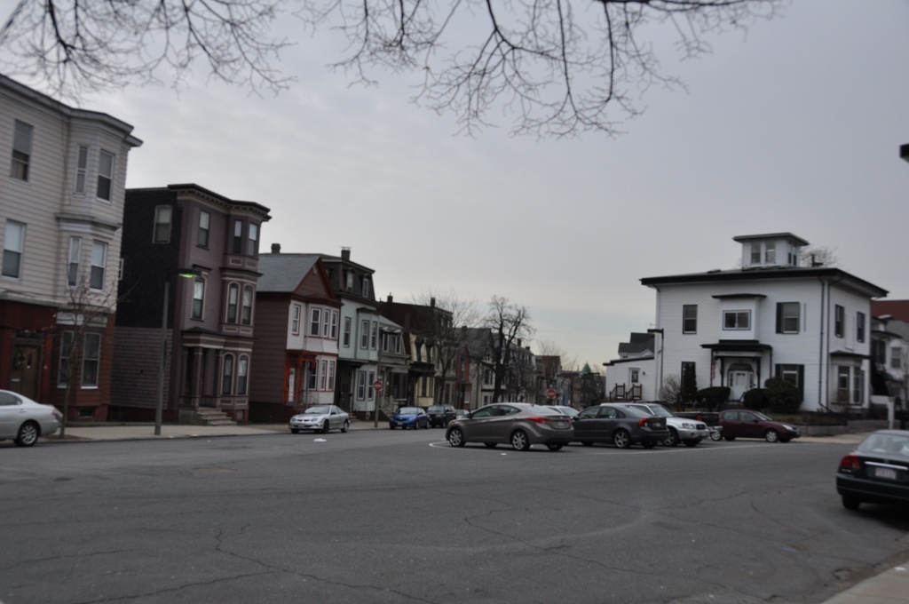
Eagle Hill Historic District
Monument and historic site · National Register of Historic Places · 3.4 mi
Historic district in Massachusetts, United States

Edward B. Newton School
Monument and historic site · National Register of Historic Places · 1.2 mi
School building in Winthrop, United States of America

Greenlawn Cemetery
Monument and historic site · National Register of Historic Places · 3.4 mi
Cemetery in Nahant, Massachusetts
17 more on the map.
Parks, trails and playgrounds31

Belle Isle Marsh Reservation
Hiking and trails · 1.1 mi
1399 Bennington Street, East Boston
09:00-sunset
Revere Beach
Park · National Register of Historic Places · 1.8 mi
First public beach in United States



Mary Ellen Welch Greenway
Park · 3.2 mi
Shared use path and park in East Boston



19 more on the map.
Restaurants and cafes15

Belle Isle Seafood
Restaurant · Seafood · 1.3 mi
1 Main Street, Winthrop
Mo-Sa 11:00-20:00; Su 11:00-19:00
Thai Taki
Restaurant · Thai, Asian, Sushi · 1.2 mi
7 Michaels Mall, Winthrop
Su-Th 11:30-21:00; Fr-Sa 11:30-21:30

Winthrop Center Café
Cafe · Bagel, Breakfast, Coffee, Lunch · 1.3 mi
36 Woodside Avenue, Winthrop
Tu-Fr 07:00-20:00; Sa-Su 07:00-18:00

Twisted Fate Brewing
Brewery and winery · 1.4 mi
64 Salt Street
We 15:00-21:00; Th 16:00-21:00; Fr 15:00-22:00; Sa 12:00-22:00; Su...
Winthrop Book Depot & Cafe
Cafe · 1.3 mi
9 Somerset Avenue, Winthrop
Mo-We 06:30-13:00; Th-Fr 06:30-16:00; Sa 07:30-13:00

Riley’s Ice Cream
Ice cream · 1.3 mi
This ice cream shop only has a customer window and there is no indoor seating.
196 Hagman Road, Winthrop

3 more on the map.
History
Winthrop was settled in 1630 by English Puritan colonists as "Pullen Poynt" (Pulling Point), so named because the tides made hard pulling for boatmen. The present town is named after John Winthrop (1587–1649), second governor of the Massachusetts Bay Colony and an English Puritan leader. On April 8, 1630, Winthrop departed from the Isle of Wight, England on the ship Arbella, arriving in Salem in June where he was met by John Endecott, the first governor of the colony. John Winthrop served as governor for twelve of the colony's first twenty years of existence. It was he who decided to base the colony at the Shawmut Peninsula, where he and other colonists founded what is now the City of Boston.
From the History section of Winthrop, Massachusetts on Wikipedia, under CC BY-SA 4.0.
Where to stay1
Churches and places of worship6
Baker Congregational Church
Church · National Register of Historic Places · 2.5 mi
Church of Christ
Church · National Register of Historic Places · 2.4 mi
First Church of Winthrop, United Methodist
Church · United Methodist · 1.1 mi
217 Winthrop Street, Winthrop
Shopping1
Gas and EV charging1
Schools, colleges and libraries52
Map of Winthrop Town
144 places. The map loads OpenStreetMap tiles when you open it.
Climate by month
Monthly table
| Month | High | Low | Rain | Snow |
|---|---|---|---|---|
| Jan | 37°F | 23°F | 3.4 in | 14.3 in |
| Feb | 39°F | 25°F | 3.2 in | 14.4 in |
| Mar | 46°F | 31°F | 4.2 in | 9.0 in |
| Apr | 56°F | 41°F | 3.6 in | 1.6 in |
| May | 66°F | 50°F | 3.2 in | 0.0 in |
| Jun | 76°F | 60°F | 3.9 in | 0.0 in |
| Jul | 82°F | 66°F | 3.3 in | 0.0 in |
| Aug | 80°F | 65°F | 3.2 in | 0.0 in |
| Sep | 73°F | 58°F | 3.6 in | 0.0 in |
| Oct | 62°F | 48°F | 4.0 in | 0.2 in |
| Nov | 52°F | 38°F | 3.7 in | 0.7 in |
| Dec | 42°F | 29°F | 4.3 in | 9.0 in |
U.S. Climate Normals 1991-2020 for Boston Logan Intl Ap 72509 (3 mi away), NOAA NCEI.
People and cost of living
American Community Survey 5-year estimates, 2020-2024, U.S. Census Bureau. Estimates have margins of error, larger for small towns.
Disaster history
Suffolk County has had 24 federal disaster declarations since 2000, most often for severe storms.
- 2023-09-15: Hurricane Lee (Hurricane)
- 2022-04-18: Severe Winter Storm And Snowstorm (Snowstorm)
- 2020-03-27: Covid-19 Pandemic (Biological)
- 2020-03-13: Covid-19 (Biological)
- 2018-07-19: Severe Winter Storm And Snowstorm (Snowstorm)
- 2015-04-13: Severe Winter Storm, Snowstorm, And Flooding (Severe Storm)
OpenFEMA disaster declarations summaries.
Getting there and nearby towns
Logan International Airport (BOS) is the nearest airport with scheduled flights listed in OpenStreetMap, 2 miles away.
- Revere 2 mi northwest, about 4 min by car
- Chelsea 3 mi west, about 5 min by car
- Boston 4 mi southwest, about 7 min by car
- Everett 5 mi west, about 7 min by car
- Malden 5 mi northwest, about 9 min by car
- Lynn 6 mi north, about 10 min by car
- Saugus 6 mi northwest, about 10 min by car
- Hull 6 mi southeast, about 9 min by car
- Somerville 7 mi west, about 11 min by car
- Melrose 7 mi northwest, about 11 min by car
Drive times are estimates from straight-line distance, not routes.
Local news
Headlines from INDB, the NEMICO news database.
Reviews, tips and questions
Loading what members have shared...
Sources and licences
- NCES EDGE (Public domain): public schools
- NOAA NCEI U.S. Climate Normals 1991-2020 (Public domain): climate by month
- OpenFEMA (Public domain): disaster declarations
- OpenStreetMap contributors (ODbL 1.0): places, airports, map data
- U.S. Census Bureau (Public domain): population, income, housing, education, commute
- Wikidata (CC0 1.0): elevation, founding date, time zone, website, landmarks and historic places
- Wikimedia Commons (see each image): photos
- Wikipedia (CC BY-SA 4.0): overview and history text
Photo credits
- Winthrop ma, Sean 2015 at English Wikipedia, Public domain
- Winthrop Parkway Revere MA, Jameslwoodward, CC BY-SA 3.0
- Frost Public Library, Winthrop MA, John Phelan, CC BY 3.0
- Bennington Street Burying Ground East Boston MA 02, Jameslwoodward, CC BY-SA 3.0
- Church of Christ Revere MA 01, Jameslwoodward, CC BY-SA 3.0
- Sunset-after-rain-revere-beach-causevic, Reveah-patriot at English Wikipedia, Public domain
- BostonMA MonmouthSquareEastBoston, User:Magicpiano, CC BY-SA 4.0
- Bellingham-Cary House Chelsea MA, Jameslwoodward, CC BY-SA 3.0
- Downtown Chelsea Residential HD Chelsea MA 01, Jameslwoodward, CC BY-SA 3.0
- Congregation Agudath Shalom Chelsea MA, Jameslwoodward, CC BY-SA 3.0
- Winthrop Shore Drive Winthrop MA, Jameslwoodward, CC BY-SA 3.0
- Donald McKay House, East Boston MA, Jameslwoodward, CC BY-SA 3.0
- Chelsea Garden Cemetery Chelsea MA 01, Jameslwoodward, CC BY-SA 3.0
- NahantMA LifeSavingStation, User:Magicpiano, CC BY-SA 4.0
- WinthropMA HighlandSchool, User:Magicpiano, CC BY-SA 4.0
- Immaculate Conception Rectory Revere MA 03, Jameslwoodward, CC BY-SA 3.0
- Deane Winthrop House Winthrop MA 02, Jameslwoodward, CC BY-SA 3.0
- Rumney Marsh Burying Ground HS Revere MA 01, Jameslwoodward, CC BY-SA 3.0
- C Henry Kimball House Chelsea MA 01, Jameslwoodward, CC BY-SA 3.0
- Edward B Newton School Winthrop MA 01, Jameslwoodward, CC BY-SA 3.0
- Greenlawn Cemetery, Nahant MA, John Phelan, CC BY 3.0
- RevereMA CityHall, User:Magicpiano, CC BY-SA 4.0
- Baker Congregational Church East Boston MA 02, Jameslwoodward, CC BY-SA 3.0
- Bellingham Square Historic District Chelsea MA 02, Jameslwoodward, CC BY-SA 3.0
- Ohabei Shalom Cemetery East Boston MA 04, Jameslwoodward, CC BY-SA 3.0
- Mary T Ronan School Revere MA, Jameslwoodward, CC BY-SA 3.0
- Fort Banks Mortar Battery Winthrop MA 01, Jameslwoodward, CC BY-SA 3.0
- Winthrop Beach, Winthrop MA, John Phelan, CC BY 3.0
- Chelsea Street Bridge and Boston skyline, March 2014, Pi.1415926535, CC BY 3.0
- Deer Island Light, June 19 2016, RadioTheodric, CC BY-SA 4.0
- East Boston Greenway.agr, ArnoldReinhold, CC BY-SA 4.0
- Markey bridge at Wonderland, February 2014, jpitha, CC BY-SA 2.0
- JamesOConway, Elmar Klausmeier, CC0
- Winthrop Highlands station undivided back postcard, Alfred T. Bagness, Public domain
- Highlands station postcard, Unknown author Unknown author, Public domain
- Winthrop Highlands station 1917 postcard, Unknown author Unknown author, Public domain
- Winthrop Highlands station 1910 postcard, Metropolitan News and Publishing Company, Public domain
- Winthrop Loop under construction from Shore Drive, 1886, Unknown author Unknown author, Public domain
- MBTA route 712 bus on Revere Street, July 2015, Pi.1415926535, CC BY 3.0
- Sera Tuxedo Cat, Nicholas Healy, CC BY-SA 4.0


Page built October 30, 2026. Spotted a mistake? Tell us or suggest a place.