


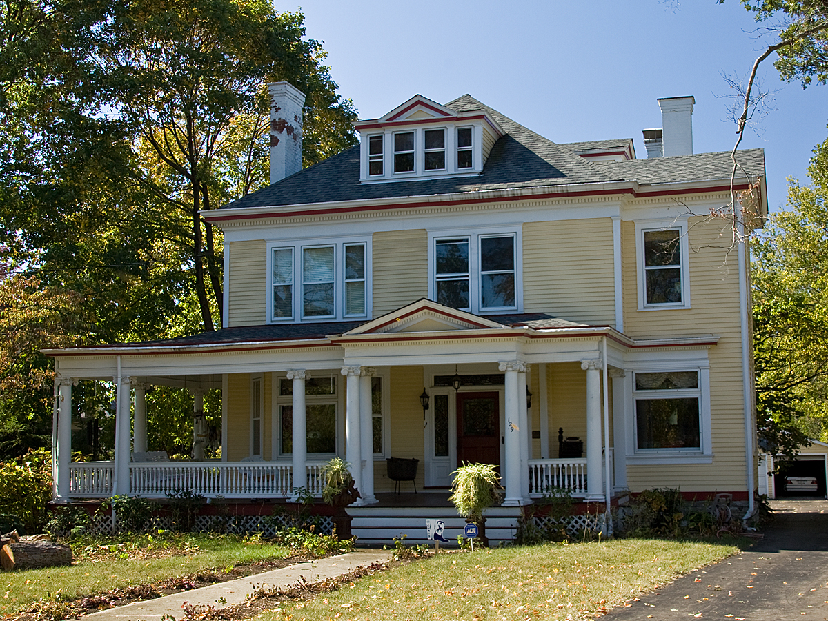


Amberley, Ohio
Amberley is a village of 3,826 people in Hamilton County, Ohio, founded in 1940.
Why visit Amberley
Townapedia lists 30 museums and landmarks, 21 parks and trails, 24 places to eat and 1 attraction in and around town.
Highlights include 20th Century Theatre, Benham Mound, French Park and Kennedy Heights Park.
July is the warmest month, with average highs of 87°F; January lows average 24°F.
Weather in Amberley
Forecast from the National Weather Service. Full forecast
About Amberley
Amberley, commonly known as Amberley Village, is a village in Hamilton County, Ohio, United States. A residential suburb of Cincinnati, it had a population of 3,840 at the 2020 census. The village developed rapidly following World War II and became an important center of Cincinnati's suburban Jewish community. It contains several large green spaces, including French Park and Amberley Green.
From the Wikipedia article Amberley, Ohio (this version), under CC BY-SA 4.0.
Things to do1

Museums and landmarks30
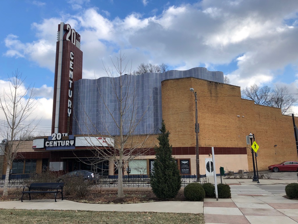
20th Century Theatre
Cinema and theater · National Register of Historic Places · 3.6 mi
Events venue and former movie theater in Cincinnati, Ohio, United States

Benham Mound
Monument and historic site · National Register of Historic Places · 0.7 mi
Archaeological site in Ohio, United States

Charles Fay House
Monument and historic site · National Register of Historic Places · 3.3 mi
Historic house in Ohio, United States

Charles H. Moore House
Monument and historic site · National Register of Historic Places · 2.9 mi
Wyoming, Ohio, NRHP-listed

Charles Woodruff House
Monument and historic site · National Register of Historic Places · 2.9 mi
Historic house in Ohio, United States

Eastwood Historic District
Monument and historic site · National Register of Historic Places · 2.9 mi
Historic district in Cincinnati, Ohio

Edward R. Stearns House
Monument and historic site · National Register of Historic Places · 3.3 mi
Historic house in Ohio, United States

Elmer Hess House
Monument and historic site · National Register of Historic Places · 2.8 mi
Historic house in Ohio, United States

Gerald B. and Beverley Tonkens House
Monument and historic site · National Register of Historic Places · 0.9 mi
Historic house in Ohio, United States

Gorman Heritage Farm
Monument and historic site · National Register of Historic Places · 2.9 mi
Working farm museum in Evendale, Ohio, United States


Jacob Bromwell House
Monument and historic site · National Register of Historic Places · 2.9 mi
Historic house in Ohio, United States

James Baxter House
Monument and historic site · National Register of Historic Places · 0.8 mi
Amberley Village, Ohio, NRHP-listed
18 more on the map.
Parks, trails and playgrounds21

French Park
Park · 0.4 mi
Public park in Amberley, Ohio, United States
Daniel Drake Park
Park · 2.4 mi
Park in Ohio, United States of America

Amberley Park
Park · 0.4 mi
Several amenities are available on the grounds of Village Hall for residents to enjoy: playground equipment and the walking track, which...
9 more on the map.
Restaurants and cafes24

Café Alma
Restaurant · Mediterranean · 1.4 mi
Our mission at Café Alma is to encourage the habit of healthy eating, living a well-balanced lifestyle and spreading the knowledge we...
6111 Montgomery Road, Cincinnati
Mo-Fr 07:00-15:00; Sa-Su 08:00-15:00
Amma’s Kitchen
Restaurant · Indian · 1.6 mi
7633 Reading Road, Cincinnati
Mo-Fr 11:00-14:30,17:30-21:30; Sa,Su 11:30-15:00,17:30-21:30
Catch Me If You Can
Restaurant · Fish And Chips, Mexican, Sandwich · 1.5 mi
6112 Montgomery Road, Cincinnati
Tu-Su 11:00-23:00

Gas Light Cafe
Cafe · Burger · 1.5 mi
6104 Montgomery Road, Cincinnati
Mo-Th 11:00-01:00; Fr-Sa 11:00-02:00; Su 13:00-21:00
Loving Hut
Restaurant · International · 1.4 mi
6227 Montgomery Road, Cincinnati
Tu-Fr 11:00-15:00,16:00-19:00; Sa 11:00-19:00
Nine Giant
Restaurant · American, Pub · 1.5 mi
6095 Montgomery Road, Cincinnati
Tu-Th 16:00-21:00; Fr-Sa 12:00-22:00; Su 12:00-18:00
Pleasant Ridge Chili
Restaurant · Chili, Regional · 1.5 mi
6032 Montgomery Road, Cincinnati
Mo-Sa 09:00-04:30
Song Long
Restaurant · Vietnamese · 1.7 mi
1737 Section Road, Cincinnati
Mo-Th 11:00-14:30,16:30-21:00; Fr,Sa 11:00-14:30,16:30-22:00

The Overlook Lodge
Bar and pub · 1.5 mi
6083 Montgomery Road, Cincinnati
Mo 16:00-22:00; Tu-Th 16:00-02:00; Fr-Sa 15:00-02:00; Su 14:00-22:00
12 more on the map.
History
The area that became Amberley was originally part of Columbia Township and remained largely rural into the early 20th century, containing farms and country estates.
Evidence of much earlier human activity in the area includes the Benham Mound, a prehistoric earthwork attributed to people of the Hopewell tradition. The mound was added to the National Register of Historic Places in 1974.
European-American settlement began near the end of the 18th century. James Baxter purchased approximately 320 acres (1.3 km2) in the area in 1797 and constructed the original portion of the James Baxter House in 1807. The house was added to the National Register of Historic Places in 1994.
Amberley was incorporated as a village on April 5, 1940. The village was named after Amberley, West Sussex, England. Planning, zoning, and the preservation of low-density residential development were prominent concerns during the village's early years. Amberley developed rapidly after World War II, growing from 885 residents in 1950 to 2,951 in 1960.
The village adopted the council–manager form of government in 1955, with Rupert Anderegg serving as its first village manager.
Amberley Village has been recognized as a Tree City USA community. According to the village, Amberley first earned the designation in 2005 and has maintained the status in subsequent years.
From the History section of Amberley, Ohio on Wikipedia, under CC BY-SA 4.0.
Churches and places of worship30
Allen Temple AME Church
Church · National Register of Historic Places · 2.3 mi
Wyoming Presbyterian Church
Church · National Register of Historic Places · 2.7 mi
Shopping3
Gas and EV charging6
Schools, colleges and libraries64
Academy For Multilingual Immersion Studies
School · 1.9 mi
1908 Seymour Ave, Cincinnati
Healthcare3
Map of Amberley
182 places. The map loads OpenStreetMap tiles when you open it.
Climate by month
Monthly table
| Month | High | Low | Rain |
|---|---|---|---|
| Jan | 41°F | 24°F | 2.9 in |
| Feb | 45°F | 26°F | 2.8 in |
| Mar | 55°F | 33°F | 3.9 in |
| Apr | 67°F | 42°F | 4.4 in |
| May | 75°F | 53°F | 4.7 in |
| Jun | 83°F | 61°F | 4.6 in |
| Jul | 87°F | 65°F | 4.4 in |
| Aug | 86°F | 64°F | 3.4 in |
| Sep | 80°F | 56°F | 3.1 in |
| Oct | 68°F | 44°F | 3.0 in |
| Nov | 55°F | 34°F | 2.9 in |
| Dec | 45°F | 28°F | 3.3 in |
U.S. Climate Normals 1991-2020 for Cincinnati Lunken Ap (7 mi away), NOAA NCEI.
People and cost of living
American Community Survey 5-year estimates, 2020-2024, U.S. Census Bureau. Estimates have margins of error, larger for small towns.
Disaster history
Hamilton County has had 11 federal disaster declarations since 2000, most often for severe storms.
- 2026-10-02: Severe Storms, Straight-Line Winds, Tornadoes, Flooding, And Landslides (Flood)
- 2020-03-31: Covid-19 Pandemic (Biological)
- 2020-03-13: Covid-19 (Biological)
- 2018-04-17: Severe Storms, Landslides, And Mudslides (Flood)
- 2012-06-30: Severe Storms (Severe Storm)
- 2011-07-13: Severe Storms And Flooding (Severe Storm)
OpenFEMA disaster declarations summaries.
Getting there and nearby towns
Lunken Airport (LUK) is the nearest airport with scheduled flights listed in OpenStreetMap, 7 miles away.
- Reading 1 mi north, about 2 min by car
- Rossmoyne 2 mi east, about 4 min by car
- Norwood 3 mi southwest, about 5 min by car
- Lincoln Heights 3 mi northwest, about 5 min by car
- Evendale 3 mi north, about 5 min by car
- Elmwood Place 3 mi west, about 6 min by car
- Blue Ash 4 mi northeast, about 6 min by car
- Fairfax 4 mi south, about 7 min by car
- Finneytown 5 mi west, about 8 min by car
- Cincinnati 6 mi southwest, about 10 min by car
Drive times are estimates from straight-line distance, not routes.
Local news
Headlines from INDB, the NEMICO news database.
Reviews, tips and questions
Loading what members have shared...
Sources and licences
- NCES EDGE (Public domain): public schools
- NOAA NCEI U.S. Climate Normals 1991-2020 (Public domain): climate by month
- OpenFEMA (Public domain): disaster declarations
- OpenStreetMap contributors (ODbL 1.0): places, airports, map data
- U.S. Census Bureau (Public domain): population, income, housing, education, commute
- Wikidata (CC0 1.0): elevation, founding date, time zone, website, landmarks and historic places
- Wikimedia Commons (see each image): photos
- Wikipedia (CC BY-SA 4.0): overview and history text
Photo credits
- James Baxter House, Nyttend, Public domain
- Ornate houses on Wyoming Avenue, Nyttend, Public domain
- WCRetszchHouseLR, Photo by Greg Hume ( Greg5030 ), CC BY 3.0
- JohnPollockHouse, Photo by Greg Hume ( Greg5030 ), CC BY-SA 3.0
- Norwood ohio indian mound, Imokurnotok, Public domain
- Woods with the Benham Mound, Nyttend, Public domain
- Brown-Gorman Farm barn, Nyttend, Public domain
- 20th Century Theater, Oakley, Cincinnati, OH - 46184274434, w_lemay, CC0
- JohnTangemanHouseLR, Photo by Greg Hume ( Greg5030 ), CC BY 3.0
- JosiahKirbyHouse, Photo by Greg Hume ( Greg5030 ), CC BY 3.0
- Gerald B. and Beverley Tonkens House, May 2011, User:Jaydec, CC BY-SA 3.0
- Houses on Stewart Avenue in Cincinnati, Nyttend, Public domain
- Twin Oaks, Robert Reily House, Nyttend, Public domain
- WyomingPresbyterianChurchLR, Photo by Greg Hume ( Greg5030 ), CC BY 3.0
- JacobBromwellHouseLR, Photo by Greg Hume ( Greg5030 ), CC BY 3.0
- Norwood Municipal Building in color, Nyttend, Public domain
- CharlesHMooreHouse, Photo by Greg Hume ( Greg5030 ), CC BY 3.0
- LouisSawyerHouseLR, Photo by Greg Hume ( Greg5030 ), CC BY 3.0
- LuethstromHurinHouseLR, Photo by Greg Hume ( Greg5030 ), CC BY 3.0
- JosephWBaldwinHouseLR, Photo by Greg Hume ( Greg5030 ), CC BY 3.0
- Bandstand and World War One Memorial in Veterans Park, Margaretw1020, CC BY-SA 4.0
- CharlesFayHouseLR, Photo by Greg Hume ( Greg5030 ), CC BY 3.0
- RiddleFriendHouseLR, Photo by Greg Hume ( Greg5030 ), CC BY 3.0
- ProfessorWilliamPabodieHouse, Photo by Greg Hume ( Greg5030 ), CC BY 3.0
- Eastwood Historic District, Nyttend, Public domain
- WilliamStearnsHouseLR, Photo by Greg Hume ( Greg5030 ), CC BY 3.0
- CharlesWoodruffHouse, Photo by Greg Hume ( Greg5030 ), CC BY-SA 3.0
- ElmerHessHouseLR, Photo by Greg Hume ( Greg5030 ), CC BY 3.0
- EdwardStearnsHouseLR, Photo by Greg Hume ( Greg5030 ), CC BY 3.0


Page built October 30, 2026. Spotted a mistake? Tell us or suggest a place.