
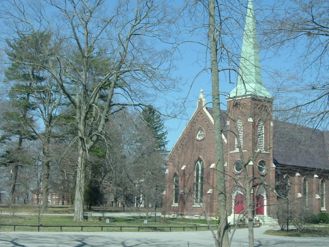


Anchorage, Kentucky
Anchorage is a city of 2,506 people in Jefferson County, Kentucky, founded in 1878.
Why visit Anchorage
Townapedia lists 13 museums and landmarks, 6 parks and trails, 27 places to eat and 1 place to stay in and around town.
Highlights include Ashwood Avenue Historic District, Bellevoir-Ormsby Village, Crosby Park and E.P. "Tom" Sawyer State Park.
July is the warmest month, with average highs of 88°F; January lows average 27°F.
Weather in Anchorage
Forecast from the National Weather Service. Full forecast
About Anchorage
Anchorage is a home rule-class city in eastern Jefferson County, Kentucky, United States. The population was 2,500 as of the 2020 census, up from 2,348 at the 2010 census and an estimated 2,432 in 2018. It is an independent municipality surrounded by Louisville Metro and is one of the wealthiest communities in Kentucky.
From the Wikipedia article Anchorage, Kentucky (this version), under CC BY-SA 4.0.
Museums and landmarks13

Ashwood Avenue Historic District
Monument and historic site · National Register of Historic Places · 3.7 mi
Historic district in Kentucky, United States

Bellevoir-Ormsby Village
Monument and historic site · National Register of Historic Places · 2.1 mi
Historic house in Kentucky, United States
Bondurant-Hustin House
Monument and historic site · National Register of Historic Places · 3.4 mi
Historic house in Kentucky, United States
Central State Hospital
Monument and historic site · National Register of Historic Places · 1.1 mi
Hospital in Kentucky, United States
Chenoweth Fort-Springhouse
Monument and historic site · National Register of Historic Places · 1.8 mi
Building in Jefferson County, Kentucky, United States
Hausgen House
Monument and historic site · National Register of Historic Places · 0.6 mi
Historic house in Kentucky, United States

James Thompson House
Monument and historic site · National Register of Historic Places · 0.6 mi
Historic house in Anchorage, Kentucky, United States

Nash-McDonald House
Monument and historic site · National Register of Historic Places · 0.5 mi
Anchorage, Kentucky, NRHP-listed

Presbyterian Manse
Monument and historic site · National Register of Historic Places · 0.6 mi
Rectory in Anchorage, Kentucky
Robert May House
Monument and historic site · National Register of Historic Places · 0.8 mi
House in Anchorage, Kentucky

Shallcross
Monument and historic site · National Register of Historic Places · 0.6 mi
Historic house in Kentucky, United States


Von Allmen Dairy Farm House
Monument and historic site · National Register of Historic Places · 3.6 mi
House in Louisville, United States of America
1 more on the map.
Parks, trails and playgrounds6


Restaurants and cafes27

Guaca Mole
Restaurant · Mexican · 1.7 mi
9921 Ormsby Station Road, Lyndon
Su 12:00-20:00; Mo-Th 11:00-21:00; Fr 11:00-22:00; Sa 12:00-22:00

Cottage Cafe
Diner · American · 1.7 mi
11609 Main Street, Middletown
Tu-Sa 11:00-14:30; Su-Mo off
Selena's at Willow Lake Tavern
Restaurant · American, Seafood, Cajun · 0.8 mi
10609 La Grange Road, Louisville

15 more on the map.
Where to stay1

SpringHill Suites - Louisville Hurstbourne/North
Motel and hotel · 1.8 mi
10101 Forest Green Boulevard, Lyndon
History
The land that is now Anchorage was a part of Isaac Hite's 1773 land grant, which awarded most of the land in today's Jefferson County to officers in the Virginia militia, in exchange for their service in the French and Indian War. Early maps refer to the area as "Hite's Mill", and it has also been known as "Hobbs Station". Part of Hite's original grant now makes up the grounds of Central State Hospital and E. P. "Tom" Sawyer State Park.
The nautical name is a bit odd, considering the city is over 12 miles (19 km) from the Ohio River. The origin is The Anchorage, the estate of riverboat captain and early resident James W. Goslee, and was chosen to honor him when the city incorporated in 1878, three years after his death. Tradition says that an anchor hanging inside the rim of a locomotive wheel at the center of town was taken by Goslee from his ship, the Matamora.
The Louisville and Frankfort Railroad (later purchased by the Louisville & Nashville Railroad) was built through the area in 1849. The development of an interurban rail line in 1901 allowed faster travel between Anchorage and Louisville, as well as other towns in the area.
From the History section of Anchorage, Kentucky on Wikipedia, under CC BY-SA 4.0.
Churches and places of worship15
Middletown United Methodist Church
Church · Methodist · National Register of Historic Places · 1.7 mi
St. Aloysius Church
Church · National Register of Historic Places · 3.6 mi
Kingdom Hall of Jehovahs Witnesses
Church · Jehovahs Witness · 1.1 mi
740 Old Harrods Creek Road, Louisville
Pilgrim Missionary Baptist Church
Church · Baptist · 1.2 mi
600 Bellewood Road, Louisville
Shopping6
Red Barn Antique & Art Emporium
Shop · 1.8 mi
12125 Old Shelbyville Road, Middletown
Gas and EV charging1
Schools, colleges and libraries43
Healthcare2
Map of Anchorage
114 places. The map loads OpenStreetMap tiles when you open it.
Climate by month
Monthly table
| Month | High | Low | Rain |
|---|---|---|---|
| Jan | 43°F | 27°F | 3.3 in |
| Feb | 48°F | 30°F | 3.3 in |
| Mar | 57°F | 38°F | 4.4 in |
| Apr | 69°F | 48°F | 4.7 in |
| May | 77°F | 57°F | 5.2 in |
| Jun | 85°F | 66°F | 4.7 in |
| Jul | 88°F | 69°F | 4.6 in |
| Aug | 87°F | 68°F | 3.5 in |
| Sep | 81°F | 60°F | 3.6 in |
| Oct | 69°F | 48°F | 3.6 in |
| Nov | 57°F | 38°F | 3.4 in |
| Dec | 46°F | 31°F | 3.9 in |
U.S. Climate Normals 1991-2020 for Louisville Bowman Fld (7 mi away), NOAA NCEI.
People and cost of living
American Community Survey 5-year estimates, 2020-2024, U.S. Census Bureau. Estimates have margins of error, larger for small towns.
Disaster history
Jefferson County has had 19 federal disaster declarations since 2000, most often for severe storms.
- 2026-01-24: Severe Winter Storm (Winter Storm)
- 2025-04-24: Severe Storms, Straight-Line Winds, Tornadoes, Flooding, Landslides, And Mudslides (Severe Storm)
- 2025-04-03: Severe Storms, Straight-Line Winds, Tornadoes, And Flooding (Severe Storm)
- 2025-02-24: Severe Storms, Straight-Line Winds, Flooding, Landslides, And Mudslides (Severe Storm)
- 2025-02-16: Severe Storms, Straight-Line Winds, Flooding, And Landslides (Severe Storm)
- 2024-05-22: Severe Storms, Straight-Line Winds, Tornadoes, Landslides, And Mudslides (Severe Storm)
OpenFEMA disaster declarations summaries.
Getting there and nearby towns
Bowman Field (LOU) is the nearest airport with scheduled flights listed in OpenStreetMap, 7 miles away.
- Lyndon 3 mi west, about 4 min by car
- Jeffersontown 5 mi south, about 8 min by car
- St. Matthews 6 mi west, about 9 min by car
- Utica 8 mi northwest, about 13 min by car
- Louisville/Jefferson County 9 mi southwest, about 15 min by car
- Jeffersonville 10 mi northwest, about 16 min by car
- La Grange 12 mi northeast, about 20 min by car
- Clarksville 13 mi west, about 21 min by car
- Charlestown 13 mi northwest, about 21 min by car
- New Albany 16 mi west, about 25 min by car
Drive times are estimates from straight-line distance, not routes.
Local news
Headlines from INDB, the NEMICO news database.
Reviews, tips and questions
Loading what members have shared...
Sources and licences
- NCES EDGE (Public domain): public schools
- NOAA NCEI U.S. Climate Normals 1991-2020 (Public domain): climate by month
- OpenFEMA (Public domain): disaster declarations
- OpenStreetMap contributors (ODbL 1.0): places, airports, map data
- U.S. Census Bureau (Public domain): population, income, housing, education, commute
- Wikidata (CC0 1.0): elevation, founding date, time zone, website, landmarks and historic places
- Wikimedia Commons (see each image): photos
- Wikipedia (CC BY-SA 4.0): overview and history text
Photo credits
- AnchChurch 053, Angry Aspie, CC BY 3.0
- Middletown UMC, front, Nyttend, Public domain
- Von Allmen Dairy Farm House, Nyttend, Public domain
- Chenoweth springhouse, Unknown author Unknown author, Public domain
- The Bondurant-Hustin House in Pewee Valley, KY, TEDD LiGGETT, CC BY-SA 4.0
- Anchorage Presbyterian Manse, Nyttend, Public domain
- St Aloysius Pewee Valley Kentucky, LisaGS, CC BY-SA 4.0
- Shallcross, Anchorage, Nyttend, Public domain
- Nash-McDonald House, Nyttend, Public domain
- James Thompson House in Anchorage, Nyttend, Public domain
- Bellevoir Louisville KY Flickr, w.marsh on Flickr, CC BY 2.0
- Southeast Christian Church, local louisville, CC BY 2.0


Page built October 30, 2026. Spotted a mistake? Tell us or suggest a place.