


Why visit Baltic
Townapedia lists 7 museums and landmarks, 6 parks and trails, 2 places to eat and 1 attraction in and around town.
Highlights include Colegrove Hill, Ashbel Woodward House, Ashlawn and Sprague Rod and Gun Club.
July is the warmest month, with average highs of 84°F; January lows average 21°F, and about 28 inches of snow fall in a normal year.
Weather in Baltic
Forecast from the National Weather Service. Full forecast
About Baltic
Baltic is the town center village of the town of Sprague, Connecticut, United States, and a census-designated place (CDP). As of the 2020 census, Baltic had a population of 1,186. The Sprague town hall is in Baltic. The Baltic Historic District is a historic district that was listed on the National Register of Historic Places in 1987, encompassing virtually the entire extent of the village.
From the Wikipedia article Baltic, Connecticut (this version), under CC BY-SA 4.0.
Things to do1

Museums and landmarks7

Ashbel Woodward House
Monument and historic site · National Register of Historic Places · 2.9 mi
Historic house in Connecticut, United States

Ashlawn
Monument and historic site · National Register of Historic Places · 2.5 mi
Building in Connecticut, United States

Occum Hydroelectric Plant and Dam
Monument and historic site · National Register of Historic Places · 1.9 mi
Dam in New London County, Connecticut, United States of America

Taftville
Monument and historic site · National Register of Historic Places · 3.4 mi
City in the United States of America


William Park House
Monument and historic site · National Register of Historic Places · 2.6 mi
Sprague, Connecticut, listed on the National Register of Historic Places (NRHP) in New London County
Parks, trails and playgrounds6


White Plains Road Open Space
Hiking and trails · 1.1 mi
16 White Plains Road, Norwich

Restaurants and cafes2

History
Baltic was formed around a cotton mill established on the Shetucket River on land purchased in 1856 by former Rhode Island Governor and Senator William Sprague III. The A. & W. Sprague Manufacturing Co. mill burned down in 1887, and Frederick Sayles of Pawtucket, Rhode Island purchased the site. He built the Baltic Mills Co. cotton mill which opened in 1899. The company operated until 1963, when the mill was sold to a syndicate from New York. The mill continued operating until 1967, when it was closed and the property and equipment were sold. In 1970, the property was sold to the Casper Division of Bevis Industries, which used it for a mail order operation.
The historic district includes 210 contributing structures over a 122-acre (49 ha) area.
In August 1999, the remains of the mill were destroyed by fire. There was only one building that survived, although it was also critically damaged. The fire was set by three local boys. The mill suffered another fire on April 23, 2018. Fire officials said that hot sparks hit debris from citing pipes, likely sparking the flames of the fire.
From the History section of Baltic, Connecticut on Wikipedia, under CC BY-SA 4.0.
Churches and places of worship1
Saint Mary of the Immaculate Conception Catholic Church
Church · Roman Catholic · 0.6 mi
64 West Main Street, Sprague
Gas and EV charging1
Schools, colleges and libraries18
Map of Baltic
36 places. The map loads OpenStreetMap tiles when you open it.
Climate by month
Monthly table
| Month | High | Low | Rain | Snow |
|---|---|---|---|---|
| Jan | 38°F | 21°F | 3.9 in | 9.0 in |
| Feb | 40°F | 23°F | 3.8 in | 7.1 in |
| Mar | 48°F | 29°F | 5.1 in | 5.0 in |
| Apr | 59°F | 39°F | 4.7 in | 0.8 in |
| May | 70°F | 49°F | 3.6 in | 0.0 in |
| Jun | 78°F | 58°F | 4.3 in | 0.0 in |
| Jul | 84°F | 65°F | 3.6 in | 0.0 in |
| Aug | 83°F | 63°F | 4.4 in | 0.0 in |
| Sep | 76°F | 55°F | 4.8 in | 0.0 in |
| Oct | 64°F | 44°F | 4.9 in | 0.0 in |
| Nov | 53°F | 34°F | 4.2 in | 0.3 in |
| Dec | 43°F | 27°F | 5.0 in | 5.6 in |
U.S. Climate Normals 1991-2020 for Norwich Public Utility Plt (6 mi away), NOAA NCEI.
People and cost of living
American Community Survey 5-year estimates, 2020-2024, U.S. Census Bureau. Estimates have margins of error, larger for small towns.
Disaster history
The county has had 24 federal disaster declarations since 2000, most often for severe storms.
- 2024-01-13: Severe Storms, Flooding, And A Potential Dam Breach (Severe Storm)
- 2021-10-30: Remnants Of Hurricane Ida (Hurricane)
- 2021-08-22: Hurricane Henri (Hurricane)
- 2021-01-12: Tropical Storm Isaias (Hurricane)
- 2020-08-06: Tropical Storm Isaias (Hurricane)
- 2020-03-28: Covid-19 Pandemic (Biological)
OpenFEMA disaster declarations summaries.
Getting there and nearby towns
Groton-New London Airport (GON) is the nearest airport with scheduled flights listed in OpenStreetMap, 19 miles away.
- Norwich 4 mi south, about 7 min by car
- Jewett City 5 mi east, about 8 min by car
- South Windham 7 mi northwest, about 12 min by car
- Plainfield Village 9 mi northeast, about 15 min by car
- Willimantic 10 mi northwest, about 16 min by car
- Oxoboxo River 12 mi south, about 19 min by car
- Colchester 13 mi west, about 21 min by car
- Moosup 13 mi northeast, about 21 min by car
- Gales Ferry 13 mi south, about 21 min by car
- Wauregan 13 mi northeast, about 21 min by car
Drive times are estimates from straight-line distance, not routes.
Local news
Headlines from INDB, the NEMICO news database.
Reviews, tips and questions
Loading what members have shared...
Sources and licences
- NCES EDGE (Public domain): public schools
- NOAA NCEI U.S. Climate Normals 1991-2020 (Public domain): climate by month
- OpenFEMA (Public domain): disaster declarations
- OpenStreetMap contributors (ODbL 1.0): places, airports, map data
- U.S. Census Bureau (Public domain): population, income, housing, education, commute
- Wikidata (CC0 1.0): landmarks and historic places
- Wikimedia Commons (see each image): photos
- Wikipedia (CC BY-SA 4.0): overview and history text
Photo credits
- Connecticut - Baltic - 20180309173955, JJBers, CC BY-SA 4.0
- Cumberland Farms (Baltic, Connecticut) (42839312524), JJBers from Willimantic, Connecticut, USA, CC BY 2.0
- Main Street at Mill Street, Baltic - postcard, Unknown author Unknown author, Public domain
- Railroad and High streets, Baltic, Connecticut - postcard, Unknown author Unknown author, Public domain
- Baltic Switch 1906 postcard, Unknown author Unknown author, Public domain
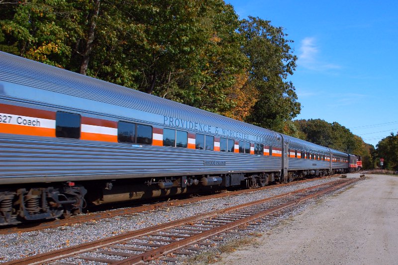
- P&W Psgr Train Baltic CT, Lexcie, CC BY-SA 3.0
- Top of Baltic Dam, December 2025, Pi.1415926535, CC BY-SA 4.0
- Baltic Dam from the west (2), December 2025, Pi.1415926535, CC BY-SA 4.0
- Brick channels in Baltic Dam, December 2025, Pi.1415926535, CC BY-SA 4.0
- The remains of the Baltic Dam, Colleen Caulfield, CC BY-SA 4.0
- Shetucket River west of Baltic Dam, December 2025, Pi.1415926535, CC BY-SA 4.0
- Baltic Dam from the west (1), December 2025, Pi.1415926535, CC BY-SA 4.0
- Baltic CT station postcard (2), Unknown author Unknown author, Public domain
- Route 97 grade crossing in Baltic, December 2025, Pi.1415926535, CC BY-SA 4.0
- Remains of Baltic station (2), December 2025, Pi.1415926535, CC BY-SA 4.0
- Baltic CT station postcard, Unknown author Unknown author, Public domain
- Remains of Baltic station (1), December 2025, Pi.1415926535, CC BY-SA 4.0
- Willimantic Branch in Baltic, December 2025, Pi.1415926535, CC BY-SA 4.0
- Baltic, CT, CTsignhunt, CC0
- Occum Hydroelectric Plant and Dam, Digitalpilgrim, CC BY-SA 3.0
- Woodward, Ashbel, House (New London County, Connecticut), CLK Hatcher, CC BY-SA 2.0
- William Parker House, Cathy Cline, CC BY-SA 3.0
- Ashlawn, Hanover, Connecticut, December 2025, Pi.1415926535, CC BY-SA 4.0
- ISS054-E-35142 - View of Earth, Earth Science and Remote Sensing Unit, NASA Johnson Space Center, Public domain
- ISS035-E-39964 - View of Earth, Earth Science and Remote Sensing Unit , Lyndon B. Johnson Space Center, Public domain
- ISS054-E-34569 - View of Earth, Earth Science and Remote Sensing Unit, NASA Johnson Space Center, Public domain
- ISS027-E-32046 - View of Earth, Earth Science and Remote Sensing Unit , Lyndon B. Johnson Space Center, Public domain
- ISS067-E-156065 - View of Earth, Earth Science and Remote Sensing Unit , Lyndon B. Johnson Space Center, Public domain
- ISS026-E-17056 - View of Rhode Island, Earth Science and Remote Sensing Unit , Lyndon B. Johnson Space Center, Public domain
- Streetcar ROW off Lacroix Road, December 2021, Pi.1415926535, CC BY-SA 4.0
- Streetcar bridge off Lacroix Road, June 2021, Pi.1415926535, CC BY-SA 4.0
- Streetcar bridge off Lacroix Road, December 2021, Pi.1415926535, CC BY-SA 4.0
- Occum, CT, CTsignhunt, CC0


Page built October 30, 2026. Spotted a mistake? Tell us or suggest a place.