


Why visit Wauregan
Townapedia lists 5 museums and landmarks, 3 parks and trails, 4 places to eat and 2 attractions in and around town.
Highlights include Allen Hill, Shepherd Hill, Aldrich Free Public Library and Brooklyn Green Historic District.
July is the warmest month, with average highs of 80°F; January lows average 17°F.
Weather in Wauregan
Forecast from the National Weather Service. Full forecast
About Wauregan
Wauregan is a village located in the northwestern corner of the town of Plainfield, Connecticut, United States. Originally a mill village, Wauregan was established around a cotton mill powered by the Quinebaug River. Wauregan and West Wauregan, across the Quinebaug in the town of Brooklyn, together comprise the Wauregan census-designated place, with a population of 1,539 at the 2020 census.
From the Wikipedia article Wauregan, Connecticut (this version), under CC BY-SA 4.0.
Things to do2

Museums and landmarks5

Aldrich Free Public Library
Monument and historic site · National Register of Historic Places · 3.0 mi
Library building in Plainfield, Connecticut
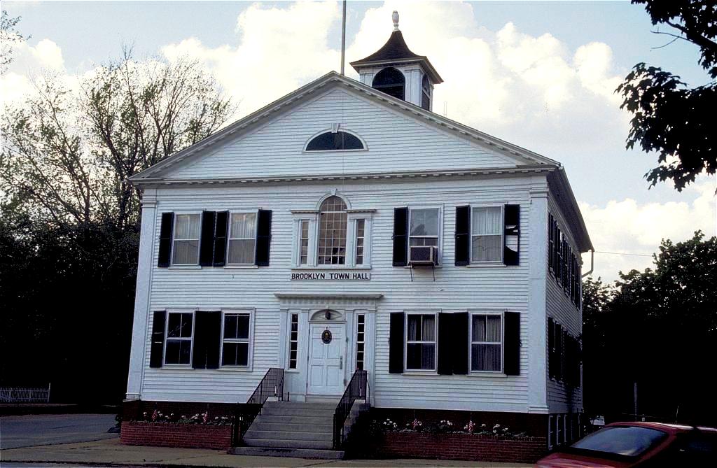
Brooklyn Green Historic District
Monument and historic site · National Register of Historic Places · 3.2 mi
Historic district in Connecticut, United States

Central Village Historic District
Monument and historic site · National Register of Historic Places · 2.3 mi
Historic district in Connecticut, United States


Plainfield Woolen Company Mill
Monument and historic site · National Register of Historic Places · 2.2 mi

Parks, trails and playgrounds3

J. Arthur Atwood Memorial Field
Park · 0.4 mi
Municipal, Open To Public Without Fee
Grove Street, Plainfield

Restaurants and cafes4


History
Named for a Mohegan word meaning "Pleasant Valley" Wauregan has a long history as an industrial village. In 1850, Amos D. Lockwood, who was involved with the Quinebaug Mill in Danielsonville, bought the water privileges and surrounding land at Wauregan. After the Wauregan Mills Company charter was approved by the Connecticut legislature in 1853, the first mill was constructed circa 1853–1854. Wauregan Mills was well known for its woven cotton goods, including various types of flannel. Lockwood became the mill's first agent and recruited James S. Atwood as his superintendent, who became responsible for setting up all machinery and starting production. The principal product of Wauregan was cotton sheeting.
From the History section of Wauregan, Connecticut on Wikipedia, under CC BY-SA 4.0.
Churches and places of worship3
Unitarian Meetinghouse
Church · National Register of Historic Places · 3.1 mi
Shopping1
Gas and EV charging2
Schools, colleges and libraries13
Map of Wauregan
33 places. The map loads OpenStreetMap tiles when you open it.
Climate by month
Monthly table
| Month | High | Low | Rain |
|---|---|---|---|
| Jan | 36°F | 17°F | 4.0 in |
| Feb | 38°F | 18°F | 3.4 in |
| Mar | 46°F | 25°F | 4.4 in |
| Apr | 58°F | 35°F | 4.7 in |
| May | 68°F | 45°F | 3.7 in |
| Jun | 75°F | 54°F | 4.3 in |
| Jul | 80°F | 60°F | 3.9 in |
| Aug | 79°F | 58°F | 4.2 in |
| Sep | 72°F | 51°F | 4.3 in |
| Oct | 62°F | 40°F | 4.7 in |
| Nov | 51°F | 31°F | 4.1 in |
| Dec | 41°F | 23°F | 4.8 in |
U.S. Climate Normals 1991-2020 for Hampton (7 mi away), NOAA NCEI.
People and cost of living
American Community Survey 5-year estimates, 2020-2024, U.S. Census Bureau. Estimates have margins of error, larger for small towns.
Disaster history
The county has had 22 federal disaster declarations since 2000, most often for hurricanes.
- 2021-08-22: Hurricane Henri (Hurricane)
- 2021-01-12: Tropical Storm Isaias (Hurricane)
- 2020-08-06: Tropical Storm Isaias (Hurricane)
- 2020-03-28: Covid-19 Pandemic (Biological)
- 2020-03-13: Covid-19 (Biological)
- 2015-04-08: Severe Winter Storm And Snowstorm (Severe Storm)
OpenFEMA disaster declarations summaries.
Getting there and nearby towns
North Central State Airport (SFZ) is the nearest airport with scheduled flights listed in OpenStreetMap, 25 miles away.
- Willimantic 15 mi west, about 25 min by car
- North Grosvenor Dale 16 mi north, about 26 min by car
- Norwich 17 mi southwest, about 27 min by car
- Storrs 18 mi west, about 29 min by car
- Quinebaug 18 mi north, about 29 min by car
- South Coventry 20 mi west, about 32 min by car
- Webster 21 mi north, about 33 min by car
- Cranston 22 mi east, about 36 min by car
- Southbridge Town 22 mi north, about 36 min by car
- Providence 26 mi east, about 42 min by car
Drive times are estimates from straight-line distance, not routes.
Local news
Headlines from INDB, the NEMICO news database.
Reviews, tips and questions
Loading what members have shared...
Sources and licences
- NCES EDGE (Public domain): public schools
- NOAA NCEI U.S. Climate Normals 1991-2020 (Public domain): climate by month
- OpenFEMA (Public domain): disaster declarations
- OpenStreetMap contributors (ODbL 1.0): places, airports, map data
- U.S. Census Bureau (Public domain): population, income, housing, education, commute
- Wikidata (CC0 1.0): elevation, founding date, time zone, website, landmarks and historic places
- Wikimedia Commons (see each image): photos
- Wikipedia (CC BY-SA 4.0): overview and history text
Photo credits
- Wauregan Mill Village, Marcbela (Marc N. Belanger), Public domain
- Honor Roll, West Wauregan CT, John Phelan, CC BY 4.0
- AMVETS Post 47, West Wauregan CT, John Phelan, CC BY 4.0
- Wauregan Road, West Wauregan CT, John Phelan, CC BY 4.0
- Former Fire Station, West Wauregan CT, John Phelan, CC BY 4.0
- Sacred Heart Cemetery, West Wauregan CT, John Phelan, CC BY 4.0
- My Community Bible Church, West Wauregan CT, John Phelan, CC BY 4.0
- Wauregan Mill from South Walnut Street (2), August 2022, Pi.1415926535, CC BY-SA 4.0
- Wauregan Mill from South Walnut Street (1), August 2022, Pi.1415926535, CC BY-SA 4.0
- Wauregan Grain, Wauregan CT, John Phelan, CC BY 4.0
- Aldrich Free Public Library, The original uploader was Polaron at English Wikipedia ., CC BY 2.5
- PlainfieldCenter, Jerry Dougherty, CC BY 2.5
- BrooklynCT Town hall 1024px, Unknown author, Public domain
- Plainfield Woolen Mill, Marcbela (Marc N. Belanger), Public domain
- Post Office, Wauregan CT, John Phelan, CC BY-SA 4.0
- Atwood Hose Company 1907 postcard, Unknown author Unknown author, Public domain
- Streetcar right of way north of Trout Hatchery Road, June 2017, Pi.1415926535, CC BY-SA 4.0


Page built October 30, 2026. Spotted a mistake? Tell us or suggest a place.