


Why visit Bayfield
Townapedia lists 14 museums and landmarks, 25 parks and trails, 22 places to eat, 32 places to stay and 2 attractions in and around town.
Highlights include Apostle Islands National Lakeshore Visitor Center, Bayfield Historic District, Apostle Highlands Golf Course and Bayfield Marina.
July is the warmest month, with average highs of 77°F; January lows average 4°F.
Weather in Bayfield
Forecast from the National Weather Service. Full forecast
About Bayfield
Bayfield is a city in Bayfield County, Wisconsin, United States. The population was 584 at the 2020 census, making it the city with the smallest population in Wisconsin.
From the Wikipedia article Bayfield, Wisconsin (this version), under CC BY-SA 4.0.
Things to do2


Museums and landmarks14

Apostle Islands National Lakeshore Visitor Center
Monument and historic site
415 Washington Avenue, Bayfield

Bayfield Historic District
Monument and historic site · National Register of Historic Places · 0.6 mi
Historic district in Bayfield, Wisconsin

Bayfield Fish Hatchery
Monument and historic site · National Register of Historic Places · 2.8 mi
Historic fish hatchery in Salmo, Wisconsin

Booth Cooperage
Monument and historic site · National Register of Historic Places · 0.6 mi
Building in Bayfield, United States

Frank Boutin, Jr. House
Monument and historic site · National Register of Historic Places · 0.5 mi
Historic house in Wisconsin, United States
Old Bayfield County Courthouse
Monument and historic site · National Register of Historic Places
Historic former courthouse in Bayfield, Wisconsin, USA

Pureair Sanatorium
Monument and historic site · National Register of Historic Places · 2.0 mi
Hospital in Bayfield County, Wisconsin, United States
Reiten Boatyard
Monument and historic site · National Register of Historic Places · 0.7 mi
Marina in Bayfield, Wisconsin
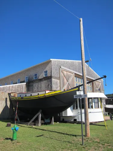


Madeline Island Information Station
Monument and historic site · 0.6 mi
2 more on the map.
Parks, trails and playgrounds25








13 more on the map.
Restaurants and cafes22


Pier Plaza Restaurant
Restaurant · Regional · 0.6 mi
1 Rittenhouse Avenue, Bayfield
Tu-Th 11:00-21:00; Fr,Sa 11:00-21:30; Su 11:00-20:30
Yaku Superior
Restaurant · Peruvian · 0.5 mi
257 Manypenny Avenue, Bayfield
We-Sa 07:00-10:00,17:00-20:00

Adventure Club Brewing
Bar and pub · 1.1 mi
35265 County Road J, Bayfield
Mo-Th 14:00-21:00; Fr-Su 12:00-21:00


Hoop's Dockside Market Fish & Chips
Restaurant · Fish And Chips · 0.8 mi
207 Wilson Avenue, Bayfield
10 more on the map.
History
Bayfield was named in 1856 for Henry Bayfield, a British Royal Topographic Engineer who explored the region in 1822–23. A post office has been in operation at Bayfield since 1856.
The first Catholic church was built in Bayfield in 1860, with the Franciscans following in 1878. Mass was held in the English and Ojibwe languages. In 1879, the Sisters of St. Francis of Mary Immaculate established an Indian residential school in Bayfield at the request of the Franciscan pastor. Bayfield Mission Boarding and Day School, also known as Holy Family Mission School, included students from the Fond du Lac Band Chippewa and the Saulteaux Ojibwe. In an 1889 report the school's superintendent said that his goals for the school were "civilizing the children and entirely abolishing the use of the Chippewa language." The school operated until 1999.
From the History section of Bayfield, Wisconsin on Wikipedia, under CC BY-SA 4.0.
Where to stay32
Churches and places of worship6
Christ Episcopal Church of Chequamegon Bay
Church · Episcopal · 0.4 mi
125 North 3rd Street, Bayfield
Christ Episcopal Church
Church · National Register of Historic Places · 0.4 mi
Bayfield Presbyterian Church
Church · Presbyterian · 0.4 mi
27 North 3rd Street, Bayfield
Bethesda Lutheran Church
Church · Lutheran · 0.5 mi
109 South 6th Street, Bayfield
Holy Family Catholic Church
Church · Roman Catholic · 0.5 mi
232 North 1st Street, Bayfield
Shopping16
Gas and EV charging1
Schools, colleges and libraries8
Map of Bayfield
126 places. The map loads OpenStreetMap tiles when you open it.
Climate by month
Monthly table
| Month | High | Low | Rain |
|---|---|---|---|
| Jan | 22°F | 4°F | 1.5 in |
| Feb | 26°F | 6°F | 1.3 in |
| Mar | 37°F | 17°F | 1.6 in |
| Apr | 49°F | 29°F | 2.7 in |
| May | 60°F | 40°F | 3.5 in |
| Jun | 71°F | 50°F | 3.9 in |
| Jul | 77°F | 56°F | 3.9 in |
| Aug | 76°F | 55°F | 3.6 in |
| Sep | 68°F | 48°F | 3.4 in |
| Oct | 55°F | 36°F | 3.2 in |
| Nov | 40°F | 25°F | 2.1 in |
| Dec | 28°F | 12°F | 2.0 in |
U.S. Climate Normals 1991-2020 for Bayfield Fish Hatchery (3 mi away), NOAA NCEI.
People and cost of living
American Community Survey 5-year estimates, 2020-2024, U.S. Census Bureau. Estimates have margins of error, larger for small towns.
Disaster history
Bayfield County has had 9 federal disaster declarations since 2000, most often for floods.
- 2026-06-30: Severe Storms, Tornadoes, And Flooding (Flood)
- 2020-04-04: Covid-19 Pandemic (Biological)
- 2020-03-13: Covid-19 (Biological)
- 2018-08-10: Severe Storms, Straight-Line Winds, And Flooding (Flood)
- 2016-08-09: Severe Storms And Flooding (Severe Storm)
- 2013-08-08: Severe Storms, Flooding, And Mudslides (Severe Storm)
OpenFEMA disaster declarations summaries.
Getting there and nearby towns
John F. Kennedy Memorial Airport (ASX) is the nearest airport with scheduled flights listed in OpenStreetMap, 19 miles away.
- Washburn 10 mi south, about 17 min by car
- Ashland 16 mi south, about 26 min by car
- Iron River 32 mi southwest, about 51 min by car
- Montreal 38 mi southeast, about 1 h by car
- Silver Bay 39 mi northwest, about 1 h by car
- Hurley 39 mi southeast, about 1 h by car
- Ironwood 41 mi southeast, about 1 h by car
- Two Harbors 43 mi west, about 1 h 15 min by car
- Bessemer 44 mi southeast, about 1 h 15 min by car
- Wakefield 48 mi southeast, about 1 h 15 min by car
Drive times are estimates from straight-line distance, not routes.
Local news
Headlines from INDB.
Reviews, tips and questions
Loading what members have shared...
Sources and licences
- NCES EDGE (Public domain): public schools
- NOAA NCEI U.S. Climate Normals 1991-2020 (Public domain): climate by month
- OpenFEMA (Public domain): disaster declarations
- OpenStreetMap contributors (ODbL 1.0): places, airports, map data
- Openverse (see each image): photos
- U.S. Census Bureau (Public domain): population, income, housing, education, commute
- Wikidata (CC0 1.0): landmarks and historic places
- Wikimedia Commons (see each image): photos
- Wikipedia (CC BY-SA 4.0): overview and history text
Photo credits
- Bayfieldwi, The original uploader was Nationalparks at English Wikipedia ., CC BY-SA 2.5
- Bayfield Historic District 2, Billertl, CC BY-SA 3.0
- Frank Boutin Jr House Bayfield Wisconsin, Royalbroil, CC BY-SA 3.0
- Old Bayfield County Courthouse 1, Billertl, CC BY-SA 3.0
- Bayfield Christ Episcopal Church, Billertl, CC BY-SA 3.0
- Bayfield Elementary-Middle-High School - panoramio, Corey Coyle, CC BY 3.0
- Old Bayfield County Courthouse 2, Billertl, CC BY-SA 3.0
- Christ Episcopal Church Bayfield, WI - panoramio, Corey Coyle, CC BY 3.0
- Faith Baptist Church Bayfield, WI - panoramio, Corey Coyle, CC BY 3.0
- Bayfield Presbyterian Church - panoramio, Corey Coyle, CC BY 3.0
- Bayfield Historic District 3, Billertl, CC BY-SA 3.0
- Bayfield Historic District 1, Billertl, CC BY-SA 3.0
- Bayfield Carnegie Library - panoramio, Corey Coyle, CC BY 3.0
- Bethesda Lutheran Church Bayfield, WI - panoramio, Corey Coyle, CC BY 3.0
- Holy Family Catholic Church Bayfield,WI - panoramio, Corey Coyle, CC BY 3.0
- Bayfield Post Office 54814 - panoramio, Corey Coyle, CC BY 3.0
- Downtown Bayfield - panoramio, Corey Coyle, CC BY 3.0
- Bayfield Historic District Downtown WIS13, I, the copyright holder of this work, hereby publish it under the following license:, CC BY-SA 3.0
- Historic Downtown Bayfield - panoramio, Corey Coyle, CC BY 3.0
- Bayfield IMG 1599, Bjoertvedt, CC BY-SA 3.0
- Bayfield Fish Hatchery 1, Billertl, CC BY-SA 3.0
- Sanitarium, Travellers & Tinkers, CC BY-SA 4.0
- TrailTrek, Travellers & Tinkers, CC BY-SA 4.0
- Old Bayfield County Courthouse, Bahrsoap, CC BY-SA 4.0
- Chequamegon Bay - panoramio, Corey Coyle, CC BY 3.0
- Apostle Islands Visitors Center - panoramio, Corey Coyle, CC BY 3.0
- Chequamegon Bay from top of the hill - panoramio, Corey Coyle, CC BY 3.0
- Old Rittenhouse Inn, Thesavagenorwegian, CC BY 4.0
- Iron Bridge - panoramio (1), Corey Coyle, CC BY 3.0
- Ethel's At 250 - panoramio, Corey Coyle, CC BY 3.0
- Old Rittenhouse Inn - panoramio, Corey Coyle, CC BY 3.0
- Former St. Francis School - panoramio, Corey Coyle, CC BY 3.0
- Joanne's Scandinavian Store - panoramio, Corey Coyle, CC BY 3.0
- Currie G. Bell Block - panoramio, Corey Coyle, CC BY 3.0
- Andy's IGA - panoramio, Corey Coyle, CC BY 3.0
- William Knight House - panoramio, Corey Coyle, CC BY 3.0
- Le Chateau Boutin - panoramio, Corey Coyle, CC BY 3.0
- Greunke's Restaurant ^ First Street Inn - panoramio, Corey Coyle, CC BY 3.0
- Sergeant's Pepperoni Pizza - panoramio, Corey Coyle, CC BY 3.0
- Apostle Islands Booksellers ^ Morty's Pub - panoramio, Corey Coyle, CC BY 3.0
- Bayfield Marina at night, Thesavagenorwegian, CC BY 4.0
- Bayfield Maritime Museum, eekim, CC BY 2.0


Page built November 2, 2026. Spotted a mistake? Tell us or suggest a place.