



Narsingdi, Bangladesh
নরসিংদী জেলা
Narsingdi is a town of 281,080 people in Dhaka Division, Bangladesh, founded in 1984.
Why visit Narsingdi
Townapedia lists 8 museums and landmarks, 10 parks and trails, 16 places to eat, 11 places to stay and 3 attractions in and around town.
Highlights include Royal Fancier, Wari-Bateshwar ruins and SHEIKH CATTLE RANCH.
Weather in Narsingdi
Forecast from MET Norway (CC BY 4.0). Full forecast
About Narsingdi
Narsingdi District (Bengali: নরসিংদী জেলা) is a district in central Bangladesh. It is located 50 km north-east of Dhaka, the Bangladeshi capital. It is a part of Dhaka Division. The district is famous for its textile craft industry.
From the Wikipedia article Narsingdi District (this version), under CC BY-SA 4.0.
Things to do3

Royal Fancier
Zoo and aquarium · 1.8 km
Fancier Street, Narsingdi
Mo-Su 08:00-19:00

Museums and landmarks8
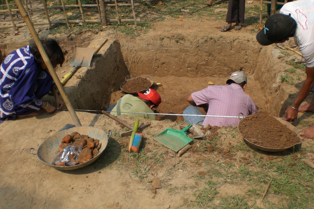
Wari-Bateshwar ruins
Monument and historic site
Site of an ancient fort city dating back to 450 BC in Narsingdi district of Bangladesh

Narsingdi Govt. College Shadid Minar
Monument and historic site · 1.3 km
West Brahmondi Narsingdi Govt. College Raod, Narsingdi
Parks, trails and playgrounds10


Restaurants and cafes16


4 more on the map.
History
The district is home to one of the earliest archaeological sites in Bangladesh, the Wari-Bateshwar ruins. These ruins, dating to the early 2nd millennium BCE, represent one of the earliest urban centres in South Asia. Currency of the Mauryan form has been found here, suggesting the region was under the influence of the Mauryas. In the early medieval period, the region fell under the control of the Palas and later Senas, before being conquered like the rest of the Dhaka area by the Muslims, and became part of a province of the Delhi Sultanate administered from nearby Sonargaon.
From the History section of Narsingdi District on Wikipedia, under CC BY-SA 4.0.
Where to stay11
Jitendra Kishor Moulik Hostel
Motel and hotel · 1.3 km
West Brahmondi Narsingdi Govt. College Raod, Narsingdi
Doctor Zohra Begum Kazi Ladies Hostel
Motel and hotel · 1.2 km
West Brahmondi Narsingdi Govt. College Raod, Narsingdi
Narsingdi Govt. College Ladies Hostel
Motel and hotel · 1.2 km
West Brahmondi Narsingdi Govt. College Raod, Narsingdi
Churches and places of worship66
Sahapur Baitul Hasor Jame Masjid
Place of worship · 12.8 km
Shahapur Road, Narsingdi
Shopping17
Gas and EV charging20
Schools, colleges and libraries52
Brahmondi Kamini Kishore Moulik Government High School
School · 1.3 km
West Brahmondi, Narsingdi
Narsingdi Government College
School · 1.2 km
205/3, West Brahmondi Narsingdi Govt. College Raod, Narsingdi
Healthcare7
Hazrat Sahjalal General Hospital
Hospital · 1.7 km
Dhaka-Sylhet Highway, Narsingdi
Holly Dental Care
Hospital · 1.7 km
254 Humayun Kabir Tower Dhaka-Sylhet Highway, Narsingdi
Map of Narsingdi
210 places. The map loads OpenStreetMap tiles when you open it.
Getting there and nearby towns
Hazrat Shahjalal International Airport (DAC) is the nearest airport with scheduled flights listed in OpenStreetMap, 33 km away.
- Barajona 23 km northwest, about 23 min by car
- Bārun 24 km northwest, about 24 min by car
- Nagar Naluākot 27 km north, about 27 min by car
- Nabīnagar 26 km east, about 26 min by car
- Gazipur 31 km west, about 31 min by car
- Bhatara 30 km southwest, about 30 min by car
- Bhairab Bāzār 30 km northeast, about 30 min by car
- Tungi 32 km west, about 32 min by car
- Dhaka 39 km southwest, about 39 min by car
- Agartala 58 km east, about 58 min by car
Drive times are estimates from straight-line distance, not routes.
Local news
Headlines from INDB.
Reviews, tips and questions
Loading what members have shared...
Sources and licences
- GeoNames (CC BY 4.0): population, coordinates, regions and time zone
- OpenStreetMap contributors (ODbL 1.0): places, airports, map data
- Wikidata (CC0 1.0): elevation, founding date, time zone, website, landmarks and historic places
- Wikimedia Commons (see each image): photos
- Wikipedia (CC BY-SA 4.0): overview and history text
Photo credits
- Narsingdi Govt College2, Alrazy Sonet, CC BY-SA 3.0
- Narsingdi Govt. College - Academic Building, Mr.Chandrajit, CC BY-SA 4.0
- Narsingdi Govt. College 2, Mr.Chandrajit, CC BY-SA 4.0
- Bateshwar archaeological museum and library of Habibulla Pathan at Bateshwar, Narsingdi, Bangladesh (1), Salim Khandoker, CC BY-SA 4.0
- N2 (Dhaka - Sylhet highway) at Babur Hat Seker Chor Bus Stop, Madhabdi, Narsingdi. (2019), Salim_Khandoker, CC BY-SA 4.0
- Archeologists taking measurement for a new dig 0102, user:omarshehab, CC BY-SA 3.0
- BKKM Govt School Playground & Academic Building, মামুনুর রশিদ ইভান, CC BY-SA 4.0
- Bangali Fuchka, Zenith zian, CC0
- Ballot paper 2023 University of Dhaka Senate elections by ROY, Subrata Roy, CC0
- Hurricane's legacy, Dipu.apu, CC0
- Beef Kebab, Reazul Islam Dolan (রিয়াজুল ইসলাম দোলন), CC BY-SA 4.0
- Md. Shahidur Rashid Bhuiyan by ROY (2), Suvray, CC BY-SA 4.0
- Md. Shahidur Rashid Bhuiyan by ROY (14), Suvray, CC BY-SA 4.0
- Md. Shahidur Rashid Bhuiyan by ROY (12), Suvray, CC BY-SA 4.0
- Md. Shahidur Rashid Bhuiyan by ROY (13), Suvray, CC BY-SA 4.0
- Md. Shahidur Rashid Bhuiyan by ROY (6), Suvray, CC BY-SA 4.0
- Md. Shahidur Rashid Bhuiyan by ROY (8), Suvray, CC BY-SA 4.0
- Md. Shahidur Rashid Bhuiyan by ROY (10), Subrata Roy, CC BY-SA 4.0
- Md. Shahidur Rashid Bhuiyan by ROY (11), Suvray, CC BY-SA 4.0
- Md. Shahidur Rashid Bhuiyan by ROY (9), Suvray, CC BY-SA 4.0
- Md. Shahidur Rashid Bhuiyan by ROY (5), Suvray, CC BY-SA 4.0
- Md. Shahidur Rashid Bhuiyan by ROY (7), Suvray, CC BY-SA 4.0
- ISS014-E-14695 - View of Bangladesh, Earth Science and Remote Sensing Unit , Lyndon B. Johnson Space Center, Public domain
- পারুলিয়া শাহী মসজিদ 01, KHAN MOHAMMAD SHIBLI HASAN, CC BY-SA 4.0
- Oil flowers, Tapo Bhuiyan, CC BY-SA 4.0
- River site.jp, Tapo Bhuiyan, CC BY-SA 4.0
- Our trees flowers, Tapo Bhuiyan, CC BY-SA 4.0
- Our village .jp, Tapo Bhuiyan, CC BY-SA 4.0
- River.jp, Tapo Bhuiyan, CC BY-SA 4.0
- Shah jalal sagor, Shah jalal sagor, CC BY-SA 4.0
- Our village.jpj, Tapo Bhuiyan, CC BY-SA 4.0
- ISS053-E-444920 - View of Earth, Earth Science and Remote Sensing Unit, NASA Johnson Space Center, Public domain
- ISS053-E-451563 - View of Earth, Earth Science and Remote Sensing Unit, NASA Johnson Space Center, Public domain
- ISS031-E-88981 - View of Earth, Earth Science and Remote Sensing Unit , Lyndon B. Johnson Space Center, Public domain
- ISS053-E-444917 - View of Earth, Earth Science and Remote Sensing Unit, NASA Johnson Space Center, Public domain
- ISS031-E-88980 - View of Earth, Earth Science and Remote Sensing Unit , Lyndon B. Johnson Space Center, Public domain
- ISS053-E-451560 - View of Earth, Earth Science and Remote Sensing Unit, NASA Johnson Space Center, Public domain
- ISS037-E-10004 - View of Earth, Earth Science and Remote Sensing Unit , Lyndon B. Johnson Space Center, Public domain
- ডালিম 2, Khantarak, CC BY-SA 4.0


Page built November 4, 2026. Spotted a mistake? Tell us or suggest a place.