


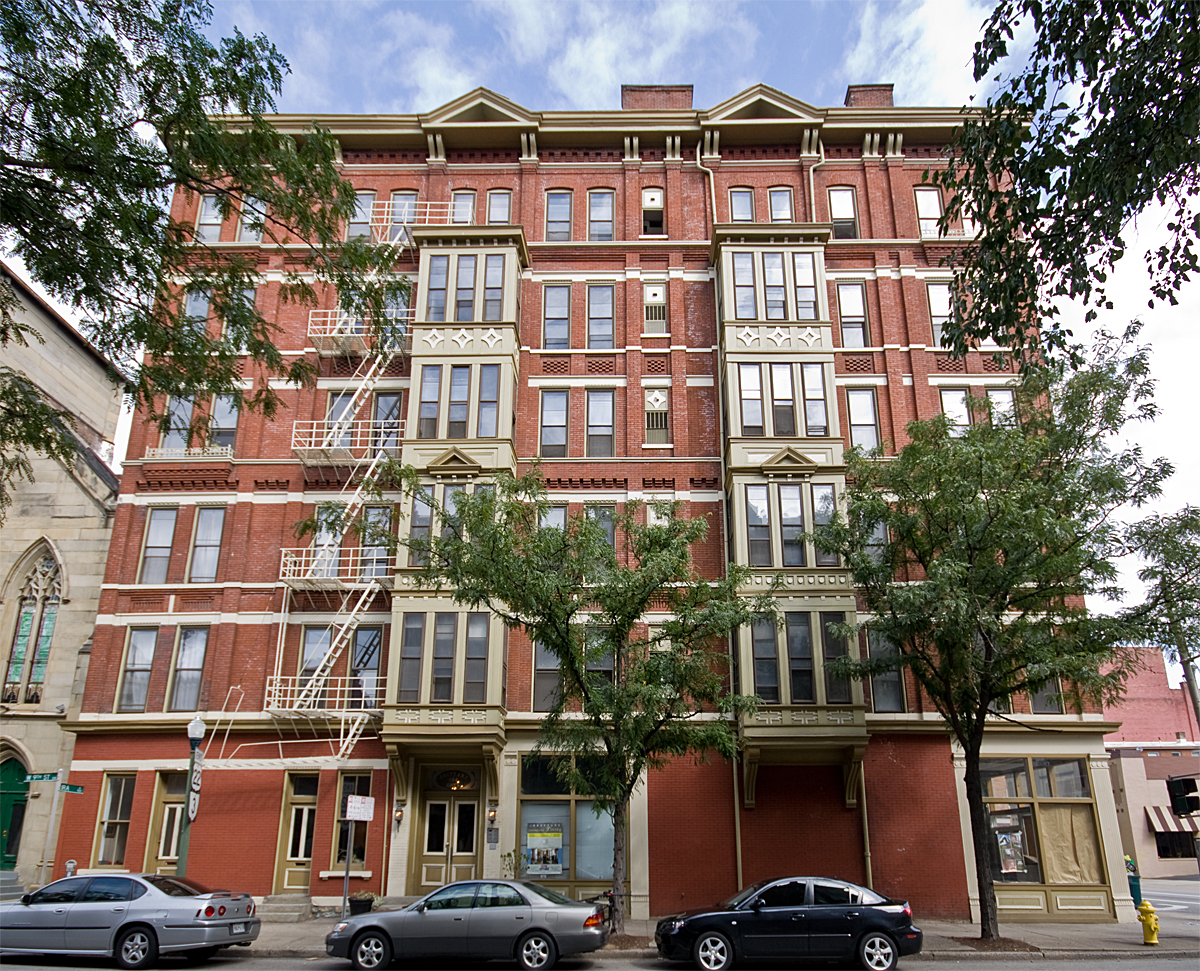


Why visit Bellevue
Townapedia lists 102 museums and landmarks, 39 parks and trails, 131 places to eat, 9 places to stay and 16 attractions in and around town.
Highlights include Newport Aquarium, Cincinnati Playhouse in the Park, Cincinnati Art Museum and Lytle Park Historic District.
July is the warmest month, with average highs of 87°F; January lows average 24°F.
Weather in Bellevue
Forecast from the National Weather Service. Full forecast
About Bellevue
Bellevue is a home rule-class city in Campbell County, Kentucky, in the United States. It is located along the southern bank of the Ohio River. The population was 5,548 at the 2020 census.
From the Wikipedia article Bellevue, Kentucky (this version), under CC BY-SA 4.0.
Things to do16



Cincinnati Skywalk
Bridge · 2.0 mi
Elevated walkway system in downtown Cincinnati, Ohio, United States
Pike's Opera House
Cinema and theater · 1.8 mi
Former theater and concert hall in Cincinnati, Ohio, United States
Taft Theatre
Cinema and theater · 1.6 mi
Theater in Cincinnati, Ohio, United States

Seasongood Pavilion
Cinema and theater · 1.3 mi
1752 Art Museum Drive, Cincinnati
The Southgate House Revival
Cinema and theater · 1.1 mi
111 East 6th Street, Newport
4 more on the map.
Museums and landmarks102

Cincinnati Art Museum
Museum · 1.4 mi
953 Eden Park Drive, Cincinnati
Tu-We,Fr-Su 11:00-17:00; Th 11:00-20:00

Lytle Park Historic District
Monument and historic site · National Register of Historic Places · 1.5 mi
Historic district in Cincinnati, Ohio, United States

Taft Museum of Art
Museum · National Register of Historic Places · 1.3 mi
Historic house museum holding a fine art collection in Cincinnati
316 Pike Street, Cincinnati

Abraham J. Friedlander House
Monument and historic site · National Register of Historic Places · 2.0 mi
House in Cincinnati, Ohio

Alkemeyer Commercial Buildings
Monument and historic site · National Register of Historic Places · 2.0 mi
Building in Ohio, United States

Alms and Doepke Dry Goods Company
Monument and historic site · National Register of Historic Places · 1.8 mi
United States historic place
Apostolic Bethlehem Temple Church
Monument and historic site · National Register of Historic Places · 2.3 mi
Church building in Ohio, United States of America
Bartlett Building
Monument and historic site · National Register of Historic Places · 1.8 mi
Building in Cincinnati, Ohio


Bellevue
Monument and historic site · National Register of Historic Places · 0.9 mi
House in Newport, Kentucky
Betts-Longworth Historic District
Monument and historic site · National Register of Historic Places · 2.4 mi
Historic district in Cincinnati, Ohio, United States
Brittany Apartments
Monument and historic site · National Register of Historic Places · 2.1 mi
Historic apartment building in Cincinnati, Ohio
Carew Tower
Monument and historic site · National Register of Historic Places · 1.9 mi
Skyscraper in Cincinnati, Ohio, United States
90 more on the map.
Parks, trails and playgrounds39


27 more on the map.
Restaurants and cafes131

Bellevue Bistro
Restaurant · Sandwich · 0.5 mi
313 Fairfield Avenue, Bellevue
Mo-Tu 09:00-14:00; We closed; Th-Su 08:00-14:00
Bourbon House Pizza
Restaurant · Pizza · 1.0 mi
100 Aqua Way, Newport
Mo off; Tu-Th 16:00-21:00; Fr-Sa 11:00-22:00; Su 12:00-21:00

Carabello Coffee Company
Cafe · Coffee Shop · 1.1 mi
107 East 9th Street, Newport
Mo-Fr 07:00-20:00; Sa 08:00-20:00; Su off
Fessler's Legendary Pizza and Hoagies
Restaurant · Pizza, Italian, Hoagies · 0.5 mi
343 Fairfield Avenue, Bellevue
Su-Mo off; Tu-Th 11:00-21:00; Fr-Sa 11:00-22:00
Galactic Fried Chicken
Restaurant · Chicken · 0.9 mi
624 6th Avenue, Dayton
Th-Sa 11:30-21:00; Su,We 11:30-20:00
MRBL
Restaurant · Steak House, Sushi · 0.6 mi
119 Fairfield Avenue, Bellevue
We-Th 16:30-21:00; Fr 16:30-21:30; Sa 16:00-21:30; Su 16:00-20:30
Montgomery Inn Boathouse
Restaurant · Ribs · 0.9 mi
925 Riverside Drive, Cincinnati
Mo-Fr 11:00-23:00; Sa 15:00-23:00; Su 15:00-21:00
Sake Bomb Sushi
Restaurant · Sushi, Korean · 1.1 mi
500 Monmouth Street, Newport
Mo-Fr 11:00-14:30,16:30-21:30; Sa 12:00-21:30; Su 13:00-21:30
Shiners On The Levee
Restaurant · 1.0 mi
Shiners On The Levee is a vibrant barbecue restaurant and live music bar nestled in Newport, KY, that has been serving the greater...
1 Levee Way, Newport
Mo 19:00-24:00; Tu closed; We-Th 17:00-24:00; Fr,Sa 11:00-02:00;...
Your Mom's Pizzeria
Restaurant · Pizza · 1.2 mi
1045 Saint Gregory Street, Cincinnati
We-Sa 16:00-21:00
119 more on the map.
History
Before Bellevue was founded, the area was used for hunting, fishing, and warfare by Native Americans tribes such as the Illini, Miami, Shawnee, Cherokee, and Tuscarora. In 1745, a three-day battle occurred in Bellevue among the Shawnee, Miami, and Cherokee Indians, resulting in many deaths.
Bellevue was named for the plantation of Gen. James Taylor Jr., Quartermaster General of the western U.S. Army in the War of 1812. The city was once the eastern part of his plantation. The name Bellevue was taken from the General's family plantation in Virginia. Bellevue, or "belle vue," translates from French to mean "beautiful view." James Taylor Jr. was the fifth child born to James Taylor Sr. and his wife, Anne Hubbard Taylor, in 'Midway', Caroline County, Virginia. His father bought 2,700 acres (11 km2) of land in Northern Kentucky from his friend George Muse, part of which Muse had been awarded for his military service in the French and Indian War. James Taylor Jr. was one of the wealthiest men in the state of Kentucky. In 1848, his estate was valued at more than $4 million. Today, his home stands in the East Row local Historic District in the adjoining City of Newport, Kentucky. East Row is the second-largest local district in Kentucky, and the Taylor Mansion is the district's oldest house.
From the History section of Bellevue, Kentucky on Wikipedia, under CC BY-SA 4.0.
Where to stay9
Residence Inn by Marriott Cincinnati Downtown/The Phelps
Motel and hotel · 1.5 mi
506 East 4th Street, Cincinnati
Churches and places of worship31
St. Francis Xavier Church
Church · National Register of Historic Places · 1.7 mi
Corpus Christi Roman Catholic Church
Church · Catholic · 1.5 mi
840 Isabella Street, Newport
Shopping28
Gas and EV charging7
Schools, colleges and libraries55
Holy Trinity Junior High School and Child Development Center
School · Catholic · 1.0 mi
Healthcare4
Map of Bellevue
250 places. The map loads OpenStreetMap tiles when you open it.
Climate by month
Monthly table
| Month | High | Low | Rain |
|---|---|---|---|
| Jan | 41°F | 24°F | 2.9 in |
| Feb | 45°F | 26°F | 2.8 in |
| Mar | 55°F | 33°F | 3.9 in |
| Apr | 67°F | 42°F | 4.4 in |
| May | 75°F | 53°F | 4.7 in |
| Jun | 83°F | 61°F | 4.6 in |
| Jul | 87°F | 65°F | 4.4 in |
| Aug | 86°F | 64°F | 3.4 in |
| Sep | 80°F | 56°F | 3.1 in |
| Oct | 68°F | 44°F | 3.0 in |
| Nov | 55°F | 34°F | 2.9 in |
| Dec | 45°F | 28°F | 3.3 in |
U.S. Climate Normals 1991-2020 for Cincinnati Lunken Ap (3 mi away), NOAA NCEI.
People and cost of living
American Community Survey 5-year estimates, 2020-2024, U.S. Census Bureau. Estimates have margins of error, larger for small towns.
Disaster history
Campbell County has had 14 federal disaster declarations since 2000, most often for severe storms.
- 2026-01-24: Severe Winter Storm (Winter Storm)
- 2025-04-24: Severe Storms, Straight-Line Winds, Tornadoes, Flooding, Landslides, And Mudslides (Severe Storm)
- 2025-04-03: Severe Storms, Straight-Line Winds, Tornadoes, And Flooding (Severe Storm)
- 2025-02-16: Severe Storms, Straight-Line Winds, Flooding, And Landslides (Severe Storm)
- 2020-03-28: Covid-19 Pandemic (Biological)
- 2020-03-13: Covid-19 (Biological)
OpenFEMA disaster declarations summaries.
Getting there and nearby towns
Lunken Airport (LUK) is the nearest airport with scheduled flights listed in OpenStreetMap, 3 miles away.
- Newport 1 mi southwest, about 2 min by car
- Fort Thomas 2 mi southeast, about 3 min by car
- Cincinnati 3 mi northwest, about 5 min by car
- Norwood 4 mi north, about 7 min by car
- Covington 5 mi southwest, about 8 min by car
- St. Bernard 5 mi north, about 8 min by car
- Fairfax 5 mi northeast, about 8 min by car
- Turpin Hills 6 mi east, about 9 min by car
- Salem Heights 6 mi southeast, about 9 min by car
- Elmwood Place 6 mi north, about 9 min by car
Drive times are estimates from straight-line distance, not routes.
Local news
Headlines from INDB, the NEMICO news database.
Reviews, tips and questions
Loading what members have shared...
Sources and licences
- NCES EDGE (Public domain): public schools
- NOAA NCEI U.S. Climate Normals 1991-2020 (Public domain): climate by month
- OpenFEMA (Public domain): disaster declarations
- OpenStreetMap contributors (ODbL 1.0): places, airports, map data
- U.S. Census Bureau (Public domain): population, income, housing, education, commute
- Wikidata (CC0 1.0): elevation, founding date, time zone, website, landmarks and historic places
- Wikimedia Commons (see each image): photos
- Wikipedia (CC BY-SA 4.0): overview and history text
Photo credits
- Bellevue-Kentucky-September-2008, Wholtone, Public domain
- TaftMuseum, Greg Hume ( User:Greg5030 ), CC BY-SA 2.5
- Literary Club of Cincinnati, Nyttend, Public domain
- BrittanyApartments, Photo by Greg Hume ( Greg5030 ), CC BY 3.0
- PhoenixClub, Photo by Greg Hume ( Greg5030 ), CC BY 3.0
- Gwynne, Photo by Greg Hume ( Greg5030 ), CC BY 3.0
- CovenantPresbyterian, Photo by Greg Hume ( Greg5030 ), CC BY 3.0
- Alkmeyer, Photo by Greg Hume ( Greg5030 ), CC BY 3.0
- Race Street Historic District building, Nyttend, Public domain
- Bellevue in Mansion Hill, Newport, Nyttend, Public domain
- StFrancisXavierChurch frontview, MamaGeek at en.wikipedia, CC BY-SA 3.0
- Friedlander, Photo by Greg Hume ( Greg5030 ), CC BY 3.0
- District2PoliceStation, Unknown author, CC BY 3.0
- Cincinnati-800-broadway, Unknown author, Public domain
- StPaulDistrict, Photo by Greg Hume ( Greg5030 ), CC BY 3.0
- CincinnatiBell, Photo by Greg Hume ( Greg5030 ), CC BY 3.0
- HolyCrossMonastery, Photo by Greg Hume ( Greg5030 ), CC BY 3.0
- FireMuseum, Photo by Greg Hume ( Greg5030 ), CC BY 3.0
- Remnant of the Laurel Homes, Nyttend, Public domain
- Terrace Plaza Hotel, Cincinnati, Ohio (78788), Pub. by Bell Block News & Novelty Co., Cincinnati, Ohio. "Tichnor Quality Views," Reg. U. S. Pat. Off. Made Only by Tichnor Bros., Inc., Boston, Mass., Public domain
- St Paul's Episcopal Church Newport, KY 03, Paul Barnes, CC BY-SA 4.0
- PhoenixBuilding, Greg5030, CC BY 3.0
- ImmaculateConceptionChurch, Photo by Greg Hume ( Greg5030 ), CC BY 3.0
- Third and Garrard in Covington, Nyttend, Public domain
- Ohio National Guard Armory, Cincinnati, Robert Keller, Public domain
- Main and Third Street Cluster, Nyttend, Public domain
- JohnChurchCompanyBuilding, Photo by Greg Hume ( Greg5030 ), CC BY 3.0
- 123E4LR, Greg Hume, CC BY 3.0
- RopesBuilding, Unknown author, CC BY 3.0
- Police Station No. 5 site, Nyttend, Public domain
- GoodallBuilding, Photo by Greg Hume ( Greg5030 ), CC BY 3.0
- Sacred-Heart-Church-Bellevue-KY, Wholtone, Public domain
- Bellevue High School, Center and Washington, Nyttend, Public domain


Page built October 30, 2026. Spotted a mistake? Tell us or suggest a place.