


Bethlehem Village, Connecticut
Bethlehem Village is a community of 2,195 people in Connecticut.
Why visit Bethlehem Village
Townapedia lists 11 museums and landmarks, 21 parks and trails, 4 places to eat and 7 attractions in and around town.
Highlights include Bird Hill, Carmel Hill, Bethlehem Green Historic District and Bellamy-Ferriday House and Garden.
July is the warmest month, with average highs of 82°F; January lows average 15°F, and about 59 inches of snow fall in a normal year.
Weather in Bethlehem Village
Forecast from the National Weather Service. Full forecast
About Bethlehem Village
Bethlehem Village is a census-designated place (CDP) within the town of Bethlehem in Litchfield County, Connecticut, United States. The CDP includes the Bethlehem Green Historic District at the town center, as well as surrounding residential and rural land. As of the 2020 census, Bethlehem Village had a population of 1,970.
From the Wikipedia article Bethlehem Village, Connecticut (this version), under CC BY-SA 4.0.
Things to do7



Museums and landmarks11

Bethlehem Green Historic District
Monument and historic site · National Register of Historic Places · 0.5 mi
Bethlehem, Connecticut
Bellamy-Ferriday House and Garden
Monument and historic site · National Register of Historic Places
Historic house in Connecticut, United States

Caleb Martin House
Monument and historic site · National Register of Historic Places · 1.4 mi
Historic house in Connecticut, United States
Roderick Bryan House
Monument and historic site · National Register of Historic Places · 3.6 mi
Watertown, Connecticut, NRHP-listed in Litchfield County
Skilton Road Bridge
Bridge · National Register of Historic Places · 2.5 mi
Road bridge in Watertown, United States of America
Sunny Ridge Historic District
Monument and historic site · National Register of Historic Places · 3.9 mi
Historic district in Connecticut, United States


The Hollister Homestead
Monument and historic site · National Register of Historic Places · 3.9 mi
Historic house at 300 Nettleton Hollow Road in Washington, Connecticut
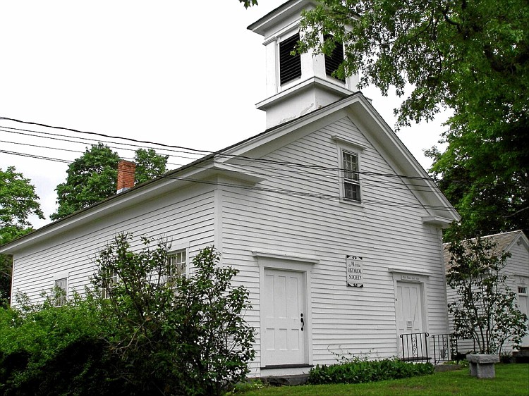
Town Hall and District School No. 6
Monument and historic site · National Register of Historic Places · 2.7 mi
Rathaus in Morris, United States of America

Garbage Museum
Museum · 3.6 mi
Waste management themed museum in Stratford, Connecticut
Parks, trails and playgrounds21

Town Open Space (Hunt's Land)
Hiking and trails · 0.7 mi
Municipal, Open To Public Without Fee

9 more on the map.
Restaurants and cafes4

Nick's Country Kitchen
Restaurant · Italian, Pizza, Burger, Regional, Sandwich · 1.0 mi
Churches and places of worship5
Shopping1
Schools, colleges and libraries13
Map of Bethlehem Village
62 places. The map loads OpenStreetMap tiles when you open it.
Climate by month
Monthly table
| Month | High | Low | Rain | Snow |
|---|---|---|---|---|
| Jan | 33°F | 15°F | 3.9 in | 13.1 in |
| Feb | 36°F | 16°F | 3.5 in | 15.8 in |
| Mar | 45°F | 23°F | 4.6 in | 12.7 in |
| Apr | 58°F | 33°F | 4.3 in | 2.6 in |
| May | 69°F | 44°F | 4.1 in | 0.0 in |
| Jun | 77°F | 53°F | 4.9 in | 0.0 in |
| Jul | 82°F | 58°F | 4.3 in | 0.0 in |
| Aug | 80°F | 56°F | 4.8 in | 0.0 in |
| Sep | 72°F | 49°F | 5.0 in | 0.0 in |
| Oct | 60°F | 38°F | 5.4 in | 0.3 in |
| Nov | 49°F | 29°F | 4.2 in | 2.6 in |
| Dec | 38°F | 21°F | 5.0 in | 12.0 in |
U.S. Climate Normals 1991-2020 for Bakersville (17 mi away), NOAA NCEI.
People and cost of living
American Community Survey 5-year estimates, 2020-2024, U.S. Census Bureau. Estimates have margins of error, larger for small towns.
Disaster history
The county has had 23 federal disaster declarations since 2000, most often for hurricanes.
- 2024-09-20: Severe Storm, Flooding, Landslides, And Mudslides (Severe Storm)
- 2024-08-21: Severe Storms, Flooding, Landslides, And Mudslides (Severe Storm)
- 2021-10-30: Remnants Of Hurricane Ida (Hurricane)
- 2021-08-22: Hurricane Henri (Hurricane)
- 2021-01-12: Tropical Storm Isaias (Hurricane)
- 2020-08-06: Tropical Storm Isaias (Hurricane)
OpenFEMA disaster declarations summaries.
Getting there and nearby towns
Waterbury-Oxford Airport (OXC) is the nearest airport with scheduled flights listed in OpenStreetMap, 12 miles away.
- Woodbury Center 7 mi south, about 11 min by car
- Litchfield 7 mi north, about 11 min by car
- New Preston 8 mi northwest, about 12 min by car
- Waterbury 10 mi southeast, about 17 min by car
- Naugatuck 13 mi southeast, about 21 min by car
- Bristol 14 mi east, about 22 min by car
- Torrington 14 mi north, about 22 min by car
- Inglenook 16 mi southwest, about 26 min by car
- New Britain 22 mi east, about 35 min by car
- Danbury 22 mi southwest, about 36 min by car
Drive times are estimates from straight-line distance, not routes.
Local news
Headlines from INDB, the NEMICO news database.
Reviews, tips and questions
Loading what members have shared...
Sources and licences
- NCES EDGE (Public domain): public schools
- NOAA NCEI U.S. Climate Normals 1991-2020 (Public domain): climate by month
- OpenFEMA (Public domain): disaster declarations
- OpenStreetMap contributors (ODbL 1.0): places, airports, map data
- U.S. Census Bureau (Public domain): population, income, housing, education, commute
- Wikidata (CC0 1.0): landmarks and historic places
- Wikimedia Commons (see each image): photos
- Wikipedia (CC BY-SA 4.0): overview and history text
Photo credits
- Christ Episcopal Church, Bethlehem CT, John Phelan, CC BY 4.0
- Bellamy house, Jerry Dougherty, CC BY 2.5
- RoderickBryanHouseWatertownCT, Jerry Dougherty, CC BY 2.5
- SkiltonRoadBridge, Jerry Dougherty, CC BY 2.5
- CALEB MARTIN HOUSE, BETHLEHEM, LITCHFIELD COUNTY CT, JERRYE AND ROY KLOTZ, M.D., CC BY-SA 4.0
- FormerTownHallMorrisCT, Jerry Dougherty, CC BY 2.5
- WashingtonCT HollisterHomestead, Magicpiano, CC BY-SA 4.0
- Christ Church Bethlehem, Quod Felix, CC BY-SA 4.0
- BethlehemCT JosephBellamyHouse, Magicpiano, CC BY-SA 4.0
- District No 1 Schoolhouse, Bethlehem CT, John Phelan, CC BY 4.0
- Little Free Library, Bethlehem CT, John Phelan, CC BY 4.0
- Main St S, Bethlehem CT, John Phelan, CC BY 4.0
- BethlehemCT BethlehemGreenHD 3, Magicpiano, CC BY-SA 4.0
- BethlehemCT EpiscopalChurch, Magicpiano, CC BY-SA 4.0
- BethlehemCT CongregationalChurch, Magicpiano, CC BY-SA 4.0
- BethlehemCT BethlehemGreenHD 1, Magicpiano, CC BY-SA 4.0
- BethlehemCT BethlehemGreenHD 2, Magicpiano, CC BY-SA 4.0
- BethlehemCT SchoolhouseMuseum, Magicpiano, CC BY-SA 4.0
- Camp Columbia State Park Class Of 1906 Tower, Morrowlong, CC BY-SA 4.0
- Class of 1906 Tower 1942, Morrowlong, CC BY-SA 4.0
- Tower Inside and Outside staircases, Morrowlong, CC BY-SA 4.0
- View From Tower in Autumn, Morrowlong, CC BY-SA 4.0
- Camp Columbia Instrument House Front Door, Morrowlong, CC BY-SA 4.0
- Camp Columbia Instrument House Full View, Morrowlong, CC BY-SA 4.0
- Camp Columbia Instrument House Inside View, Morrowlong, CC BY-SA 4.0


Page built October 30, 2026. Spotted a mistake? Tell us or suggest a place.