

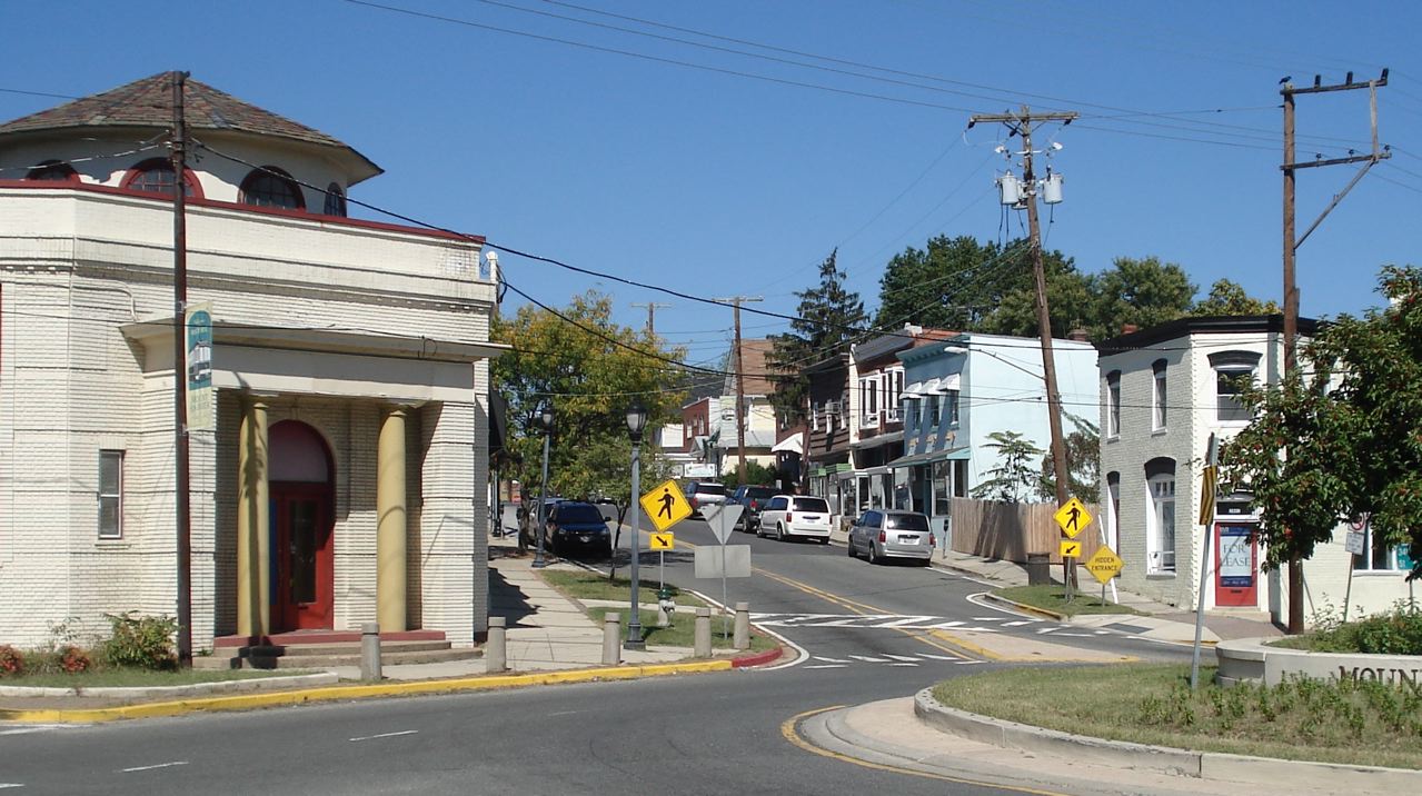


Brentwood, Maryland
Brentwood is a town of 3,777 people in Prince George's County, Maryland, founded in 1922.
Why visit Brentwood
Townapedia lists 76 museums and landmarks, 48 parks and trails, 66 places to eat, 1 place to stay and 16 attractions in and around town.
Highlights include Amtrak Railroad Anacostia Bridge, Bladensburg Park Pedestrian Bridge, Mount Rainier Historic District and Adams Memorial.
July is the warmest month, with average highs of 90°F; January lows average 28°F.
Weather in Brentwood
Forecast from the National Weather Service. Full forecast
About Brentwood
Brentwood is a town in Prince George's County, Maryland, United States.
From the Wikipedia article Brentwood, Maryland (this version), under CC BY-SA 4.0.
Things to do16

Amtrak Railroad Anacostia Bridge
Bridge · 2.0 mi
Bridge in United States of America
Bladensburg Park Pedestrian Bridge
Bridge · 1.0 mi
Bicycle and pedestrian bridge over the Anacostia River in the U.S. state of Maryland
Bladensburg Road Bridge
Bridge · 0.8 mi
Bridge in Prince George's County, Maryland, United States

Clarice Smith Performing Arts Center
Cinema and theater · 3.3 mi
Theater and concert hall of the University of Maryland in College Park, Maryland, United States

Gallaudet University
School · 3.2 mi
American university providing education for deaf and hard of hearing students
New York Avenue Bridge
Bridge · 3.3 mi
Bridge crossing over Amtrak, CSX, and WMATA railway lines in Washington, D.C.
School of Nursing at The Catholic University of America
School · 2.3 mi
Nursing school of Washington, D.C., U.S
Trinity Washington University
School · 2.8 mi
Catholic university in Washington, D.C.
University of Maryland
School · 3.2 mi
Public research university in the city of College Park in Prince George's County, Maryland, USA
University of Maryland Global Campus
School · 2.9 mi
One of 11 degree-granting institutions within the University System of Maryland
4 more on the map.
Museums and landmarks76
Mount Rainier Historic District
Monument and historic site · National Register of Historic Places · 0.4 mi
Historic district located in Mount Rainier, Maryland

Adams Memorial
Monument and historic site · National Register of Historic Places · 2.9 mi
Artwork by Augustus Saint-Gaudens

Alexander Crummell School
Monument and historic site · National Register of Historic Places · 2.6 mi
Historic school building in Washington, DC

Armed Forces Retirement Home-Washington
Monument and historic site · National Register of Historic Places · 2.8 mi
United States historic place

Ash Hill
Monument and historic site · National Register of Historic Places · 2.5 mi
House in Hyattsville, Maryland, United States

Bostwick
Monument and historic site · National Register of Historic Places · 1.3 mi
Historic home located at Bladensburg

Brooks Mansion
Monument and historic site · National Register of Historic Places · 2.1 mi
Greek Revival plantation house
Calvert Hills Historic District
Monument and historic site · National Register of Historic Places · 2.4 mi
Historic district in Maryland, United States
Children's Country Home
Monument and historic site · National Register of Historic Places · 1.1 mi
Hospital

College Heights Estates Historic District
Monument and historic site · National Register of Historic Places · 2.3 mi
Historic district in Maryland, United States
College Park Airport
Monument and historic site · National Register of Historic Places · 3.1 mi
Airport in College Park, Maryland, United States


Engine Company 27
Monument and historic site · National Register of Historic Places · 3.0 mi
Fire station in Washington, D.C.
64 more on the map.
Parks, trails and playgrounds48

Bladensburg Dueling Grounds
Park · 1.6 mi
Site where more than 50 duels were fought during the 1800s in Maryland, US
McKeldin Mall
Park · 3.0 mi
Green space at the University of Maryland, College Park campus
McMillan Sand Filtration Site
Park · 3.2 mi
Twenty-five acre decommissioned water treatment plant in Northwest Washington, D.C., United States
David C. Driskell Community Park
Park · 0.6 mi
32 acres of park land Two picnic pavilions, available by permit only Basketball court Tennis courts Playgrounds Walking and biking...
3911 Hamilton Street, Hyattsville
36 more on the map.
Restaurants and cafes66

Pizzeria Paradiso
Restaurant · Pizza · 0.8 mi
Casual restaurant with a central oven for wood-fired pizzas has a vast menu of international beers.
4800 Rhode Island Avenue, Hyattsville
We-Th 16:00-21:00; Fr-Su 13:00-21:00
Mid Atlantic Seafood
Restaurant · Fish · 0.7 mi
3100 Queens Chapel Road, Hyattsville
Mo-Th,Sa 10:00-21:00; Fr 10:00-21:30; Su 11:00-21:00
Pennyroyal Station
Restaurant · Comfort Food · 0.6 mi
3310 Rhode Island Avenue, Mount Rainier
We-Fr 11:00-14:30, Tu-Th 16:00-21:00, Fr,Sa 17:00-22:00, Su...

DC Brau
Brewery and winery · 1.0 mi
3178 Bladensburg Road Northeast
Th 16:00-21:00, Fr 15:00-23:00, Sa 12:00-20:00, Su 12:00-18:00
Dodah's Kitchen
Restaurant · 0.5 mi
4300 Rhode Island Avenue, Mount Rainier
Mo-Sa 11:00-20:00; Su 11:00-18:00

Maryland Meadworks
Bar and pub · 0.6 mi
4700 Rhode Island Avenue, Hyattsville
Th 16:00-19:00; Fr 16:00-22:00; Sa 14:00-22:00; Su 11:00-19:00
Carbon y Leña
Restaurant · Dominican, Latin American · 1.5 mi
6033 Baltimore Avenue
Mo-Su 10:00-22:00

Streetcar 82 Brewing Co.
Bar and pub · 0.8 mi
4824 Rhode Island Avenue, Hyattsville
Tu-Th 15:00-22:00; Fr,Sa 12:00-22:00; Su 12:00-20:00
54 more on the map.
Where to stay1
Churches and places of worship45
Union Wesley African Methodist Episcopal Zion Church
Church · African Methodist Episcopal Zion · 1.2 mi
1860 Michigan Avenue Northeast, Washington
Shopping14
Gas and EV charging14
Schools, colleges and libraries77
Healthcare7
Rehabilitation & Specialized Care - Bunker Hill Road
Hospital · 1.3 mi
1731 Bunker Hill Road Northeast, Washington
Kaiser Permanente West Hyattsville Medical Center
Clinic and pharmacy · 1.1 mi
5320 Ager Road, Hyattsville
Map of Brentwood
250 places. The map loads OpenStreetMap tiles when you open it.
Climate by month
Monthly table
| Month | High | Low | Rain | Snow |
|---|---|---|---|---|
| Jan | 45°F | 28°F | 3.0 in | 4.7 in |
| Feb | 48°F | 30°F | 2.8 in | 2.3 in |
| Mar | 56°F | 36°F | 4.0 in | 1.4 in |
| Apr | 68°F | 46°F | 3.4 in | 0.0 in |
| May | 77°F | 57°F | 4.3 in | 0.0 in |
| Jun | 85°F | 66°F | 4.6 in | 0.0 in |
| Jul | 90°F | 71°F | 4.6 in | 0.0 in |
| Aug | 88°F | 69°F | 3.7 in | 0.0 in |
| Sep | 82°F | 62°F | 4.1 in | 0.0 in |
| Oct | 70°F | 49°F | 4.2 in | 0.0 in |
| Nov | 58°F | 39°F | 3.2 in | 0.0 in |
| Dec | 49°F | 32°F | 3.7 in | 1.3 in |
U.S. Climate Normals 1991-2020 for Natl Arboretum Dc (2 mi away), NOAA NCEI.
People and cost of living
American Community Survey 5-year estimates, 2020-2024, U.S. Census Bureau. Estimates have margins of error, larger for small towns.
Disaster history
Prince George's County has had 13 federal disaster declarations since 2000, most often for hurricanes.
- 2026-01-24: Severe Winter Storm (Winter Storm)
- 2020-03-26: Covid-19 Pandemic (Biological)
- 2020-03-13: Covid-19 (Biological)
- 2016-03-04: Severe Winter Storm And Snowstorm (Snowstorm)
- 2012-11-20: Hurricane Sandy (Hurricane)
- 2012-10-28: Hurricane Sandy (Hurricane)
OpenFEMA disaster declarations summaries.
Getting there and nearby towns
College Park Airport (CGS) is the nearest airport with scheduled flights listed in OpenStreetMap, 3 miles away.
- Hyattsville 1 mi north, about 2 min by car
- Bladensburg 2 mi east, about 3 min by car
- Chillum 2 mi northwest, about 3 min by car
- East Riverdale 3 mi northeast, about 4 min by car
- Langley Park 3 mi north, about 5 min by car
- Washington 4 mi southwest, about 7 min by car
- Takoma Park 4 mi northwest, about 6 min by car
- College Park 4 mi north, about 6 min by car
- Adelphi 4 mi north, about 6 min by car
- Landover 4 mi east, about 6 min by car
Drive times are estimates from straight-line distance, not routes.
Local news
Headlines from INDB, the NEMICO news database.
Reviews, tips and questions
Loading what members have shared...
Sources and licences
- NCES EDGE (Public domain): public schools
- NOAA NCEI U.S. Climate Normals 1991-2020 (Public domain): climate by month
- OpenFEMA (Public domain): disaster declarations
- OpenStreetMap contributors (ODbL 1.0): places, airports, map data
- U.S. Census Bureau (Public domain): population, income, housing, education, commute
- Wikidata (CC0 1.0): elevation, founding date, time zone, website, landmarks and historic places
- Wikimedia Commons (see each image): photos
- Wikipedia (CC BY-SA 4.0): overview and history text
Photo credits
- Bunker Hill Fire Station Brentwood Maryland USA, Cornellrockey, CC BY-SA 4.0
- US Route 1 & 34th St, Mt. Rainier, Maryland, Nonvirtual, CC BY-SA 3.0
- Calvert Street in College Park, Ser Amantio di Nicolao, CC BY-SA 3.0
- Gallaudet tower, Andrew Kuchling from Vienna, Virginia, USA, CC BY-SA 2.0
- Leland Hospital Sept 09, Pubdog ( talk ), Public domain
- Deanwood Old Church, Smallbones, CC0
- College Heights Estates Historic District 07, Farragutful, CC BY-SA 4.0
- H Street Playhouse, AgnosticPreachersKid, CC BY-SA 3.0
- Kenilworthgarden1, Jennifer Boyer from Maryland, USA, CC BY 2.0
- Entrance - Glenwood Cemetery - 2014-09-14, Tim1965, CC BY-SA 4.0
- Market Masters House June 2009, Pubdog ( talk ), Public domain
- St. Paul's Church, Cliff, CC BY 2.0
- University Park MD Nov 08, Pubdog ( talk ), Public domain
- Mount St Sepulchre DC, Abraham Sobkowski OFM, CC BY-SA 2.5
- Langston Golf Course, NPS Photo, Public domain
- Hyattsville Historic District Nov 08, Pubdog ( talk ), Public domain
- Mayfair Mansons DC, Farragutful, CC BY-SA 3.0
- Ralph Bunche House DC, Smallbones, CC0
- Engine Company 27 DC, Smallbones, CC0
- Brooks Mansion DC, Smallbones, CC0
- Hyattsville PO Nov 08, Pubdog ( talk ), Public domain
- Ash Hill Nov 08, Pubdog ( talk ), Public domain
- DC Fire Alarm HQ, Smallbones, CC0
- Hecht warehouse washington dc, Superbass, CC BY-SA 3.0
- Alexander Crummell School, AgnosticPreachersKid, CC BY-SA 3.0
- Hampshire Garden Apartments DC, Farragutful, CC BY-SA 3.0
- BostwickHouse, Jonathunder, GFDL 1.2
- St. Gabriel Church DC 01, Farragutful, CC BY-SA 3.0
- World War I Memorial, Bladensburg, Maryland 003, Ben Jacobson ( Kranar Drogin ), CC BY-SA 3.0
- Newton Theater, AgnosticPreachersKid, CC BY-SA 3.0
- North Brentwood Historic District Dec 10, Pubdog, Public domain
- Langston Terrace DC 1, Smallbones, CC0
- Glenwood Cemetery Mortuary Chapel DC, Farragutful, CC BY-SA 3.0
- Lincoln Cottage 2009, Hal Jespersen,, Public domain
- Hilltop Manor Entrance Dec 08, Pubdog ( talk ), Public domain
- Metro One, Pubdog, Public domain
- Rock Creek Cemetery, grave marker, AgnosticPreachersKid, CC BY-SA 3.0
- President's House, Gallaudet University, AgnosticPreachersKid, CC BY-SA 3.0


Page built October 30, 2026. Spotted a mistake? Tell us or suggest a place.