


Why visit Plantsville
Townapedia lists 30 museums and landmarks, 5 parks and trails, 20 places to eat, 1 place to stay and 3 attractions in and around town.
Highlights include Starplex Cinemas Southington 12, Southington Drive-In, Meriden Avenue-Oakland Road Historic District and Southington Center Historic District.
July is the warmest month, with average highs of 84°F; January lows average 19°F.
Weather in Plantsville
Forecast from the National Weather Service. Full forecast
About Plantsville
Plantsville is a neighborhood in the town of Southington, Hartford County, Connecticut, United States. It is centered at the merger between South Main Street (road from the Milldale section) and West Main Street (road from the Marion section). As of the 2020 census, Plantsville had a population of 2,016. The Zip Code Tabulation Area for zip code 06479, which is assigned the postal city name Plantsville, includes the entire southwestern corner of the town of Southington, including Marion and Milldale.
From the Wikipedia article Plantsville, Connecticut (this version), under CC BY-SA 4.0.
Things to do3

Starplex Cinemas Southington 12
Cinema and theater · 1.5 mi
1821 Meriden-Waterbury Turnpike, Southington

Mount Southington
Ski area · 1.8 mi
Ski area in Plantsville, Connecticut
Museums and landmarks30

Meriden Avenue-Oakland Road Historic District
Monument and historic site · National Register of Historic Places · 1.1 mi
Historic district in Connecticut, United States

Southington Center Historic District
Monument and historic site · National Register of Historic Places · 1.5 mi
Historic district in Connecticut, United States

Atwater Manufacturing Company
Monument and historic site · National Register of Historic Places · 0.5 mi
Building in Connecticut, United States

Avery Clark House
Monument and historic site · National Register of Historic Places · 2.4 mi
House in Southington, Connecticut

Barnes-Frost House
Monument and historic site · National Register of Historic Places · 2.1 mi
Historic house in Connecticut, United States
Blakeslee Forging Company
Monument and historic site · National Register of Historic Places
Historic building in Southington, Connecticut, United States

Capt. Samuel Woodruff House
Monument and historic site · National Register of Historic Places · 2.5 mi
House in Southington, Connecticut
Clark Brothers Factory No. 2
Monument and historic site · National Register of Historic Places · 0.9 mi
Historic building in Southington, Connecticut, United States
Dr. Henry Skelton House
Monument and historic site · National Register of Historic Places
House in Southington, Connecticut
Dr. J. Porter House
Monument and historic site · National Register of Historic Places · 1.2 mi
In Southington CT, listed on the NRHP in Connecticut

Ezekiel Woodruff House
Monument and historic site · National Register of Historic Places · 2.7 mi
Historic house in Connecticut, United States

H. D. Smith Company Building
Monument and historic site · National Register of Historic Places · 0.5 mi
Factory in Southington, United States of America
18 more on the map.
Parks, trails and playgrounds5
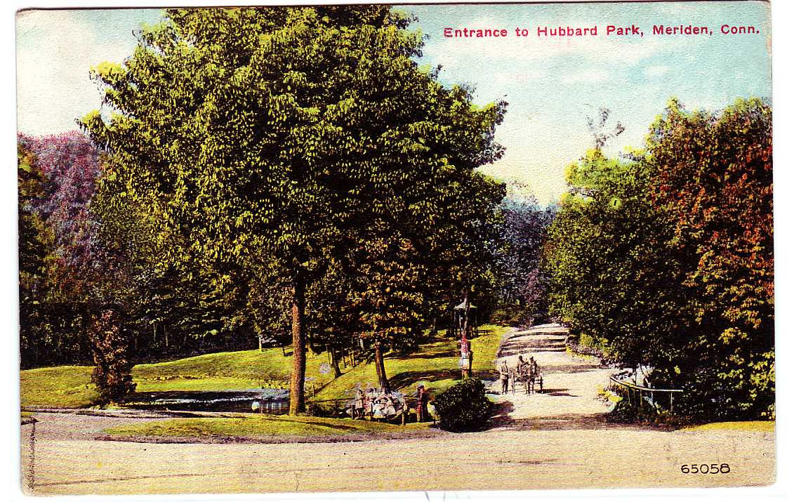


Hubbard Park
Park · National Register of Historic Places · 3.3 mi
Which extends into adjacent town Southington, and is listed on the NRHP in Connecticut


Restaurants and cafes20

Pepper Pot
Diner · American · 1.5 mi
9 Center Street, Southington
Mo closed, Tu-Fr 07:00-14:00, Sa 07:00-12:00, Su 07:00-13:00

Smokin` With Chris
Restaurant · Barbecue · 1.3 mi
59 West Center Street, Southington
Tu-Th 11:30-20:00; Fr-Sa 11:30-21:00; Su 12:00-18:00



8 more on the map.
Where to stay1
Churches and places of worship10
Immaculate Conception Church
Church · Catholic · 0.9 mi
152 Summer Street, Southington
Plantsville Congregational Church
Church · United Church Of Christ · 0.4 mi
109 Church Street, Southington
Holy Trinity Polish Catholic Church
Church · Polish National Catholic · 0.8 mi
200 Summer Street, Southington
Saint Aloysius Church
Church · Roman Catholic · 1.3 mi
254 Burritt Street, Southington
Shopping1
Schools, colleges and libraries39
Southington Public Library
Library · National Register of Historic Places · 1.1 mi
255 Main Street, Southington
Healthcare3
Hospital of Central Connecticut Bradley Memorial Campus
Hospital · 1.2 mi
81 Meriden Avenue, Southington
Map of Plantsville
112 places. The map loads OpenStreetMap tiles when you open it.
Climate by month
Monthly table
| Month | High | Low | Rain |
|---|---|---|---|
| Jan | 37°F | 19°F | 3.0 in |
| Feb | 39°F | 20°F | 2.9 in |
| Mar | 48°F | 28°F | 4.0 in |
| Apr | 60°F | 38°F | 4.1 in |
| May | 70°F | 48°F | 3.5 in |
| Jun | 79°F | 57°F | 4.0 in |
| Jul | 84°F | 62°F | 3.4 in |
| Aug | 82°F | 61°F | 3.5 in |
| Sep | 75°F | 54°F | 4.3 in |
| Oct | 64°F | 42°F | 4.5 in |
| Nov | 52°F | 32°F | 3.4 in |
| Dec | 42°F | 24°F | 4.1 in |
U.S. Climate Normals 1991-2020 for Meriden Markham Muni Ap (6 mi away), NOAA NCEI.
People and cost of living
American Community Survey 5-year estimates, 2020-2024, U.S. Census Bureau. Estimates have margins of error, larger for small towns.
Disaster history
The county has had 21 federal disaster declarations since 2000, most often for hurricanes.
- 2024-10-24: Hawthorne Fire (Fire)
- 2021-08-22: Hurricane Henri (Hurricane)
- 2021-01-12: Tropical Storm Isaias (Hurricane)
- 2020-08-06: Tropical Storm Isaias (Hurricane)
- 2020-03-28: Covid-19 Pandemic (Biological)
- 2020-03-13: Covid-19 (Biological)
OpenFEMA disaster declarations summaries.
Getting there and nearby towns
Waterbury-Oxford Airport (OXC) is the nearest airport with scheduled flights listed in OpenStreetMap, 14 miles away.
- Cheshire Village 5 mi south, about 9 min by car
- Meriden 6 mi southeast, about 10 min by car
- Bristol 7 mi north, about 12 min by car
- Kensington 7 mi northeast, about 11 min by car
- Waterbury 8 mi west, about 12 min by car
- New Britain 8 mi northeast, about 14 min by car
- Wallingford Center 10 mi south, about 16 min by car
- Oakville 10 mi west, about 17 min by car
- Naugatuck 11 mi southwest, about 17 min by car
- Newington 11 mi northeast, about 18 min by car
Drive times are estimates from straight-line distance, not routes.
Local news
Headlines from INDB, the NEMICO news database.
Reviews, tips and questions
Loading what members have shared...
Sources and licences
- NCES EDGE (Public domain): public schools
- NOAA NCEI U.S. Climate Normals 1991-2020 (Public domain): climate by month
- OpenFEMA (Public domain): disaster declarations
- OpenStreetMap contributors (ODbL 1.0): places, airports, map data
- U.S. Census Bureau (Public domain): population, income, housing, education, commute
- Wikidata (CC0 1.0): landmarks and historic places
- Wikimedia Commons (see each image): photos
- Wikipedia (CC BY-SA 4.0): overview and history text
Photo credits
- Plantsville Charles Cowles House, Sphilbrick, CC BY-SA 3.0
- SouthingtonCT NewHavenAndNorthamptonRailTrail ViewSouthFromPlantsville, Magicpiano, CC BY-SA 4.0
- SouthingtonCT Plantsville BlakesleeForgingCompany, Magicpiano, CC BY-SA 4.0
- Plantsville Center 1908 postcard, Unknown author Unknown author, Public domain
- SouthingtonCT Plantsville NewHavenAndNorthamptonRailTrailMarker, Magicpiano, CC BY-SA 4.0
- Plantsville station postcard, Unknown author Unknown author, Public domain
- SouthingtonCT NewHavenAndNorthamptonRailTrail Plantsville, Magicpiano, CC BY-SA 4.0
- Plantsville Center postcard, Unknown author Unknown author, Public domain
- Plantsville station 1917 postcard, Unknown author Unknown author, Public domain
- FormerLibrarySouthingtonCT, Jerry Dougherty, CC BY 2.5
- Southington Civil War monument, Sphilbrick, CC BY-SA 3.0
- Southington Charles W. Beckley House, Sphilbrick, CC BY-SA 3.0
- Jonathan Root House, Sphilbrick, CC BY-SA 3.0
- Marion Lester Beecher House, Sphilbrick, CC BY-SA 3.0
- SouthingtonCT StephenGrannisHouse, David Ransom, Public domain
- SouthingtonCT CaptSamuelWoodruffHouse, Magicpiano, CC BY-SA 4.0
- Capt. Josiah Cowles House, Sphilbrick, CC BY-SA 3.0
- SouthingtonCT WoodruffHouse, Magicpiano, CC BY-SA 4.0
- Barnes-Frost House, Sphilbrick, CC BY-SA 3.0
- PostcardHubbardParkEntranceMeridenCT1913, Unknown author Unknown author, Public domain
- Asa Barnes Tavern, Duncan Jones, CC BY-SA 3.0
- SouthingtonCT 590WestStreet, Magicpiano, CC BY-SA 4.0
- SouthingtonCT HoraceWebsterHouse, Magicpiano, CC BY-SA 4.0
- SouthingtonCT JothamWoodruffHouse, Magicpiano, CC BY-SA 4.0
- ValentineWightmanHouse, David Ransom, Public domain
- SouthingtonCT UrbanaWoodruffHouse, Magicpiano, CC BY-SA 4.0
- SouthingtonCT WestStreetSchool, Magicpiano, CC BY-SA 4.0
- HDSmithCompanySouthingtonCT, Jerry Dougherty, CC BY 2.5
- SouthingtonCT RevJohnWightmanHouse, Magicpiano, CC BY-SA 4.0
- SouthingtonCT EzekielWoodruffHouse, Magicpiano, CC BY-SA 4.0
- SouthingtonCT AveryClarkHouse, Magicpiano, CC BY-SA 4.0
- SouthingtonCT DrHenrySkeltonHouse, Magicpiano, CC BY-SA 4.0
- SouthingtonCT PultzAndWalkleyCompany, Magicpiano, CC BY-SA 4.0
- SouthingtonCT HurwoodCompany, Magicpiano, CC BY-SA 4.0
- SouthingtonCT AtwaterManufacturingCompany2, Magicpiano, CC BY-SA 4.0
- SouthingtonCT AtwaterManufacturingCompany1, Magicpiano, CC BY-SA 4.0
- SouthingtonCT HDSmithCompanyBuilding, Magicpiano, CC BY-SA 4.0
- SouthingtonCT SelahBarnesHouse, Magicpiano, CC BY-SA 4.0
- SouthboroughCT ClarkFactoryNumber1, HRC Inc., Public domain
- Immaculate Conception Church, Southington CT, John Phelan, CC BY 4.0


Page built October 30, 2026. Spotted a mistake? Tell us or suggest a place.