


Carteret, New Jersey
Carteret is a borough of 25,496 people in Middlesex County, New Jersey, founded in April 11, 1906.
Why visit Carteret
Townapedia lists 6 museums and landmarks, 18 parks and trails, 13 places to eat, 7 places to stay and 3 attractions in and around town.
Highlights include Union County Performing Arts Center, Goethals Bridge, Barron Library and Kreischer House.
July is the warmest month, with average highs of 87°F; January lows average 26°F, and about 32 inches of snow fall in a normal year.
Weather in Carteret
Forecast from the National Weather Service. Full forecast
About Carteret
Carteret is a borough in northeastern Middlesex County, in the U.S. state of New Jersey. As of the 2020 United States census, the borough's population reached 25,326, its highest decennial count ever and an increase of 2,482 (+10.9%) from the 2010 census count of 22,844, which in turn reflected an increase of 2,135 (+10.3%) from the 20,709 counted in the 2000 census.
From the Wikipedia article Carteret, New Jersey (this version), under CC BY-SA 4.0.
Things to do3

Union County Performing Arts Center
Cinema and theater · National Register of Historic Places · 3.2 mi
Theater and former movie theater in Rahway, New Jersey, United States

Goethals Bridge
Bridge · 3.9 mi
Pair of highway bridges between NW Staten Island and New Jersey, USA
Rahway River Bridge
Bridge · 3.0 mi
Bridge in Union County, New Jersey
Museums and landmarks6

Barron Library
Monument and historic site · National Register of Historic Places · 2.9 mi
Historic building in Woodbridge, New Jersey

Kreischer House
Monument and historic site · National Register of Historic Places · 3.6 mi
NY location listed on National Register of Historic Places

Merchants and Drovers Tavern
Monument and historic site · National Register of Historic Places · 3.8 mi
Historic building in Union County, New Jersey

Sandy Ground Historical Museum
Museum · 3.0 mi
Museum on Staten Island dedicated to the oldest continuously inhabited free black settlement in the United States

Parks, trails and playgrounds18
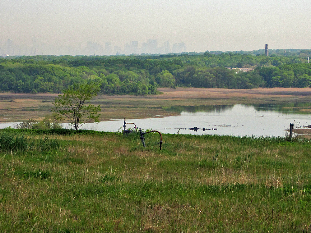



Clay Pit Ponds State Park Preserve
Park · 3.5 mi
State park in Staten Island, New York
William T. Davis Wildlife Refuge
Park · 3.2 mi
Protected area in New York, United States of America

6 more on the map.
Restaurants and cafes13




1 more on the map.
History
Carteret was originally created as the borough of Roosevelt on April 11, 1906, from portions of Woodbridge Township, based on the results of a referendum approved on May 22, 1906. The name was changed to Carteret as of November 7, 1922. The borough was also called Carteret during the period from December 19, 1921, to January 16, 1922. The borough was named after Sir George Carteret, one of the first proprietors of the province of New Jersey, and his son Philip Carteret, the first royal governor of New Jersey. Their name refers to the first village the De Carteret family had control over, namely Carteret in the French region of Normandy. They are also known to have controlled the island of Jersey, in the English Channel, hence the name of the State of New Jersey.
From the History section of Carteret, New Jersey on Wikipedia, under CC BY-SA 4.0.
Where to stay7
Holiday Inn Carteret Rahway
Motel and hotel · 0.6 mi
1000 Roosevelt Avenue, Carteret
Churches and places of worship24
First Presbyterian Church
Church · National Register of Historic Places · 2.9 mi
Trinity Episcopal Church
Church · National Register of Historic Places · 2.8 mi
Woodrow Methodist Church
Church · National Register of Historic Places · 3.1 mi
Saint Anthony of Padua Roman Catholic Church
Church · Catholic · 1.9 mi
436 Port Reading Avenue, Port Reading
Saint Demetrius Ukrainian Orthodox Cathedral
Church · Ukrainian Orthodox · 0.4 mi
Shopping2
Gas and EV charging6
Schools, colleges and libraries54
Academy For Urban Leadership Charter School
School · 5.0 mi
612 Amboy Ave, Perth Amboy
Admiral William F. Halsey Jr. Health & Public Safety Academy
School · 5.3 mi
641 South Street, Elizabeth
Map of Carteret
133 places. The map loads OpenStreetMap tiles when you open it.
Climate by month
Monthly table
| Month | High | Low | Rain | Snow |
|---|---|---|---|---|
| Jan | 40°F | 26°F | 3.4 in | 9.1 in |
| Feb | 43°F | 27°F | 3.0 in | 10.1 in |
| Mar | 51°F | 34°F | 4.1 in | 5.6 in |
| Apr | 63°F | 44°F | 3.9 in | 0.5 in |
| May | 73°F | 54°F | 4.0 in | 0.0 in |
| Jun | 82°F | 64°F | 4.3 in | 0.0 in |
| Jul | 87°F | 69°F | 4.7 in | 0.0 in |
| Aug | 85°F | 68°F | 4.2 in | 0.0 in |
| Sep | 78°F | 61°F | 3.8 in | 0.0 in |
| Oct | 66°F | 49°F | 3.8 in | 0.2 in |
| Nov | 55°F | 39°F | 3.3 in | 0.6 in |
| Dec | 45°F | 31°F | 4.1 in | 5.4 in |
U.S. Climate Normals 1991-2020 for Newark Intl Ap 72502 (7 mi away), NOAA NCEI.
People and cost of living
American Community Survey 5-year estimates, 2020-2024, U.S. Census Bureau. Estimates have margins of error, larger for small towns.
Disaster history
Middlesex County has had 17 federal disaster declarations since 2000, most often for hurricanes.
- 2021-09-05: Remnants Of Hurricane Ida (Hurricane)
- 2021-09-02: Remnants Of Hurricane Ida (Hurricane)
- 2020-03-25: Covid-19 Pandemic (Biological)
- 2020-03-13: Covid-19 (Biological)
- 2016-03-14: Severe Winter Storm And Snowstorm (Severe Storm)
- 2012-10-30: Hurricane Sandy (Hurricane)
OpenFEMA disaster declarations summaries.
Getting there and nearby towns
Linden Airport (LDJ) is the nearest airport with scheduled flights listed in OpenStreetMap, 2 miles away.
- Avenel 2 mi west, about 4 min by car
- Elizabeth 6 mi north, about 10 min by car
- Fords 6 mi southwest, about 9 min by car
- Roselle Park 6 mi north, about 10 min by car
- Bayonne 8 mi northeast, about 13 min by car
- Metuchen 8 mi west, about 12 min by car
- Newark 10 mi north, about 16 min by car
- Jersey City 12 mi northeast, about 20 min by car
- Short Hills 12 mi northwest, about 19 min by car
- New York 16 mi east, about 26 min by car
Drive times are estimates from straight-line distance, not routes.
Local news
Headlines from INDB, the NEMICO news database.
Reviews, tips and questions
Loading what members have shared...
Sources and licences
- NCES EDGE (Public domain): public schools
- NOAA NCEI U.S. Climate Normals 1991-2020 (Public domain): climate by month
- OpenFEMA (Public domain): disaster declarations
- OpenStreetMap contributors (ODbL 1.0): places, airports, map data
- U.S. Census Bureau (Public domain): population, income, housing, education, commute
- Wikidata (CC0 1.0): elevation, founding date, time zone, website, landmarks and historic places
- Wikimedia Commons (see each image): photos
- Wikipedia (CC BY-SA 4.0): overview and history text
Photo credits
- Carteret Waterfront, Jared Kofsky/Placenj.com, CC BY-SA 4.0
- Middlesex CR 604 eb past Tennyson Street, Carteret, NJ, Dec. 2024, Mr. Matté (if there is an issue with this image, contact me using this image's Commons talk page , my Commons user talk page , or my English Wikipedia user talk page ; I'll know about it a lot faster), CC BY-SA 4.0
- Carteret High School, NJ, Dec. 2024, Mr. Matté (if there is an issue with this image, contact me using this image's Commons talk page , my Commons user talk page , or my English Wikipedia user talk page ; I'll know about it a lot faster), CC BY-SA 4.0
- St. Mary's Ukrainian Catholic Church from Roosevelt Avenue, Carteret, NJ, Dec. 2024, Mr. Matté (if there is an issue with this image, contact me using this image's Commons talk page , my Commons user talk page , or my English Wikipedia user talk page ; I'll know about it a lot faster), CC BY-SA 4.0
- Louis Street wb, Carteret, NJ, Dec. 2024, Mr. Matté (if there is an issue with this image, contact me using this image's Commons talk page , my Commons user talk page , or my English Wikipedia user talk page ; I'll know about it a lot faster), CC BY-SA 4.0
- St. Demetrius Cathedral - Carteret, New Jersey 04, Farragutful, CC BY-SA 4.0
- St. Demetrius Cathedral - Carteret, New Jersey 01, Farragutful, CC BY-SA 4.0
- St. Demetrius Cathedral - Carteret, New Jersey 02, Farragutful, CC BY-SA 4.0
- St. Demetrius Cathedral - Carteret, New Jersey 05, Farragutful, CC BY-SA 4.0
- St. Demetrius Cathedral - Carteret, New Jersey 06, Farragutful, CC BY-SA 4.0
- St. Demetrius Cathedral - Carteret, New Jersey 03, Farragutful, CC BY-SA 4.0
- St. Demetrius Ukrainian Orthodox Cathedral and Rectory from Roosevelt Avenue, Carteret, NJ, Dec. 2024, Mr. Matté (if there is an issue with this image, contact me using this image's Commons talk page , my Commons user talk page , or my English Wikipedia user talk page ; I'll know about it a lot faster), CC BY-SA 4.0
- Middlesex CR 602 wb approaching NJ Turnpike, Carteret, NJ, Dec. 2024, Mr. Matté (if there is an issue with this image, contact me using this image's Commons talk page , my Commons user talk page , or my English Wikipedia user talk page ; I'll know about it a lot faster), CC BY-SA 4.0
- Carteret School District offices, Dec. 2024, Mr. Matté (if there is an issue with this image, contact me using this image's Commons talk page , my Commons user talk page , or my English Wikipedia user talk page ; I'll know about it a lot faster), CC BY-SA 4.0
- Carteret, NJ post office, Dec. 2024, Mr. Matté (if there is an issue with this image, contact me using this image's Commons talk page , my Commons user talk page , or my English Wikipedia user talk page ; I'll know about it a lot faster), CC BY-SA 4.0
- Carteret, NJ municipal building front and public library, Jan. 2025, Mr. Matté (if there is an issue with this image, contact me using this image's Commons talk page , my Commons user talk page , or my English Wikipedia user talk page ; I'll know about it a lot faster), CC BY-SA 4.0
- Carteret, NJ municipal building side view, Dec. 2024, Mr. Matté (if there is an issue with this image, contact me using this image's Commons talk page , my Commons user talk page , or my English Wikipedia user talk page ; I'll know about it a lot faster), CC BY-SA 4.0
- Carteret, NJ RWJ Wellness Center, Dec. 2024, Mr. Matté (if there is an issue with this image, contact me using this image's Commons talk page , my Commons user talk page , or my English Wikipedia user talk page ; I'll know about it a lot faster), CC BY-SA 4.0
- Middlesex CR 602 wb past Industrial Highway, Carteret, NJ, Dec. 2024, Mr. Matté (if there is an issue with this image, contact me using this image's Commons talk page , my Commons user talk page , or my English Wikipedia user talk page ; I'll know about it a lot faster), CC BY-SA 4.0
- 2021-05-25 17 21 24 View along the ramps from Interstate 95 (New Jersy Turnpike) to Middlesex County Route 602 (Roosevelt Avenue) in Carteret, Middlesex County, New Jersey, Famartin, CC BY-SA 4.0
- 2021-05-25 18 44 18 View east along Middlesex County Route 602 (Roosevelt Avenue) at the exit for Interstate 95 (New Jersey Turnpike) in Carteret, Middlesex County, New Jersey, Famartin, CC BY-SA 4.0
- 2018-05-21 09 00 44 View north along Interstate 95 (New Jersey Turnpike) just south of Exit 12 (Carteret, Rahway) in Carteret, Middlesex County, New Jersey, Famartin, CC BY-SA 4.0
- 2020-07-07 16 29 56 View north along Interstate 95 (New Jersey Turnpike) at Exit 12 (Carteret, Rahway) in Carteret, Middlesex County, New Jersey, Famartin, CC BY-SA 4.0
- 2021-05-26 11 38 18 View along the ramps connecting Middlesex County Route 602 (Roosevelt Avenue) to Interstate 95 (New Jersey Turnpike) in Carteret, Middlesex County, New Jersey, Famartin, CC BY-SA 4.0
- Middlesex CR 604 eb approaching Washington Avenue, Carteret, NJ, Dec. 2024, Mr. Matté (if there is an issue with this image, contact me using this image's Commons talk page , my Commons user talk page , or my English Wikipedia user talk page ; I'll know about it a lot faster), CC BY-SA 4.0
- Middlesex CR 602 eb in industrial section of Carteret, NJ, Dec. 2024, Mr. Matté (if there is an issue with this image, contact me using this image's Commons talk page , my Commons user talk page , or my English Wikipedia user talk page ; I'll know about it a lot faster), CC BY-SA 4.0
- 2021-05-25 18 39 20 View south along Interstate 95 (New Jersey Turnpike) from the overpass for Middlesex County Route 602 (Roosevelt Avenue) in Carteret, Middlesex County, New Jersey, Famartin, CC BY-SA 4.0
- 2021-05-25 18 40 31 View north along Interstate 95 (New Jersey Turnpike) from the overpass for Middlesex County Route 602 (Roosevelt Avenue) in Carteret, Middlesex County, New Jersey, Famartin, CC BY-SA 4.0
- 2025-09-15 16 15 14 Aerial view west up the Rahway River along the border of Carteret, Middlesex County and Linden, Union County in New Jersey, with Interstate 95 (New Jersey Turnpike) visible near..., Famartin, CC BY-SA 4.0
- 2021-05-26 10 54 20 View south along Interstate 95 (New Jersey Turnpike) from the overpass for the ramps to Middlesex County Route 602 (Roosevelt Avenue) in Carteret, Middlesex County, New Jersey, Famartin, CC BY-SA 4.0
- Middlesex CR 604 eb approaching Pershing Avenue, Carteret, NJ, Dec. 2024, Mr. Matté (if there is an issue with this image, contact me using this image's Commons talk page , my Commons user talk page , or my English Wikipedia user talk page ; I'll know about it a lot faster), CC BY-SA 4.0
- 2021-05-26 10 54 45 View north along Interstate 95 (New Jersey Turnpike) from the overpass for the ramps to Middlesex County Route 602 (Roosevelt Avenue) in Carteret, Middlesex County, New Jersey, Famartin, CC BY-SA 4.0
- Rahway theatre, PeterMac13, CC BY-SA 3.0
- First Presbyterian Church of Woodbridge, Perrycart, CC BY-SA 3.0
- Woodrow U Meth Ch Huguenot jeh, Jim.henderson, Public domain
- Trinity Episcopal Church, Woodbridge, NJ - south west view, Zeete, CC BY-SA 4.0
- MerchantsAndDrovers, KForce at en.wikipedia, CC BY-SA 3.0
- Barron Arts Center-Barron Library, Perrycart, CC BY-SA 3.0
- Kreischer House uncut jeh, Jim.henderson, CC0
- Downtown Manhattan view over Freshkills Park, H.L.I.T., CC BY 2.0


Page built October 30, 2026. Spotted a mistake? Tell us or suggest a place.