


Clifton Heights, Pennsylvania
Clifton Heights is a borough of 6,832 people in Delaware County, Pennsylvania, founded in 1885.
Why visit Clifton Heights
Townapedia lists 21 museums and landmarks, 21 parks and trails, 20 places to eat, 1 place to stay and 2 attractions in and around town.
Highlights include Lansdowne Theater, Farm Fresh, Collen Brook Farm and Darby Meeting.
July is the warmest month, with average highs of 88°F; January lows average 26°F, and about 23 inches of snow fall in a normal year.
Weather in Clifton Heights
Forecast from the National Weather Service. Full forecast
About Clifton Heights
Clifton Heights is a borough in Delaware County, Pennsylvania, United States, located on Darby Creek 5 miles (8 km) west of downtown Philadelphia. As of the 2020 census, the population was 6,863.
From the Wikipedia article Clifton Heights, Pennsylvania (this version), under CC BY-SA 4.0.
Things to do2


Farm Fresh
Farm and orchard · 1.0 mi
3801 Garrett Road, Drexel Hill
Mo-Su 09:00-18:00
Museums and landmarks21

Collen Brook Farm
Museum · National Register of Historic Places · 2.0 mi
Historic house in Pennsylvania, United States

Darby Meeting
Monument and historic site · National Register of Historic Places · 1.9 mi
Historic church in Pennsylvania, United States

Eden Cemetery
Monument and historic site · National Register of Historic Places · 1.3 mi
Cemetery in Collingdale, Pennsylvania, United States
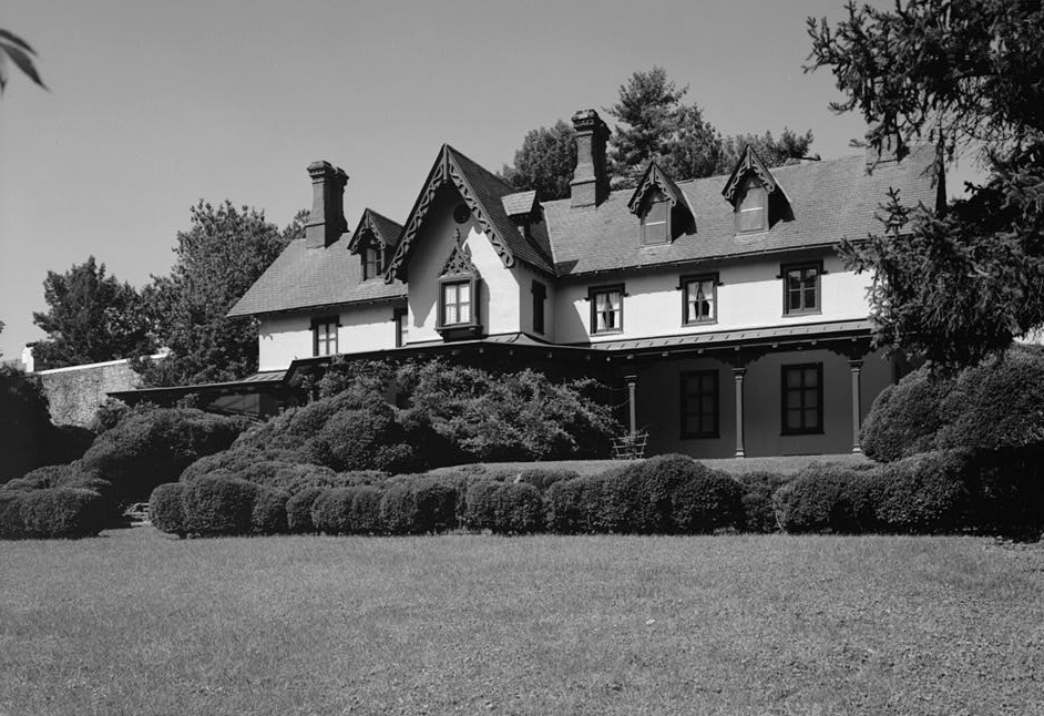
Grange Estate
Monument and historic site · National Register of Historic Places · 3.2 mi
Human settlement in Pennsylvania, United States of America

Henry Albertson Subdivision Historic District
Monument and historic site · National Register of Historic Places · 1.5 mi
United States historic place

John Bartram High School
Monument and historic site · National Register of Historic Places · 3.3 mi
High school in Philadelphia, Pennsylvania

John M. Patterson School
Monument and historic site · National Register of Historic Places · 3.3 mi
Public elementary school in Philadelphia, Pennsylvania

Lansdowne Park Historic District
Monument and historic site · National Register of Historic Places · 1.2 mi
Historic district in Pennsylvania, United States

Lansdowne Theatre
Cinema and theater · National Register of Historic Places · 1.4 mi
Theater in Lansdowne, Pennsylvania, United States

Llanerch Public School
Monument and historic site · National Register of Historic Places · 2.9 mi
Former school in Havertown, Pennsylvania

Lower Swedish Cabin
Monument and historic site · National Register of Historic Places
Building in Pennsylvania, United States


Ogden House
Monument and historic site · National Register of Historic Places · 3.2 mi
Listed on the National Register of Historic Places in Delaware County, Pennsylvania
9 more on the map.
Parks, trails and playgrounds21

Elson Glen Park
Park · 0.9 mi
Springfield Township Parks & Recreation Baseball/ Softball Field Basketball Court Playground Natural Environment Park Hiking Trails
Indian Rock Park
Park · 1.4 mi
Springfield Parks & Recreation Basketball Court Picnic Bench Playground Hiking Trails
9 more on the map.
Restaurants and cafes20

Chuck E. Cheese
Restaurant · Pizza · 1.5 mi
371 Baltimore Pike, Springfield
Mo-Th 10:00-21:00; Fr-Sa 10:00-22:00; Su 11:00-21:00
Fourno Pizza & Grill
Restaurant · Pizza · 1.5 mi
4306 Woodland Avenue, Drexel Hill
Mo-Th 10:00-22:00; Fr-Sa 10:00-23:00; Su 11:00-21:00

Miller's Ale House
Diner · American · 0.9 mi
18 Baltimore Pike, Springfield
Mo-Th,Su 11:30-24:00; Fr-Sa 11:30-25:00
Red Lobster
Restaurant · Seafood · 1.0 mi
1 Baltimore Pike, Springfield
Mo-Th,Su 11:00-22:00; Fr-Sa 11:00-23:00

Artillery Brewing Co.
Bar and pub · 1.4 mi
4221 Ferne Boulevard, Drexel Hill
Mo off; Tu-Th 12:00-01:00; Fr-Sa 12:00+, Su 12:00-22:00
Brothers Pizza & Restaurant
Restaurant · Pizza · 1.5 mi
700 Burmont Road, Drexel Hill
Mo-Th 11:00-22:00; Fr-Sa 11:00-23:00; Su 12:00-21:00

Ming’s Coffee & Tea
Cafe · 1.5 mi
730 Burmont Road, Drexel Hill
Mo off; Tu-We,Fr 06:30-13:30; Th,Sa-Su 07:00-13:30

Barone’s Ice Cream & Water Ice
Ice cream · 1.2 mi
534 Burmont Road, Drexel Hill

Arby's
Fast food · Sandwich · 0.6 mi
523 West Baltimore Avenue, Clifton Heights
Mo-Th,Su 10:00-23:00; Fr-Sa 10:00-24:00
8 more on the map.
History
The demographics of the greater Delaware Valley were significantly impacted by European colonization. By 1754, Native American populations in this region had been significantly displaced, however various uprisings of Native Americans were common throughout the region.
According to historian Freas B. Snyder, settlers set up a large tin kettle at a high point on what is now Oak Avenue, between Baltimore Avenue and Springfield Road. When hostile Indians were moving through the area, an alert would be sounded by banging on the tin kettle. This high point was called "Tin Kettle Hill" and would become a landmark used in three-point calculation surveying, along with a point in Central Philadelphia and a point on the Delaware River to the south.
The high point, Tin Kettle Hill, is believed to be the origin of "Heights" in the borough's name.
In 1839, Thomas Kent settled in the area and established the J. and T. Kent Company, which manufactured carpet yarn. The company's workers built houses throughout Clifton Heights, surrounding the Kent Mills factory. The original factory building and many of the millworker houses still exist today.
From the History section of Clifton Heights, Pennsylvania on Wikipedia, under CC BY-SA 4.0.
Where to stay1
Holiday Inn Hotel & Suites Philadelphia West at Drexel Hill
Motel and hotel · 1.4 mi
5400 Ferne Boulevard, Drexel Hill
Churches and places of worship9
Christ's Community Church
Church · Presbyterian Church Usa · 1.2 mi
337 Riverview Avenue, Drexel Hill
Drexel Hill United Methodist Church
Church · Methodist · 1.3 mi
600 Burmont Road, Drexel Hill
Holy Cross Parish
Church · Roman Catholic · 0.8 mi
651 East Springfield Road, Springfield
Saint Stephen's Episcopal Church
Church · Episcopal
199 West Baltimore Avenue, Clifton Heights
Shopping4
Gas and EV charging6
Schools, colleges and libraries59
Healthcare5
Medical Office Building
Clinic and pharmacy · 1.5 mi
1501 South Lansdowne Avenue, Darby
Map of Clifton Heights
148 places. The map loads OpenStreetMap tiles when you open it.
Climate by month
Monthly table
| Month | High | Low | Rain | Snow |
|---|---|---|---|---|
| Jan | 41°F | 26°F | 3.1 in | 7.1 in |
| Feb | 44°F | 28°F | 2.8 in | 8.4 in |
| Mar | 53°F | 34°F | 4.0 in | 3.6 in |
| Apr | 65°F | 44°F | 3.5 in | 0.3 in |
| May | 74°F | 54°F | 3.3 in | 0.0 in |
| Jun | 83°F | 64°F | 4.0 in | 0.0 in |
| Jul | 88°F | 70°F | 4.4 in | 0.0 in |
| Aug | 86°F | 68°F | 4.3 in | 0.0 in |
| Sep | 79°F | 61°F | 4.4 in | 0.0 in |
| Oct | 67°F | 49°F | 3.5 in | 0.0 in |
| Nov | 56°F | 39°F | 2.9 in | 0.2 in |
| Dec | 46°F | 31°F | 4.0 in | 3.5 in |
U.S. Climate Normals 1991-2020 for Philadelphia Intl Ap 72408 (5 mi away), NOAA NCEI.
People and cost of living
American Community Survey 5-year estimates, 2020-2024, U.S. Census Bureau. Estimates have margins of error, larger for small towns.
Disaster history
Delaware County has had 15 federal disaster declarations since 2000, most often for hurricanes.
- 2021-09-10: Remnants Of Hurricane Ida (Hurricane)
- 2020-03-30: Covid-19 Pandemic (Biological)
- 2020-03-13: Covid-19 (Biological)
- 2014-02-06: Severe Winter Storm (Severe Ice Storm)
- 2012-10-29: Hurricane Sandy (Hurricane)
- 2011-09-12: Tropical Storm Lee (Flood)
OpenFEMA disaster declarations summaries.
Getting there and nearby towns
Philadelphia Essington Seaplane Base (PSQ) is the nearest airport with scheduled flights listed in OpenStreetMap, 5 miles away.
- Aldan 1 mi southeast, about 1 min by car
- Lansdowne 1 mi northeast, about 2 min by car
- Drexel Hill 1 mi north, about 2 min by car
- Darby 2 mi east, about 3 min by car
- Yeadon 2 mi east, about 4 min by car
- Millbourne 3 mi northeast, about 5 min by car
- Broomall 4 mi northwest, about 7 min by car
- Ardmore 5 mi north, about 8 min by car
- Rose Valley 5 mi southwest, about 9 min by car
- Haverford College 6 mi north, about 9 min by car
Drive times are estimates from straight-line distance, not routes.
Local news
Headlines from INDB, the NEMICO news database.
Reviews, tips and questions
Loading what members have shared...
Sources and licences
- NCES EDGE (Public domain): public schools
- NOAA NCEI U.S. Climate Normals 1991-2020 (Public domain): climate by month
- OpenFEMA (Public domain): disaster declarations
- OpenStreetMap contributors (ODbL 1.0): places, airports, map data
- U.S. Census Bureau (Public domain): population, income, housing, education, commute
- Wikidata (CC0 1.0): elevation, founding date, time zone, website, landmarks and historic places
- Wikimedia Commons (see each image): photos
- Wikipedia (CC BY-SA 4.0): overview and history text
Photo credits
- Clifton-Aldan Station, Spmarshall42 at English Wikipedia, CC BY 3.0
- CollenbrookFarm, User:Smallbones on English Wikipedia., Public domain
- Turret w house 35 West Lansdowne HD, Smallbones, CC BY-SA 3.0
- LansdowneTheatre, User:Smallbones on English Wikipedia., Public domain
- Llanerch school, EytanMelech, CC BY-SA 4.0
- Albertson 85 Greenway DelCo PA, Smallbones, CC BY-SA 3.0
- 20thCenturyClub, Smallbones at English Wikipedia, Public domain
- Bartram HS Philly, Smallbones, Public domain
- GrangeEstate, Unknown (US government). Original uploader was BillFlis at en.wikipedia, Public domain
- Ogden House, Abby Norling-Ruggles, CC BY-SA 3.0
- Walnut Park Plaza A, Smallbones, Public domain
- Patterson School Philly, Smallbones, Public domain
- TB Read School Philly, Smallbones, Public domain
- Tilden Jr HS 2, Smallbones, Public domain
- Octavius Catto grave, Lblanchard, CC BY-SA 2.0
- Sellers Hall Delco, Smallbones, CC0
- LowerSwedishCabin, User:Smallbones on English Wikipedia., Public domain
- DarbyMeeting2, Smallbones at en.wikipedia, Public domain
- Catherine School SW Philly, Smallbones, Public domain
- City of Conquerors, Philadelphia corner, waarmstr, Public domain
- St. Philomena Lansdown PA, Smallbones, CC0


Page built October 30, 2026. Spotted a mistake? Tell us or suggest a place.