


Lansdowne, Pennsylvania
Lansdowne is a borough of 11,122 people in Delaware County, Pennsylvania, founded in 1893.
Why visit Lansdowne
Townapedia lists 43 museums and landmarks, 26 parks and trails, 33 places to eat and 4 attractions in and around town.
Highlights include Fresh for All: Upper Darby, Nixon Theatre, Breslyn Apartments and City Line Avenue Bridge.
July is the warmest month, with average highs of 88°F; January lows average 26°F, and about 23 inches of snow fall in a normal year.
Weather in Lansdowne
Forecast from the National Weather Service. Full forecast
About Lansdowne
Lansdowne is a borough in Delaware County, Pennsylvania, United States, located 6 miles (10 km) southwest of Center City Philadelphia. It was named for the Marquess of Lansdowne. As of the 2020 census, Lansdowne had a population of 11,107.
From the Wikipedia article Lansdowne, Pennsylvania (this version), under CC BY-SA 4.0.
Things to do4

Fresh for All: Upper Darby
Farm and orchard · 1.3 mi
Free produce distributed weekly, weather permitting. No income restrictions. Bring your own bags.
7240 Walnut Street, Upper Darby
Fr 09:30-10:30

Nixon Theatre
Cinema and theater · 3.0 mi
Former movie theater in Philadelphia, Pennsylvania, United States
Farm Fresh
Farm and orchard · 1.2 mi
3801 Garrett Road, Drexel Hill
Mo-Su 09:00-18:00
Museums and landmarks43

Breslyn Apartments
Monument and historic site · National Register of Historic Places · 3.4 mi
Building in Pennsylvania, United States

City Line Avenue Bridge
Bridge · National Register of Historic Places · 3.2 mi
Bridge in United States of America

Collen Brook Farm
Museum · National Register of Historic Places · 2.5 mi
Historic house in Pennsylvania, United States

Darby Meeting
Monument and historic site · National Register of Historic Places · 1.5 mi
Historic church in Pennsylvania, United States

Eden Cemetery
Monument and historic site · National Register of Historic Places · 1.3 mi
Cemetery in Collingdale, Pennsylvania, United States

George L. Brooks School
Monument and historic site · National Register of Historic Places · 2.9 mi
School building in Philadelphia, Pennsylvania
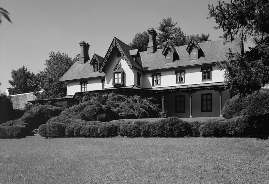
Grange Estate
Monument and historic site · National Register of Historic Places · 2.5 mi
Human settlement in Pennsylvania, United States of America

Hanson Haines House
Monument and historic site · National Register of Historic Places · 3.2 mi
Historic house in Pennsylvania, United States

Hardy Williams Academy
Monument and historic site · National Register of Historic Places · 2.6 mi
Charter school in Philadelphia, Pennsylvania

Henry Albertson Subdivision Historic District
Monument and historic site · National Register of Historic Places
United States historic place

Henry C. Lea School
Monument and historic site · National Register of Historic Places · 3.3 mi
Public elementary school in Philadelphia, Pennsylvania


Holmes Junior High School
Monument and historic site · National Register of Historic Places · 2.7 mi
High school in Pennsylvania, United States
31 more on the map.
Parks, trails and playgrounds26

Malcolm X Park
Park · 2.8 mi
Urban park in West Philadelphia named for Malcolm X
Morris Park, Philadelphia
Park · 2.9 mi
City park in Overbrook, Philadelphia
14 more on the map.
Restaurants and cafes33

Casey's
Diner · American · 1.5 mi
812 North Lansdowne Avenue, Drexel Hill
Mo-Sa 11:00-11:00; Su 11:00-22:00


Starbucks
Cafe · Coffee Shop · 1.4 mi
1891 South State Road, Upper Darby
Mo 06:00-18:00; Tu-Fr 05:00-21:00; Sa 05:30-21:00; Su 05:30-20:00

Royal Diner & Bakery
Restaurant · 0.6 mi
106 East Baltimore Avenue, Lansdowne
Mo-Sa 00:00-24:00; Su 00:00-21:00
Barone’s Ice Cream & Water Ice
Ice cream · 1.5 mi
534 Burmont Road, Drexel Hill

21 more on the map.
Churches and places of worship15
Wharton Street Memorial Methodist Episcopal Church
Church · National Register of Historic Places · 2.5 mi
Blessed Virgin Mary Church
Church · Roman Catholic · 1.5 mi
1101 Main Street, Darby
Christ's Community Church
Church · Presbyterian Church Usa · 0.9 mi
337 Riverview Avenue, Drexel Hill
Knox Orthodox Presbyterian Church
Church · Presbyterian · 0.6 mi
311 North Lansdowne Avenue, Lansdowne
Christ Lutheran Church Upper Darby
Church · Evangelical Lutheran · 1.3 mi
7240 Walnut Street, Upper Darby
Drexel Hill United Methodist Church
Church · Methodist · 1.5 mi
600 Burmont Road, Drexel Hill
Shopping10
The Fresh Grocer of Upper Darby
Grocery · 1.3 mi
421 South 69th Street, Upper Darby
Gas and EV charging9
Schools, colleges and libraries66
Monsignor Bonner and Archbishop Prendergast Catholic High School
School · Catholic · 0.9 mi
403 North Lansdowne Avenue, Drexel Hill
Healthcare4
Medical Office Building
Clinic and pharmacy · 1.0 mi
1501 South Lansdowne Avenue, Darby
Map of Lansdowne
210 places. The map loads OpenStreetMap tiles when you open it.
Climate by month
Monthly table
| Month | High | Low | Rain | Snow |
|---|---|---|---|---|
| Jan | 41°F | 26°F | 3.1 in | 7.1 in |
| Feb | 44°F | 28°F | 2.8 in | 8.4 in |
| Mar | 53°F | 34°F | 4.0 in | 3.6 in |
| Apr | 65°F | 44°F | 3.5 in | 0.3 in |
| May | 74°F | 54°F | 3.3 in | 0.0 in |
| Jun | 83°F | 64°F | 4.0 in | 0.0 in |
| Jul | 88°F | 70°F | 4.4 in | 0.0 in |
| Aug | 86°F | 68°F | 4.3 in | 0.0 in |
| Sep | 79°F | 61°F | 4.4 in | 0.0 in |
| Oct | 67°F | 49°F | 3.5 in | 0.0 in |
| Nov | 56°F | 39°F | 2.9 in | 0.2 in |
| Dec | 46°F | 31°F | 4.0 in | 3.5 in |
U.S. Climate Normals 1991-2020 for Philadelphia Intl Ap 72408 (6 mi away), NOAA NCEI.
People and cost of living
American Community Survey 5-year estimates, 2020-2024, U.S. Census Bureau. Estimates have margins of error, larger for small towns.
Disaster history
Delaware County has had 15 federal disaster declarations since 2000, most often for hurricanes.
- 2021-09-10: Remnants Of Hurricane Ida (Hurricane)
- 2020-03-30: Covid-19 Pandemic (Biological)
- 2020-03-13: Covid-19 (Biological)
- 2014-02-06: Severe Winter Storm (Severe Ice Storm)
- 2012-10-29: Hurricane Sandy (Hurricane)
- 2011-09-12: Tropical Storm Lee (Flood)
OpenFEMA disaster declarations summaries.
Getting there and nearby towns
Philadelphia International Airport (PHL) is the nearest airport with scheduled flights listed in OpenStreetMap, 5 miles away.
- Drexel Hill 2 mi west, about 3 min by car
- Darby 2 mi southeast, about 3 min by car
- Ardmore 4 mi north, about 7 min by car
- Broomall 5 mi northwest, about 7 min by car
- Bala Cynwyd 6 mi northeast, about 9 min by car
- Chester 8 mi southwest, about 13 min by car
- Philadelphia 9 mi northeast, about 14 min by car
- Camden 9 mi east, about 14 min by car
- Gloucester City 9 mi east, about 15 min by car
- Woodbury 10 mi southeast, about 16 min by car
Drive times are estimates from straight-line distance, not routes.
Local news
Headlines from INDB, the NEMICO news database.
Reviews, tips and questions
Loading what members have shared...
Sources and licences
- NCES EDGE (Public domain): public schools
- NOAA NCEI U.S. Climate Normals 1991-2020 (Public domain): climate by month
- OpenFEMA (Public domain): disaster declarations
- OpenStreetMap contributors (ODbL 1.0): places, airports, map data
- U.S. Census Bureau (Public domain): population, income, housing, education, commute
- Wikidata (CC0 1.0): elevation, founding date, time zone, website, landmarks and historic places
- Wikimedia Commons (see each image): photos
- Wikipedia (CC BY-SA 4.0): overview and history text
Photo credits
- LansdowneTheatre, User:Smallbones on English Wikipedia., Public domain
- 5 Owen Ave Lansdowne HD, Smallbones, CC BY-SA 3.0
- Turret 35 West Lansdowne HD, Smallbones, CC BY-SA 3.0
- Find the cat 65 Runnemede Lansdowne HD, Smallbones, CC BY-SA 3.0
- St Johns Episc gateway Lansdowne HD, Smallbones, CC BY-SA 3.0
- St John Episc Lansdowne HD A, Smallbones, CC BY-SA 3.0
- St John Episc Lansdowne HD B, Smallbones, CC BY-SA 3.0
- Built 1732 Owen Ave. Lansdowne HD, Smallbones, CC BY-SA 3.0
- 75 LaCrosse Lansdowne HD, Smallbones, CC BY-SA 3.0
- 53 Windmere Lansdowne HD, Smallbones, CC BY-SA 3.0
- 63 65 Owen Ave Lansdowne HD, Smallbones, CC BY-SA 3.0
- Stratford n Owen Lansdowne HD, Smallbones, CC BY-SA 3.0
- St John Episc Lansdowne HD C, Smallbones, CC BY-SA 3.0
- 59 61 Owen Ave Lansdowne HD, Smallbones, CC BY-SA 3.0
- 47 Runnemede Lansdowne HD, Smallbones, CC BY-SA 3.0
- 73 LaCrossse Lansdowne HD, Smallbones, CC BY-SA 3.0
- Turret w house 35 West Lansdowne HD, Smallbones, CC BY-SA 3.0
- 47 49 W LaCrosse Lansdowne HD, Smallbones, CC BY-SA 3.0
- 11 E Greenwood Albertson Lansdowne PA, Smallbones, CC BY-SA 3.0
- 23 E Greenwood Albertson Lansdowne PA, Smallbones, CC BY-SA 3.0
- 51 E Greenwood Albertson Lansdowne PA, Smallbones, CC BY-SA 3.0
- 19 E Greenwood Albertson Lansdowne pA, Smallbones, CC BY-SA 3.0
- NitreHall, User:Smallbones on English Wikipedia., Public domain
- Breslyn apts Philly, Smallbones, Public domain
- CollenbrookFarm, User:Smallbones on English Wikipedia., Public domain
- Overbrook School 1913, Smallbones, Public domain
- Robesonhouse.Philadelphia, Ekem, CC BY-SA 3.0
- Brooks School Philly, Smallbones, Public domain
- Shaw School Philly, Smallbones, Public domain
- Holmes School Philly, Smallbones, Public domain
- City Line Bridge Philly, Smallbones, Public domain
- Montevista apts, Smallbones, Public domain
- Lea School Philly, Smallbones, Public domain
- GrangeEstate, Unknown (US government). Original uploader was BillFlis at en.wikipedia, Public domain
- Haines tower W Philly, Smallbones, Public domain
- Patterson School Philly, Smallbones, Public domain
- Octavius Catto grave, Lblanchard, CC BY-SA 2.0
- LowerSwedishCabin, User:Smallbones on English Wikipedia., Public domain
- DarbyMeeting2, Smallbones at en.wikipedia, Public domain
- WTP A17 youcanlookitup 2, See below, CC BY-SA 3.0


Page built October 30, 2026. Spotted a mistake? Tell us or suggest a place.