


Yeadon, Pennsylvania
Yeadon is a borough of 12,181 people in Delaware County, Pennsylvania, founded in 1893.
Why visit Yeadon
Townapedia lists 60 museums and landmarks, 37 parks and trails, 70 places to eat and 13 attractions in and around town.
Highlights include B&O Railroad Bridge, Christian to Crescent Trail Connector bridge, John Bartram High School and John M. Patterson School.
July is the warmest month, with average highs of 88°F; January lows average 26°F, and about 23 inches of snow fall in a normal year.
Weather in Yeadon
Forecast from the National Weather Service. Full forecast
About Yeadon
Yeadon is a borough in Delaware County, Pennsylvania, United States. It borders the city of Philadelphia. As of the 2020 census, Yeadon had a population of 12,054.
From the Wikipedia article Yeadon, Pennsylvania (this version), under CC BY-SA 4.0.
Things to do13

B&O Railroad Bridge
Bridge · 2.5 mi
Bridge in Grays Ferry neighborhood in Philadelphia, Pennsylvania
Christian to Crescent Trail Connector bridge
Bridge · 3.2 mi
Bridge in Philadelphia
George C. Platt Bridge
Bridge · 3.2 mi
Bridge in Philadelphia, Pennsylvania
Gray's Ferry Bridge
Bridge · 2.6 mi
Bridge in Philadelphia, Pennsylvania, United States of America

Nixon Theatre
Cinema and theater · 2.3 mi
Former movie theater in Philadelphia, Pennsylvania, United States
Philadelphia, Wilmington and Baltimore Railroad Bridge No. 1
Bridge · 2.6 mi
Railroad bridge in Philadelphia, Pennsylvania
Schuylkill Arsenal Railroad Bridge
Bridge · 3.3 mi
Bridge in in Philadelphia, Pennsylvania
Schuylkill Expressway Bridge
Bridge · 3.2 mi
Bridge in United States of America

The Wharton School
School · 3.2 mi
Business school of the University of Pennsylvania
University of Pennsylvania
School · 3.4 mi
Private research university in Philadelphia, Pennsylvania, United States
University of the Sciences in Philadelphia
School · 2.6 mi
United States university (1998-2022)

1 more on the map.
Museums and landmarks60

John Bartram High School
Monument and historic site · National Register of Historic Places · 1.2 mi
High school in Philadelphia, Pennsylvania

John M. Patterson School
Monument and historic site · National Register of Historic Places · 1.4 mi
Public elementary school in Philadelphia, Pennsylvania
7001 Buist Avenue, Philadelphia

Anthony Wayne School
Monument and historic site · National Register of Historic Places · 3.3 mi
Historic former school in Philadelphia, Pennsylvania
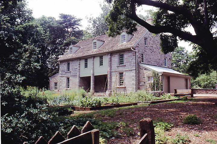
Bartram's Garden
Monument and historic site · National Register of Historic Places · 2.1 mi
Historic house in Pennsylvania, United States
Bell Telephone Exchange Building
Monument and historic site · National Register of Historic Places · 3.1 mi
Building in Pennsylvania, United States

Breslyn Apartments
Monument and historic site · National Register of Historic Places · 2.5 mi
Building in Pennsylvania, United States

Charles Y. Audenried Junior High School
Monument and historic site · National Register of Historic Places · 2.8 mi
High school in Pennsylvania, United States
Chestnut Hall
Monument and historic site · National Register of Historic Places · 3.2 mi
Historic site in Philadelphia, PA
College Hall
Monument and historic site · National Register of Historic Places · 3.4 mi
Philadelphia, listed on the NRHP in West Philadelphia
Darby Meeting
Monument and historic site · National Register of Historic Places · 1.0 mi
Historic church in Pennsylvania, United States
Drexel Development Historic District
Monument and historic site · National Register of Historic Places · 2.9 mi
Historic district in Pennsylvania, United States


Eden Cemetery
Monument and historic site · National Register of Historic Places · 1.3 mi
Cemetery in Collingdale, Pennsylvania, United States
48 more on the map.
Parks, trails and playgrounds37

Clark Park
Park · 2.5 mi
Municipal park in West Philadelphia, Pennsylvania
Malcolm X Park
Park · 2.0 mi
Urban park in West Philadelphia named for Malcolm X
Morris Park, Philadelphia
Park · 3.3 mi
City park in Overbrook, Philadelphia

Jack Frazier Memorial Tot Lot
Playground · 1.5 mi
102 Front Street, Colwyn
Mo-Su 08:00-22:30
25 more on the map.
Restaurants and cafes70

Emma's Liberian Kitchen
Restaurant · 1.0 mi
7201 Woodland Avenue, Philadelphia
Mo 09:00-20:00; Tu-Sa 08:00-20:00; Su 12:00-16:00
Royal Diner & Bakery
Restaurant · 0.8 mi
106 East Baltimore Avenue, Lansdowne
Mo-Sa 00:00-24:00; Su 00:00-21:00
Ackee Tree
Restaurant · Jamaican · 1.0 mi
6631 Woodland Avenue, Philadelphia
Mo-Th,Su 11:00-21:00; Fr-Sa 11:00-21:30
JD African Restaurant
Restaurant · African · 1.1 mi
880 Main Street, Darby
Mo-Sa 11:30-21:30
Makeneh Kamara African Food Market
Restaurant · 1.1 mi
6526 Woodland Avenue, Philadelphia
Mo-Sa 08:30-20:00; Su 08:30-18:30
China House
Restaurant · Chinese · 1.2 mi
1944 South 60th Street, Philadelphia
Susanna African Kitchen
Restaurant · African · 1.1 mi
6521 Woodland Avenue, Philadelphia
Top Taste
Restaurant · Jamaican · 1.4 mi
7252 Elmwood Avenue, Philadelphia
58 more on the map.
History
Yeadon and its surrounding land were once part of New Sweden. Yeadon was then known as the Swedish settlement of Mölndal (founded in 1645). The borough of Yeadon took its name from Yeadon Manor, which takes its name from Yeadon, West Yorkshire, in England.
In the years following World War II, Yeadon became home to a large middle-class African American community. In 1959, the borough's Nile Swim Club became the first swim club owned and operated by African Americans in the United States.
From the History section of Yeadon, Pennsylvania on Wikipedia, under CC BY-SA 4.0.
Churches and places of worship72
Saint James Kingsessing Episcopal Church
Church · Episcopal · 1.0 mi
6838 Woodland Avenue, Philadelphia
Berry Long Memorial Methodist Church
Church · Methodist · 1.3 mi
1737 South 58th Street, Philadelphia
Blessed Virgin Mary Church
Church · Roman Catholic · 0.9 mi
1101 Main Street, Darby
St. Cyprian Roman Catholic Church
Church · Roman Catholic · 1.5 mi
6213 Cedar Avenue, Philadelphia
Shopping13
The Fresh Grocer of Upper Darby
Grocery · 1.5 mi
421 South 69th Street, Upper Darby
Gas and EV charging11
Schools, colleges and libraries85
Alliance For Progress Cs
School · 5.7 mi
1821-39 Cecil B Moore Avenue, Philadelphia
Healthcare8
Medical Office Building
Clinic and pharmacy · 0.9 mi
1501 South Lansdowne Avenue, Darby
Map of Yeadon
250 places. The map loads OpenStreetMap tiles when you open it.
Climate by month
Monthly table
| Month | High | Low | Rain | Snow |
|---|---|---|---|---|
| Jan | 41°F | 26°F | 3.1 in | 7.1 in |
| Feb | 44°F | 28°F | 2.8 in | 8.4 in |
| Mar | 53°F | 34°F | 4.0 in | 3.6 in |
| Apr | 65°F | 44°F | 3.5 in | 0.3 in |
| May | 74°F | 54°F | 3.3 in | 0.0 in |
| Jun | 83°F | 64°F | 4.0 in | 0.0 in |
| Jul | 88°F | 70°F | 4.4 in | 0.0 in |
| Aug | 86°F | 68°F | 4.3 in | 0.0 in |
| Sep | 79°F | 61°F | 4.4 in | 0.0 in |
| Oct | 67°F | 49°F | 3.5 in | 0.0 in |
| Nov | 56°F | 39°F | 2.9 in | 0.2 in |
| Dec | 46°F | 31°F | 4.0 in | 3.5 in |
U.S. Climate Normals 1991-2020 for Philadelphia Intl Ap 72408 (5 mi away), NOAA NCEI.
People and cost of living
American Community Survey 5-year estimates, 2020-2024, U.S. Census Bureau. Estimates have margins of error, larger for small towns.
Disaster history
Delaware County has had 15 federal disaster declarations since 2000, most often for hurricanes.
- 2021-09-10: Remnants Of Hurricane Ida (Hurricane)
- 2020-03-30: Covid-19 Pandemic (Biological)
- 2020-03-13: Covid-19 (Biological)
- 2014-02-06: Severe Winter Storm (Severe Ice Storm)
- 2012-10-29: Hurricane Sandy (Hurricane)
- 2011-09-12: Tropical Storm Lee (Flood)
OpenFEMA disaster declarations summaries.
Getting there and nearby towns
Philadelphia International Airport (PHL) is the nearest airport with scheduled flights listed in OpenStreetMap, 4 miles away.
- Darby 1 mi southwest, about 1 min by car
- Lansdowne 1 mi northwest, about 2 min by car
- Drexel Hill 3 mi northwest, about 5 min by car
- Ardmore 5 mi northwest, about 9 min by car
- Bala Cynwyd 6 mi north, about 9 min by car
- Broomall 6 mi northwest, about 10 min by car
- Philadelphia 8 mi northeast, about 13 min by car
- Camden 8 mi east, about 12 min by car
- Gloucester City 8 mi east, about 12 min by car
- Chester 9 mi southwest, about 14 min by car
Drive times are estimates from straight-line distance, not routes.
Local news
Headlines from INDB, the NEMICO news database.
Reviews, tips and questions
Loading what members have shared...
Sources and licences
- NCES EDGE (Public domain): public schools
- NOAA NCEI U.S. Climate Normals 1991-2020 (Public domain): climate by month
- OpenFEMA (Public domain): disaster declarations
- OpenStreetMap contributors (ODbL 1.0): places, airports, map data
- U.S. Census Bureau (Public domain): population, income, housing, education, commute
- Wikidata (CC0 1.0): elevation, founding date, time zone, website, landmarks and historic places
- Wikimedia Commons (see each image): photos
- Wikipedia (CC BY-SA 4.0): overview and history text
Photo credits
- Downtown Yeadon, PA, Smallbones, CC0
- Yeadon, PA post office, Aug. 2025, Mr. Matté (if there is an issue with this image, contact me using this image's Commons talk page , my Commons user talk page , or my English Wikipedia user talk page ; I'll know about it a lot faster), CC BY-SA 4.0
- 2022-10-16 12 20 07 View south along U.S. Route 13 (Church Lane) just south of Baily Road in Yeadon, Delaware County, Pennsylvania, Famartin, CC BY-SA 4.0
- Yeadon, PA Fire Department and Borough Hall, Aug. 2025, Mr. Matté (if there is an issue with this image, contact me using this image's Commons talk page , my Commons user talk page , or my English Wikipedia user talk page ; I'll know about it a lot faster), CC BY-SA 4.0
- 2022-10-16 15 06 52 View north along U.S. Route 13 (Church Lane) just south of Myra Avenue in Yeadon, Delaware County, Pennsylvania, Famartin, CC BY-SA 4.0
- 2022-10-16 12 24 49 View south along U.S. Route 13 (MacDade Boulevard) just south of Rundale Avenue in Yeadon, Delaware County, Pennsylvania, Famartin, CC BY-SA 4.0
- 2022-10-16 15 03 50 View north along U.S. Route 13 (MacDade Boulevard) just south of Church Lane in Yeadon, Delaware County, Pennsylvania, Famartin, CC BY-SA 4.0
- US 13 sb entering Yeadon, PA, Aug. 2025, Mr. Matté (if there is an issue with this image, contact me using this image's Commons talk page , my Commons user talk page , or my English Wikipedia user talk page ; I'll know about it a lot faster), CC BY-SA 4.0
- SEPTA Yeadon Loop entrance, July 2003, David Wilson from Oak Park, Illinois, USA, CC BY 2.0
- 2022-10-16 15 15 08 View north along U.S. Route 13 (Baltimore Avenue) just south of Cobbs Creek in Yeadon, Delaware County, Pennsylvania, Famartin, CC BY-SA 4.0
- Bartram HS Philly, Smallbones, Public domain
- Patterson School Philly, Smallbones, Public domain
- WoodlandTerrace, Jack Boucher, Public domain
- Breslyn apts Philly, Smallbones, Public domain
- HABSWoodlandsColor, Joseph Elliott, HABS photographer, Public domain
- WTP A17 youcanlookitup 2, See below, CC BY-SA 3.0
- Turret w house 35 West Lansdowne HD, Smallbones, CC BY-SA 3.0
- Robesonhouse.Philadelphia, Ekem, CC BY-SA 3.0
- LansdowneTheatre, User:Smallbones on English Wikipedia., Public domain
- Brooks School Philly, Smallbones, Public domain
- Alcorn School Philly, Smallbones, Public domain
- CY Audenreid HS Philly, Smallbones, Public domain
- Pinehurst apts W Philly, Smallbones, Public domain
- University of Pennsylvania College Hall, R. Newell & Sons, Public domain
- Albertson 85 Greenway DelCo PA, Smallbones, CC BY-SA 3.0
- WHARTON STREET MEMORIAL METHODIST EPISCOPAL CHURCH, WEST PHILADELPHIA,PA, JERRYE & ROY KLOTZ, M.D., CC BY-SA 4.0
- 20thCenturyClub, Smallbones at English Wikipedia, Public domain
- Shaw School Philly, Smallbones, Public domain
- Holmes School Philly, Smallbones, Public domain
- Montevista apts, Smallbones, Public domain
- Lea School Philly, Smallbones, Public domain
- Haines tower W Philly, Smallbones, Public domain
- Walnut Park Plaza A, Smallbones, Public domain
- TB Read School Philly, Smallbones, Public domain
- Tilden Jr HS 2, Smallbones, Public domain
- Regent Rennoc Court, Smallbones, Public domain
- Octavius Catto grave, Lblanchard, CC BY-SA 2.0
- Hamilton Family Estate W Philly, Smallbones, Public domain
- Bartram House May 2002c, Jtfry at English Wikipedia, CC BY 3.0
- Sellers Hall Delco, Smallbones, CC0


Page built October 30, 2026. Spotted a mistake? Tell us or suggest a place.