


Cochituate, Massachusetts
Cochituate is a community of 6,471 people in Middlesex County, Massachusetts.
Why visit Cochituate
Townapedia lists 27 museums and landmarks, 43 parks and trails, 29 places to eat and 5 attractions in and around town.
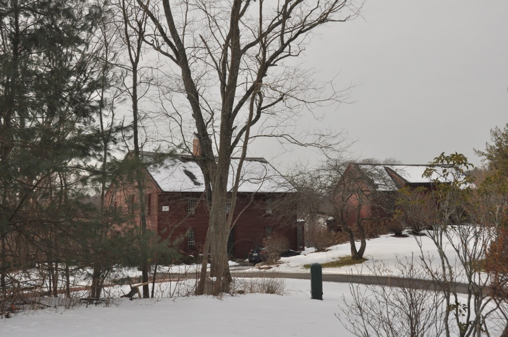
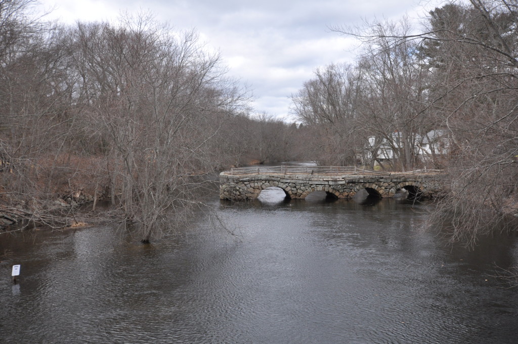
Highlights include Old Town Bridge, Stone's Bridge, Abel Allen House and Bogle-Walker House.
July is the warmest month, with average highs of 82°F; January lows average 18°F, and about 46 inches of snow fall in a normal year.
Weather in Cochituate
Forecast from the National Weather Service. Full forecast
About Cochituate
Cochituate (; koh-CHIT-choo-it) is a census-designated place (CDP) in the town of Wayland in Middlesex County, Massachusetts, United States. The population was 6,927 at the 2020 census, out of 13,943 in the entire town of Wayland.
From the Wikipedia article Cochituate, Massachusetts (this version), under CC BY-SA 4.0.
Things to do5

Old Town Bridge
Bridge · National Register of Historic Places · 3.6 mi
Listed on the National Register of Historic Places in Middlesex County, Massachusetts
Stone's Bridge
Bridge · National Register of Historic Places · 2.3 mi
Bridge in Massachusetts

Wellesley College
School · 3.3 mi
Private women's liberal arts college in Massachusetts

Museums and landmarks27

Abel Allen House
Monument and historic site · National Register of Historic Places · 3.1 mi
House in Weston, Massachusetts

Bogle-Walker House
Monument and historic site · National Register of Historic Places · 3.6 mi
Building in Massachusetts, United States

Boston Post Road Historic District
Monument and historic site · National Register of Historic Places · 3.5 mi
Listed on the NRHP in Massachusetts

Case's Corner Historic District
Monument and historic site · National Register of Historic Places · 3.5 mi
Historic district in Massachusetts, United States

Clark Houses
Monument and historic site · National Register of Historic Places · 3.2 mi
Building in Massachusetts, United States

Glen Road Historic District
Monument and historic site · National Register of Historic Places · 3.3 mi
Historic district in Massachusetts, United States

Harrington House
Monument and historic site · National Register of Historic Places · 2.2 mi
Historic building in Weston, Massachusetts

Henderson House
Monument and historic site · National Register of Historic Places · 2.8 mi
Historic house in Weston, Massachusetts, United States

Hopestill Bent Tavern
Monument and historic site · National Register of Historic Places · 1.3 mi
Building in Massachusetts, United States

Lake Cochituate Dam
Monument and historic site · National Register of Historic Places · 1.9 mi
Dam in Middlesex County, Massachusetts, United States of America


Natick Center Historic District
Monument and historic site · National Register of Historic Places · 3.0 mi
Historic district in Massachusetts, United States
Noyes-Parris House
Monument and historic site · National Register of Historic Places · 1.6 mi
Building in Massachusetts, United States
15 more on the map.
Parks, trails and playgrounds43





31 more on the map.
Restaurants and cafes29




17 more on the map.
Churches and places of worship11
Wellesley Congregational Church and Cemetery
Church · National Register of Historic Places · 3.7 mi
Saint Mark's Coptic Orthodox Church
Church · Coptic Orthodox · 1.6 mi
145 Oak Street
The Church of Jesus Christ of Latter-day Saints
Church · Mormon · 1.8 mi
150 Brown Street
Shopping4
Gas and EV charging6
Schools, colleges and libraries50
Brandon School and Residential Treatment Center
School · 1.1 mi
27 Winter, Natick
Bennett-Hemenway Elementary School
School · 1.4 mi
22 East Evergreen Road, Natick
Healthcare2
Map of Cochituate
177 places. The map loads OpenStreetMap tiles when you open it.
Climate by month
Monthly table
| Month | High | Low | Rain | Snow |
|---|---|---|---|---|
| Jan | 35°F | 18°F | 3.4 in | 13.8 in |
| Feb | 38°F | 18°F | 3.1 in | 8.9 in |
| Mar | 46°F | 25°F | 4.0 in | 8.2 in |
| Apr | 58°F | 35°F | 4.1 in | 2.2 in |
| May | 68°F | 46°F | 3.8 in | 0.0 in |
| Jun | 76°F | 56°F | 4.1 in | 0.0 in |
| Jul | 82°F | 62°F | 3.9 in | 0.0 in |
| Aug | 80°F | 59°F | 3.8 in | 0.0 in |
| Sep | 73°F | 52°F | 4.2 in | 0.0 in |
| Oct | 62°F | 40°F | 4.8 in | 0.0 in |
| Nov | 51°F | 31°F | 3.7 in | 1.1 in |
| Dec | 41°F | 23°F | 4.4 in | 11.5 in |
U.S. Climate Normals 1991-2020 for Natick (3 mi away), NOAA NCEI.
People and cost of living
American Community Survey 5-year estimates, 2020-2024, U.S. Census Bureau. Estimates have margins of error, larger for small towns.
Disaster history
Middlesex County has had 26 federal disaster declarations since 2000, most often for severe storms.
- 2023-09-15: Hurricane Lee (Hurricane)
- 2020-03-27: Covid-19 Pandemic (Biological)
- 2020-03-13: Covid-19 (Biological)
- 2018-07-19: Severe Winter Storm And Snowstorm (Snowstorm)
- 2015-04-13: Severe Winter Storm, Snowstorm, And Flooding (Severe Storm)
- 2013-04-19: Severe Winter Storm, Snowstorm, And Flooding (Severe Storm)
OpenFEMA disaster declarations summaries.
Getting there and nearby towns
Laurence G. Hanscom Field (BED) is the nearest airport with scheduled flights listed in OpenStreetMap, 10 miles away.
- Wellesley 4 mi southeast, about 6 min by car
- Framingham 4 mi west, about 7 min by car
- Needham 6 mi southeast, about 10 min by car
- Waltham 7 mi northeast, about 11 min by car
- Newton 7 mi east, about 12 min by car
- Dover 7 mi southeast, about 11 min by car
- Maynard 9 mi northwest, about 14 min by car
- Watertown 9 mi east, about 15 min by car
- Marlborough 10 mi west, about 16 min by car
- Belmont 10 mi northeast, about 16 min by car
Drive times are estimates from straight-line distance, not routes.
Local news
Headlines from INDB, the NEMICO news database.
Reviews, tips and questions
Loading what members have shared...
Sources and licences
- NCES EDGE (Public domain): public schools
- NOAA NCEI U.S. Climate Normals 1991-2020 (Public domain): climate by month
- OpenFEMA (Public domain): disaster declarations
- OpenStreetMap contributors (ODbL 1.0): places, airports, map data
- U.S. Census Bureau (Public domain): population, income, housing, education, commute
- Wikidata (CC0 1.0): elevation, founding date, time zone, website, landmarks and historic places
- Wikimedia Commons (see each image): photos
- Wikipedia (CC BY-SA 4.0): overview and history text
Photo credits
- Cochituate School, Cochituate MA, John Phelan, CC BY-SA 4.0
- Sudbury Department, improvement of Lake Cochituate, Snake Brook at Main Street, looking west, Natick, Mass., Oct. 26, 1906 - DPLA - 42727bceb89207d93f46bd477e59f839, Massachusetts. Metropolitan Water and Sewerage Board, Tryon, Oliver, 1883-1922, Tryon, Oliver, 1883-1922, Tryon, Oliver, 1883-1922, Public domain
- Cochituate, Wayland, MA 01778, USA - panoramio, mckaymooneyka, CC BY 3.0
- Mile 2, Cochituate Rail Trail, Natick MA, John Phelan, CC BY-SA 4.0
- WaylandMA NoyesParrisHouse, User:Magicpiano, CC BY-SA 4.0
- WaylandMA StonesBridge3, User:Magicpiano, CC BY-SA 4.0
- Hopestill Bent Tavern, Wayland MA, John Phelan, CC BY 3.0
- WellesleyMA CongChurch, Magicpiano, CC BY-SA 3.0
- Land's Sake Farm, Weston MA, John Phelan, CC BY 3.0
- WestonMA AbelAllenHouse, User:Magicpiano, CC BY-SA 4.0
- WestonMA WellingtonFarmHD, User:Magicpiano, CC BY-SA 4.0
- Wellesley MA Town Hall 04, Jameslwoodward, CC BY-SA 3.0
- Lake Cochituate Dam, Framingham MA, John Phelan, CC BY 3.0
- Old Town Bridge (Wayland, Massachusetts) - DSC00505, Daderot, Public domain
- 76 West Central, Charles P. MacMullen, Public domain
- WestonMA HarringtonHouse, User:Magicpiano, CC BY-SA 4.0
- Natick center, Marcbela (Marc N. Belanger), Public domain
- WestonMA HendersonHouse, User:Magicpiano, CC BY-SA 4.0
- NatickMA RobertJenisonHouse, User:Magicpiano, CC BY-SA 4.0
- BogleWalkerHouse, M. McCarthy, Public domain
- Saxonville district, Marcbela (Marc N. Belanger), Public domain
- WestonMA SamuelTrainHouse, User:Magicpiano, CC BY-SA 4.0
- First Parish Church, Weston MA, John Phelan, CC BY 3.0
- Wayland Depot, Wayland MA, John Phelan, CC BY 3.0
- WestonMA GlenRoadHD, User:Magicpiano, CC BY-SA 4.0
- WestonMA RevSamuelWoodwardHouse, User:Magicpiano, CC BY-SA 4.0
- NatickMA StephenBaconHouse, User:Magicpiano, CC BY-SA 4.0
- Golden Ball Tavern, Weston MA, John Phelan, CC BY 3.0
- Henry Wilson Shoe Shop in Winter, Totrcs, CC BY-SA 4.0
- WestonAqueduct ChannelChamber, User:Magicpiano, CC BY-SA 4.0
- Davis Museum at Wellesley College, Davis Museum Staff, CC0
- Green Hall, Wellesley College, Wellesley MA, John Phelan, CC BY-SA 3.0
- Weston Aqueduct, School Street, looking southerly, Wayland, Mass., May 6, 1901 - DPLA - efb9f22ac43dff0aba2b1ccaf60f5159, Massachusetts. Metropolitan Water and Sewerage Board, Larned, Edward S., 1866, Larned, Edward S., 1866, Larned, Edward S., 1866, Public domain
- Cheetah Street Grill (53525695136), Douglas Muth from Philadelphia, PA, USA, CC BY-SA 2.0
- 18 Miles From Boston, Wayland MA, John Phelan, CC BY-SA 4.0
- Little Free Library, Old Connecticut Path, Wayland MA, John Phelan, CC BY-SA 4.0
- Service area on Highway I90 Boston MA - panoramio, Chanilim714, CC BY-SA 3.0
- Knox-ma23-wayland, Woz2, CC BY-SA 3.0
- Samuel-train-house-weston-ma, Colin Warwick, CC BY-SA 3.0
- East Natick, Rames1651, CC BY-SA 4.0


Page built October 30, 2026. Spotted a mistake? Tell us or suggest a place.