


Needham, Massachusetts
Needham is a community of 32,459 people in Norfolk County, Massachusetts.
Why visit Needham
Townapedia lists 98 museums and landmarks, 144 parks and trails, 99 places to eat, 3 places to stay and 10 attractions in and around town.
Highlights include Maugus Hill, Bird's Hill, McIntosh Corner Historic District and Saco-Lowell Shops Housing Historic District.
July is the warmest month, with average highs of 82°F; January lows average 18°F, and about 46 inches of snow fall in a normal year.
Weather in Needham
Forecast from the National Weather Service. Full forecast
Things to do10


Bardwell Auditorium
Cinema and theater · 2.6 mi
Grove Street, Wellesley
Museums and landmarks98

McIntosh Corner Historic District
Monument and historic site · National Register of Historic Places · 0.6 mi
Historic district in Massachusetts, United States

Saco-Lowell Shops Housing Historic District
Monument and historic site · National Register of Historic Places · 2.1 mi
Historic district in Massachusetts, United States
Wellesley Town Hall
Monument and historic site · National Register of Historic Places · 2.7 mi
Rathaus in Massachusetts, United States of America
525 Washington Street, Wellesley

Amos Fuller House
Monument and historic site · National Register of Historic Places
House in Needham, Massachusetts
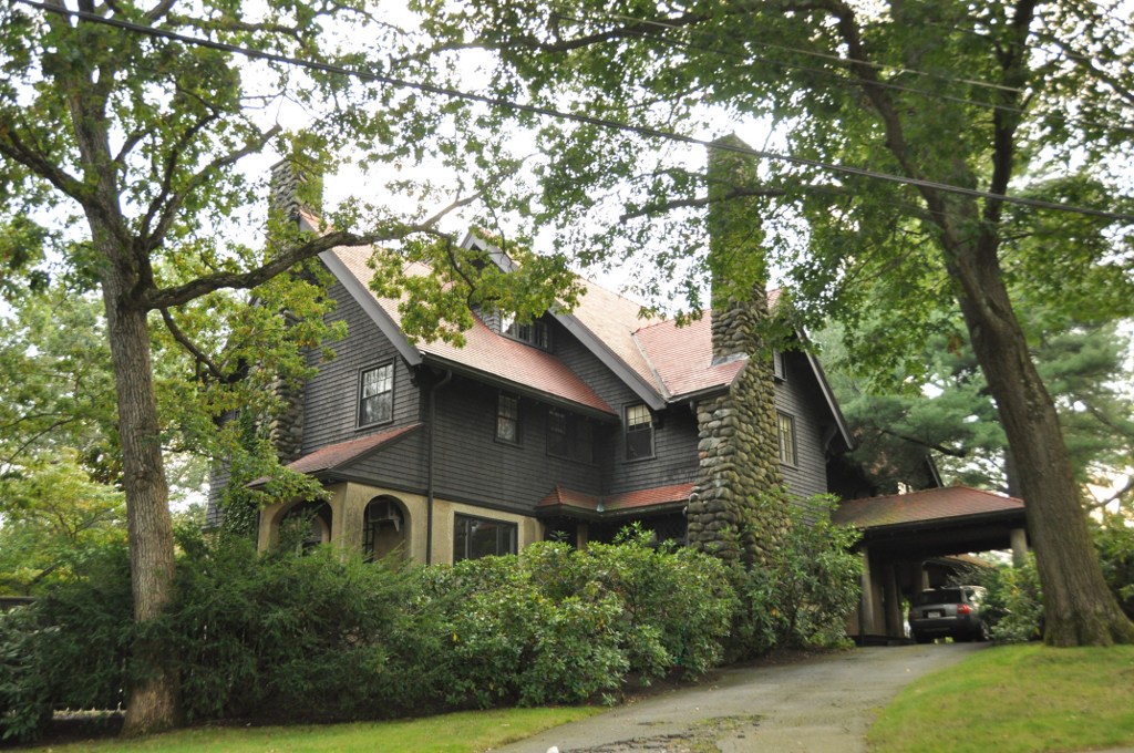
Arthur F. Luke House
Monument and historic site · National Register of Historic Places · 4.1 mi
Building in Massachusetts, United States

Benjamin Caryl House
Monument and historic site · National Register of Historic Places · 2.7 mi
Historic house in Massachusetts, United States
Boston Edison Power Station
Monument and historic site · National Register of Historic Places · 4.2 mi
Historic power station in Newton, Massachusetts, United States
Brandeis University President's House
Monument and historic site · National Register of Historic Places · 2.8 mi
House in Newton, Massachusetts, United States

Brook Farm
Monument and historic site · National Register of Historic Places · 3.6 mi
Intentional community


Charles W. Noyes House
Monument and historic site · National Register of Historic Places · 4.2 mi
Historic house in Massachusetts, United States
City Stable and Garage
Monument and historic site · National Register of Historic Places · 2.8 mi
Building in Massachusetts, United States
86 more on the map.
Parks, trails and playgrounds144




132 more on the map.
Restaurants and cafes99

Alta Strada
Restaurant · Italian · 3.0 mi
92 Central Street, Wellesley
Mo-Sa 17:00-21:00; Su 17:00-20:00

Blue on Highland
Diner · American · 0.9 mi
882 Highland Avenue, Needham
Mo-Th 11:30-22:00; Fr,Sa 11:30-23:00; Su 10:00-15:00,15:00-21:00
Bocado Tapas Bar
Restaurant · Tapas, Spanish · 2.9 mi
45 Church Street, Wellesley
Mo-Th 16:00-20:30, Fr 16:00-21:30, Sa 12:00-21:30, Su 12:00-20:00

Coconut Thai Cafe
Restaurant · Thai · 2.7 mi
257 Washington Street, Wellesley
Mo off; Tu-We 11:30-15:30,16:30-20:30; Th-Sa...
Conrad's Casual Dining
Restaurant · Burger, American · 0.4 mi
1257 Highland Avenue, Needham
Mo-Su 11:30-24:00
Cook's Window Pizza
Restaurant · Pizza · 3.1 mi
19 Washington Street, Wellesley
Mo-Fr 10:00-20:45; Sa-Su 10:30-20:45
Fuji Steakhouse
Restaurant · Hibachi, Japanese, Sushi
1430 Highland Avenue, Needham
Mo-Th 11:00-21:00, Fr-Sa 11:00-22:00, Su 12:00-21:00
Gari Japanese Fusion Bistro
Restaurant · Japanese, Bistro, Sushi
1019 Great Plain Avenue, Needham
Mo,We-Th 11:30-21:30; Fr-Sa 11:30-22:30; Su 12:00-21:30
Great Wok
Restaurant · Chinese, Japanese · 2.3 mi
180 Worcester Street, Wellesley
Mo-Th 11:30-22:00, Fr-Sa 11:30-23:00, Su 12:00-22:00
87 more on the map.
Where to stay3
Churches and places of worship30
United Parish of Auburndale
Church · National Register of Historic Places · 4.3 mi
Unitarian Universalist Society of Wellesley Hills
Church · 2.7 mi
309 Washington Street, Wellesley Hills
Wellesley Hills Congregational Church
Church · United Church Of Christ · 2.8 mi
207 Washington Street, Wellesley Hills
Shopping19
Gas and EV charging12
Schools, colleges and libraries86
Wellesley Hills Branch Library
Library · National Register of Historic Places · 2.7 mi
210 Washington Street, Wellesley
Healthcare15
Beth Israel Deaconess Medical Center Outpatient Clinical Center
Hospital · 0.5 mi
148 Chestnut Street, Needham
Boston Endoscopy Center
Clinic and pharmacy · 2.4 mi
175 Worcester Street, Wellesley Hills
Mass General Brigham Healthcare Center
Clinic and pharmacy · 2.5 mi
159 Wells Avenue
Map of Needham
250 places. The map loads OpenStreetMap tiles when you open it.
Climate by month
Monthly table
| Month | High | Low | Rain | Snow |
|---|---|---|---|---|
| Jan | 35°F | 18°F | 3.4 in | 13.8 in |
| Feb | 38°F | 18°F | 3.1 in | 8.9 in |
| Mar | 46°F | 25°F | 4.0 in | 8.2 in |
| Apr | 58°F | 35°F | 4.1 in | 2.2 in |
| May | 68°F | 46°F | 3.8 in | 0.0 in |
| Jun | 76°F | 56°F | 4.1 in | 0.0 in |
| Jul | 82°F | 62°F | 3.9 in | 0.0 in |
| Aug | 80°F | 59°F | 3.8 in | 0.0 in |
| Sep | 73°F | 52°F | 4.2 in | 0.0 in |
| Oct | 62°F | 40°F | 4.8 in | 0.0 in |
| Nov | 51°F | 31°F | 3.7 in | 1.1 in |
| Dec | 41°F | 23°F | 4.4 in | 11.5 in |
U.S. Climate Normals 1991-2020 for Natick (5 mi away), NOAA NCEI.
People and cost of living
American Community Survey 5-year estimates, 2020-2024, U.S. Census Bureau. Estimates have margins of error, larger for small towns.
Disaster history
Norfolk County has had 25 federal disaster declarations since 2000, most often for snowstorms.
- 2023-09-15: Hurricane Lee (Hurricane)
- 2022-04-18: Severe Winter Storm And Snowstorm (Snowstorm)
- 2020-03-27: Covid-19 Pandemic (Biological)
- 2020-03-13: Covid-19 (Biological)
- 2018-07-19: Severe Winter Storm And Snowstorm (Snowstorm)
- 2018-06-25: Severe Winter Storm And Flooding (Severe Storm)
OpenFEMA disaster declarations summaries.
Getting there and nearby towns
Norwood Memorial Airport (OWD) is the nearest airport with scheduled flights listed in OpenStreetMap, 7 miles away.
- Dedham 4 mi southeast, about 6 min by car
- Brookline 6 mi northeast, about 10 min by car
- Belmont 8 mi north, about 14 min by car
- Cambridge 9 mi northeast, about 15 min by car
- Framingham 10 mi west, about 16 min by car
- Arlington 10 mi northeast, about 17 min by car
- Lexington 11 mi north, about 18 min by car
- Boston 12 mi east, about 20 min by car
- Quincy 12 mi east, about 19 min by car
- Medford 12 mi northeast, about 19 min by car
Drive times are estimates from straight-line distance, not routes.
Local news
Headlines from INDB, the NEMICO news database.
Reviews, tips and questions
Loading what members have shared...
Sources and licences
- NCES EDGE (Public domain): public schools
- NOAA NCEI U.S. Climate Normals 1991-2020 (Public domain): climate by month
- OpenFEMA (Public domain): disaster declarations
- OpenStreetMap contributors (ODbL 1.0): places, airports, map data
- U.S. Census Bureau (Public domain): population, income, housing, education, commute
- Wikidata (CC0 1.0): landmarks and historic places
- Wikimedia Commons (see each image): photos
Photo credits
- MaryImmaculateNewtonMA ETPGrahm, Lukascb, CC BY-SA 3.0
- Wellesley Hills Branch Library MA 03, Jameslwoodward, CC BY-SA 3.0
- Wellesley MA Town Hall 04, Jameslwoodward, CC BY-SA 3.0
- Daniel Kingsbury House, Needham MA, John Phelan, CC BY 3.0
- NewtonMA SacoLowellShopsHousingHistoricDistrict, User:Magicpiano, CC BY-SA 4.0
- BrookFarm-PrintShop, Midnightdreary, CC BY-SA 3.0
- Isaac Sprague Memorial Tower Wellesley MA 02, Jameslwoodward, CC BY-SA 3.0
- Bacon Free Library - South Natick, MA - DSC09574, Daderot, CC0
- NewtonMA DrHenryJacobBigelowHouse, User:Magicpiano, CC BY-SA 4.0
- NeedhamMA JamesSmithHouse, User:Magicpiano, CC BY-SA 4.0
- Joseph L Stone House, West Newton MA, John Phelan, CC BY 3.0
- NewtonMA PutnamStreetHD, User:Magicpiano, CC BY-SA 4.0
- Benjamin Caryl House, Tim Pierce, CC BY-SA 3.0
- NeedhamMA TownsendHouse, User:Magicpiano, CC BY-SA 4.0
- WellesleyMA CongChurch, Magicpiano, CC BY-SA 3.0
- NewtonMA JamesLorinRichardsHouse, User:Magicpiano, CC BY-SA 4.0
- NewtonMA CharlesWNovesHouse, User:Magicpiano, CC BY-SA 4.0
- Intermediate Building Wellesley MA 01, Jameslwoodward, CC BY-SA 3.0
- NeedhamMA IsraelWhitneyHouse, User:Magicpiano, CC BY-SA 4.0
- King House, Newton MA, John Phelan, CC BY 3.0
- Emery Grover Building, Needham MA, John Phelan, CC BY 3.0
- The Parsonage, Natick (Middlesex County, Massachusetts), National Park Service photographer, Public domain
- NeedhamMA TownHall, User:Magicpiano, CC BY-SA 4.0
- WestonMA WellingtonFarmHD, User:Magicpiano, CC BY-SA 4.0
- House at 1008 Beacon St., Newton, Massachusetts, Thomas Kelley from Boston, MA, CC BY-SA 2.0
- NewtonMA GeorgeWEddyHouse, User:Magicpiano, CC BY-SA 4.0
- Thomas A Crimmins House, Newton MA, John Phelan, CC BY 3.0
- Kingsbury-Whitaker House, Needham MA, John Phelan, CC BY 3.0
- NewtonMA ArthurFLukeHouse, User:Magicpiano, CC BY-SA 4.0
- Elm Bank, Wellesley, MA - Goddesses and Mansion, Sculptor Martin Milmore (1844-1883); photograph by Daderot., Public domain
- NewtonMA 215BrooklineStreet, User:Magicpiano, CC BY-SA 4.0
- NewtonMA GershomHydeHouse, User:Magicpiano, CC BY-SA 4.0
- NewtonMA LafayetteGoodbarHouse, User:Magicpiano, CC BY-SA 4.0
- WestonMA HarringtonHouse, User:Magicpiano, CC BY-SA 4.0
- FairbanksHouse2013, User:Magicpiano, CC BY-SA 4.0


Page built October 30, 2026. Spotted a mistake? Tell us or suggest a place.