


Colonia, New Jersey
Colonia is a community of 18,587 people in Middlesex County, New Jersey.
Why visit Colonia
Townapedia lists 9 museums and landmarks, 26 parks and trails, 49 places to eat, 10 places to stay and 4 attractions in and around town.
Highlights include Union County Performing Arts Center, Rahway River Bridge, Barron Library and Elizabeth and Gershom Frazee House.
July is the warmest month, with average highs of 88°F; January lows average 24°F, and about 21 inches of snow fall in a normal year.
Weather in Colonia
Forecast from the National Weather Service. Full forecast
About Colonia
Colonia is an unincorporated community and census-designated place (CDP) in Woodbridge Township in Middlesex County in the U.S. state of New Jersey. As of the 2020 United States census, the CDP's population was 18,609.
From the Wikipedia article Colonia, New Jersey (this version), under CC BY-SA 4.0.
Things to do4
Union County Performing Arts Center
Cinema and theater · National Register of Historic Places · 2.3 mi
Theater and former movie theater in Rahway, New Jersey, United States

Rahway River Bridge
Bridge · 2.4 mi
Bridge in Union County, New Jersey

Stephen J. Capestro Theatre
Cinema and theater · 3.5 mi
Outdoor theater in Edison, New Jersey
Museums and landmarks9

Barron Library
Monument and historic site · National Register of Historic Places · 2.8 mi
Historic building in Woodbridge, New Jersey

Elizabeth and Gershom Frazee House
Monument and historic site · National Register of Historic Places · 3.5 mi
Historic house in Union County, New Jersey

Homestead Farm at Oak Ridge
Monument and historic site · National Register of Historic Places · 2.1 mi
Historic house at Oak Ridge Park, New Jersey

John De Camp House
Monument and historic site · National Register of Historic Places · 3.0 mi
Historic house in New Jersey, United States

Merchants and Drovers Tavern
Monument and historic site · National Register of Historic Places · 2.3 mi
Historic building in Union County, New Jersey

Middlesex Avenue–Woodwild Park Historic District
Monument and historic site · National Register of Historic Places · 3.9 mi
Historic district in Metuchen, New Jersey

Robinson Plantation House
Monument and historic site · National Register of Historic Places · 1.7 mi
Historic house in New Jersey, United States

Roosevelt Hospital
Monument and historic site · National Register of Historic Places · 3.0 mi
Historic building in Edison, New Jersey
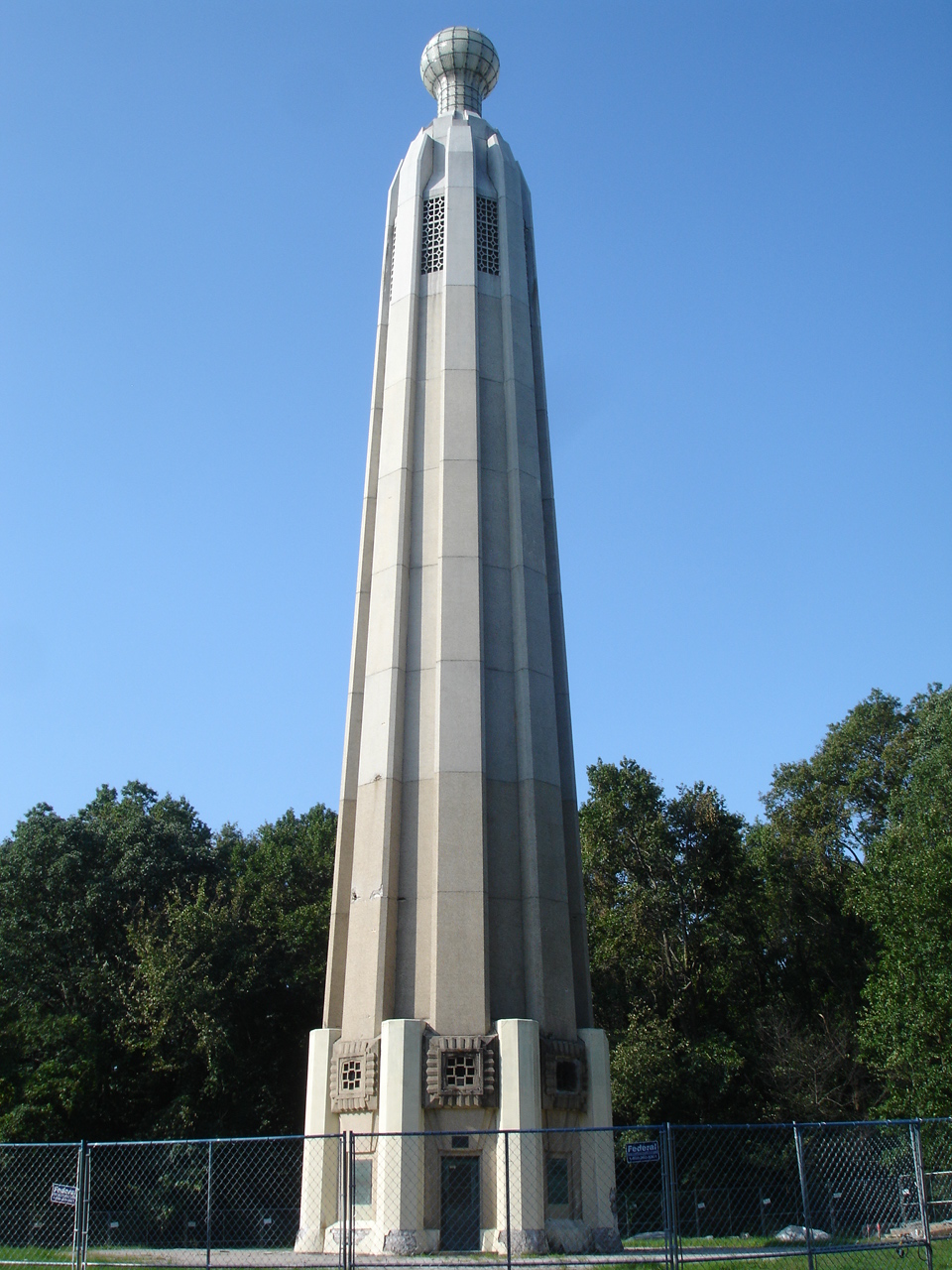
Thomas Alva Edison Memorial Tower and Museum
Museum · National Register of Historic Places · 2.3 mi
Parks, trails and playgrounds26




14 more on the map.
Restaurants and cafes49

Papa Pancho Pizza
Restaurant · Pizza, Indian · 1.9 mi
Indian-style pizza; enter through Moghul Express
1670 Oak Tree Road, Edison
Mo-Th,Su 11:30-21:30; Fr-Sa 11:30-22:00
Bombay Talk
Restaurant · Indian · 1.3 mi
1358 Oak Tree Road, Iselin
Mo-Th,Su 11:30-21:30; Fr-Sa 11:30-22:00
Chili's
Restaurant · Tex-Mex · 2.0 mi
1655 Oak Tree Road, Edison
Mo-Th,Su 11:00-23:00; Fr-Sa 11:00-24:00
Egg Mania
Restaurant · Indian · 1.5 mi
1546 Oak Tree Road, Iselin
Mo-Th 12:00-22:30; Fr 12:00-23:30; Sa 11:00-23:30; Su 11:00-22:30
Kandahar
Restaurant · Turkish, Afghan · 1.3 mi
1380 Oak Tree Road, Iselin
Mo-Th,Su 11:00-21:30; Fr-Sa 11:00-22:30
Ming Restaurant
Restaurant · Seafood · 1.9 mi
1655-185 Oak Tree Road, Edison
Tu-Su 12:00-15:00, Tu-Th, Su 17:00-21:30, Fr-Sa 17:00-22:30; Mo off
Mughal Express
Restaurant · Indian · 1.9 mi
1670 Oak Tree Road, Edison
Mo-Th,Su 11:30-21:30; Fr-Sa 11:30-23:00

Perkins
Diner · American · 1.4 mi
1009 Saint Georges Avenue, Colonia
Su 08:00-17:00; Mo-Th 09:00-18:00; Fr-Sa 08:00-18:00

Sukhadia's Fresh Kitchen & Indian Bistro
Cafe · Indian · 1.5 mi
1507 Oak Tree Road, Isela
Mo-Fr 09:00-21:00; Sa-Su 09:00-22:00
Bamboo House
Restaurant · Chinese · 0.8 mi
310 Inman Avenue, Colonia
Mo-Su 10:00-22:00
37 more on the map.
History
In 1919, the New Jersey State Highway Commission built a new road that became part of the Lincoln Highway, an early plan to create a transcontinental highway. The stretch was constructed on the west side of the Pennsylvania Railroad (now the Northeast Corridor) from near the northeast of Dow Avenue between Colonia and Iselin to Cedar Street in Menlo Park, to avoid two railroad crossings. The old road is now Middlesex-Essex Turnpike and Thornall Street, on the east side of the tracks.
From the History section of Colonia, New Jersey on Wikipedia, under CC BY-SA 4.0.
Where to stay10
Churches and places of worship11
First Presbyterian Church
Church · National Register of Historic Places · 2.7 mi
Trinity Episcopal Church
Church · National Register of Historic Places · 2.8 mi
Second Presbyterian Church
Church · Presbyterian · 2.1 mi
1221 New Brunswick Avenue, Rahway
Shopping11
Gas and EV charging17
Schools, colleges and libraries57
Academy For Urban Leadership Charter School
School · 5.1 mi
612 Amboy Ave, Perth Amboy
Healthcare4
Hackensack Meridian Health and Wellness Center at Metropark
Clinic and pharmacy · 1.8 mi
1 Wellbrook Place, Iselin
Map of Colonia
198 places. The map loads OpenStreetMap tiles when you open it.
Climate by month
Monthly table
| Month | High | Low | Rain | Snow |
|---|---|---|---|---|
| Jan | 41°F | 24°F | 3.8 in | 5.1 in |
| Feb | 44°F | 26°F | 3.1 in | 8.3 in |
| Mar | 53°F | 32°F | 4.3 in | 5.3 in |
| Apr | 66°F | 42°F | 3.6 in | 0.1 in |
| May | 75°F | 51°F | 4.0 in | 0.0 in |
| Jun | 84°F | 60°F | 4.3 in | 0.0 in |
| Jul | 88°F | 66°F | 5.3 in | 0.0 in |
| Aug | 86°F | 64°F | 4.0 in | 0.0 in |
| Sep | 79°F | 58°F | 4.3 in | 0.0 in |
| Oct | 66°F | 46°F | 4.3 in | 0.0 in |
| Nov | 56°F | 36°F | 3.5 in | 0.2 in |
| Dec | 46°F | 29°F | 4.2 in | 2.4 in |
U.S. Climate Normals 1991-2020 for Plainfield Hcn (5 mi away), NOAA NCEI.
People and cost of living
American Community Survey 5-year estimates, 2020-2024, U.S. Census Bureau. Estimates have margins of error, larger for small towns.
Disaster history
Middlesex County has had 17 federal disaster declarations since 2000, most often for hurricanes.
- 2021-09-05: Remnants Of Hurricane Ida (Hurricane)
- 2021-09-02: Remnants Of Hurricane Ida (Hurricane)
- 2020-03-25: Covid-19 Pandemic (Biological)
- 2020-03-13: Covid-19 (Biological)
- 2016-03-14: Severe Winter Storm And Snowstorm (Severe Storm)
- 2012-10-30: Hurricane Sandy (Hurricane)
OpenFEMA disaster declarations summaries.
Getting there and nearby towns
Linden Airport (LDJ) is the nearest airport with scheduled flights listed in OpenStreetMap, 4 miles away.
- Avenel 2 mi east, about 3 min by car
- Fords 4 mi south, about 6 min by car
- Metuchen 4 mi southwest, about 7 min by car
- Carteret 4 mi east, about 7 min by car
- Roselle Park 6 mi northeast, about 9 min by car
- Elizabeth 8 mi northeast, about 13 min by car
- Highland Park 9 mi southwest, about 14 min by car
- New Providence 9 mi northwest, about 15 min by car
- Middlesex 10 mi west, about 16 min by car
- Newark 12 mi northeast, about 19 min by car
Drive times are estimates from straight-line distance, not routes.
Local news
Headlines from INDB, the NEMICO news database.
Reviews, tips and questions
Loading what members have shared...
Sources and licences
- NCES EDGE (Public domain): public schools
- NOAA NCEI U.S. Climate Normals 1991-2020 (Public domain): climate by month
- OpenFEMA (Public domain): disaster declarations
- OpenStreetMap contributors (ODbL 1.0): places, airports, map data
- U.S. Census Bureau (Public domain): population, income, housing, education, commute
- Wikidata (CC0 1.0): elevation, founding date, time zone, website, landmarks and historic places
- Wikimedia Commons (see each image): photos
- Wikipedia (CC BY-SA 4.0): overview and history text
Photo credits
- 2018-05-20 09 24 12 View north along New Jersey State Route 27 (Lincoln Highway) just north of Colonia Road in Woodbridge Township, Middlesex County, New Jersey, Famartin, CC BY-SA 4.0
- 2020-07-11 15 51 52 View north along New Jersey State Route 444 (Garden State Parkway) at the Colonia North Service Area in Woodbridge Township, Middlesex County, New Jersey, Famartin, CC BY-SA 4.0
- 2020-07-16 10 32 34 View south along New Jersey State Route 444 (Garden State Parkway) at the Colonia South Service Area in Woodbridge Township, Middlesex County, New Jersey, Famartin, CC BY-SA 4.0
- 300 Middlesex Avenue, Metuchen, NJ - Corbin House, Zeete, CC BY-SA 4.0
- Rahway theatre, PeterMac13, CC BY-SA 3.0
- Roosevelt Hospital, Edison, NJ - north view, Zeete, CC BY-SA 3.0
- ELIZABETH AND GERSHOM FRAZEE HOUSE, UNION COUNTY, NJ, JERRYE & ROY KLOTZ MD, CC BY-SA 4.0
- WilliamRobinsonPlantationHouse, KForce at en.wikipedia, CC BY-SA 3.0
- First Presbyterian Church of Woodbridge, Perrycart, CC BY-SA 3.0
- Trinity Episcopal Church, Woodbridge, NJ - south west view, Zeete, CC BY-SA 4.0
- HOMESTEAD FARM AT OAK RIDGE, MIDDLESEX COUNTY, NJ, Jerrye & Roy Klotz, MD, CC BY-SA 4.0
- MerchantsAndDrovers, KForce at en.wikipedia, CC BY-SA 3.0
- Barron Arts Center-Barron Library, Perrycart, CC BY-SA 3.0
- JOHN DeCAMP HOUSE, UNION COUNTY, NJ, JERRYE & ROY KLOTZ MD, CC BY-SA 4.0
- TheEdisonTower, KForce at en.wikipedia, CC BY-SA 3.0
- 2021-08-26 11 11 26 View south along New Jersey State Route 27 (Lincoln Highway) from the overpass for Middlesex County Route 650 (New Dover Road) in Woodbridge Township, Middlesex County, New Jersey, Famartin, CC BY-SA 4.0
- 2021-08-26 11 12 41 View north along New Jersey State Route 27 (Lincoln Highway) from the overpass for Middlesex County Route 650 (New Dover Road) in Woodbridge Township, Middlesex County, New Jersey, Famartin, CC BY-SA 4.0
- 2018-05-20 09 33 37 View south along New Jersey State Route 27 (Lincoln Highway) just north of New Dover Road (Middlesex County Route 650) in Woodbridge Township, Middlesex County, New Jersey, Famartin, CC BY-SA 4.0
- 2021-06-05 11 22 41 View south along the northbound lanes of New Jersey State Route 444 (Garden State Parkway) from the overpass for Middlesex County Route 602 (Inman Avenue) in Woodbridge Township..., Famartin, CC BY-SA 4.0
- 2021-06-05 11 21 03 View south along the southbound lanes of New Jersey State Route 444 (Garden State Parkway) from the overpass for Middlesex County Route 602 (Inman Avenue) in Woodbridge Township..., Famartin, CC BY-SA 4.0
- 2021-06-05 11 24 25 View north along the northbound lanes of New Jersey State Route 444 (Garden State Parkway) from the overpass for Middlesex County Route 602 (Inman Avenue) in Woodbridge Township..., Famartin, CC BY-SA 4.0
- 2021-06-05 11 26 21 View north along the southbound lanes of New Jersey State Route 444 (Garden State Parkway) from the overpass for Middlesex County Route 602 (Inman Avenue) in Woodbridge Township..., Famartin, CC BY-SA 4.0
- Colors of glandulosa, Pachhais, CC BY-SA 4.0
- 2021-06-05 11 07 02 View north along the northbound lanes of New Jersey State Route 444 (Garden State Parkway) from the overpass for New Dover Road in Woodbridge Township, Middlesex County, New Jersey, Famartin, CC BY-SA 4.0
- 2021-06-05 11 06 07 View south along the northbound lanes of New Jersey State Route 444 (Garden State Parkway) from the overpass for New Dover Road in Woodbridge Township, Middlesex County, New Jersey, Famartin, CC BY-SA 4.0
- 2021-06-05 11 07 46 View north along the southbound lanes of New Jersey State Route 444 (Garden State Parkway) from the overpass for New Dover Road in Woodbridge Township, Middlesex County, New Jersey, Famartin, CC BY-SA 4.0
- 2021-06-05 11 05 28 View south along the southbound lanes of New Jersey State Route 444 (Garden State Parkway) from the overpass for New Dover Road in Woodbridge Township, Middlesex County, New Jersey, Famartin, CC BY-SA 4.0
- ISS026-E-20624 - View of New York, Earth Science and Remote Sensing Unit , Lyndon B. Johnson Space Center, Public domain
- ISS027-E-10433 - View of Earth, Earth Science and Remote Sensing Unit , Lyndon B. Johnson Space Center, Public domain
- ISS055-E-7452 - View of New York, Earth Science and Remote Sensing Unit, NASA Johnson Space Center, Public domain
- ISS047-E-122968 - View of Earth, Earth Science and Remote Sensing Unit , Lyndon B. Johnson Space Center, Public domain
- ISS047-E-122969 - View of Earth, Earth Science and Remote Sensing Unit , Lyndon B. Johnson Space Center, Public domain
- ISS047-E-122967 - View of Earth, Earth Science and Remote Sensing Unit , Lyndon B. Johnson Space Center, Public domain
- ISS027-E-10432 - View of Earth, Earth Science and Remote Sensing Unit , Lyndon B. Johnson Space Center, Public domain
- 2018-05-18 15 35 23 View south along New Jersey State Route 35 (Saint George Avenue) at Butler Street in Woodbridge Township, Middlesex County, New Jersey, Famartin, CC BY-SA 4.0
- 2018-06-20 13 48 35 View north along New Jersey State Route 27 (Lincoln Highway) just south of New Jersey State Route 35 (Saint Georges Avenue) in Rahway, Union County, New Jersey, Famartin, CC BY-SA 4.0
- 2018-06-20 13 46 06 View south along New Jersey State Route 27 (Lincoln Highway) just south of New Jersey State Route 35 (Saint Georges Avenue) in Rahway, Union County, New Jersey, Famartin, CC BY-SA 4.0
- Kmart Avenel - Final day 18, Curlyrnd, CC BY-SA 4.0
- Kmart Avenel - Final day 61, Curlyrnd, CC BY-SA 4.0
- Kmart Avenel - Final day 10, Curlyrnd, CC BY-SA 4.0


Page built October 30, 2026. Spotted a mistake? Tell us or suggest a place.