


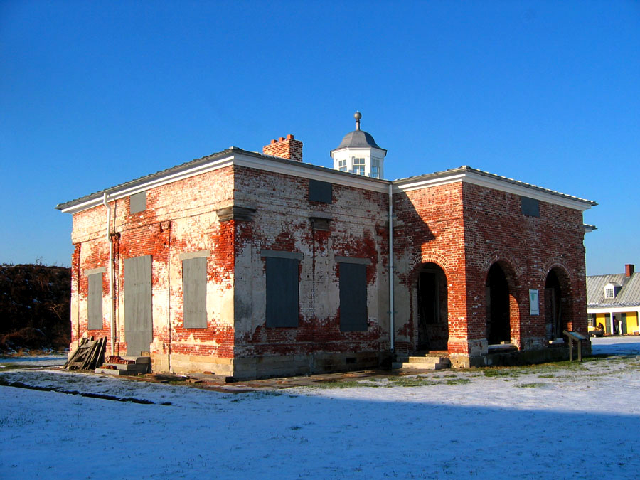


Colwyn, Pennsylvania
Colwyn is a borough of 2,325 people in Delaware County, Pennsylvania, founded in 1698.
Why visit Colwyn
Townapedia lists 28 museums and landmarks, 27 parks and trails, 50 places to eat, 1 place to stay and 6 attractions in and around town.
Highlights include B&O Railroad Bridge, George C. Platt Bridge, John Bartram High School and John M. Patterson School.
July is the warmest month, with average highs of 88°F; January lows average 26°F, and about 23 inches of snow fall in a normal year.
Weather in Colwyn
Forecast from the National Weather Service. Full forecast
About Colwyn
Colwyn is a borough in Delaware County, Pennsylvania, United States. As of the 2020 census, Colwyn had a population of 2,474.
From the Wikipedia article Colwyn, Pennsylvania (this version), under CC BY-SA 4.0.
Things to do6

B&O Railroad Bridge
Bridge · 3.0 mi
Bridge in Grays Ferry neighborhood in Philadelphia, Pennsylvania
George C. Platt Bridge
Bridge · 2.4 mi
Bridge in Philadelphia, Pennsylvania
Girard Point Bridge
Bridge · 3.2 mi
Bridge in Philadelphia County, Pennsylvania, United States
Gray's Ferry Bridge
Bridge · 3.3 mi
Bridge in Philadelphia, Pennsylvania, United States of America
Philadelphia, Wilmington and Baltimore Railroad Bridge No. 1
Bridge · 3.2 mi
Railroad bridge in Philadelphia, Pennsylvania

University of the Sciences in Philadelphia
School · 3.4 mi
United States university (1998-2022)
Museums and landmarks28

John Bartram High School
Monument and historic site · National Register of Historic Places · 1.2 mi
High school in Philadelphia, Pennsylvania

John M. Patterson School
Monument and historic site · National Register of Historic Places · 0.9 mi
Public elementary school in Philadelphia, Pennsylvania
7001 Buist Avenue, Philadelphia
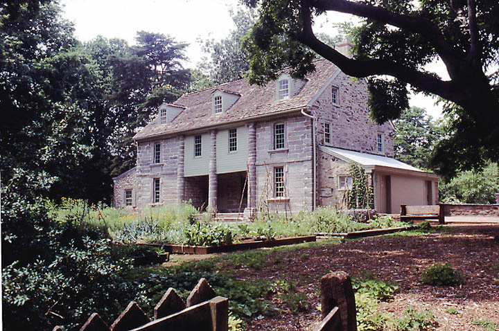
Bartram's Garden
Monument and historic site · National Register of Historic Places · 2.5 mi
Historic house in Pennsylvania, United States

Charles Y. Audenried Junior High School
Monument and historic site · National Register of Historic Places · 3.2 mi
High school in Pennsylvania, United States

Darby Meeting
Monument and historic site · National Register of Historic Places · 0.8 mi
Historic church in Pennsylvania, United States

Eden Cemetery
Monument and historic site · National Register of Historic Places · 1.3 mi
Cemetery in Collingdale, Pennsylvania, United States
Fort Mifflin
Monument and historic site · National Register of Historic Places · 3.3 mi
On the Delaware River below Philadelphia, Pennsylvania

Hanson Haines House
Monument and historic site · National Register of Historic Places · 3.0 mi
Historic house in Pennsylvania, United States

Hardy Williams Academy
Monument and historic site · National Register of Historic Places · 2.5 mi
Charter school in Philadelphia, Pennsylvania

Henry Albertson Subdivision Historic District
Monument and historic site · National Register of Historic Places · 2.4 mi
United States historic place

La Blanche Apartments
Monument and historic site · National Register of Historic Places · 3.4 mi
Apartment building in Philadelphia, Pennsylvania


Lansdowne Park Historic District
Monument and historic site · National Register of Historic Places · 2.3 mi
Historic district in Pennsylvania, United States
16 more on the map.
Parks, trails and playgrounds27

Clark Park
Park · 3.4 mi
Municipal park in West Philadelphia, Pennsylvania
Malcolm X Park
Park · 3.2 mi
Urban park in West Philadelphia named for Malcolm X

Jack Frazier Memorial Tot Lot
Playground
102 Front Street, Colwyn
Mo-Su 08:00-22:30
15 more on the map.
Restaurants and cafes50

Brown Street Cafe
Cafe · American, Brunch · 1.0 mi
2946 Island Avenue, Philadelphia
Tu 08:30-14:00, We-Th 08:30-16:00, Fr-Sa 08:30-16:30

Emma's Liberian Kitchen
Restaurant · 0.6 mi
7201 Woodland Avenue, Philadelphia
Mo 09:00-20:00; Tu-Sa 08:00-20:00; Su 12:00-16:00
Ackee Tree
Restaurant · Jamaican · 1.2 mi
6631 Woodland Avenue, Philadelphia
Mo-Th,Su 11:00-21:00; Fr-Sa 11:00-21:30
JD African Restaurant
Restaurant · African · 0.6 mi
880 Main Street, Darby
Mo-Sa 11:30-21:30
Makeneh Kamara African Food Market
Restaurant · 1.3 mi
6526 Woodland Avenue, Philadelphia
Mo-Sa 08:30-20:00; Su 08:30-18:30
Susanna African Kitchen
Restaurant · African · 1.3 mi
6521 Woodland Avenue, Philadelphia
Top Taste
Restaurant · Jamaican · 0.6 mi
7252 Elmwood Avenue, Philadelphia
38 more on the map.
Where to stay1
Churches and places of worship41
Saint James Kingsessing Episcopal Church
Church · Episcopal · 1.0 mi
6838 Woodland Avenue, Philadelphia
Wharton Street Memorial Methodist Episcopal Church
Church · National Register of Historic Places · 2.9 mi
Blessed Virgin Mary Church
Church · Roman Catholic · 0.9 mi
1101 Main Street, Darby
New Fellowship Baptist
Church · Baptist · 0.9 mi
7001 Woodland Avenue, Philadelphia
Shopping12
Gas and EV charging8
Schools, colleges and libraries68
Healthcare15
Concentra Urgent Care
Clinic and pharmacy · 1.5 mi
7000 Holstein Avenue, Philadelphia
DaVita Philadelphia West Dialysis
Clinic and pharmacy · 0.9 mi
7609 Lindbergh Boulevard, Philadelphia
Medical Office Building
Clinic and pharmacy · 1.3 mi
1501 South Lansdowne Avenue, Darby
Mercy Eastwick Medical Arts Building
Clinic and pharmacy · 0.7 mi
2801 Island Avenue, Philadelphia
Map of Colwyn
250 places. The map loads OpenStreetMap tiles when you open it.
Climate by month
Monthly table
| Month | High | Low | Rain | Snow |
|---|---|---|---|---|
| Jan | 41°F | 26°F | 3.1 in | 7.1 in |
| Feb | 44°F | 28°F | 2.8 in | 8.4 in |
| Mar | 53°F | 34°F | 4.0 in | 3.6 in |
| Apr | 65°F | 44°F | 3.5 in | 0.3 in |
| May | 74°F | 54°F | 3.3 in | 0.0 in |
| Jun | 83°F | 64°F | 4.0 in | 0.0 in |
| Jul | 88°F | 70°F | 4.4 in | 0.0 in |
| Aug | 86°F | 68°F | 4.3 in | 0.0 in |
| Sep | 79°F | 61°F | 4.4 in | 0.0 in |
| Oct | 67°F | 49°F | 3.5 in | 0.0 in |
| Nov | 56°F | 39°F | 2.9 in | 0.2 in |
| Dec | 46°F | 31°F | 4.0 in | 3.5 in |
U.S. Climate Normals 1991-2020 for Philadelphia Intl Ap 72408 (3 mi away), NOAA NCEI.
People and cost of living
American Community Survey 5-year estimates, 2020-2024, U.S. Census Bureau. Estimates have margins of error, larger for small towns.
Disaster history
Delaware County has had 15 federal disaster declarations since 2000, most often for hurricanes.
- 2021-09-10: Remnants Of Hurricane Ida (Hurricane)
- 2020-03-30: Covid-19 Pandemic (Biological)
- 2020-03-13: Covid-19 (Biological)
- 2014-02-06: Severe Winter Storm (Severe Ice Storm)
- 2012-10-29: Hurricane Sandy (Hurricane)
- 2011-09-12: Tropical Storm Lee (Flood)
OpenFEMA disaster declarations summaries.
Getting there and nearby towns
Philadelphia International Airport (PHL) is the nearest airport with scheduled flights listed in OpenStreetMap, 2 miles away.
- Darby 1 mi northwest, about 1 min by car
- Collingdale 1 mi west, about 2 min by car
- Yeadon 1 mi north, about 2 min by car
- Aldan 2 mi west, about 3 min by car
- Lansdowne 2 mi northwest, about 4 min by car
- Clifton Heights 3 mi northwest, about 4 min by car
- Drexel Hill 4 mi northwest, about 6 min by car
- Millbourne 4 mi north, about 6 min by car
- National Park 5 mi southeast, about 8 min by car
- Paulsboro 5 mi south, about 8 min by car
Drive times are estimates from straight-line distance, not routes.
Local news
Headlines from INDB, the NEMICO news database.
Reviews, tips and questions
Loading what members have shared...
Sources and licences
- NCES EDGE (Public domain): public schools
- NOAA NCEI U.S. Climate Normals 1991-2020 (Public domain): climate by month
- OpenFEMA (Public domain): disaster declarations
- OpenStreetMap contributors (ODbL 1.0): places, airports, map data
- U.S. Census Bureau (Public domain): population, income, housing, education, commute
- Wikidata (CC0 1.0): elevation, founding date, time zone, website, landmarks and historic places
- Wikimedia Commons (see each image): photos
- Wikipedia (CC BY-SA 4.0): overview and history text
Photo credits
- Colwyn School PA, Smallbones, CC0
- Patterson School Philly, Smallbones, Public domain
- Bartram HS Philly, Smallbones, Public domain
- Mifflin Commandant's House03, Joe Minardi, CC BY 2.5
- Turret w house 35 West Lansdowne HD, Smallbones, CC BY-SA 3.0
- LansdowneTheatre, User:Smallbones on English Wikipedia., Public domain
- CY Audenreid HS Philly, Smallbones, Public domain
- Albertson 85 Greenway DelCo PA, Smallbones, CC BY-SA 3.0
- 20thCenturyClub, Smallbones at English Wikipedia, Public domain
- Shaw School Philly, Smallbones, Public domain
- MortonMorton House, User:Smallbones on English Wikipedia., Public domain
- Haines tower W Philly, Smallbones, Public domain
- Walnut Park Plaza A, Smallbones, Public domain
- TB Read School Philly, Smallbones, Public domain
- Tilden Jr HS 2, Smallbones, Public domain
- Regent Rennoc Court, Smallbones, Public domain
- Octavius Catto grave, Lblanchard, CC BY-SA 2.0
- Bartram House May 2002c, Jtfry at English Wikipedia, CC BY 3.0
- LowerSwedishCabin, User:Smallbones on English Wikipedia., Public domain
- DarbyMeeting2, Smallbones at en.wikipedia, Public domain
- WHARTON STREET MEMORIAL METHODIST EPISCOPAL CHURCH, WEST PHILADELPHIA,PA, JERRYE & ROY KLOTZ, M.D., CC BY-SA 4.0
- Alcorn School Philly, Smallbones, Public domain
- Sellers Hall Delco, Smallbones, CC0
- La Blanche Philly A, Smallbones, Public domain
- Catherine School SW Philly, Smallbones, Public domain
- Mitchel School Philly, Smallbones, Public domain
- G Wolf School Philly, Smallbones, Public domain


Page built October 30, 2026. Spotted a mistake? Tell us or suggest a place.