


Croydon, Pennsylvania
Croydon is a community of 9,684 people in Bucks County, Pennsylvania.
Why visit Croydon
Townapedia lists 13 museums and landmarks, 2 parks and trails, 4 places to eat, 1 place to stay and 2 attractions in and around town.
Highlights include Burlington–Bristol Bridge, Beverly National Cemetery, Bristol College and Neshaminy State Park.
July is the warmest month, with average highs of 86°F; January lows average 22°F.
Weather in Croydon
Forecast from the National Weather Service. Full forecast
About Croydon
Croydon is a census-designated place located in Bristol Township, Bucks County, Pennsylvania, United States. As of the 2010 census, the CDP had a total population of 9,950.
From the Wikipedia article Croydon, Pennsylvania (this version), under CC BY-SA 4.0.
Things to do2

Burlington–Bristol Bridge
Bridge · 1.6 mi
Truss Bridge Connecting New Jersey & Pennsylvannia

Museums and landmarks13

Beverly National Cemetery
Monument and historic site · National Register of Historic Places · 2.8 mi
Historic veterans cemetery in Burlington County, New Jersey

Bristol College
Monument and historic site · National Register of Historic Places · 0.8 mi
Defunct college in Bucks County, Pennsylvania

Bristol Historic District
Monument and historic site · National Register of Historic Places · 2.4 mi
Historic district in Pennsylvania, United States

Bristol Industrial Historic District
Monument and historic site · National Register of Historic Places · 2.4 mi
Historic district in Pennsylvania, United States
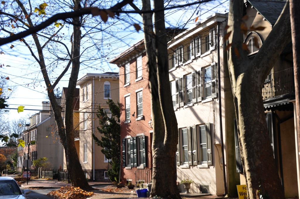
Burlington Historic District
Monument and historic site · National Register of Historic Places · 1.9 mi
Listed on the National Register of Historic Places in Burlington County, New Jersey

Dorrance Mansion
Monument and historic site · National Register of Historic Places · 2.3 mi
Historic house in Pennsylvania, United States

Harriman Historic District
Monument and historic site · National Register of Historic Places · 3.0 mi
Historic district in the United States

High Street Historic District
Monument and historic site · National Register of Historic Places · 2.2 mi
Listed on the NRHP in New Jersey

Jefferson Avenue School
Monument and historic site · National Register of Historic Places · 2.8 mi
School building in Bristol, United States of America

Jefferson Land Association Historic District
Monument and historic site · National Register of Historic Places · 2.5 mi
Historic district in Pennsylvania, United States

Quaker School
Monument and historic site · National Register of Historic Places · 2.3 mi
School building in Burlington, New Jersey


William R. Allen School
Monument and historic site · National Register of Historic Places · 2.6 mi
Historic school building in Burlington County, New Jersey
1 more on the map.
Parks, trails and playgrounds2


Restaurants and cafes4

Giovannis Dillicious Pickles
Restaurant · 0.6 mi
802 Bristol Pike, Croydon
Tu-Sa 11:00-20:00; Su 11:00-16:00


History
The name Croydon comes from the town of Croydon in South-East England; nine miles south of the historic center of London, it was traditionally part of Surrey but is now the center of the London Borough of Croydon.
The White Hall of Bristol College was listed on the National Register of Historic Places in 1984.
From the History section of Croydon, Pennsylvania on Wikipedia, under CC BY-SA 4.0.
Where to stay1
Scottish Inns & Suites Bensalem
Motel and hotel · 1.1 mi
4000 Bristol Pike, Bensalem
Churches and places of worship9
Coopertown Meetinghouse
Church · National Register of Historic Places · 3.0 mi
Little Jerusalem AME Church
Church · National Register of Historic Places · 1.6 mi
St. Elizabeth's Convent
Church · National Register of Historic Places · 3.4 mi
St. Mary's Episcopal Church
Church · National Register of Historic Places · 2.1 mi
St. Stephen's Episcopal Church
Church · National Register of Historic Places · 2.1 mi
Gas and EV charging1
Schools, colleges and libraries47
Benjamin Banneker Preparatory Charter School
School · 3.3 mi
11 South Sunset Road, Willingboro
Burlington Township Middle School At Springside
School · 3.7 mi
1600 Burlington By Pass, Burlington
Captain James Lawrence Elementary School
School · 2.4 mi
315 Barclay St, Burlington
Center For Student Learning Cs At Pennsbury
School · 5.9 mi
345 Lakeside Drive, Levittown
Map of Croydon
79 places. The map loads OpenStreetMap tiles when you open it.
Climate by month
Monthly table
| Month | High | Low | Rain | Snow |
|---|---|---|---|---|
| Jan | 39°F | 22°F | 3.7 in | 7.0 in |
| Feb | 42°F | 23°F | 3.1 in | 5.7 in |
| Mar | 50°F | 29°F | 4.6 in | 3.5 in |
| Apr | 62°F | 40°F | 4.0 in | 0.0 in |
| May | 72°F | 50°F | 4.0 in | 0.0 in |
| Jun | 81°F | 60°F | 4.6 in | 0.0 in |
| Jul | 86°F | 65°F | 4.9 in | 0.0 in |
| Aug | 84°F | 64°F | 4.7 in | 0.0 in |
| Sep | 77°F | 56°F | 4.7 in | 0.0 in |
| Oct | 66°F | 44°F | 4.2 in | 0.1 in |
| Nov | 55°F | 33°F | 3.6 in | 0.2 in |
| Dec | 44°F | 26°F | 4.7 in | 3.4 in |
U.S. Climate Normals 1991-2020 for Neshaminy Falls (5 mi away), NOAA NCEI.
People and cost of living
American Community Survey 5-year estimates, 2020-2024, U.S. Census Bureau. Estimates have margins of error, larger for small towns.
Disaster history
Bucks County has had 17 federal disaster declarations since 2000, most often for hurricanes.
- 2021-09-10: Remnants Of Hurricane Ida (Hurricane)
- 2020-03-30: Covid-19 Pandemic (Biological)
- 2020-03-13: Covid-19 (Biological)
- 2016-03-23: Severe Winter Storm And Snowstorm (Snowstorm)
- 2014-02-06: Severe Winter Storm (Severe Ice Storm)
- 2013-01-10: Hurricane Sandy (Hurricane)
OpenFEMA disaster declarations summaries.
Getting there and nearby towns
Northeast Philadelphia Airport (PNE) is the nearest airport with scheduled flights listed in OpenStreetMap, 6 miles away.
- Beverly 2 mi southwest, about 4 min by car
- Burlington 2 mi east, about 4 min by car
- Bristol 3 mi east, about 4 min by car
- Eddington 3 mi west, about 4 min by car
- Cornwells Heights 3 mi west, about 5 min by car
- Andalusia 4 mi west, about 7 min by car
- Levittown 5 mi northeast, about 8 min by car
- Penndel 5 mi north, about 7 min by car
- Florence 5 mi northeast, about 8 min by car
- Parkland 5 mi north, about 8 min by car
Drive times are estimates from straight-line distance, not routes.
Local news
Headlines from INDB, the NEMICO news database.
Reviews, tips and questions
Loading what members have shared...
Sources and licences
- NCES EDGE (Public domain): public schools
- NOAA NCEI U.S. Climate Normals 1991-2020 (Public domain): climate by month
- OpenFEMA (Public domain): disaster declarations
- OpenStreetMap contributors (ODbL 1.0): places, airports, map data
- U.S. Census Bureau (Public domain): population, income, housing, education, commute
- Wikidata (CC0 1.0): elevation, founding date, time zone, website, landmarks and historic places
- Wikimedia Commons (see each image): photos
- Wikipedia (CC BY-SA 4.0): overview and history text
Photo credits
- Croydon Pennsylvania, Marduk, CC0
- Cedar Avenue nb at Croydon, PA station, Aug. 2026, Mr. Matté (if there is an issue with this image, contact me using this image's Commons talk page , my Commons user talk page , or my English Wikipedia user talk page ; I'll know about it a lot faster), CC BY-SA 4.0
- Croydon, PA station from Cedar Avenue, Aug. 2026, Mr. Matté (if there is an issue with this image, contact me using this image's Commons talk page , my Commons user talk page , or my English Wikipedia user talk page ; I'll know about it a lot faster), CC BY-SA 4.0
- US 13 nb at Newportville Road, Croydon, PA, Aug. 2026, Mr. Matté (if there is an issue with this image, contact me using this image's Commons talk page , my Commons user talk page , or my English Wikipedia user talk page ; I'll know about it a lot faster), CC BY-SA 4.0
- US 13 sb, Croydon, PA, Nov. 2022, Mr. Matté (if there is an issue with this image, contact me using this image's Commons talk page , my Commons user talk page , or my English Wikipedia user talk page ; I'll know about it a lot faster), CC BY-SA 4.0
- Dorrance Bristol, Smallbones, Public domain
- Harriman historic district, Marduk, CC0
- BurlingtonNJ NewStMarysChurch 03, User:Magicpiano, CC BY-SA 4.0
- BurlingtonNJ WilliamRAllenSchool, User:Magicpiano, CC BY-SA 4.0
- Jefferson Land Bristol, Smallbones, Public domain
- Bristol College 1919, John Thomson Faris, Public domain
- COOPERTOWN MEETING HOUSE, BURLINGTON COUNTY, NJ, JERRYE AND ROY KLOTZ MD, CC BY-SA 3.0
- BensalemPA JerusalemAMEChurch, User:Magicpiano, CC BY-SA 4.0
- Industrial 1, Smallbones, Public domain
- BurlingtonNJ WoodStreet, User:Magicpiano, CC BY-SA 4.0
- Bristol Friends, Smallbones, Public domain
- BurlingtonNJ QuakerSchool, User:Magicpiano, CC BY-SA 4.0
- BensalemPA DrexelShrineHousing, User:Magicpiano, CC BY-SA 4.0
- Jeff School Bristol, Smallbones, Public domain
- St. Stephen's Beverly Exterior, Philly2boston, CC BY 3.0
- BEVERLY NATIONAL CEMETERY, BURLINGTON COUNTY, JERRYE AND ROY KLOTZ MD, CC BY-SA 3.0
- Grundy Mill Bristol, Smallbones, Public domain
- Burlington-Bristol Bridge heading south, User:Dough4872, CC BY-SA 3.0
- Dorrance window, Catherine D. Kerr, CC BY-SA 3.0
- 2022-10-16 10 08 10 View south along U.S. Route 13 (Bristol Pike) just south of Janet Avenue in Bristol Township, Bucks County, Pennsylvania, Famartin, CC BY-SA 4.0
- ISS047-E-653 - View of Earth, Earth Science and Remote Sensing Unit , Lyndon B. Johnson Space Center, Public domain
- ISS047-E-652 - View of Earth, Earth Science and Remote Sensing Unit , Lyndon B. Johnson Space Center, Public domain
- ISS047-E-651 - View of New York, Earth Science and Remote Sensing Unit , Lyndon B. Johnson Space Center, Public domain
- STS131-E-11288 - View of Earth, NASA, Public domain
- ISS027-E-36038 - View of Earth, Earth Science and Remote Sensing Unit , Lyndon B. Johnson Space Center, Public domain
- ISS021-E-13536 - View of Earth, Earth Science and Remote Sensing Unit , Lyndon B. Johnson Space Center, Public domain
- ISS055-E-114280 - View of the Atlantic Ocean, Earth Science and Remote Sensing Unit, NASA Johnson Space Center, Public domain
- ISS055-E-114279 - View of the Atlantic Ocean, Earth Science and Remote Sensing Unit, NASA Johnson Space Center, Public domain
- White Hall (Bristol College) 05, Two2teps, CC BY-SA 4.0
- White Hall (Bristol College) 01, Two2teps, CC BY-SA 4.0
- White Hall (Bristol College) 02, Two2teps, CC BY-SA 4.0
- White Hall (Bristol College) 03, Two2teps, CC BY-SA 4.0
- White Hall (Bristol College) 07, Two2teps, CC BY-SA 4.0
- White Hall (Bristol College) 06, Two2teps, CC BY-SA 4.0
- White Hall (Bristol College) 04, Two2teps, CC BY-SA 4.0


Page built October 30, 2026. Spotted a mistake? Tell us or suggest a place.