


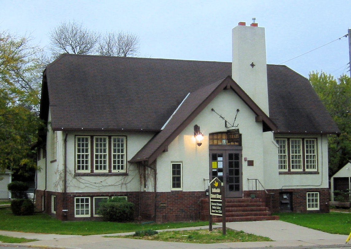


Crystal, Minnesota
Crystal is a city of 22,476 people in Hennepin County, Minnesota, founded in 1866.
Why visit Crystal
Townapedia lists 18 museums and landmarks, 74 parks and trails, 78 places to eat and 4 attractions in and around town.
Highlights include Camden Bridge, Canadian Pacific Camden Place Rail Bridge, Fredrika Bremer Intermediate School and Lawrence A. and Mary Fournier House.
July is the warmest month, with average highs of 83°F; January lows average 7°F.
Weather in Crystal
Forecast from the National Weather Service. Full forecast
About Crystal
Crystal is a suburban city in Hennepin County, Minnesota, about 5 miles (8.0 km) from downtown Minneapolis. The population was 23,330 at the 2020 census. Minnesota State Highway 100 and County Road 81 are two of Crystal's main routes.
From the Wikipedia article Crystal, Minnesota (this version), under CC BY-SA 4.0.
Things to do4

Camden Bridge
Bridge · 3.7 mi
Bridge in Minneapolis, Minnesota, United States
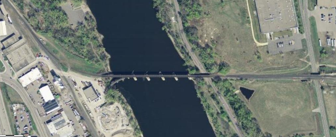
Canadian Pacific Camden Place Rail Bridge
Bridge · 3.9 mi
Bridge in Minneapolis, Minnesota

New Hope Cinema Grill
Cinema and theater · 2.3 mi
2749 Winnetka Avenue North, New Hope
Museums and landmarks18

Fredrika Bremer Intermediate School
Monument and historic site · National Register of Historic Places · 3.6 mi
Building in Minneapolis, Minnesota, United States

Lawrence A. and Mary Fournier House
Monument and historic site · National Register of Historic Places · 2.7 mi
House in Minneapolis, United States of America
Minneapolis Public Library, North Branch
Monument and historic site · National Register of Historic Places · 4.2 mi
Former library building in Minneapolis, Minnesota, United States
Robbinsdale Library
Monument and historic site · National Register of Historic Places · 1.0 mi
Branch library of the Hennepin County Library system in Robbinsdale, Minnesota



Golden Valley History Museum
Museum · 3.3 mi
Museum in Golden Valley, Minnesota
Minnesota African American Heritage Museum and Gallery
Museum · 3.6 mi
Museum in Minneapolis, Minnesota

6 more on the map.
Parks, trails and playgrounds74

Graeser Park
Park · 0.8 mi
Park in Robbinsdale, Hennepin County, United States of America
Bohanon Park
Park · 3.3 mi
City park in Minneapolis, Minnesota, United States
North Mississippi Regional Park
Park · 3.8 mi
Park in Hennepin County, Minnesota, United States of America

New Hope Ice Arena
Sports field and stadium · 0.8 mi
4949 Louisiana Avenue North, New Hope

62 more on the map.
Restaurants and cafes78

Broadway Pizza (Eagles Nest Lounge)
Restaurant · Pizza · 1.2 mi
4106 Lakeland Avenue North, Robbinsdale
Mo-Su 11:00-23:00


Mai Thai
Restaurant · Thai · 1.6 mi
3839 Lakeland Avenue North, Robbinsdale
Tu-Fr 11:30-21:00; Mo 16:00-21:00; Sa,Su 12:00-21:00

66 more on the map.
Churches and places of worship25
The Church of Jesus Christ of Latter-day Saints
Church · Mormon · 2.0 mi
2801 Douglas Drive North, Crystal
Brookdale Covenant Church
Church · Covenant · 2.0 mi
5139 Brooklyn Boulevard, Brooklyn Center
Church of Saint Austin
Church · Catholic · 2.3 mi
4047 North Thomas Avenue, Minneapolis
Church of the Epiphany
Church · Episcopal · 2.3 mi
4900 Nathan Lane North, Plymouth
Elim Lutheran Church ELCA
Church · Lutheran · 1.4 mi
3978 West Broadway Avenue, Robbinsdale
Shopping22
Gas and EV charging23
Schools, colleges and libraries62
4126 - Prairie Seeds Academy - Is
School · 2.1 mi
6200 W Broadway Ave, Brooklyn Park
Healthcare8
Crystal Medical Center
Clinic and pharmacy · 1.3 mi
5700 Bottineau Boulevard, Crystal
Crystal Urgent Care
Clinic and pharmacy · 1.3 mi
5700 Bottineau Boulevard, Crystal
North Memorial Clinic - New Hope
Clinic and pharmacy · 1.2 mi
8100 42nd Avenue North, New Hope
Northwest Family Clinics
Clinic and pharmacy · 1.3 mi
5700 Bottineau Boulevard, Crystal
Robbinsdale Clinic P.A.
Clinic and pharmacy · 1.6 mi
3819 West Broadway Avenue, Robbinsdale
Map of Crystal
250 places. The map loads OpenStreetMap tiles when you open it.
Climate by month
Monthly table
| Month | High | Low | Rain |
|---|---|---|---|
| Jan | 24°F | 7°F | 0.6 in |
| Feb | 29°F | 11°F | 0.6 in |
| Mar | 42°F | 23°F | 1.4 in |
| Apr | 57°F | 35°F | 2.9 in |
| May | 70°F | 47°F | 4.3 in |
| Jun | 79°F | 58°F | 4.4 in |
| Jul | 83°F | 62°F | 4.2 in |
| Aug | 81°F | 60°F | 4.1 in |
| Sep | 73°F | 52°F | 3.2 in |
| Oct | 58°F | 38°F | 2.6 in |
| Nov | 42°F | 26°F | 1.5 in |
| Dec | 29°F | 13°F | 0.9 in |
U.S. Climate Normals 1991-2020 for Mpls Crystal Ap (2 mi away), NOAA NCEI.
People and cost of living
American Community Survey 5-year estimates, 2020-2024, U.S. Census Bureau. Estimates have margins of error, larger for small towns.
Disaster history
Hennepin County has had 10 federal disaster declarations since 2000, most often for floods.
- 2020-04-07: Covid-19 Pandemic (Biological)
- 2020-03-13: Covid-19 (Biological)
- 2016-11-02: Severe Storms And Flooding (Flood)
- 2014-07-21: Severe Storms, Straight-Line Winds, Flooding, Landslides, And Mudslides (Flood)
- 2013-07-25: Severe Storms, Straight-Line Winds, And Flooding (Severe Storm)
- 2011-06-07: Severe Storms And Tornadoes (Severe Storm)
OpenFEMA disaster declarations summaries.
Getting there and nearby towns
Crystal Airport (MIC) is the nearest airport with scheduled flights listed in OpenStreetMap, 2 miles away.
- Brooklyn Center 3 mi northeast, about 5 min by car
- Brooklyn Park 5 mi north, about 8 min by car
- Columbia Heights 6 mi east, about 9 min by car
- Minneapolis 7 mi southeast, about 11 min by car
- Champlin 9 mi north, about 15 min by car
- Coon Rapids 10 mi north, about 16 min by car
- Blaine 12 mi northeast, about 19 min by car
- Anoka 12 mi north, about 20 min by car
- St. Paul 14 mi southeast, about 22 min by car
- Bloomington 15 mi south, about 23 min by car
Drive times are estimates from straight-line distance, not routes.
Local news
Headlines from INDB, the NEMICO news database.
Reviews, tips and questions
Loading what members have shared...
Sources and licences
- NCES EDGE (Public domain): public schools
- NOAA NCEI U.S. Climate Normals 1991-2020 (Public domain): climate by month
- OpenFEMA (Public domain): disaster declarations
- OpenStreetMap contributors (ODbL 1.0): places, airports, map data
- U.S. Census Bureau (Public domain): population, income, housing, education, commute
- Wikidata (CC0 1.0): elevation, founding date, time zone, website, landmarks and historic places
- Wikimedia Commons (see each image): photos
- Wikipedia (CC BY-SA 4.0): overview and history text
Photo credits
- Rockford Road Library 2021, McGhiever, CC BY-SA 4.0
- Highway 100, Crystal, Minnesota Sunset (23406265653), Tony Webster from Portland, Oregon, CC BY-SA 2.0
- Fournier House 1, Elkman, CC BY-SA 4.0
- Robbinsdale Library 002, Elkman, CC BY-SA 4.0
- Fredrika Bremer Intermediate School, McGhiever, CC BY-SA 4.0
- North Branch Library, McGhiever, CC BY-SA 3.0
- Camden Bridge Mpls, McGhiever, CC BY-SA 4.0
- Golden Valley Historical Society, Side View (cropped), MidwestMoss, CC0
- Canadian Pacific Camden Place Rail Bridge USGS, USGS, Public domain
- Rockford Road Library, Paul2520, CC BY-SA 4.0
- Black Lives Matter protest in support of Tania Harris (16564016923), Fibonacci Blue from Minnesota, USA, CC BY 2.0
- Black Lives Matter protest in support of Tania Harris (17156680626), Fibonacci Blue from Minnesota, USA, CC BY 2.0
- Black Lives Matter march for Tania Harris (16975134277), Fibonacci Blue from Minnesota, USA, CC BY 2.0
- Black Lives Matter protest outside North Memorial Hospital (17186111652), Fibonacci Blue from Minnesota, USA, CC BY 2.0
- Waiting until the family has seen Tania Harris (17182072041), Fibonacci Blue from Minnesota, USA, CC BY 2.0
- Black Lives Matter protest in support of Tania Harris (16976804437), Fibonacci Blue from Minnesota, USA, CC BY 2.0
- Black Lives Matter protest in support of Tania Harris (17158301746), Fibonacci Blue from Minnesota, USA, CC BY 2.0
- Black Lives Matter march for Tania Harris (16998064079), Fibonacci Blue from Minnesota, USA, CC BY 2.0
- Black Lives Matter (16996466930), Fibonacci Blue from Minnesota, USA, CC BY 2.0
- Black Lives Matter march for Tania Harris (16996732460), Fibonacci Blue from Minnesota, USA, CC BY 2.0
- Black Lives Matter march for Tania Harris (16561820274), Fibonacci Blue from Minnesota, USA, CC BY 2.0
- Graeser Park Rock Garden, Elkman, CC BY 4.0
- Graeser Park Picnic Table, Elkman, CC BY 4.0
- Graeser Park Picnic Table Spring, Elkman, CC BY 4.0
- Graeser Park Beehive Grill Spring, Elkman, CC BY 4.0
- Graeser Park Beehive Grill, Elkman, CC BY 4.0
- Graeser Park Rock Garden Spring, Elkman, CC BY 4.0
- Omlette at Perkins (10825093806), m01229 from USA, CC BY 2.0
- City of Robbinsdale, Minnesota - Water Tower, Minnesota (33702172680), Tony Webster from Minneapolis, Minnesota, United States, CC BY 2.0
- Target's Halloween display - scary skeleton decorations!, m01229, CC BY-SA 2.0
- Blowing Snow - Robbinsdale, Minnesota (25312402828), Tony Webster from Minneapolis, Minnesota, United States, CC BY 2.0
- Fish taco at Travail restaurant's Spotlight dinner 01, Runner1928, CC BY-SA 4.0
- Fish taco at Travail restaurant's Spotlight dinner 02, Runner1928, CC BY-SA 4.0
- School Library Wiki pic cropped, Rettechlms, CC BY-SA 4.0
- Spanjers Park, Gobonobo, CC BY-SA 3.0
- Cooper High School, Widgetkid, CC BY-SA 4.0
- Wells Fargo, New Hope MN (6890379188), m01229, CC BY 2.0
- Two Peanut Buster Parfaits from Dairy Queen, m01229, CC BY-SA 2.0
- New Hope City Hall, Widgetkid, CC BY-SA 4.0
- Black Lives Matter march for Tania Harris (17000288448), Fibonacci Blue from Minnesota, USA, CC BY 2.0


Page built October 30, 2026. Spotted a mistake? Tell us or suggest a place.